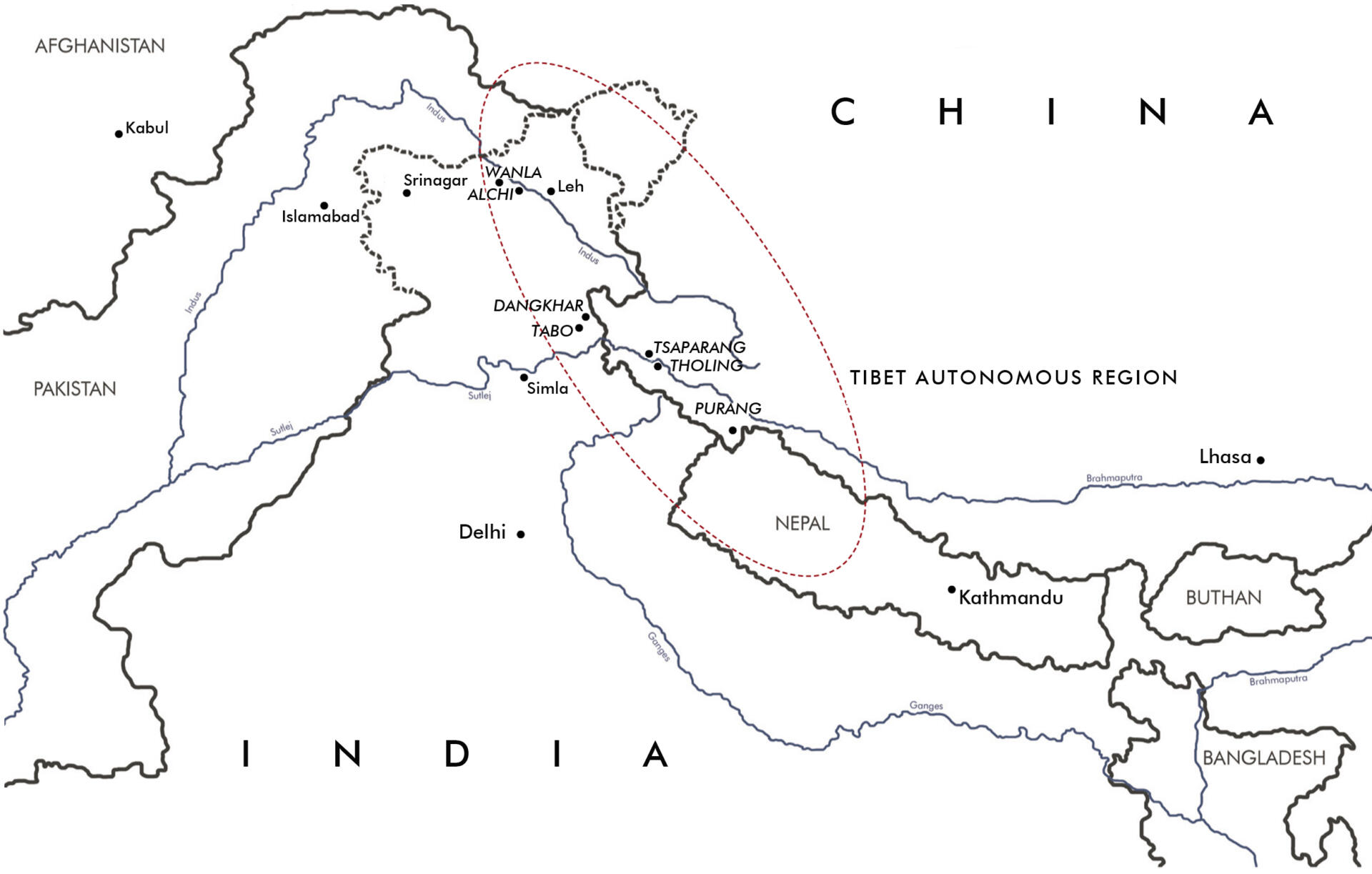
Field research
A successful field research is the prerequisite for all following work stages. In the first phase, we register the various buildings in their entirety by means of sketches and drawings that are the basis for further measurements. Geographical and topographical particularities, such as landscape, village structures and orientation of the buildings are an essential part of the survey. In a second step, we gauge the building digitally using a laser tachymeter what secures an extremely high accuracy of measurements, particularly in extreme topographies and in spacious areas. Measuring by hand completes this phase, especially in case of internal spaces that are difficult to access and for building details. The third phase includes determining the interior in order to support the interdisciplinary cooperation. Thus, we are able to locate the various particularities, such as inscriptions, sculptures, wall paintings, painted ceilings and wooden carvings within the building context. A considerable number of photographs complete every phase of the fieldwork and facilitate the elaborating of plans.
Documentation and analyses
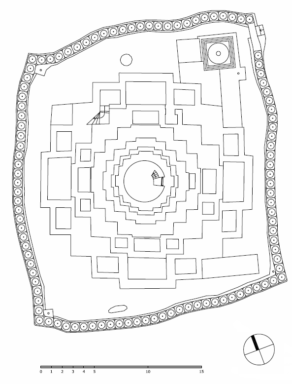
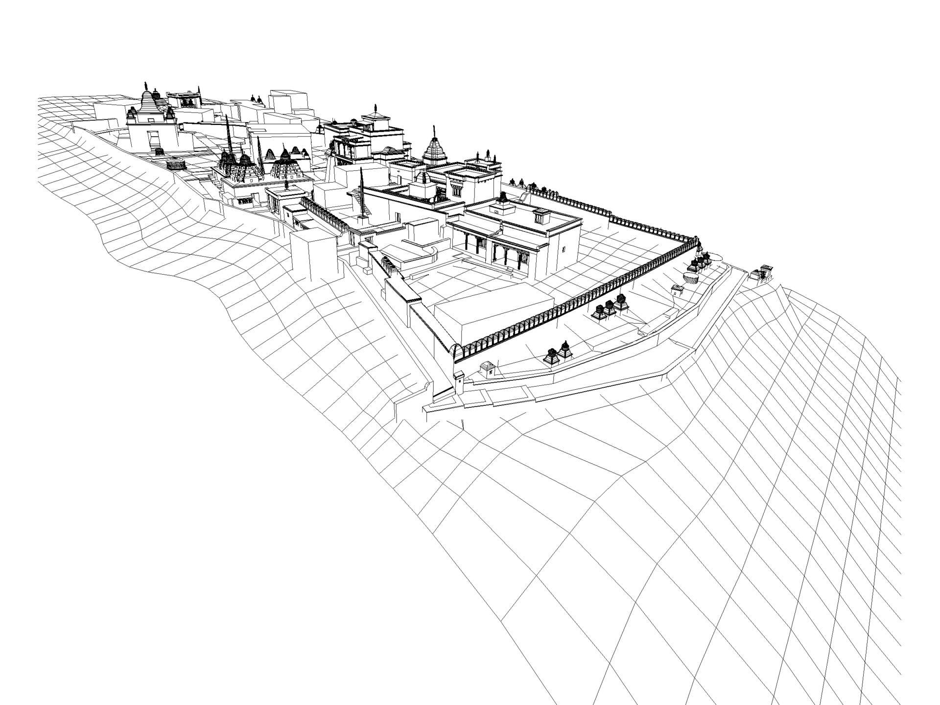
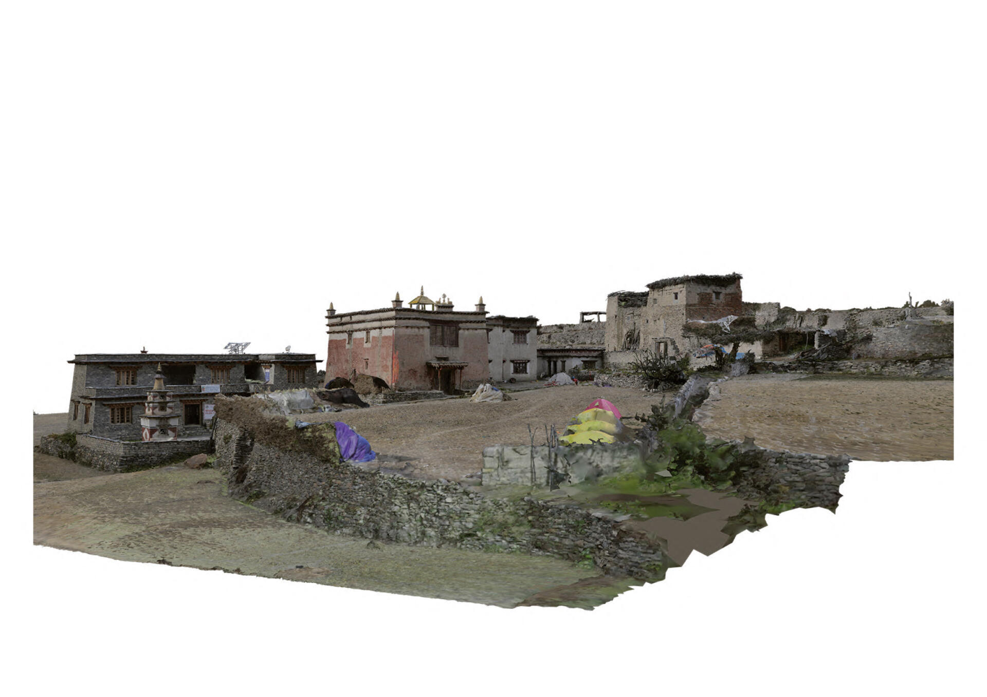
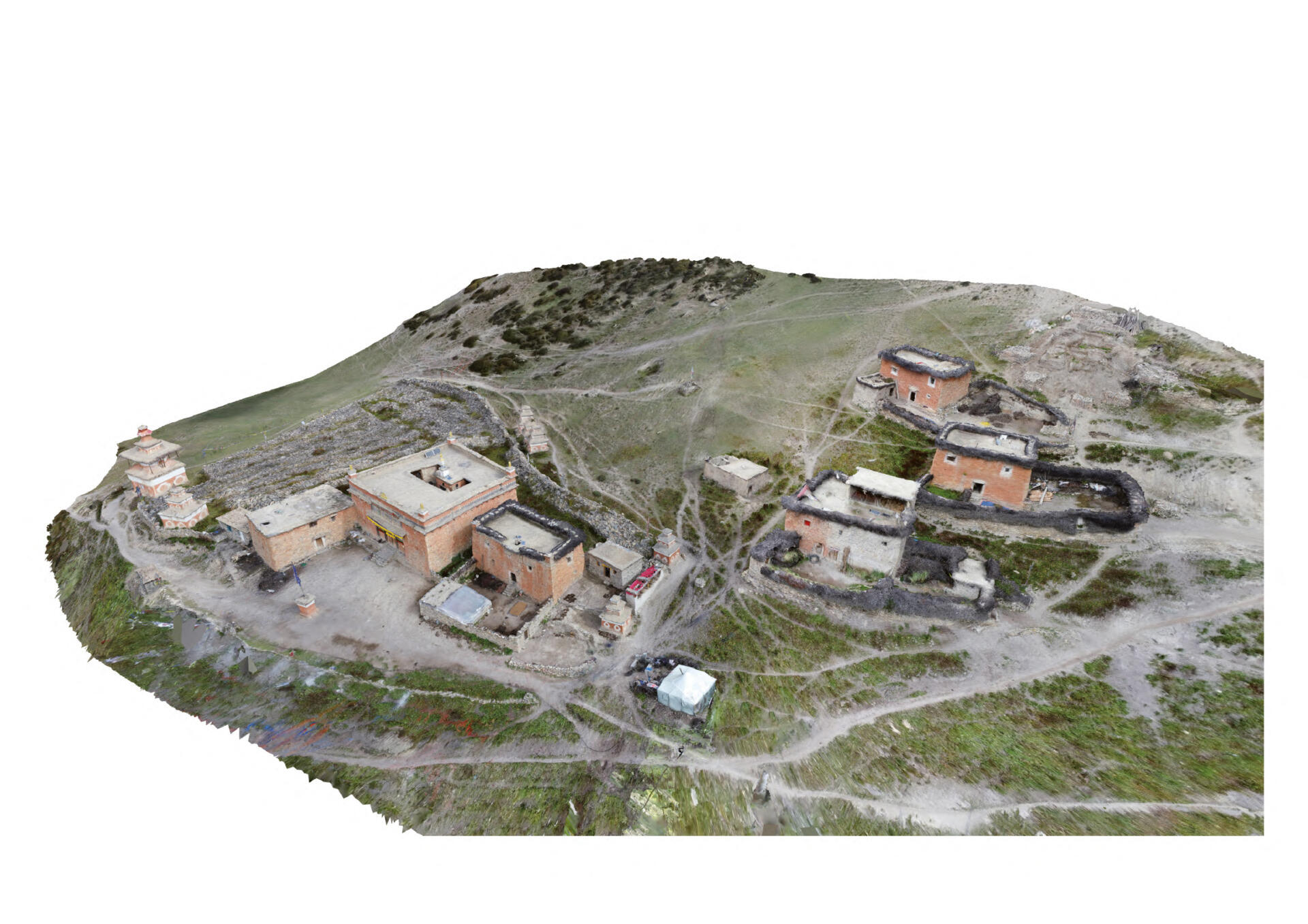
The cooperation with the Institute of Engineering Geodesy and Measurement Systems (IGMS) of the Graz University of Technology enables us to optimise the building documentation in the course of the field research by using high-tech 3D surveying and to achieve a geodetic accuracy level of the survey. The results of the measurements in 2022 and 2023 show that the use of 3D laserscan technology enables buildings to be surveyed quickly and accurately. Based on the point clouds we can generate detailed site plans, ground plans, longitudinal and cross sections, elevations, ceiling plans and wall projections. These plans allow to illustrate the monuments with all their significant aspects like spatial organisation, size, and construction. The plan documentation is fundamental for all further analysis and spatial representations.
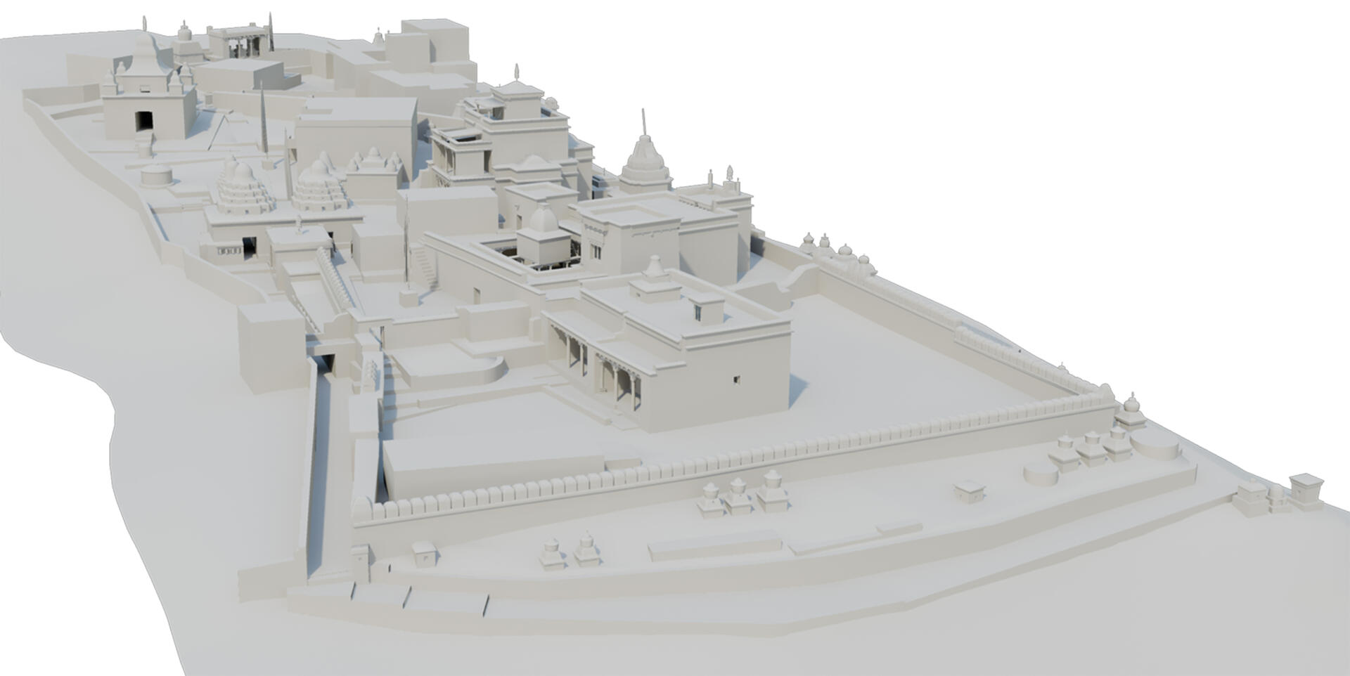
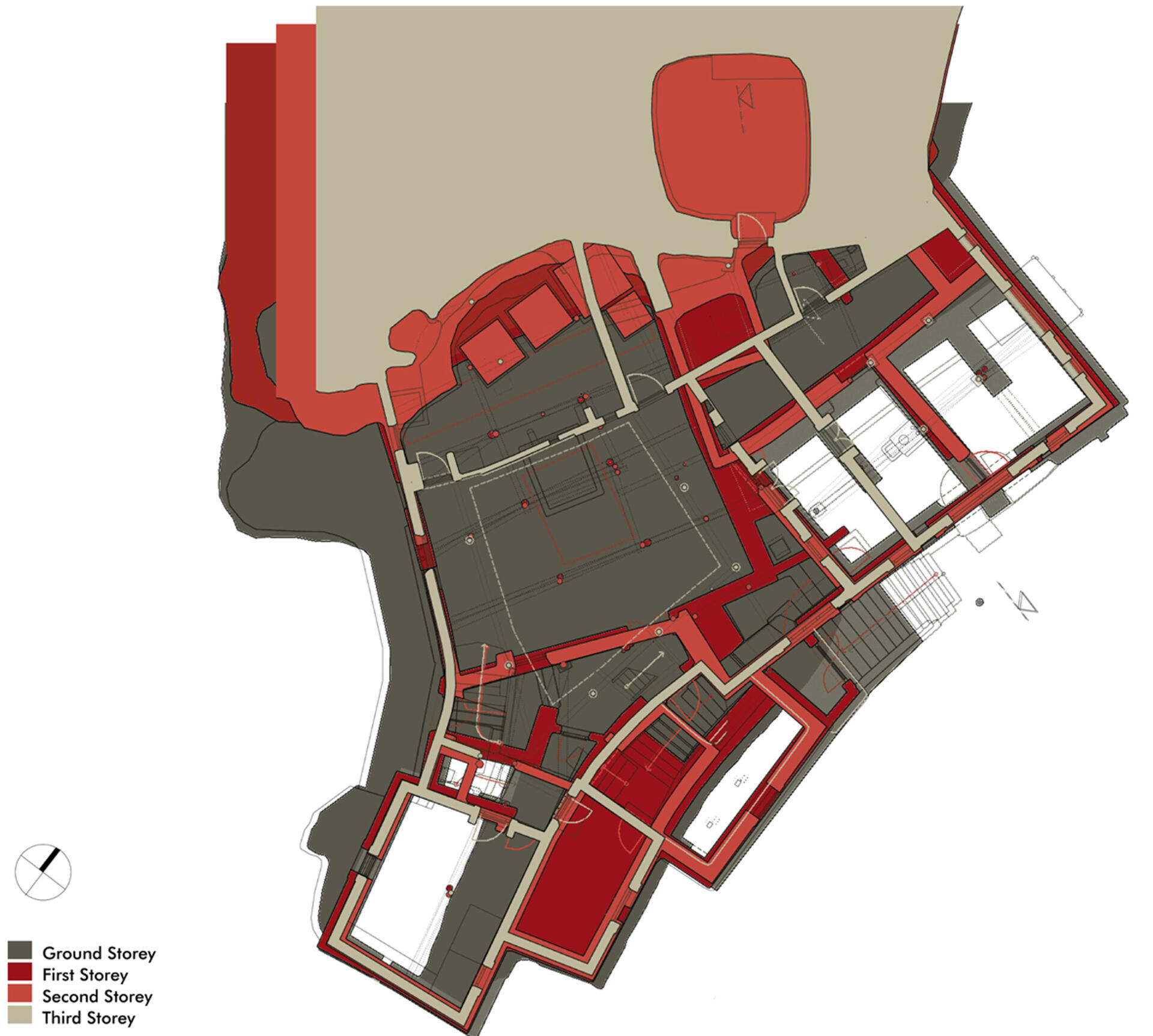
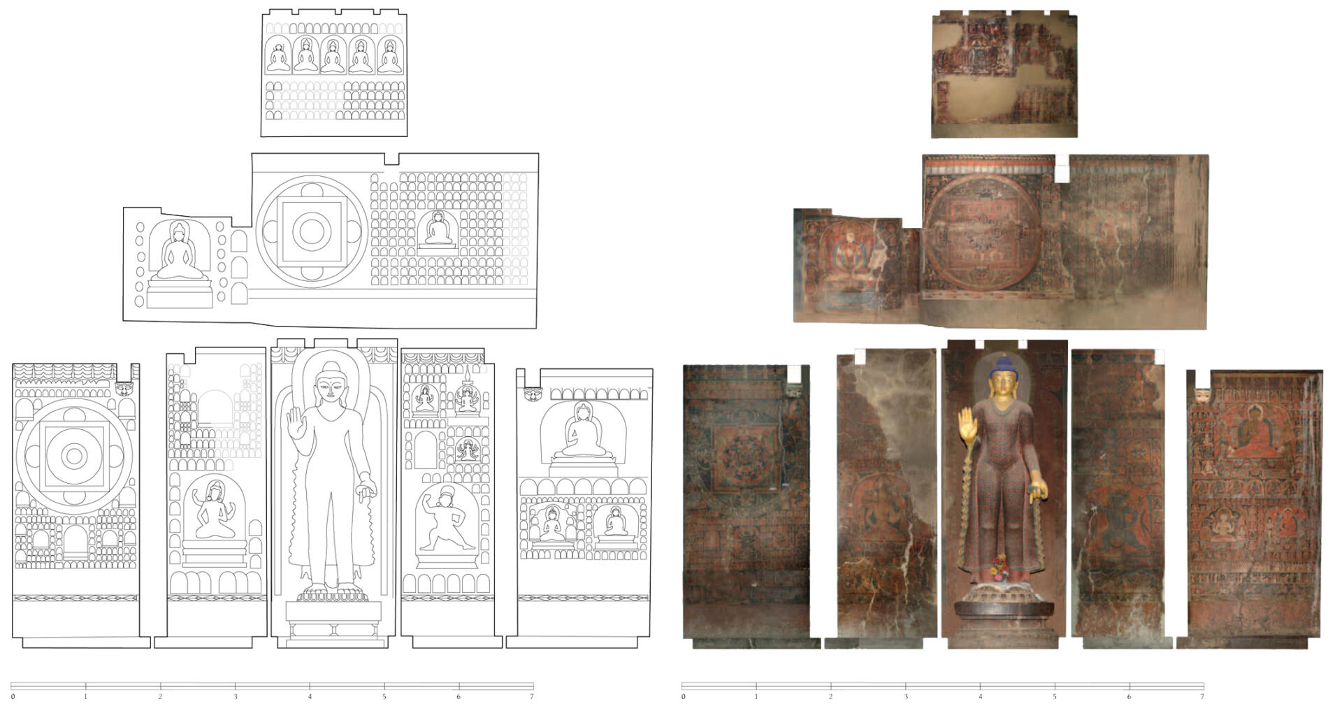
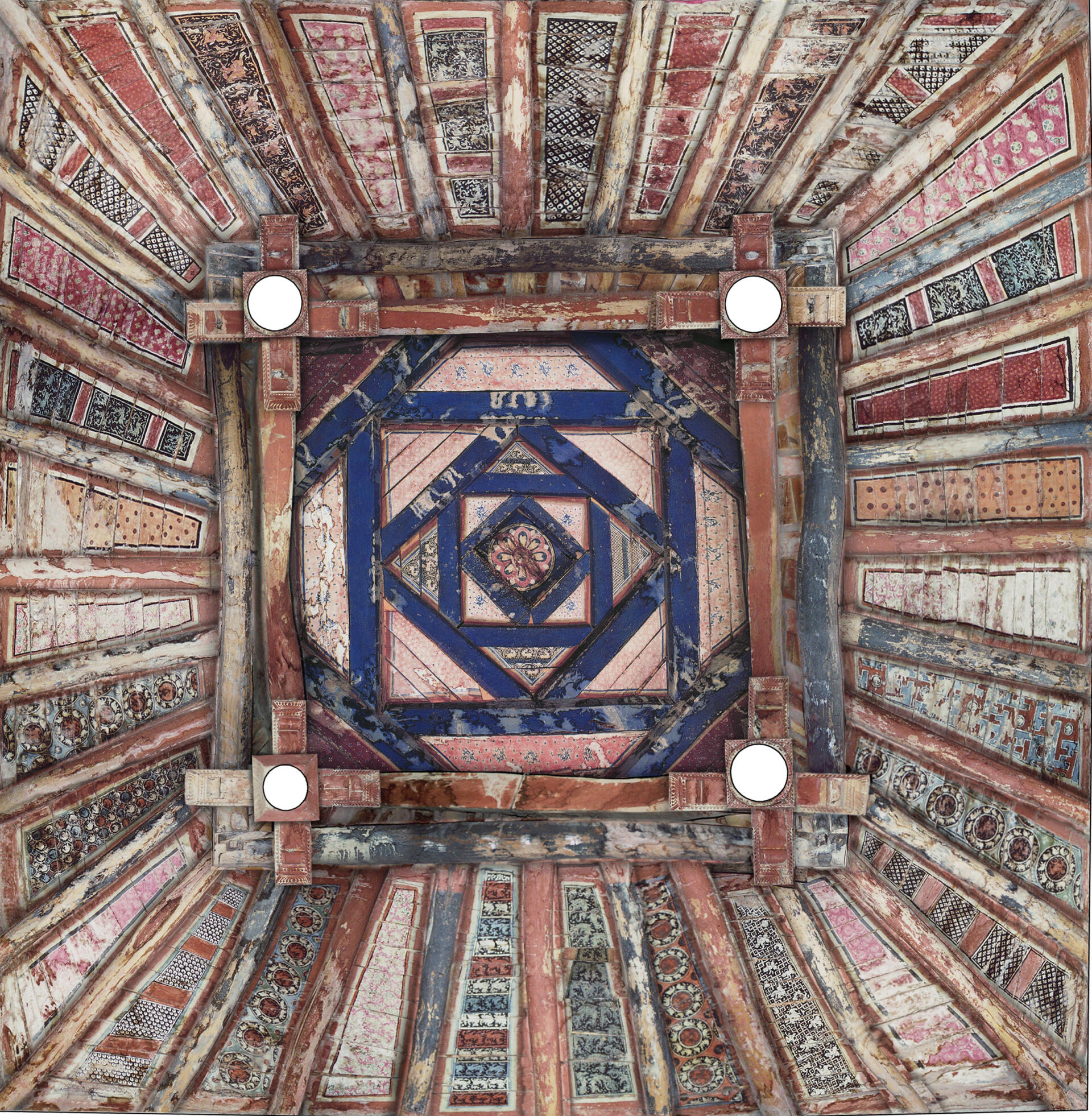
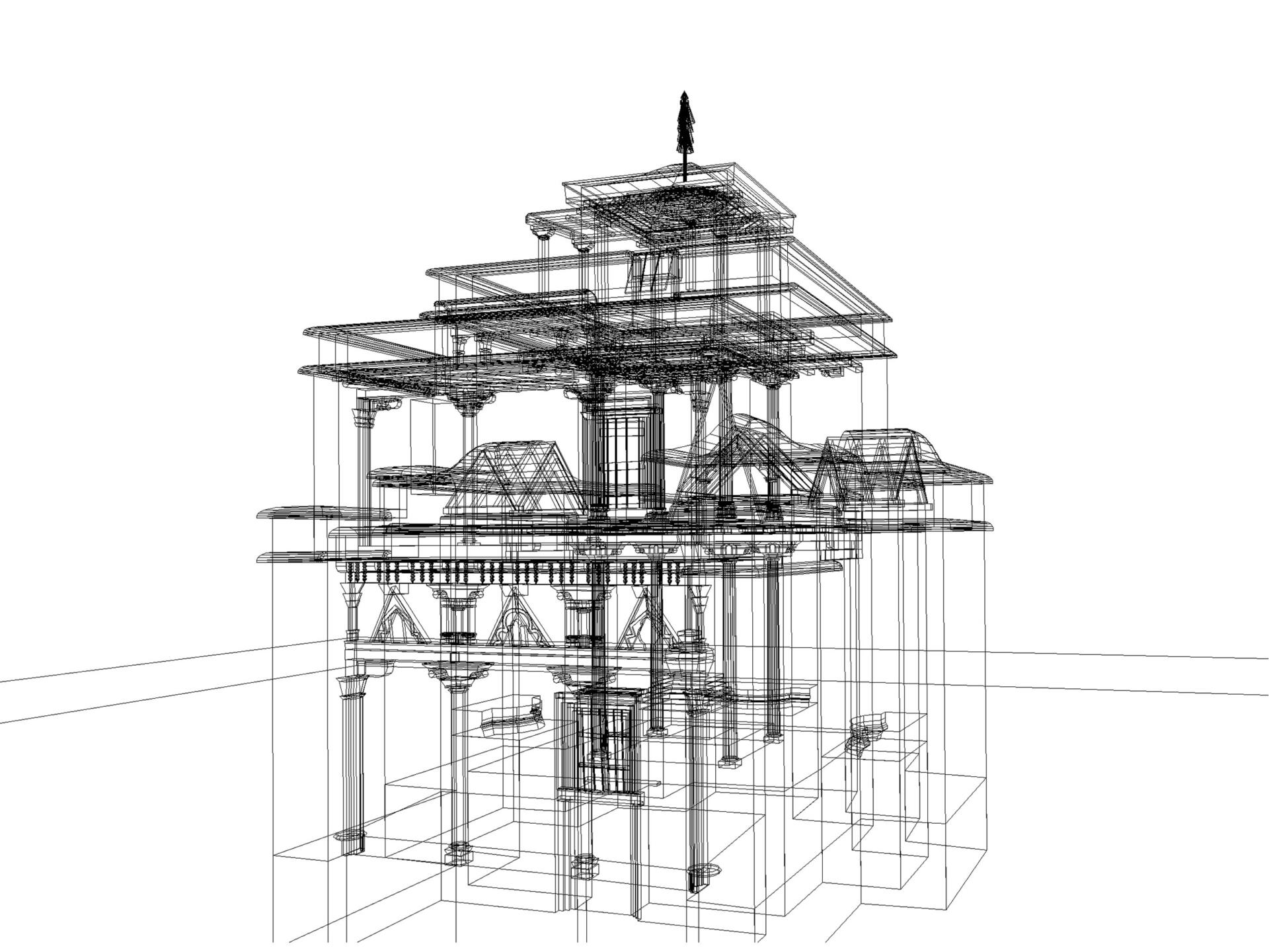
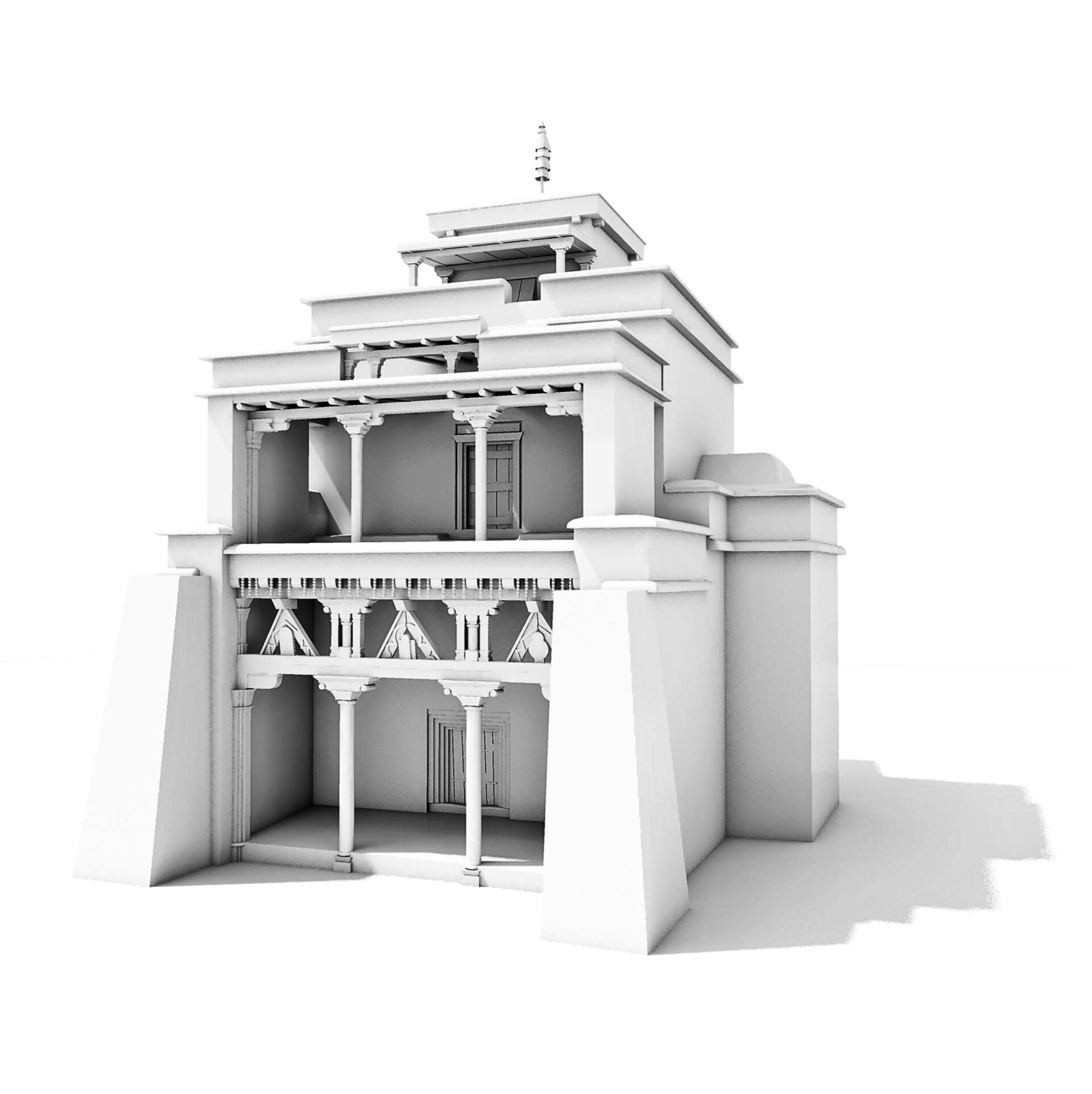
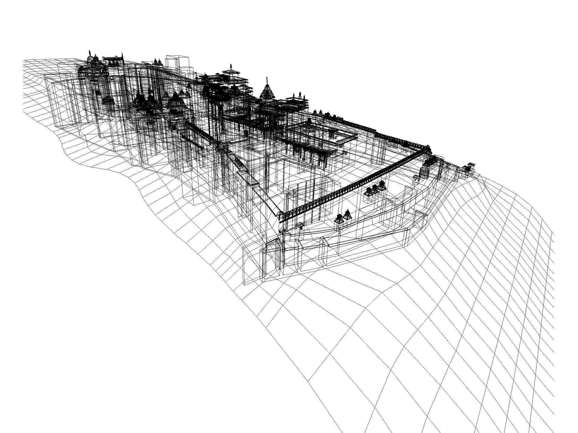
Based on the documentation we can create spatial models that provide a deeper three-dimensional insight in the building structure. The spatial elevations and sections clearly show the different configurations and proportions of the buildings. The spatial models allow to reconstruct the changes on the exterior of the temples and to illustrate the development of buildings in different building phases. A compound model of a monastic complex adds to a holistic view of the entire area. It illustrates how various buildings interact and relate spatially.Finally, we combine the plans with representations of the interior and exterior artistic particularities in order to achieve an integrated documentation. This is important because artworks with their iconographic contents often are the only help when it comes to determine the time of origin of a building and to reflect its historical context. Based on plans and detailed pictures, we can generate complete overviews of the interior by using photomontages and drawings. The scaled representations of wall paintings, painted ceilings, sculptures and woodcarvings help in assigning details and locating them in the overall context. This proved effective in terms of both iconographic research and restoration.