Ladakh
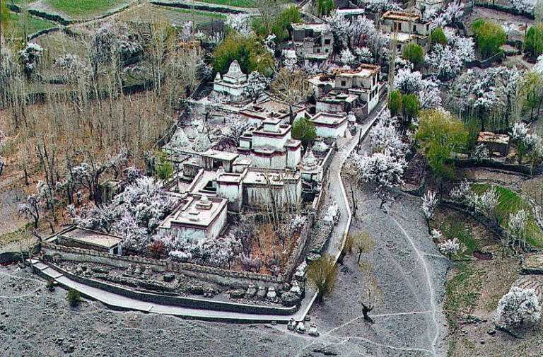
Basgo
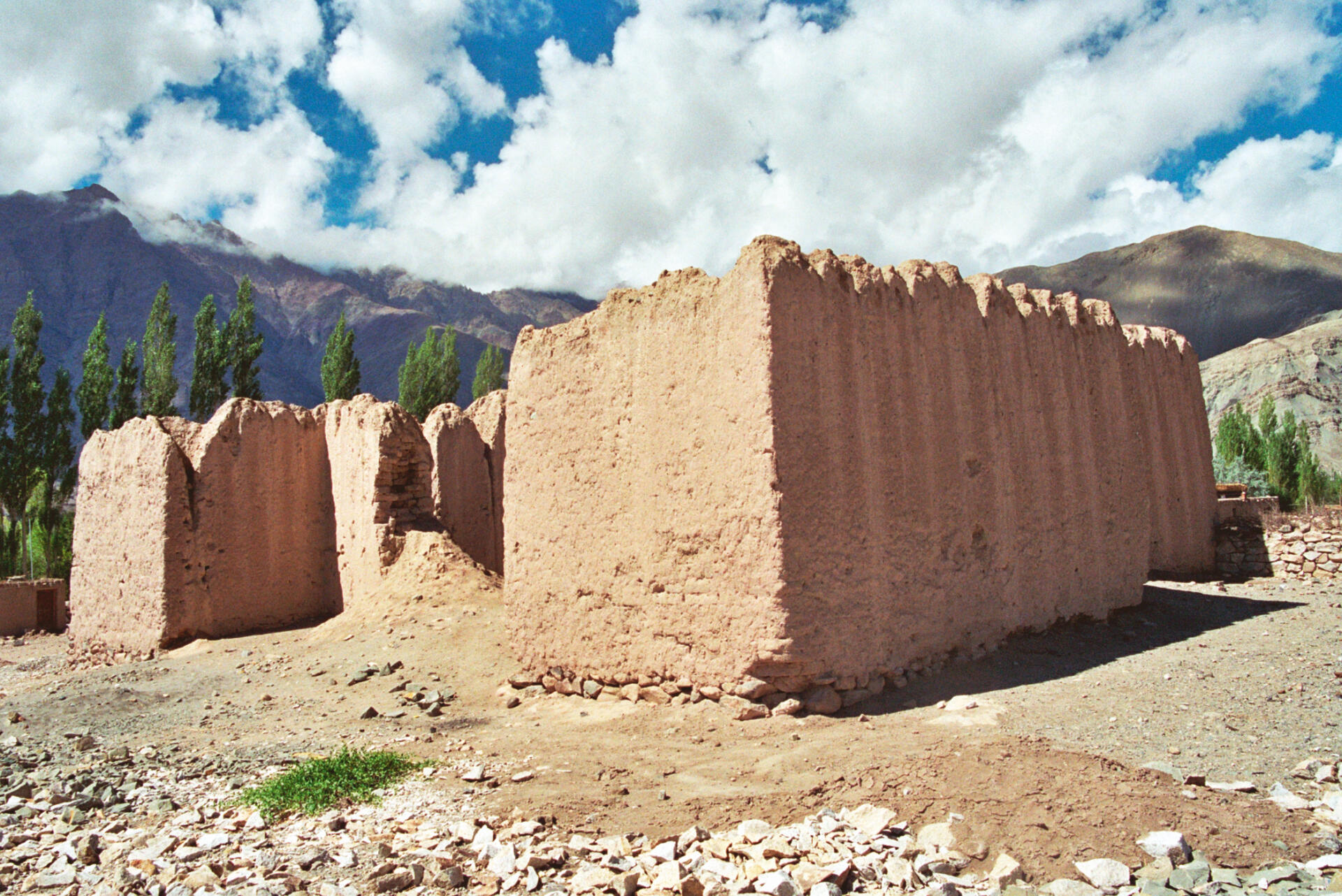
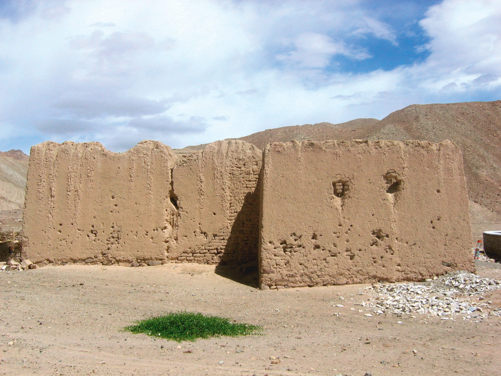
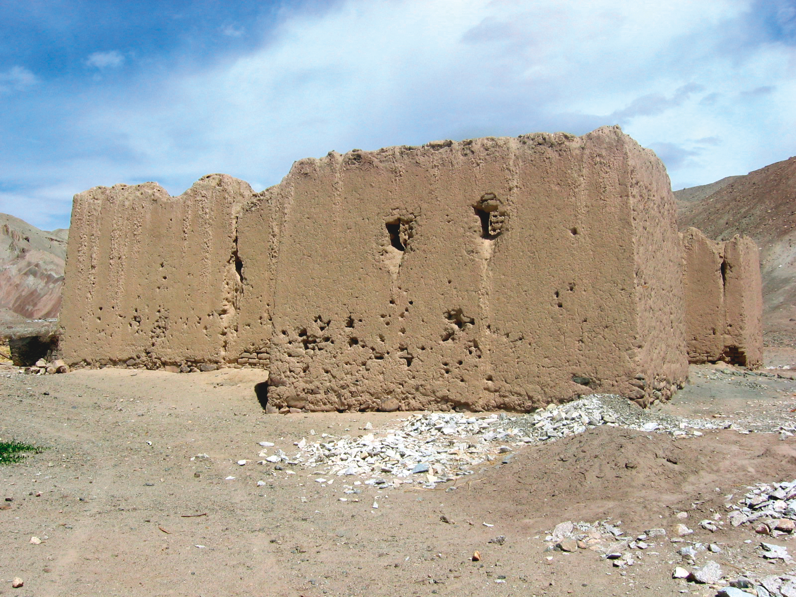
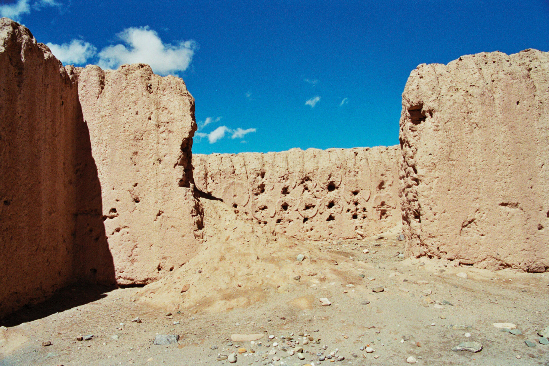
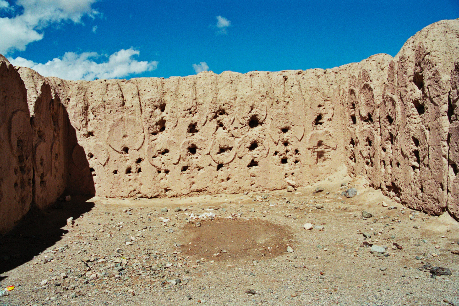
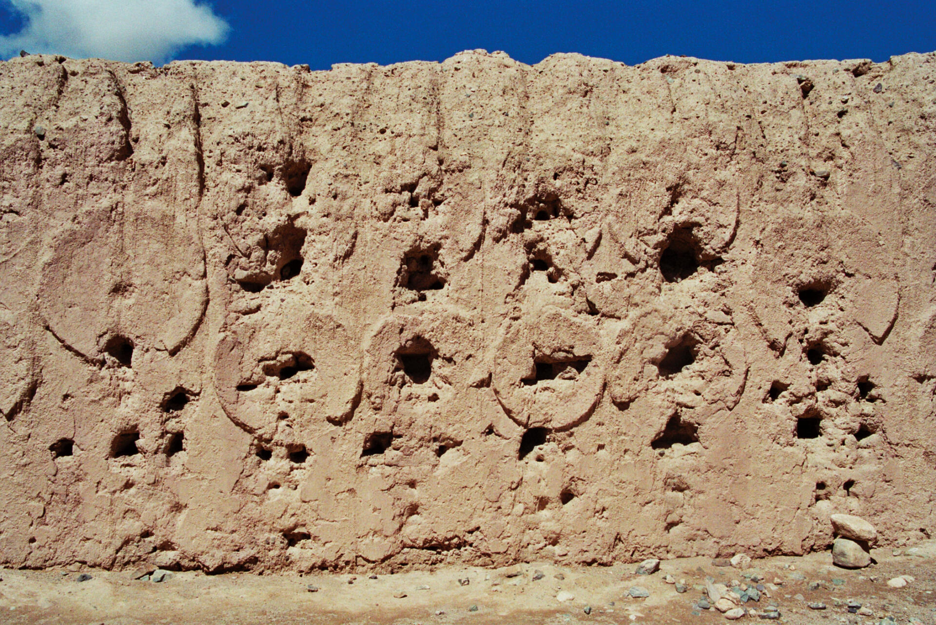
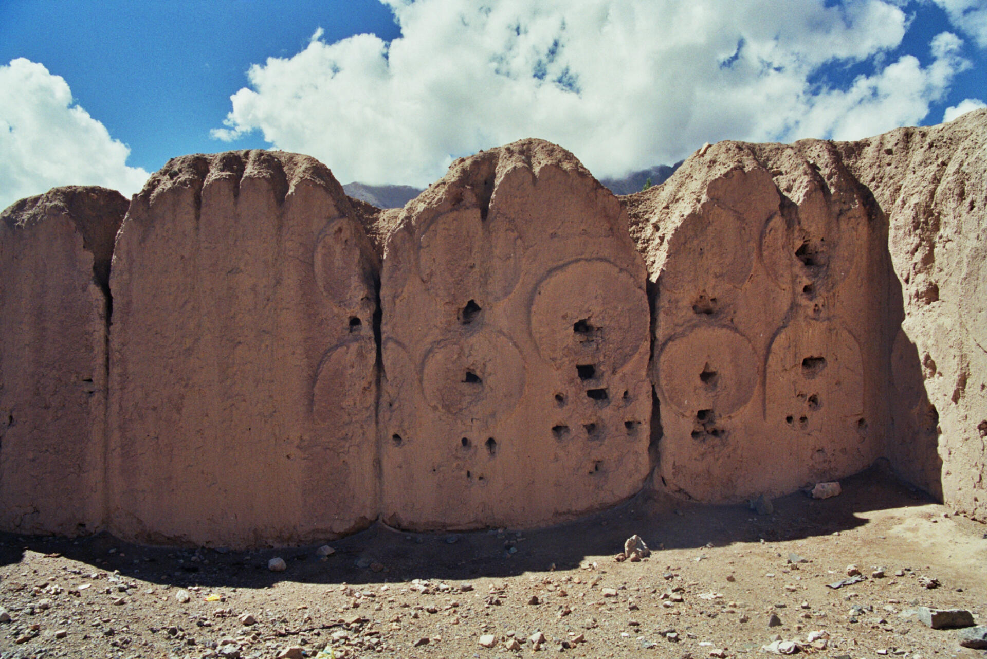
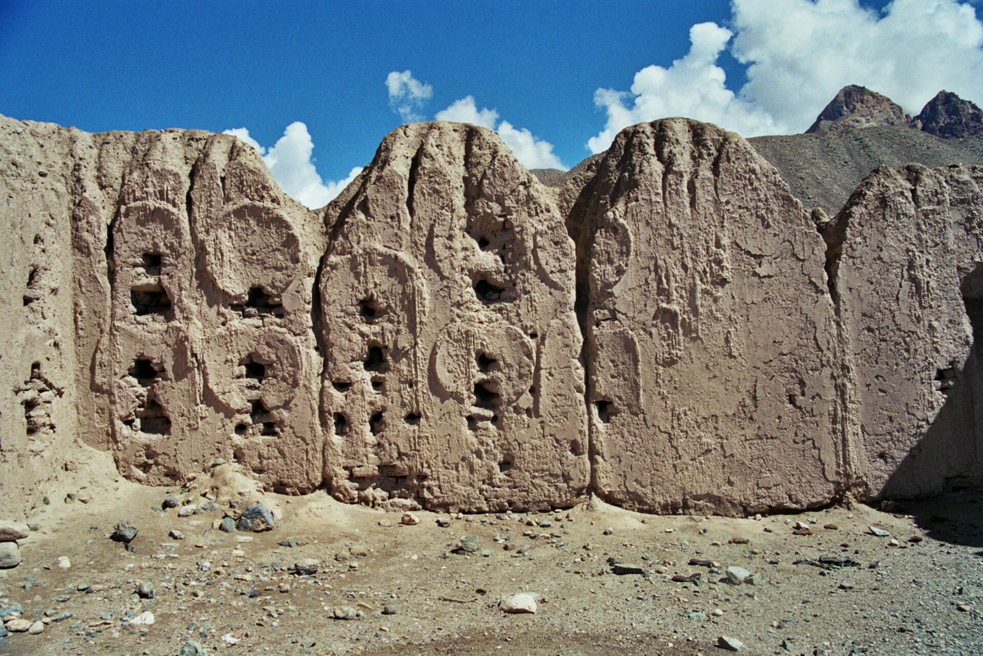
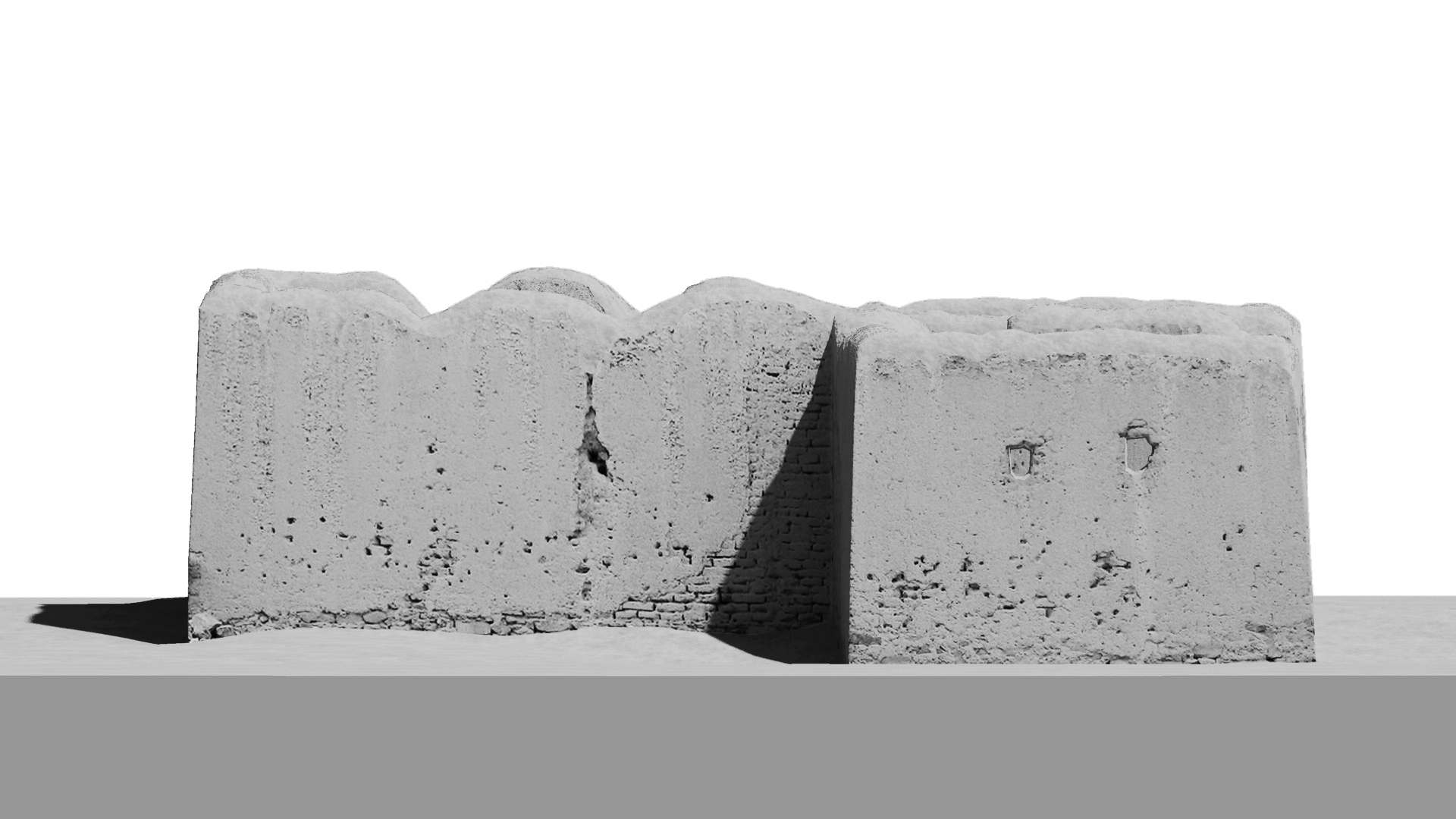
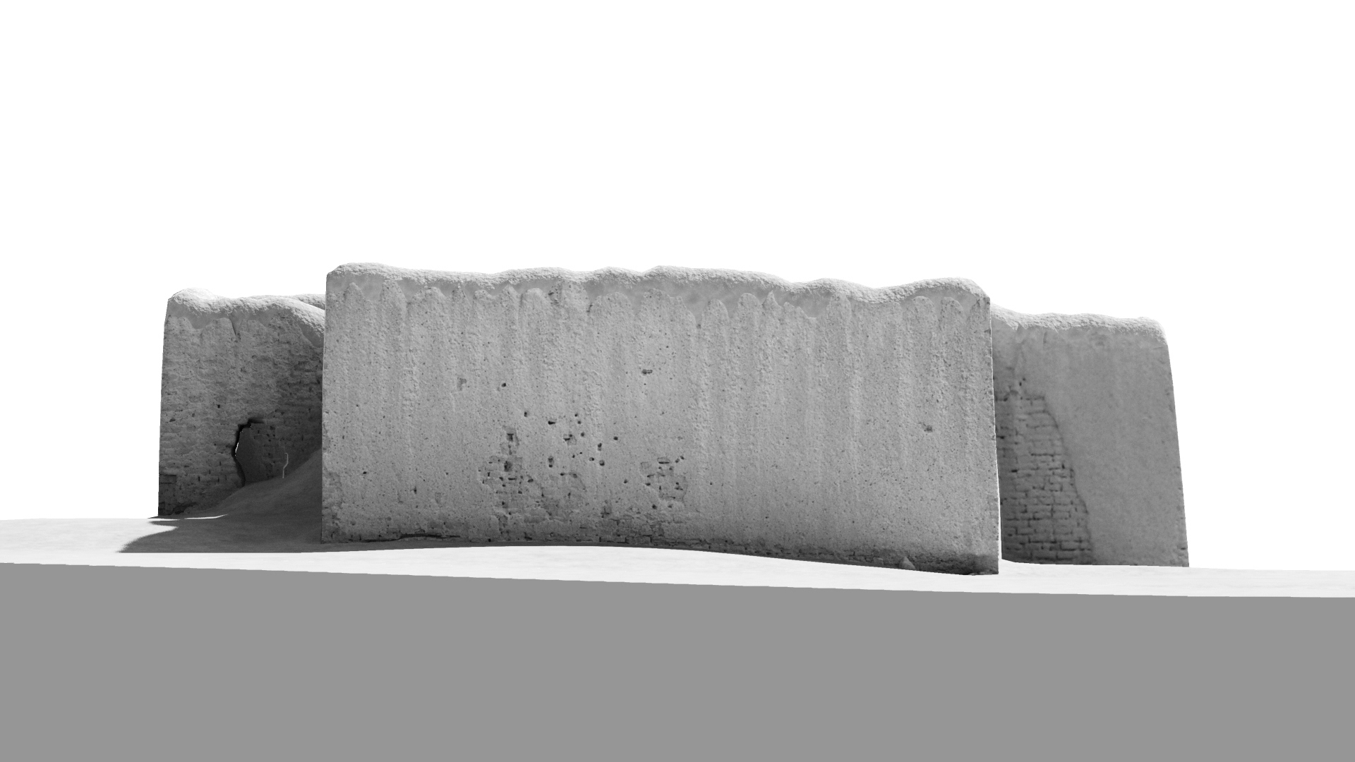
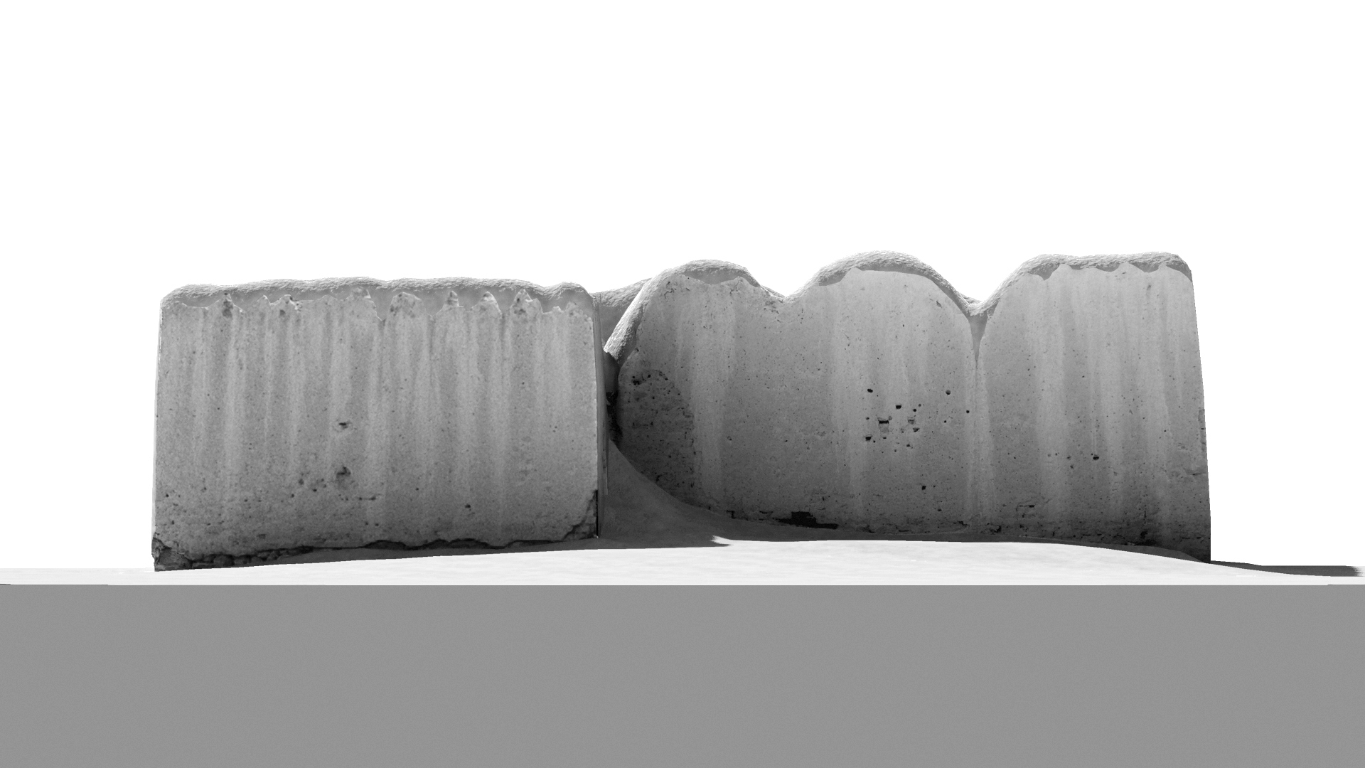
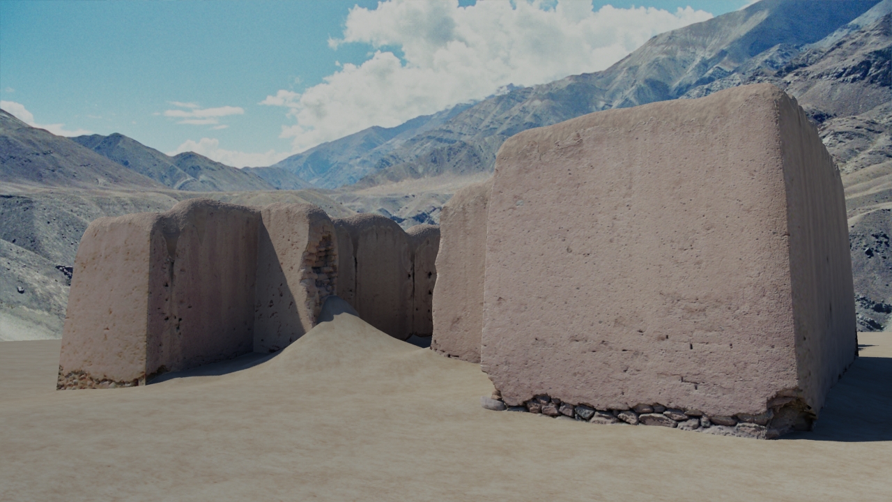
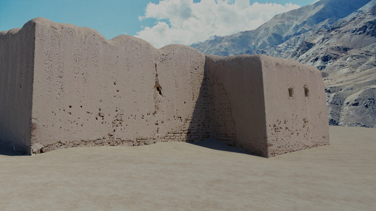
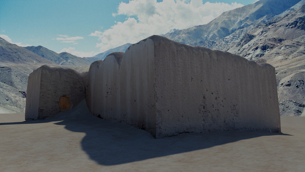
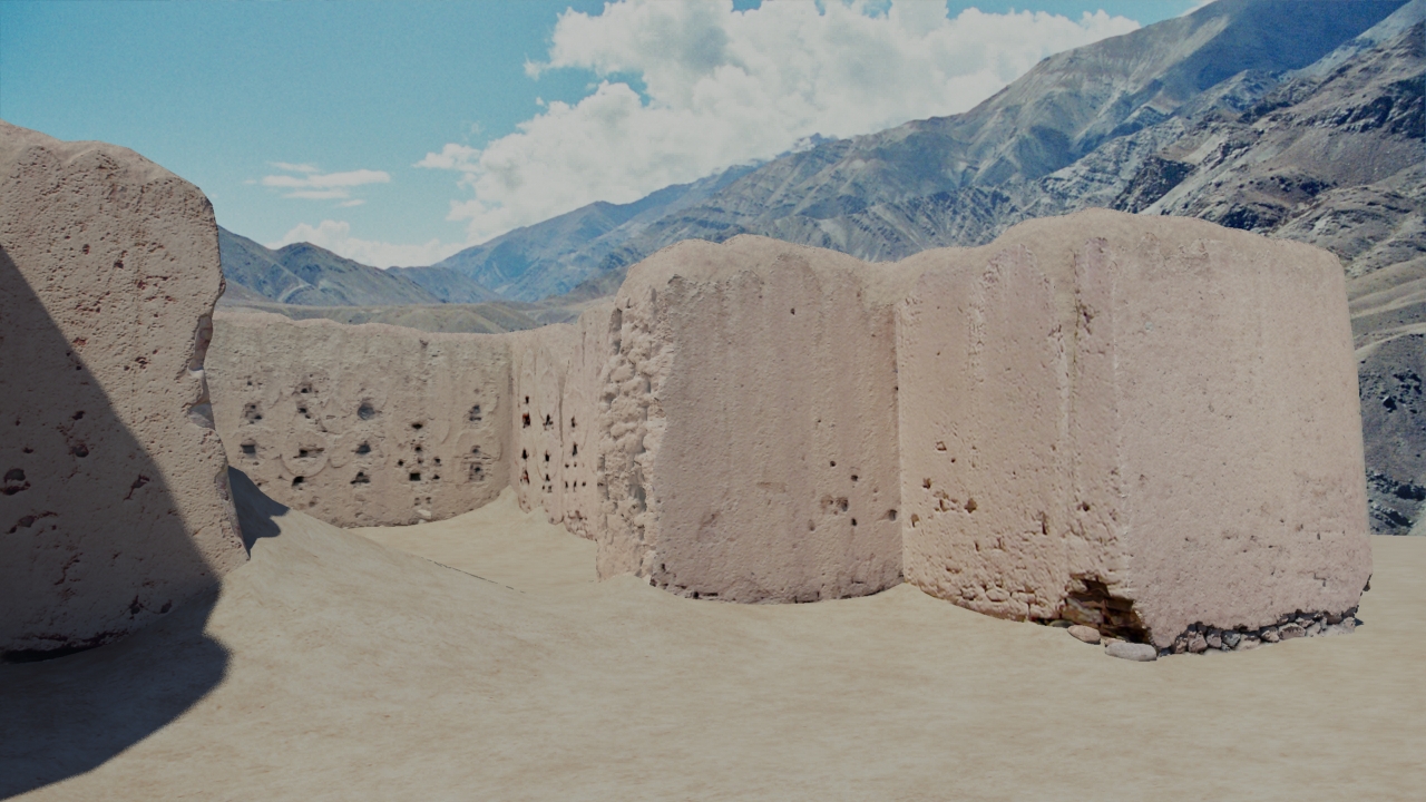
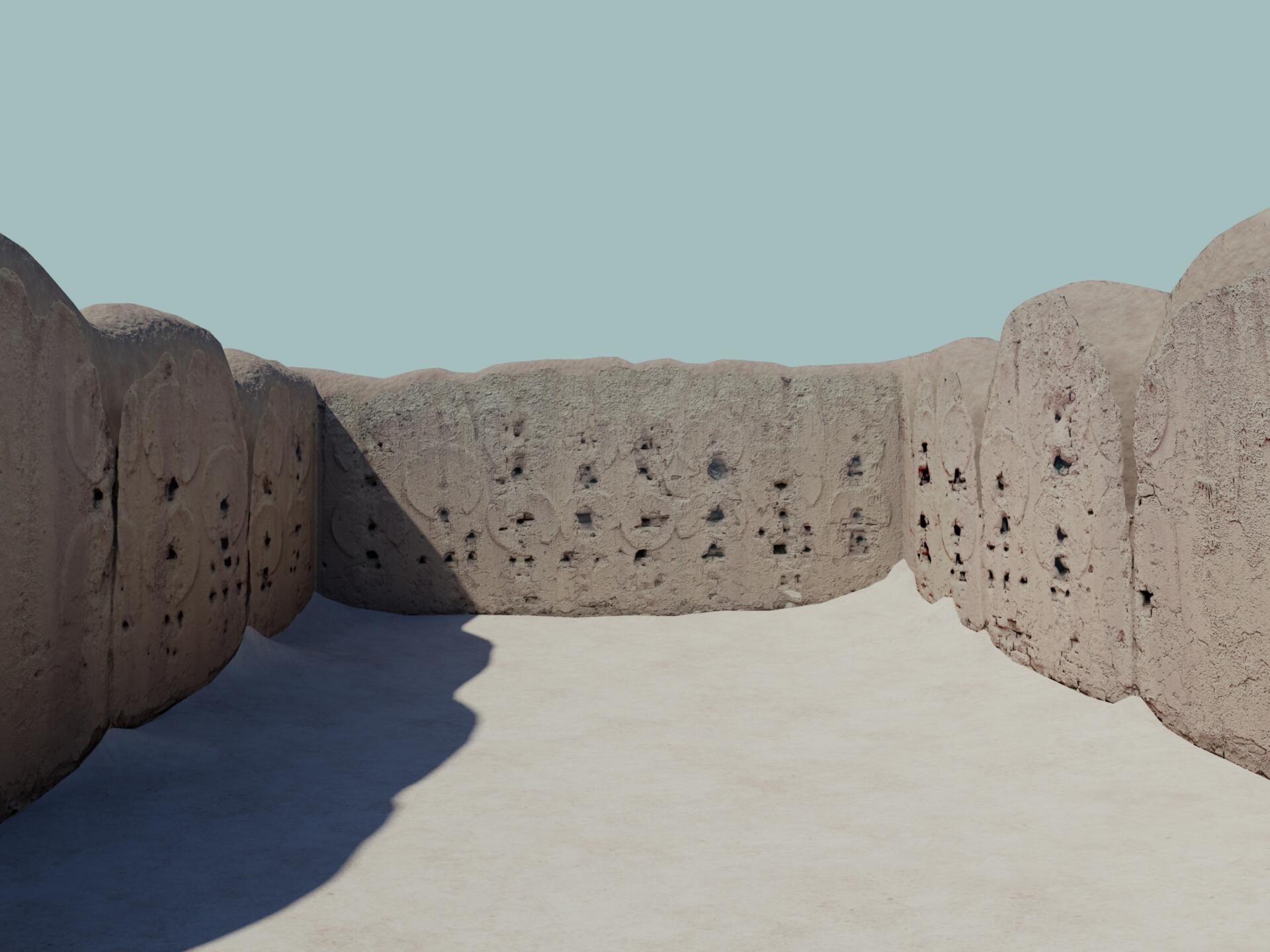
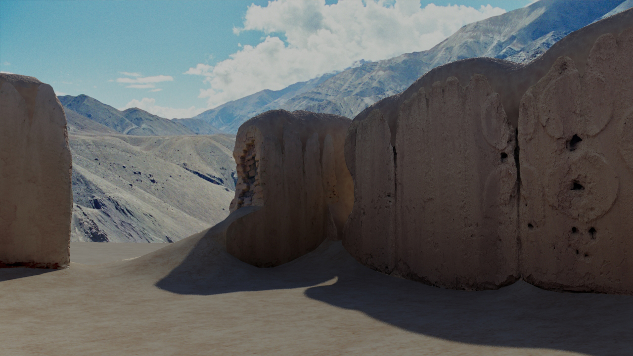
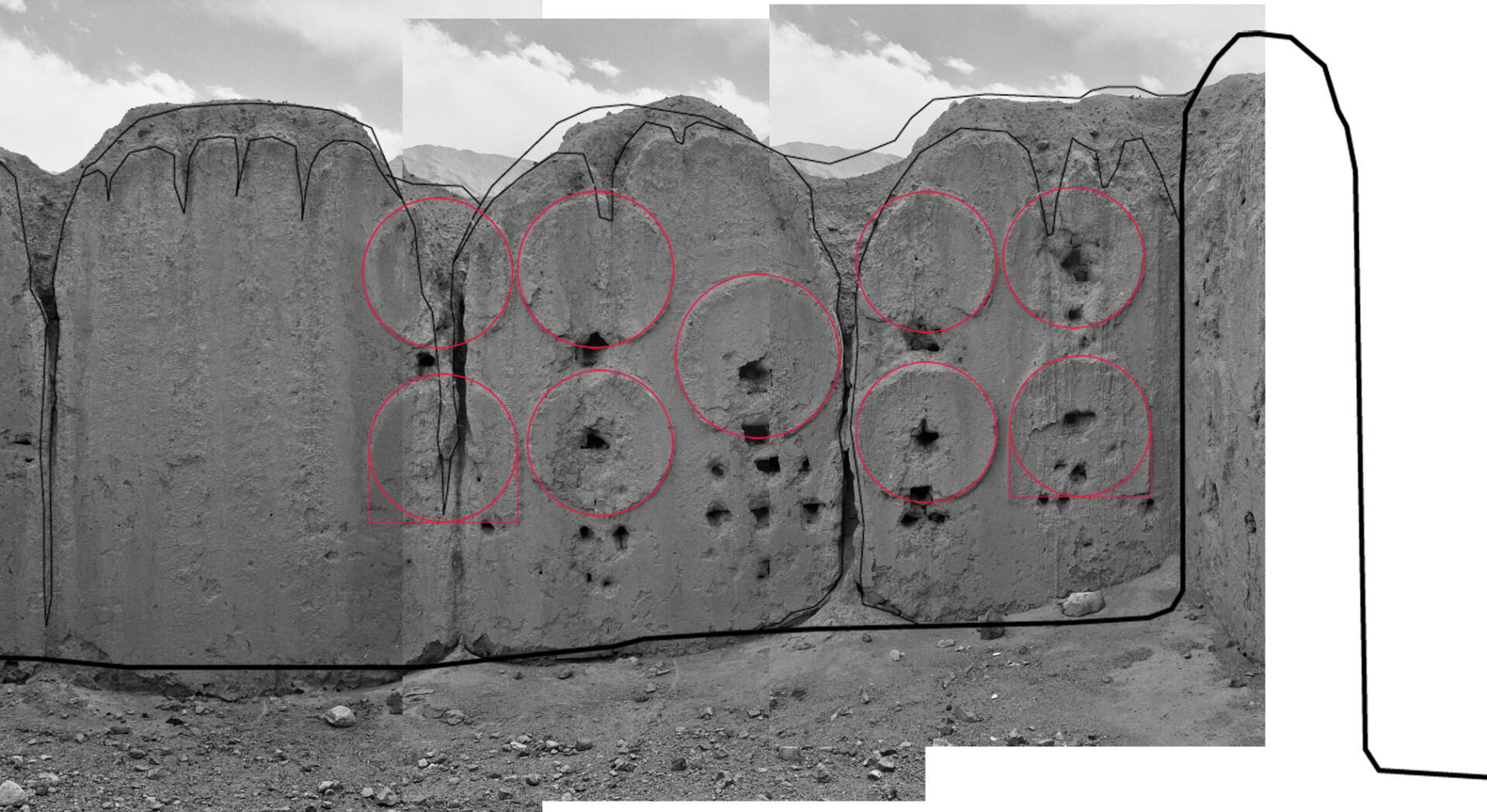
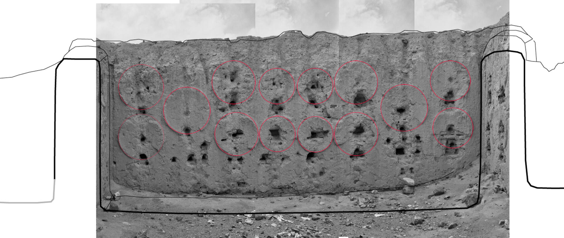
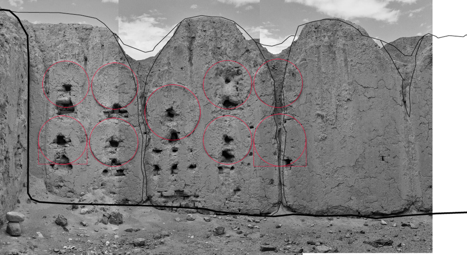
The temple ruin of Basgo
Coordinates of the site: 34°12’44.89″ northern latitude and 77°17’41.91″ eastern longitude, at an altitude of 3157 meters.
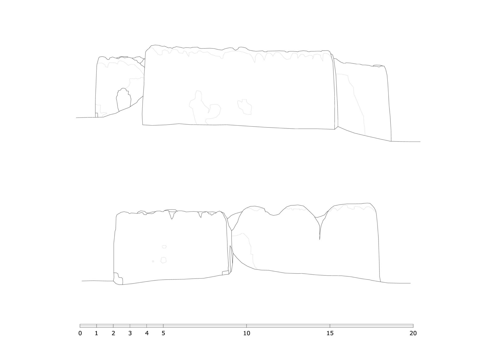
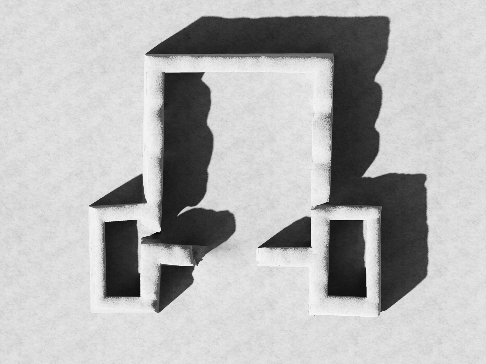
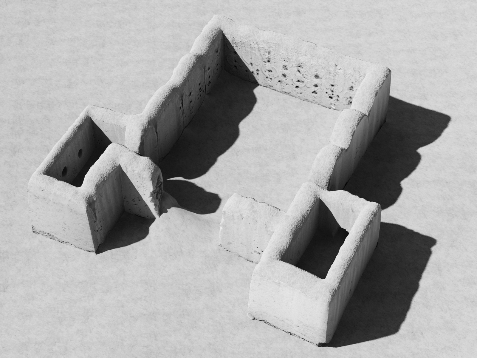
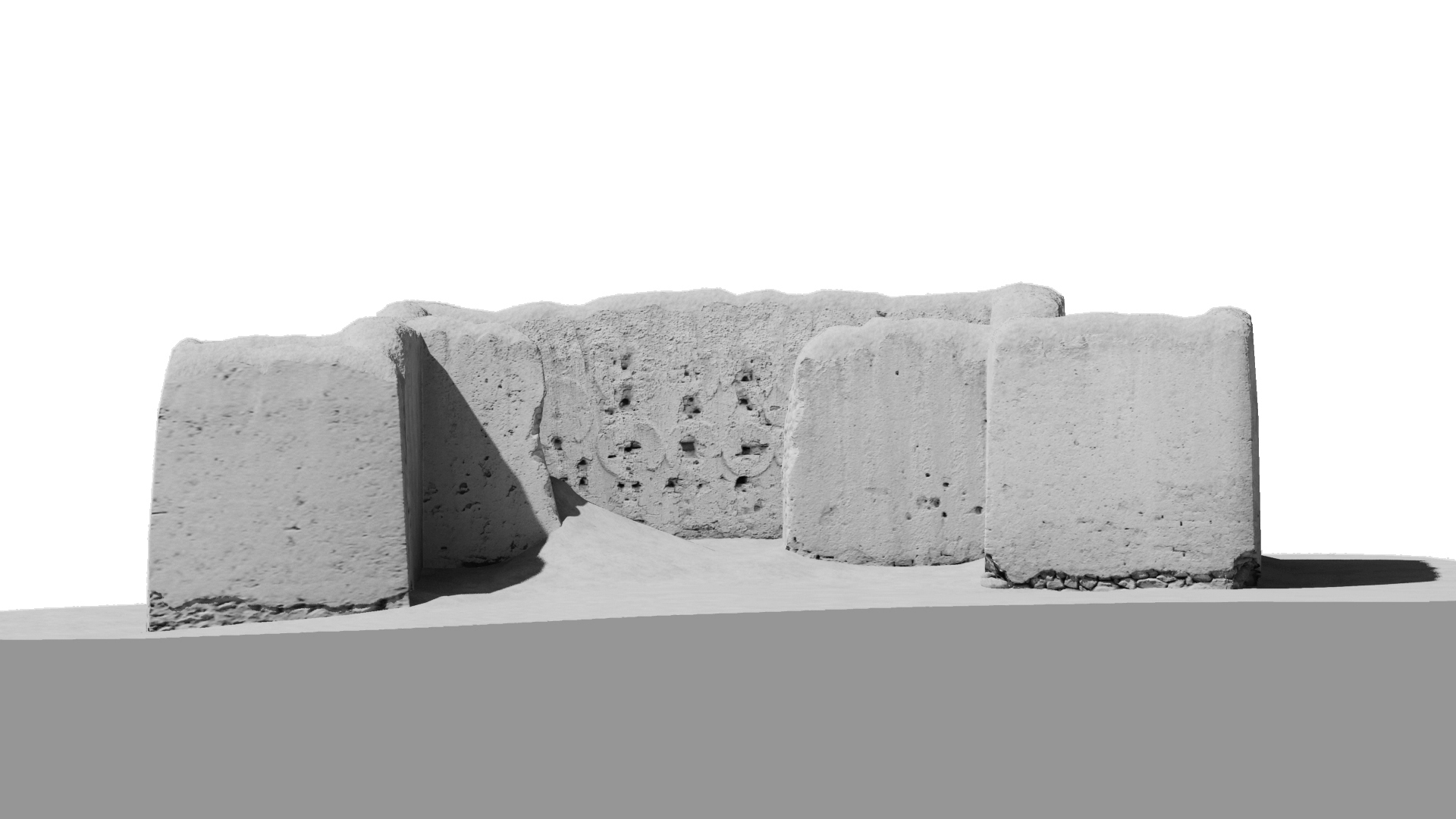
The village of Basgo is located about 26.5 kilometres (airline) west of Leh, on the northern bank of the Indus River. The village consists of about 150 houses and an imposing castle on the top of the hill. Basgo was once the centre of the West Ladakh Kingdom that existed for about 400 years. The temple ruin lies next to the main road in the eastern part of the village.The remains of the building consist of a square hall which is flanked by two closed rooms on each side of the entrance. The inside walls preserve plugholes and halo remains. The preserved plaster modelling of the circular halos and their relation to the wooden supports of the statues can be compared best to the mid-11th century sculptures of the Tabo Assembly Hall. A further contrasting juxtaposition to constructions found in other western Himalayan sites such as Tabo, Nako, Lalung and the Alchi group of monuments make possible to attribute this temple ruin to the mid or the second half of the 11th century.
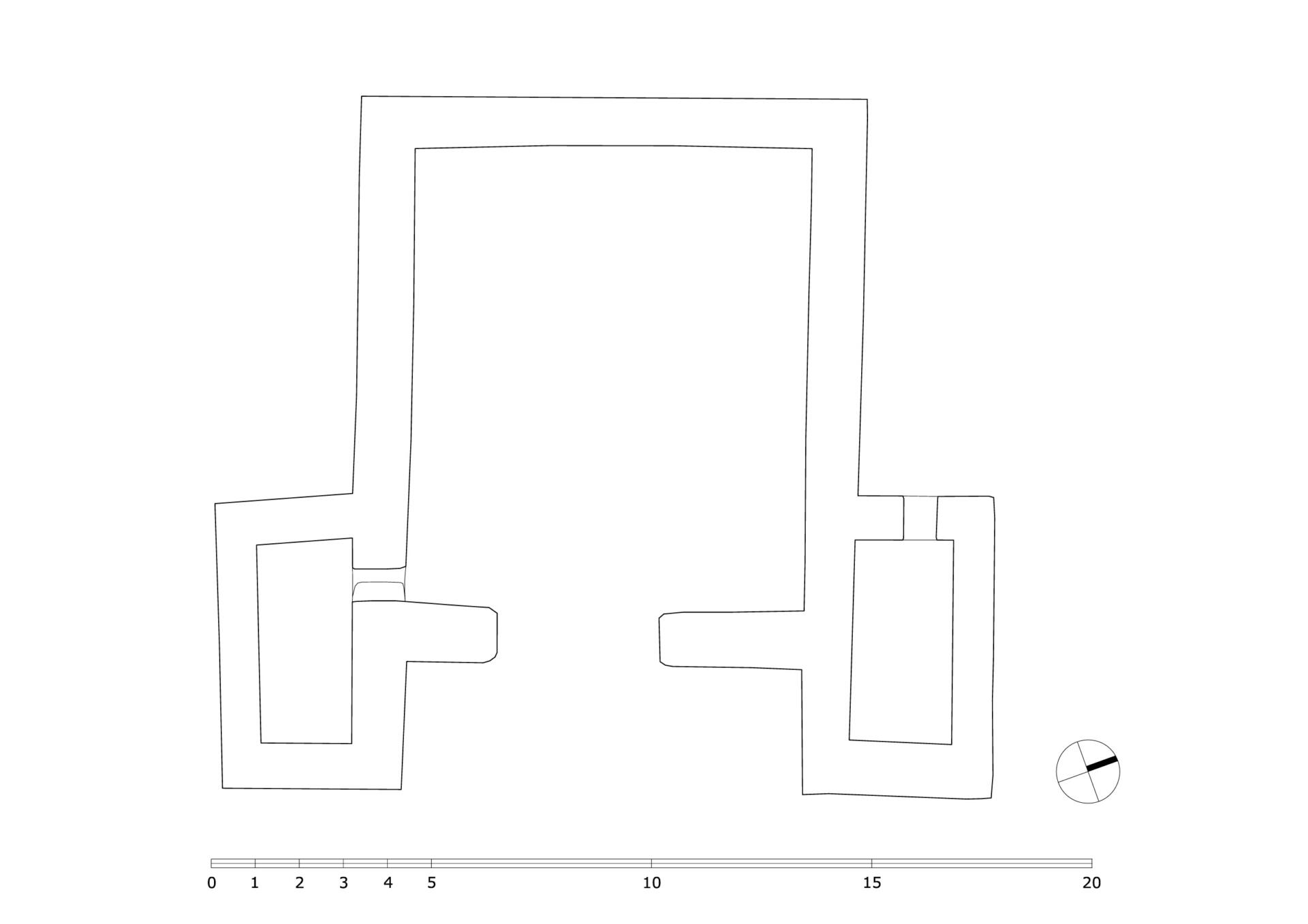
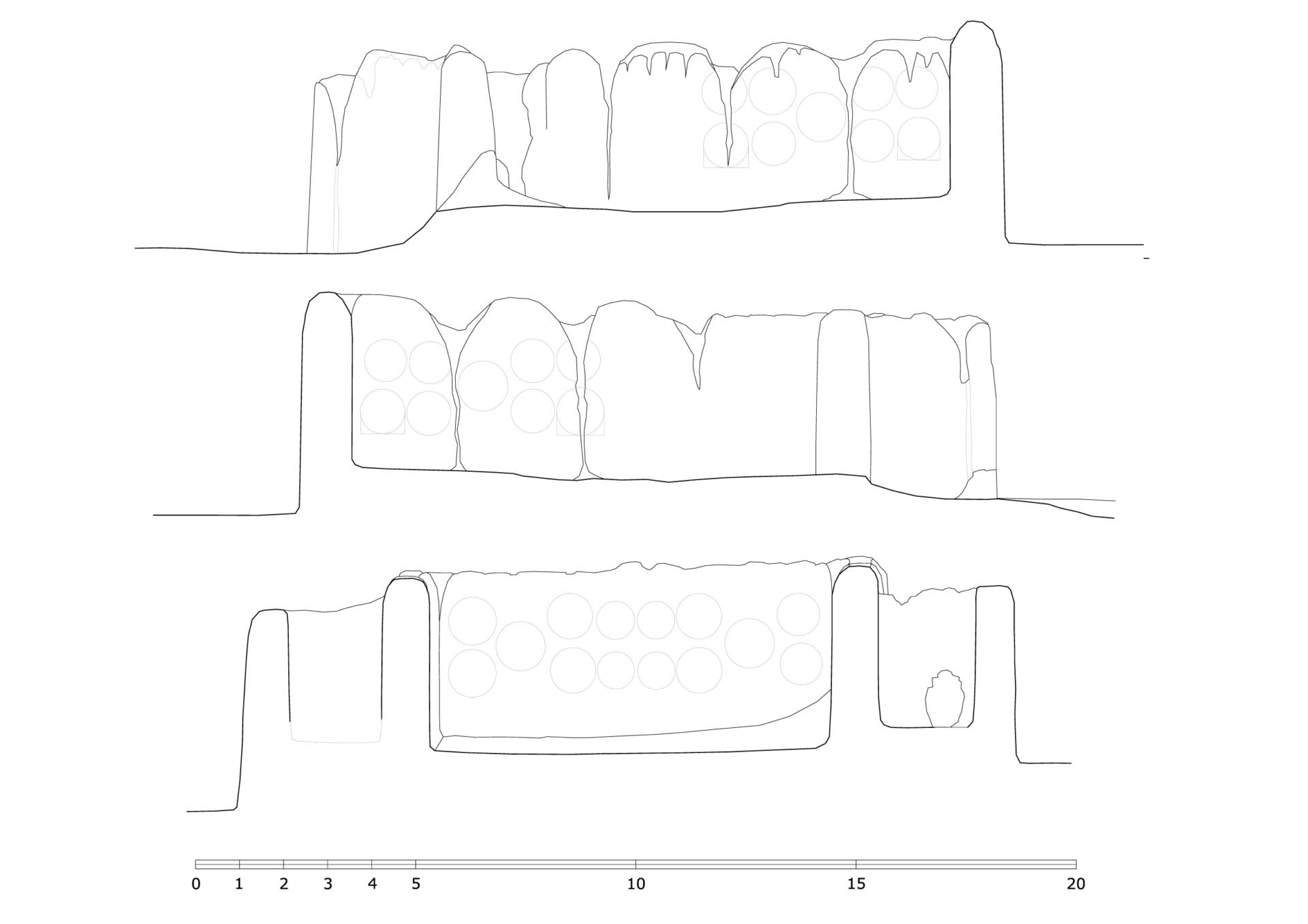
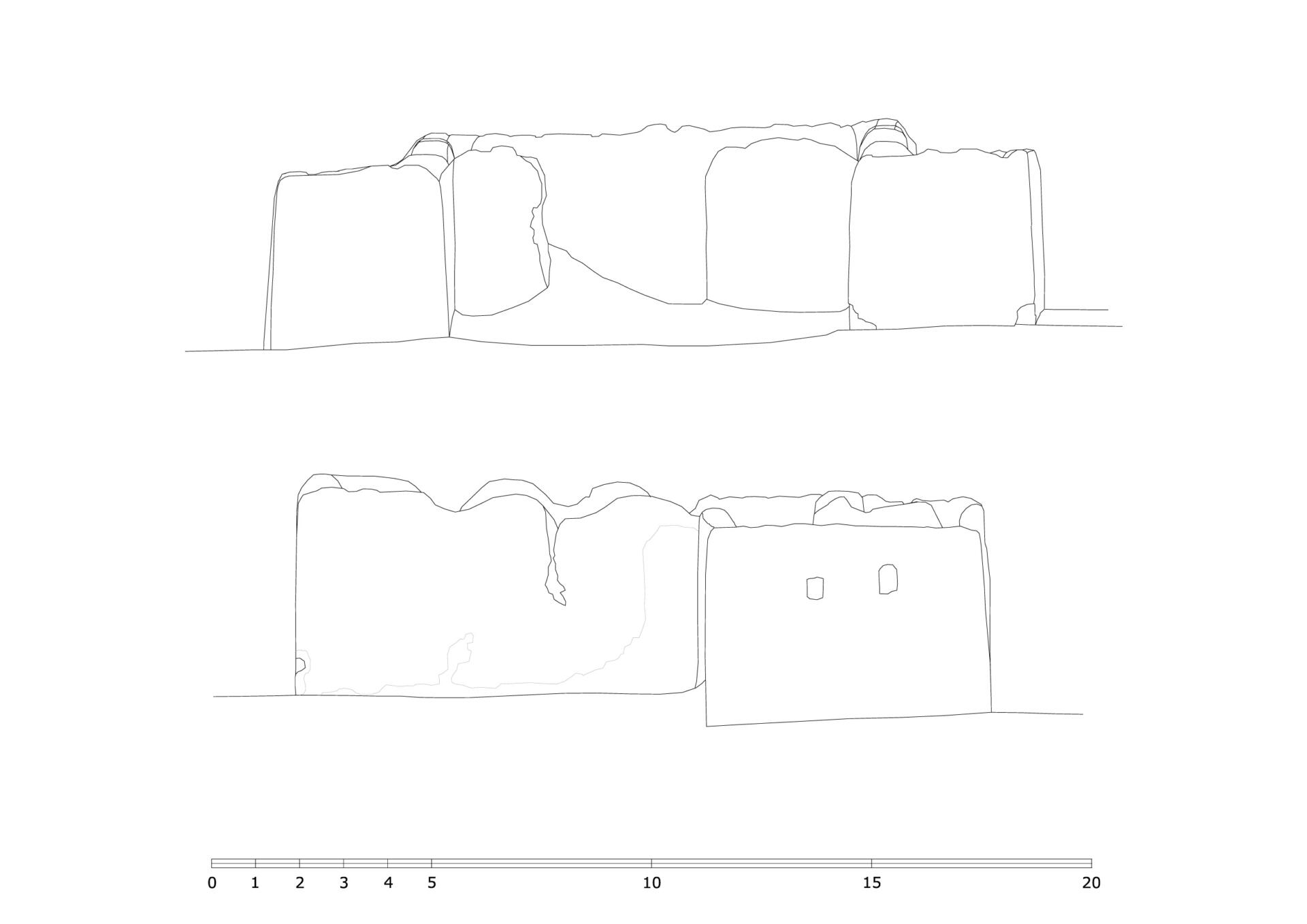
Also see: Dimensioned plan drawings of Basgo. Repository TU Graz, 2024.
Cf. Neuwirth & Auer 2021: The Ancient Monastic Complexes of Tholing, Nyarma and Tabo, pp.312-325, Open Access E- Book. Cf. Luczanits: “The early Buddhist heritage of Ladakh reconsidered”, in: Ladakhi Histories. Local and Regional Perspectives, ed. by John Bray, Leiden-Botston: Brill 2005, pp.65-96.
2D Plans
3D Model
More from