Ladakh
Nyarma
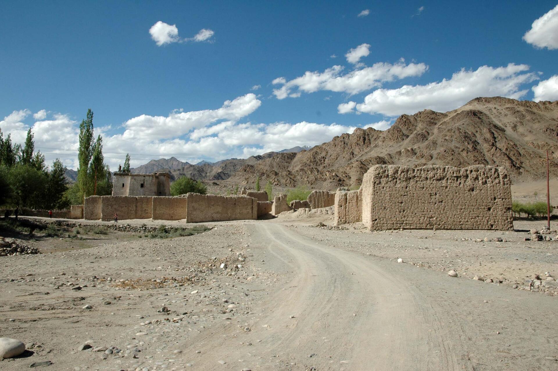
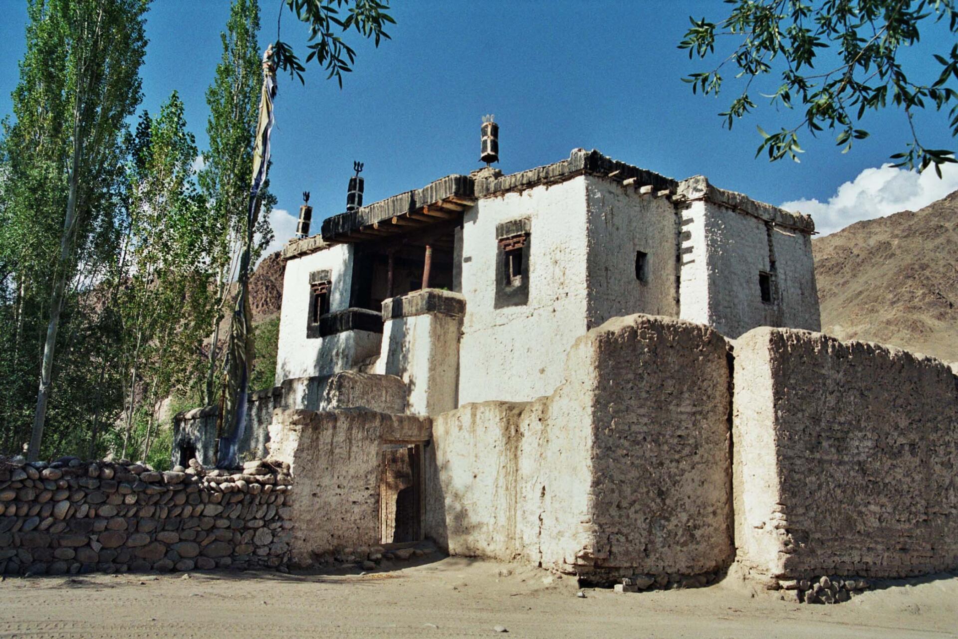
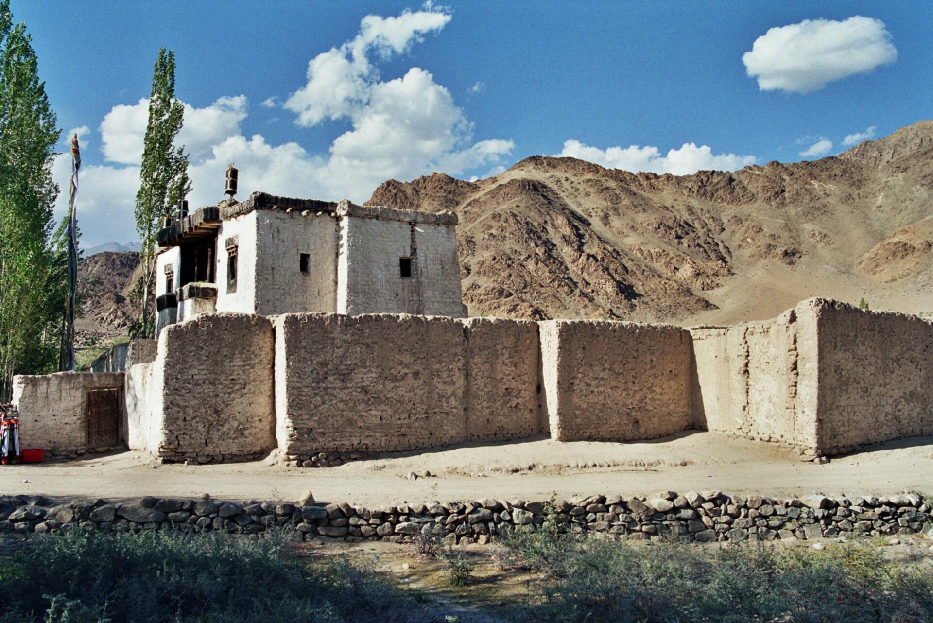
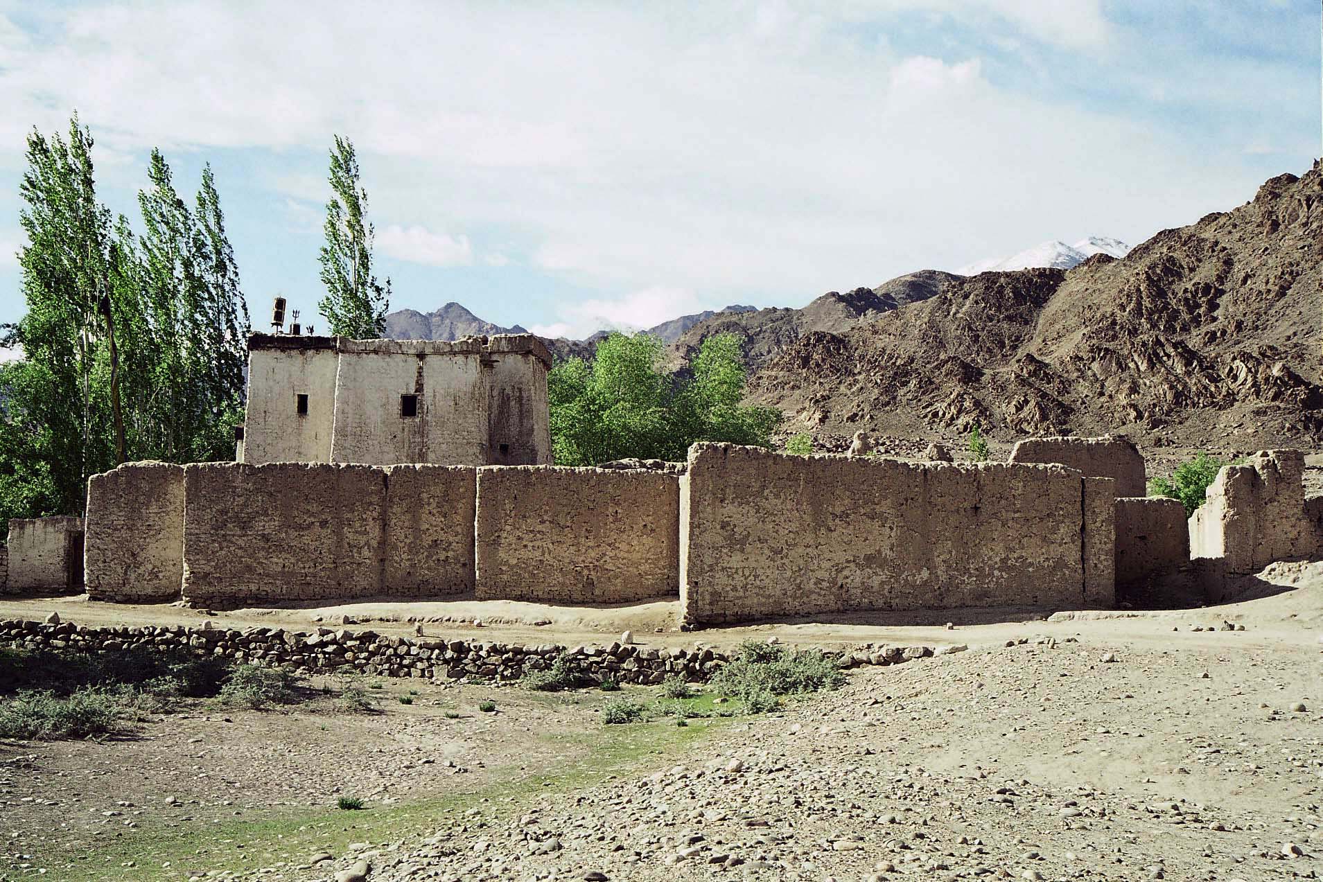
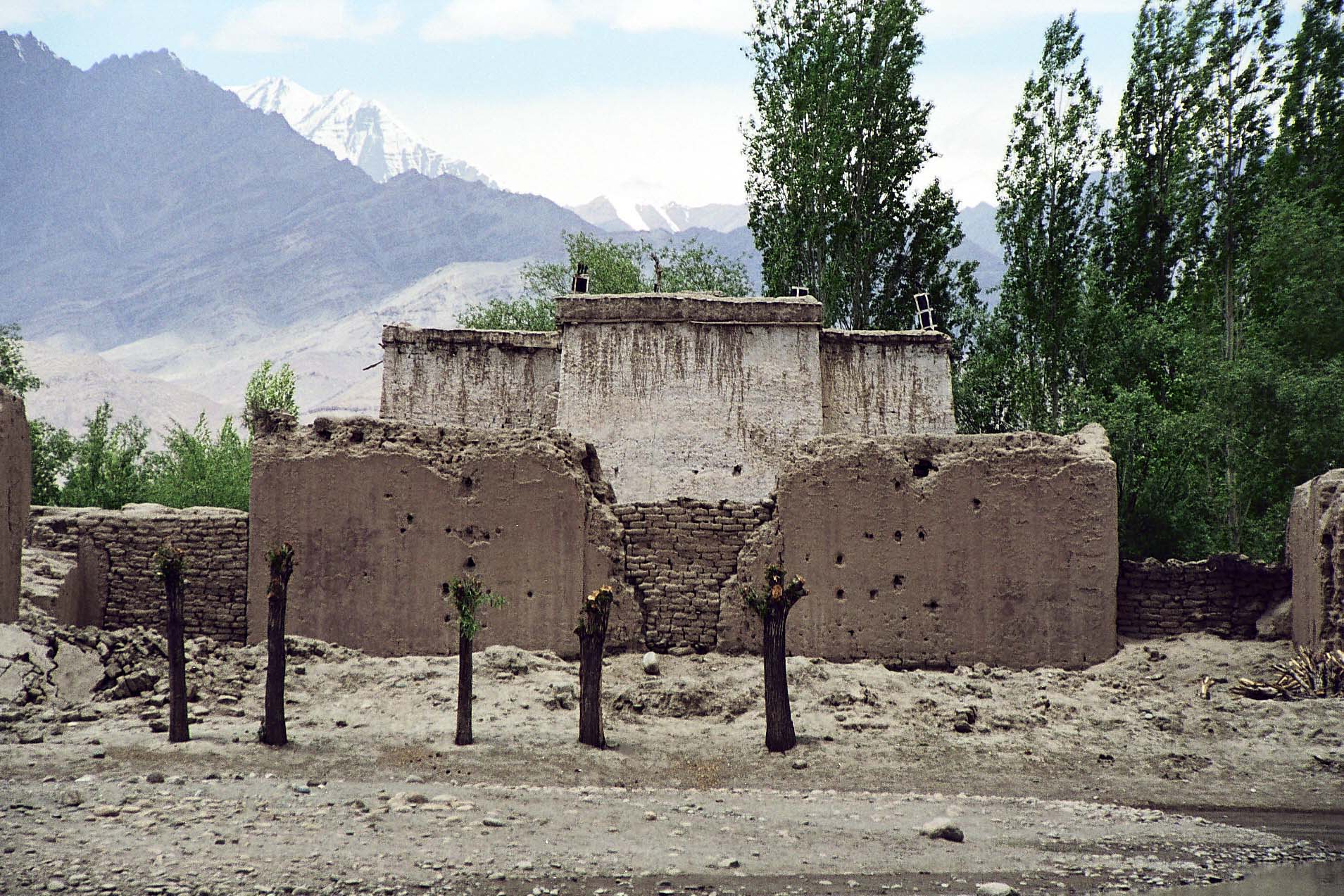
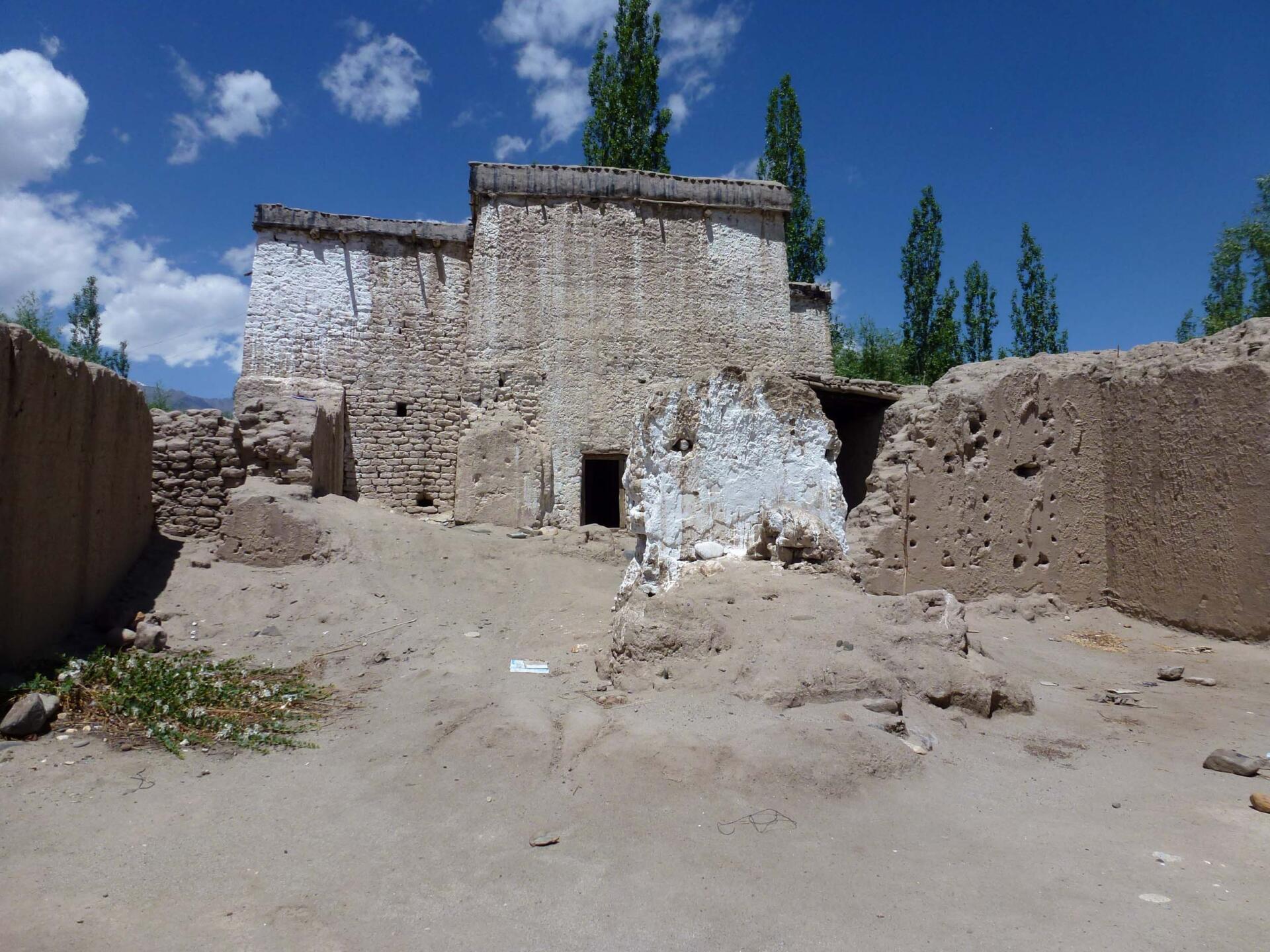
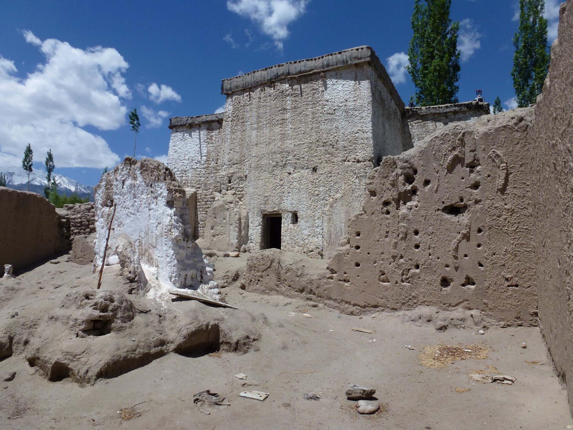
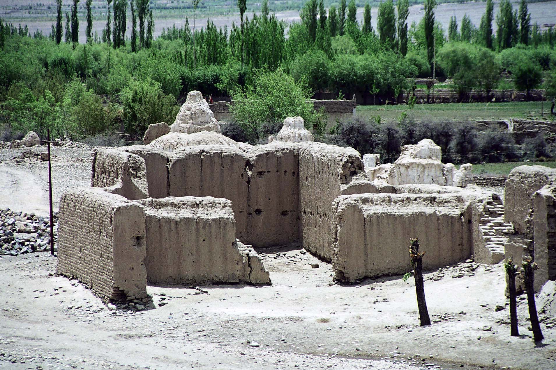
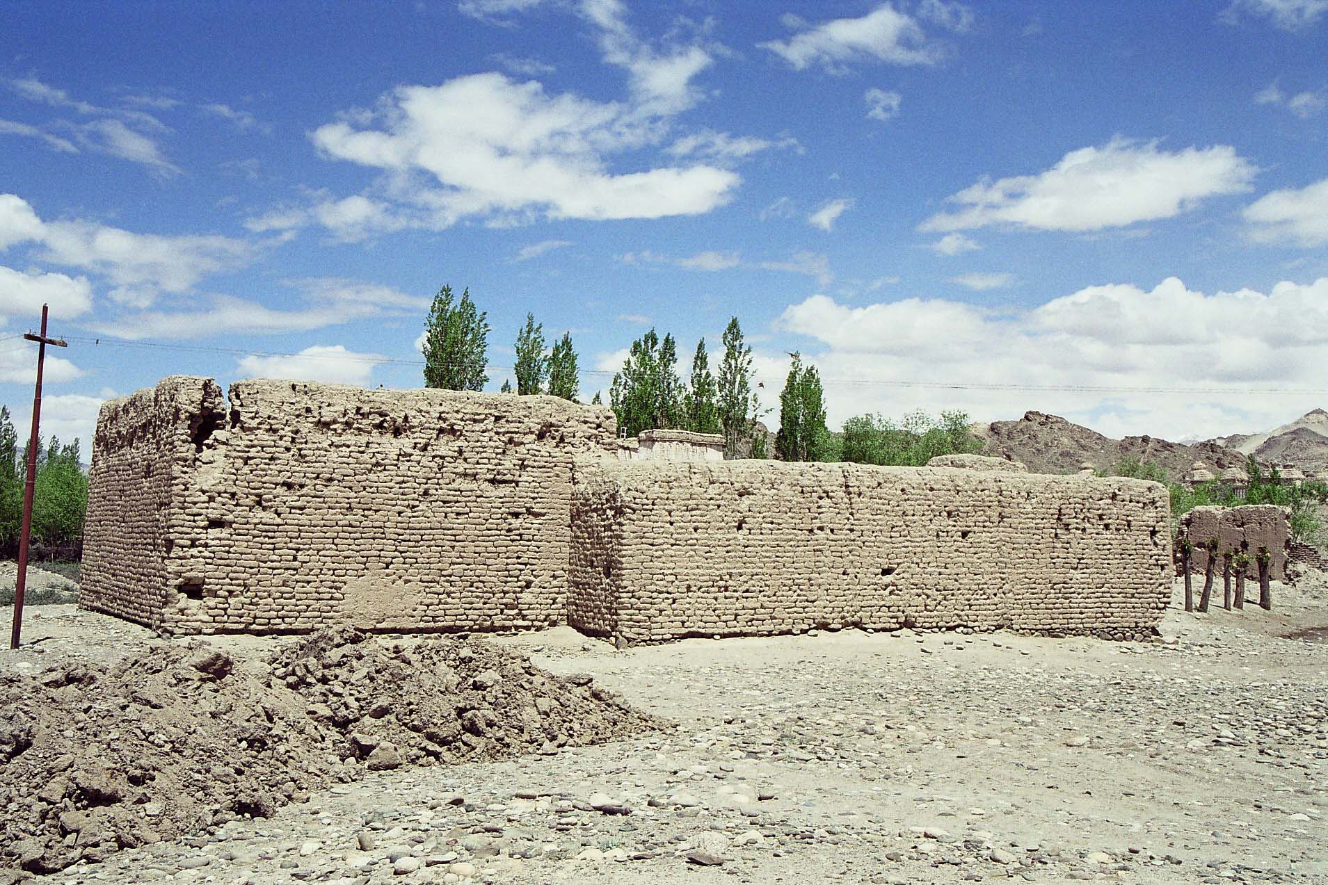
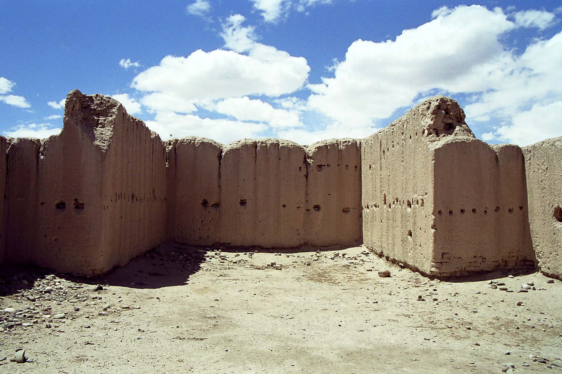
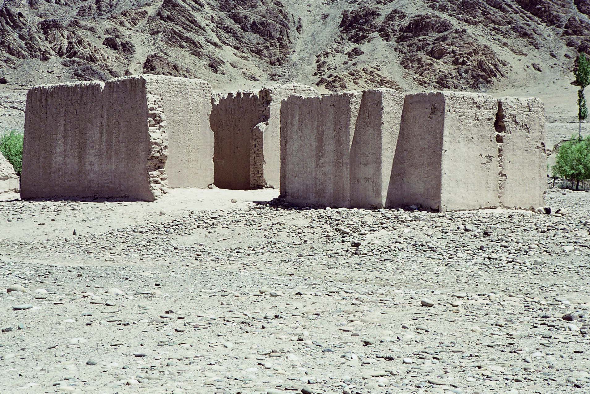
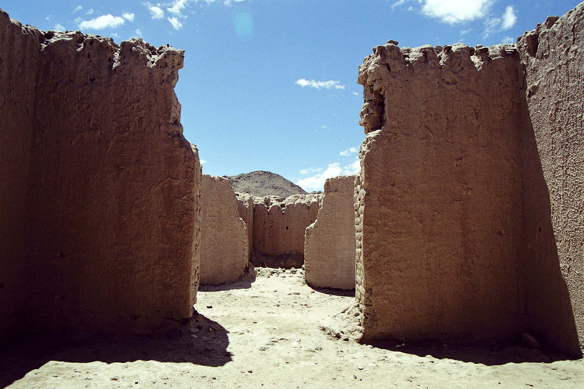
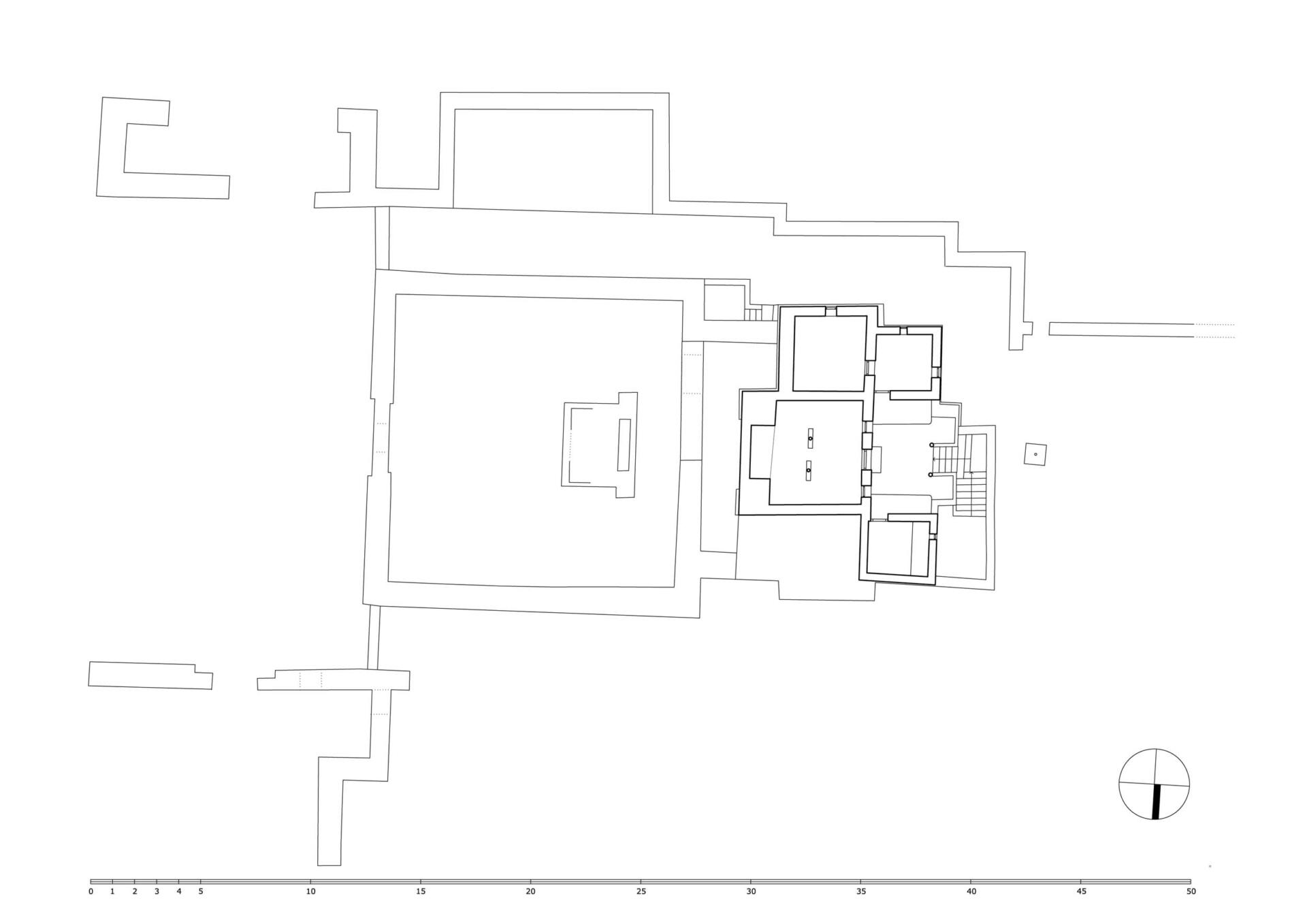
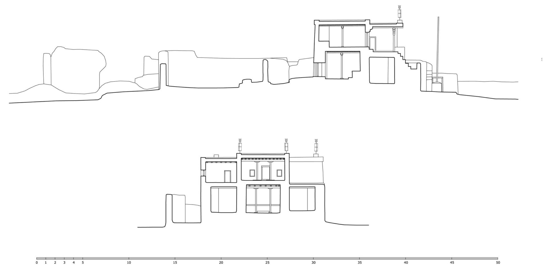
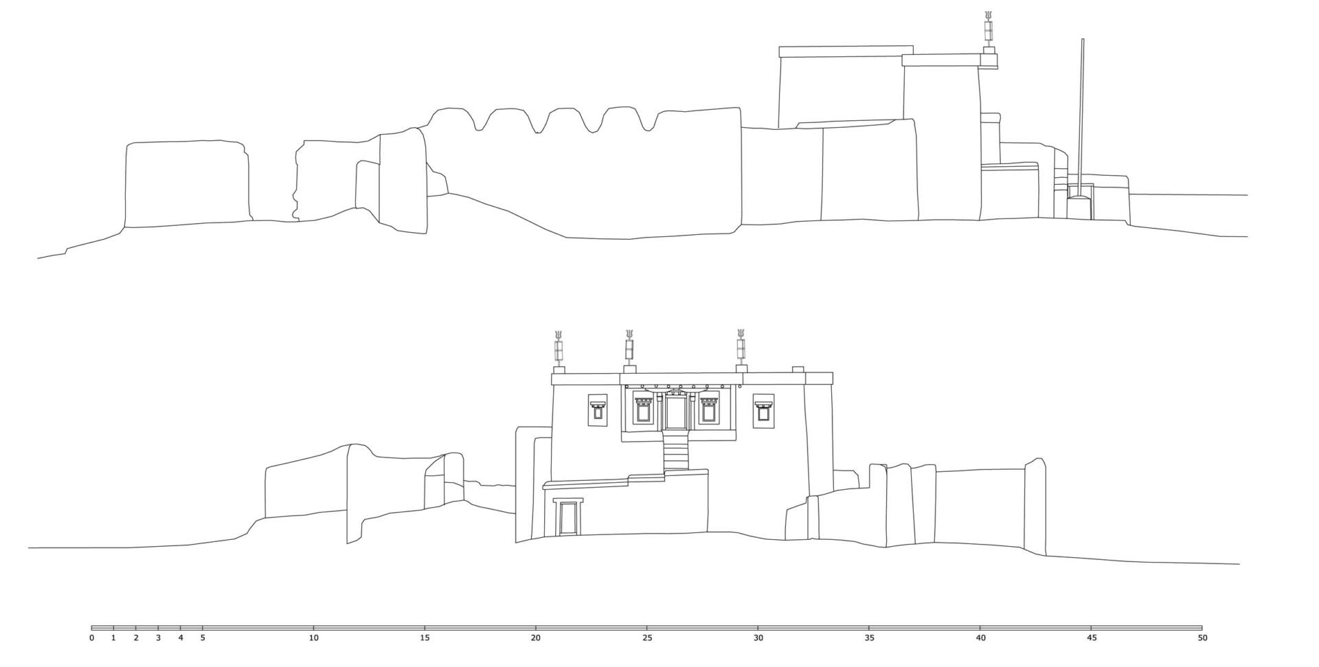
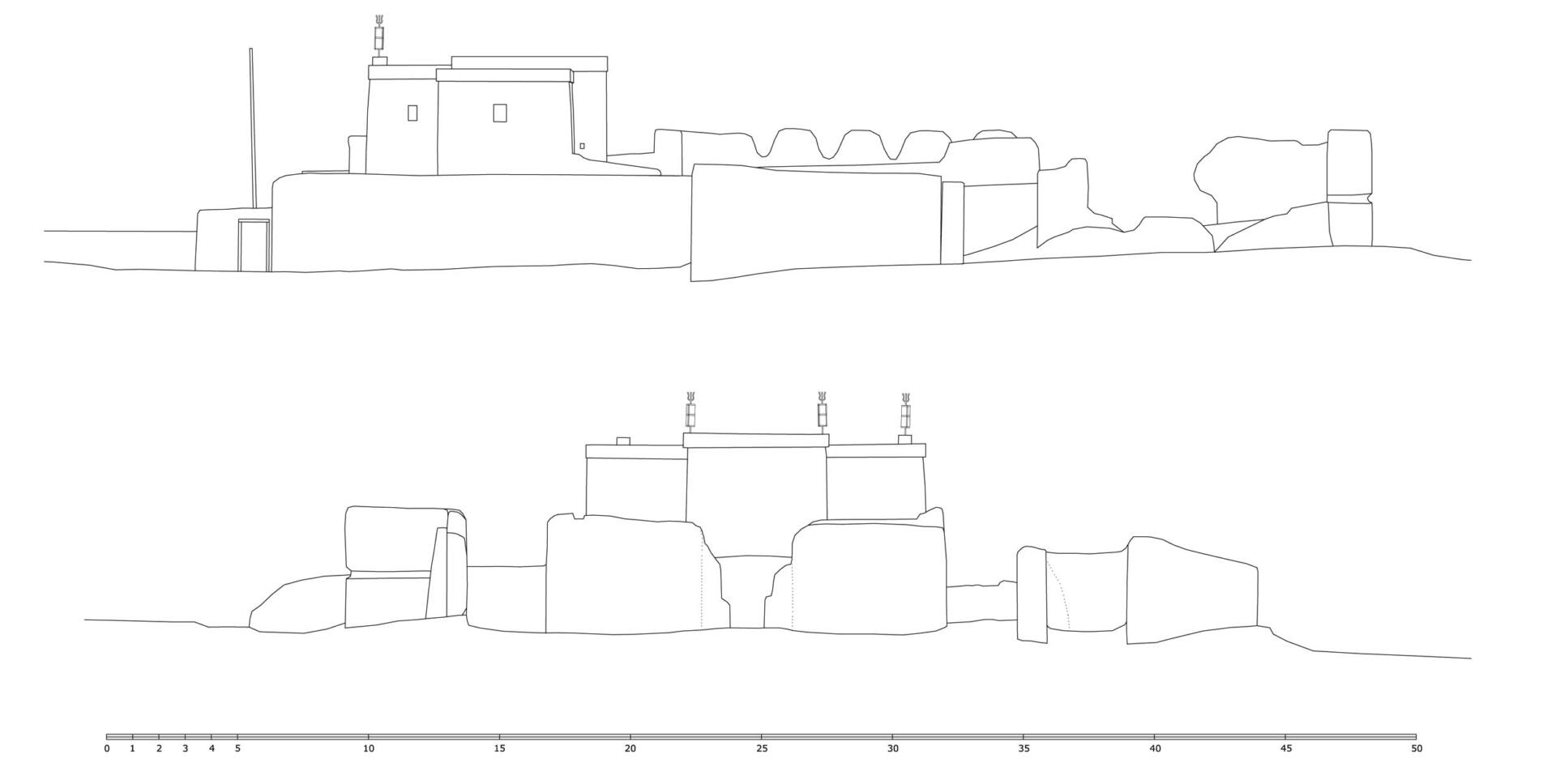
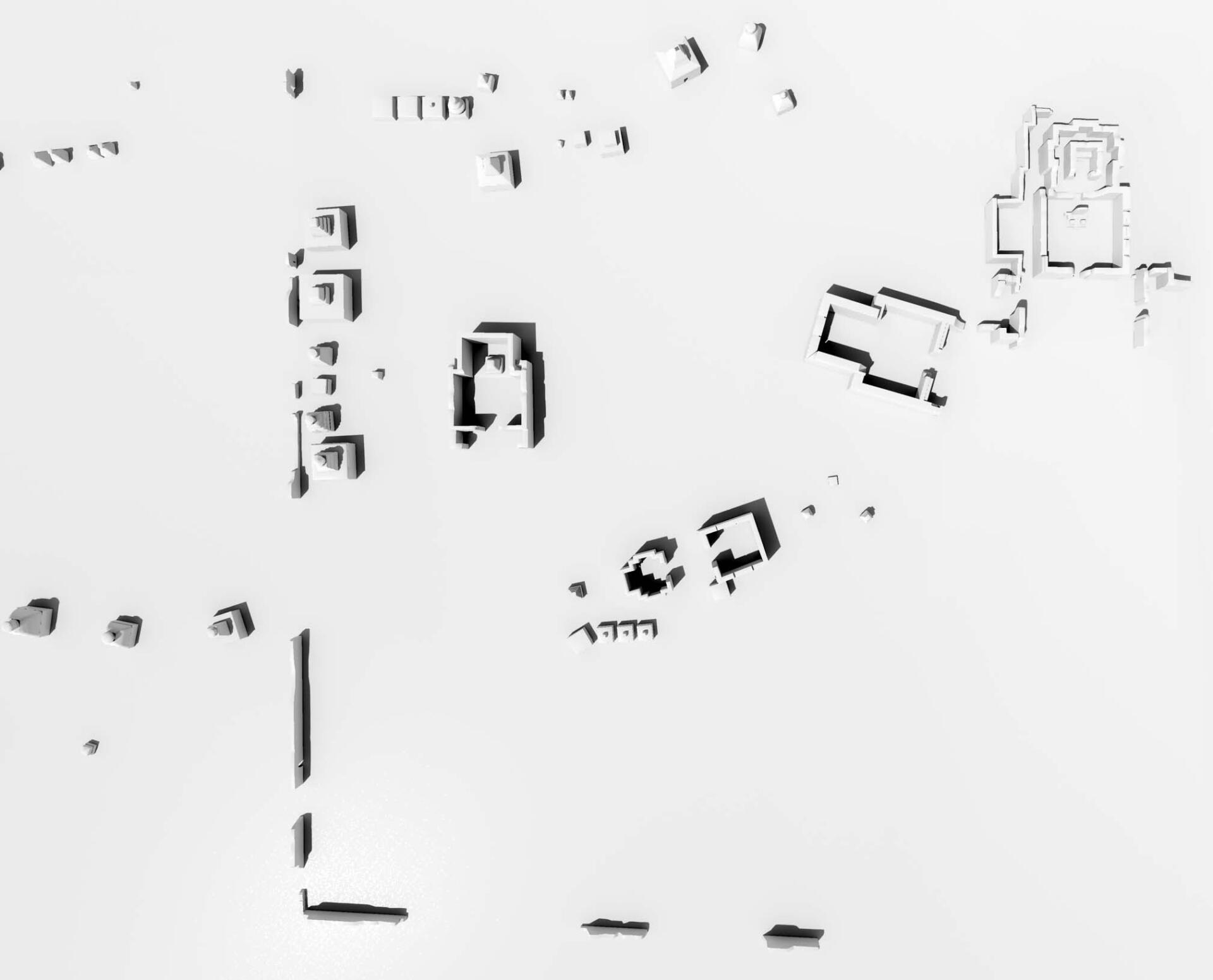
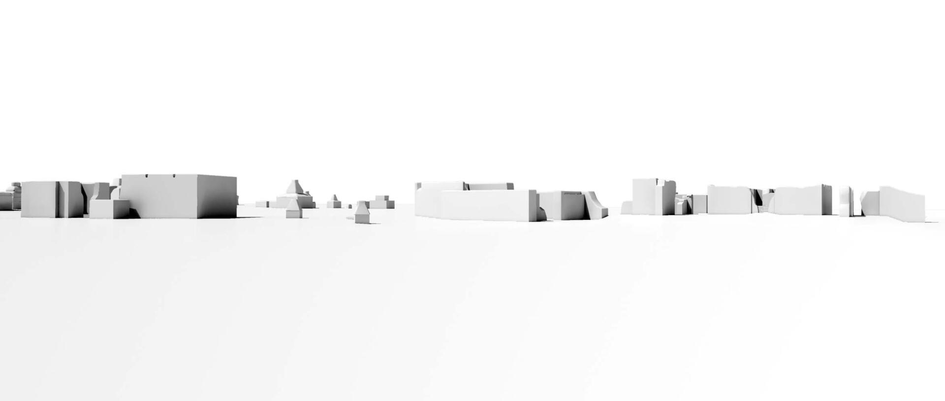
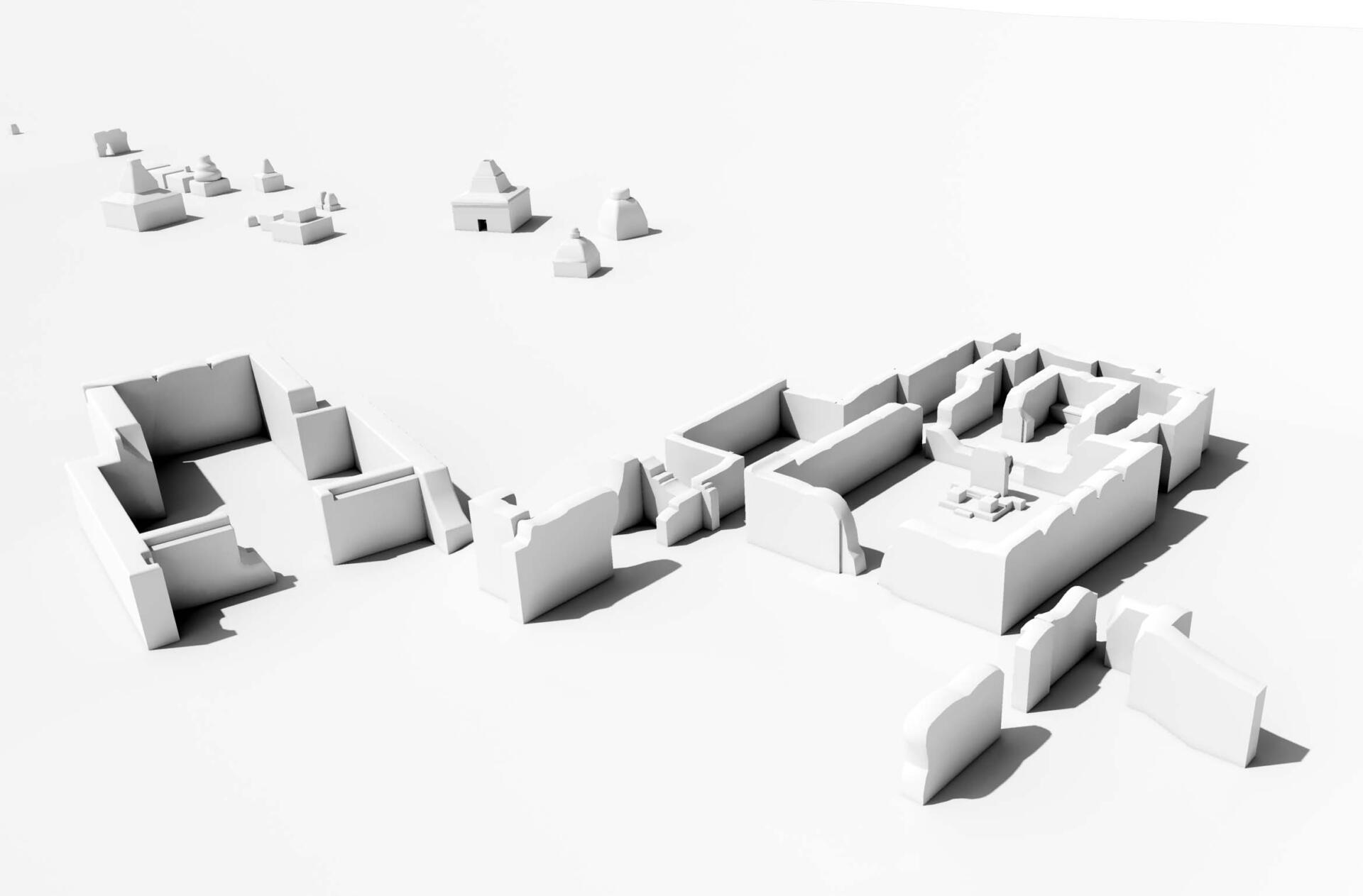
The ruins of Nyarma
Coordinates of the site: 34° 2’21.15″ northern latitude and 77°41’2.94″ eastern longitude, at an altitude of 3263 meters.
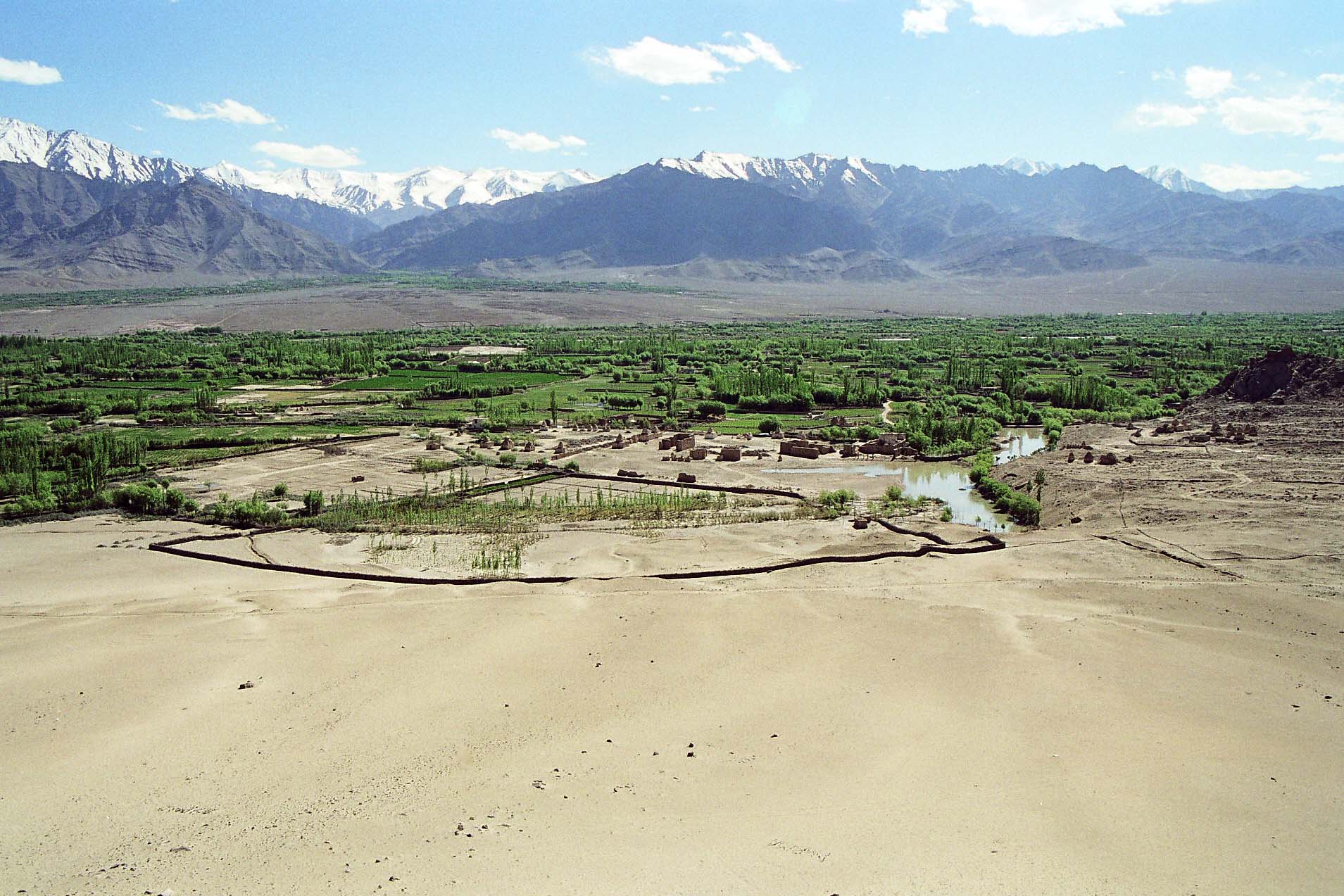
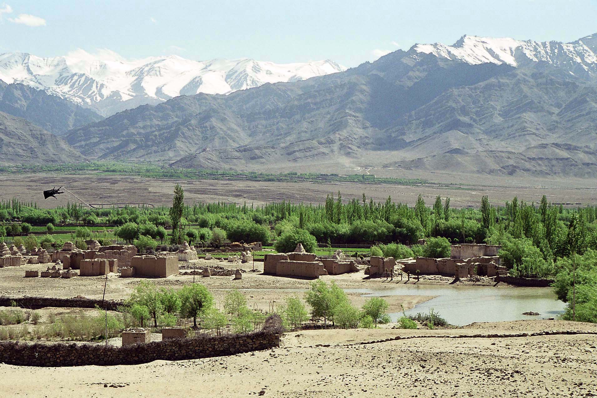
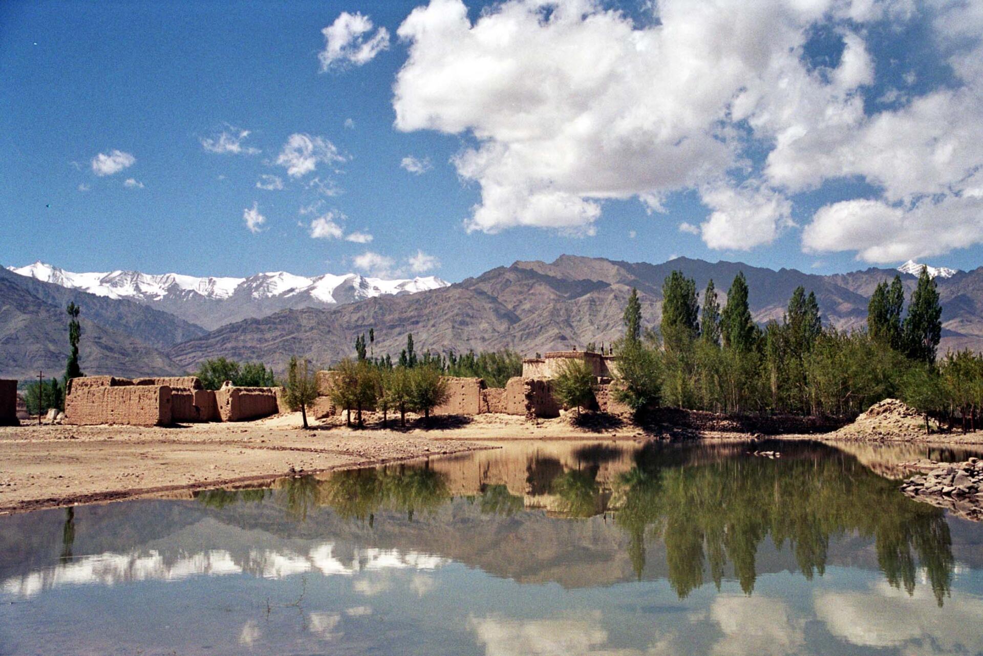
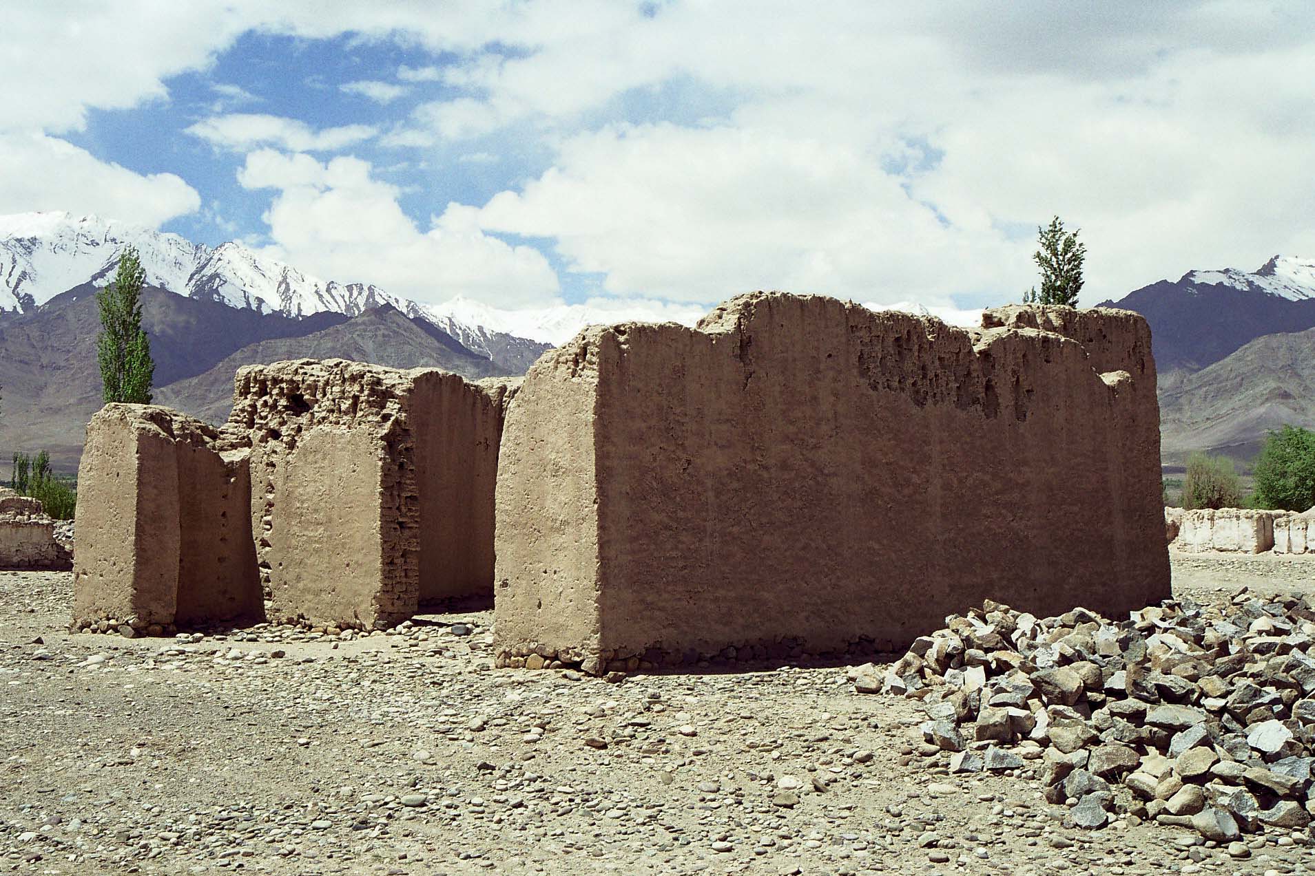
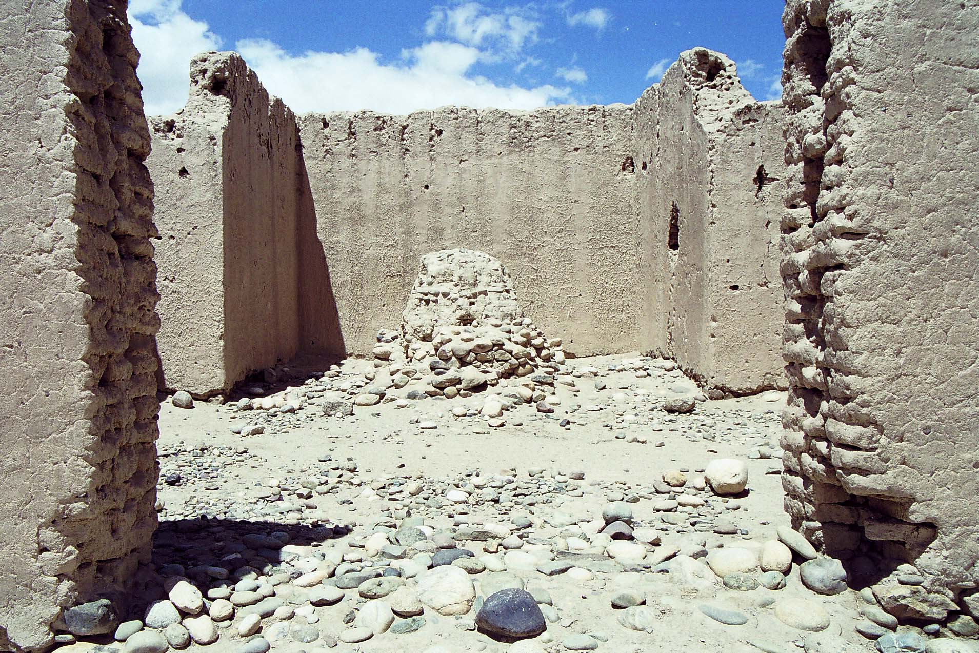
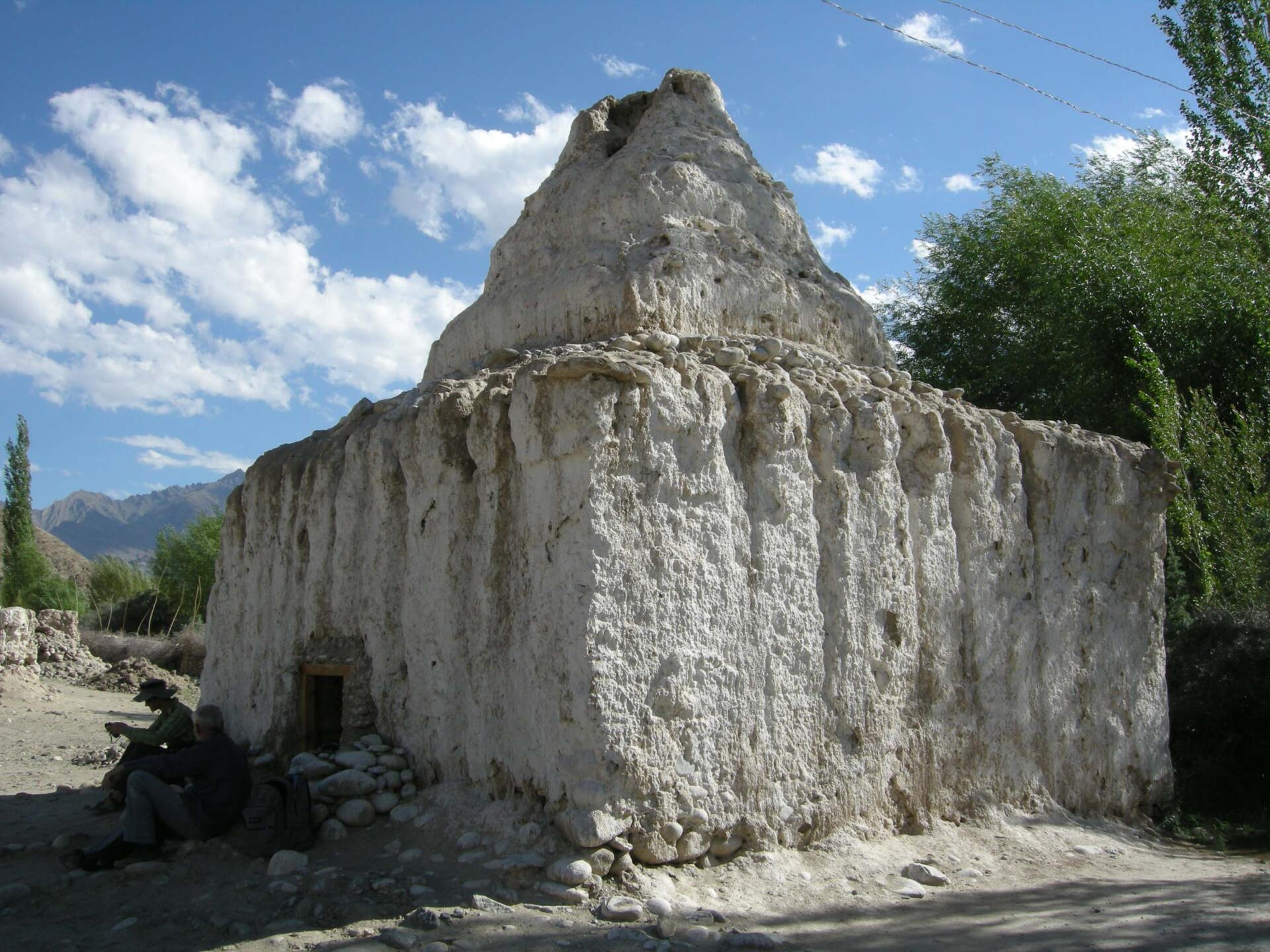
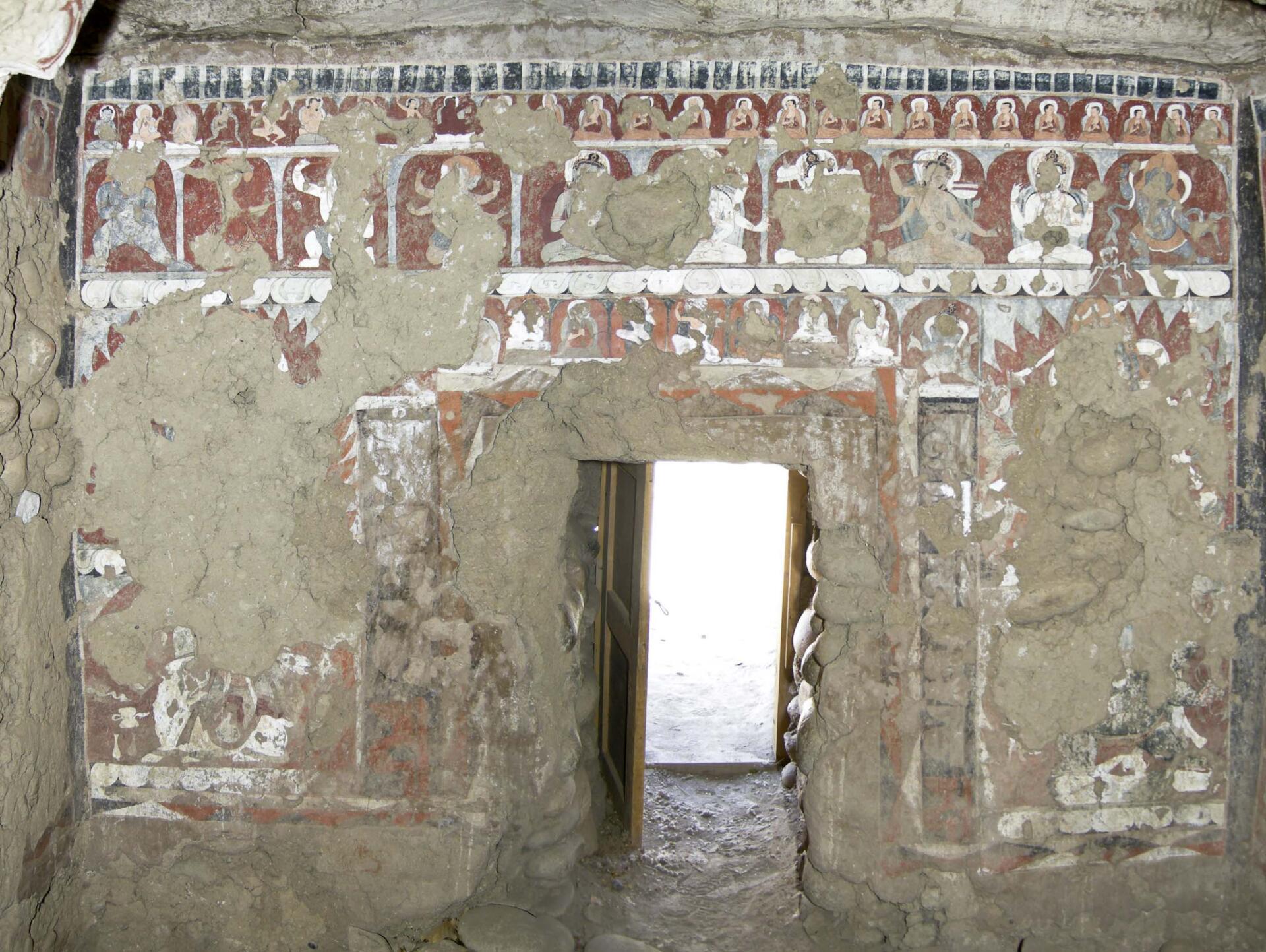
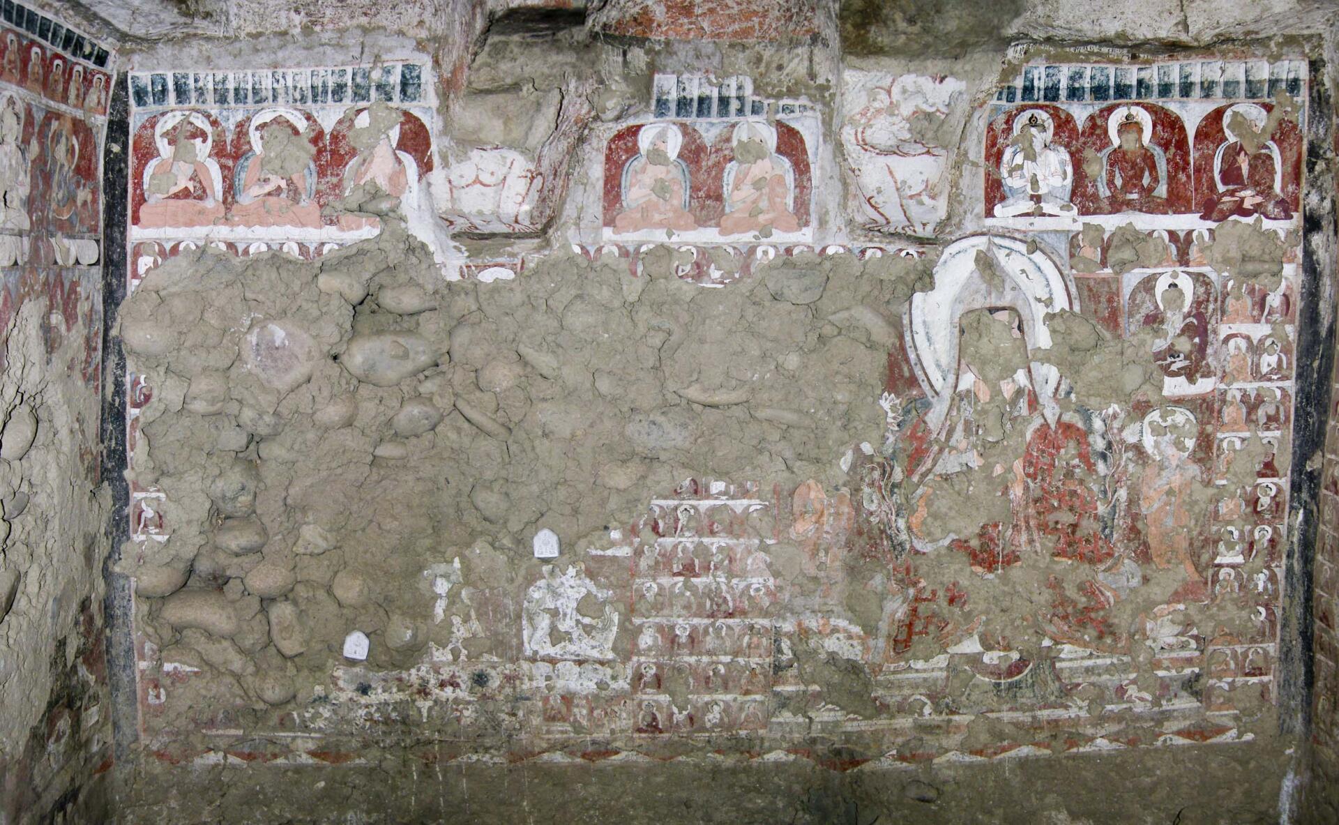
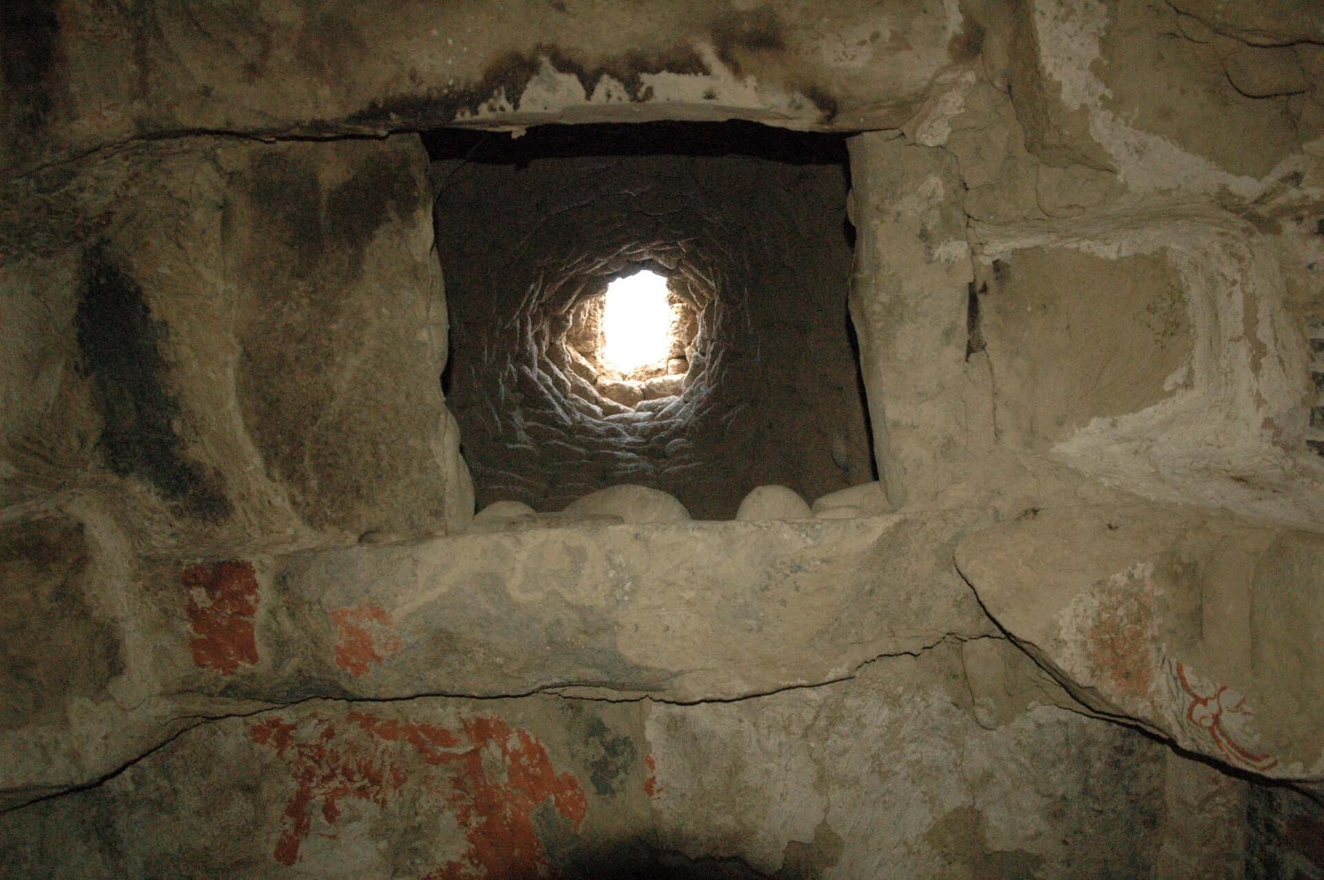
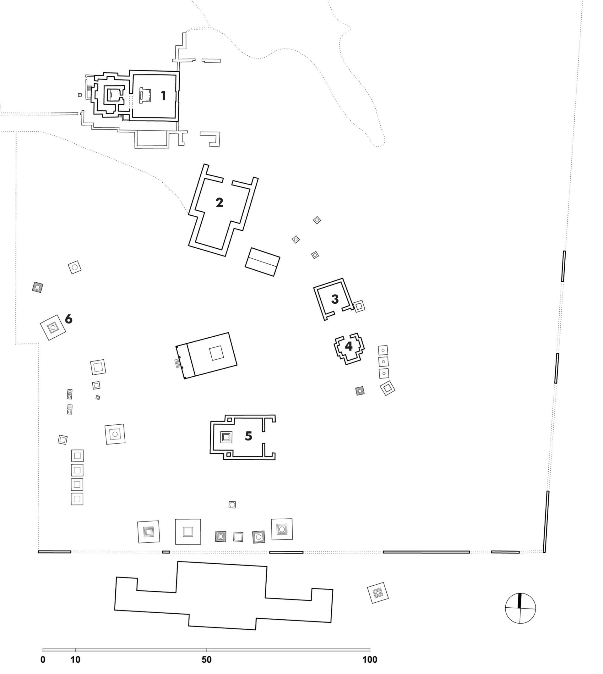
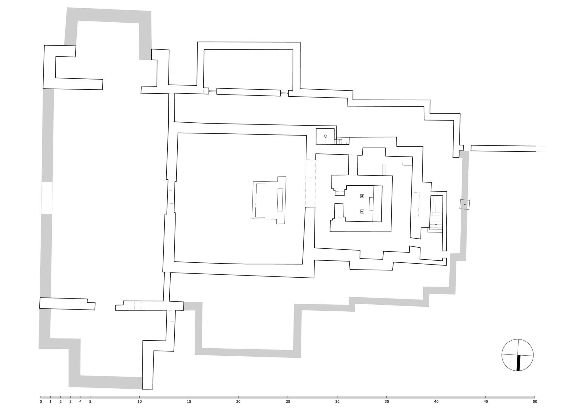
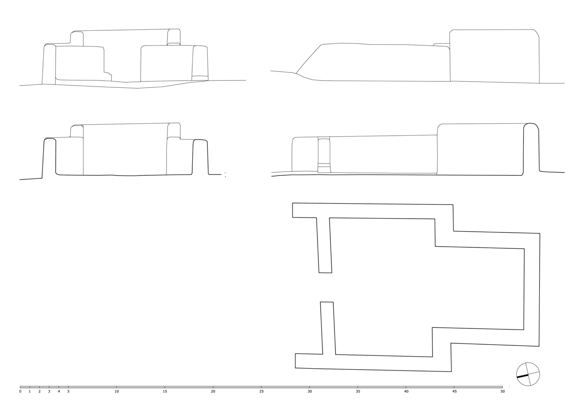
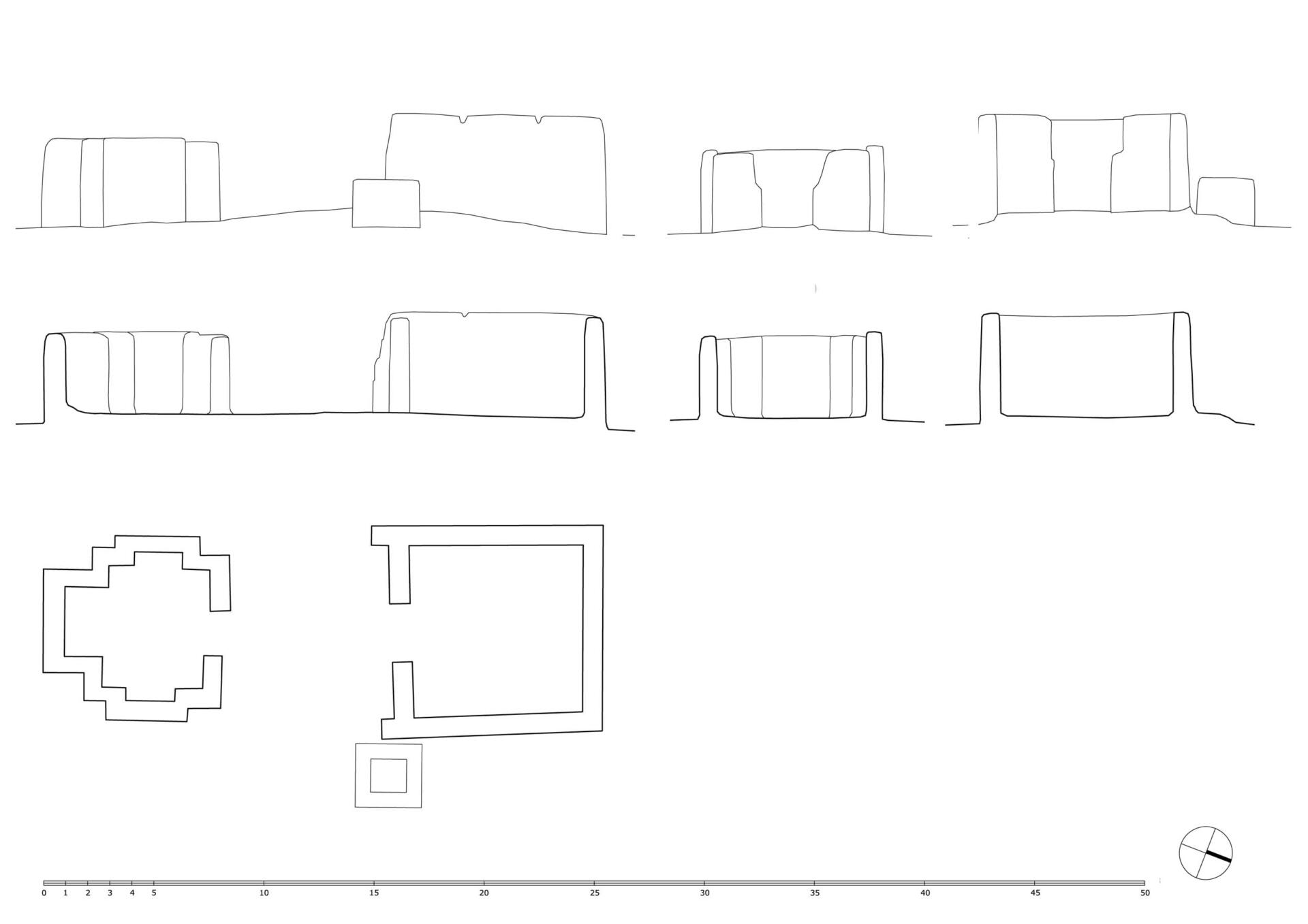
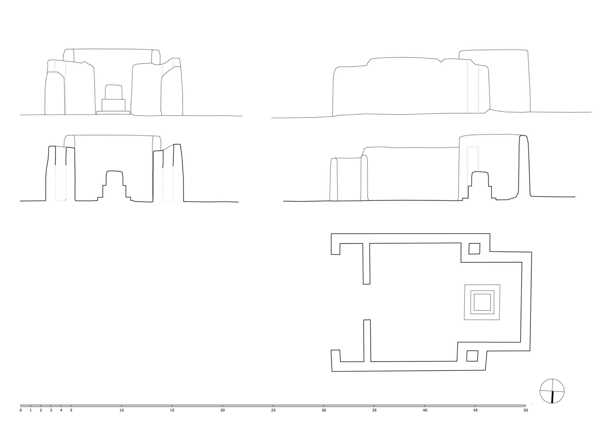
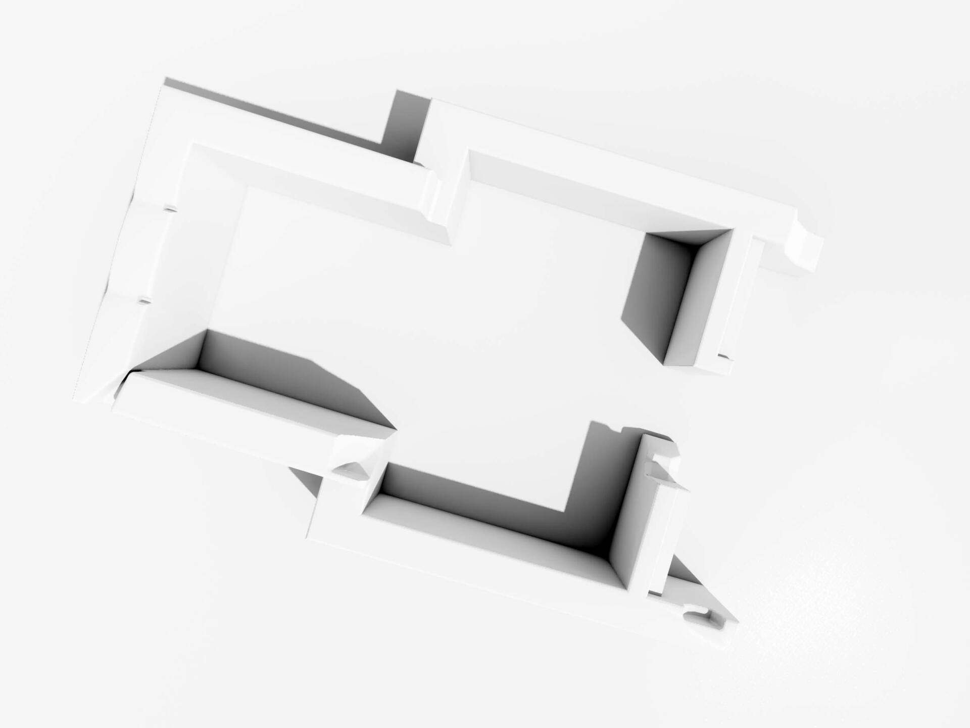
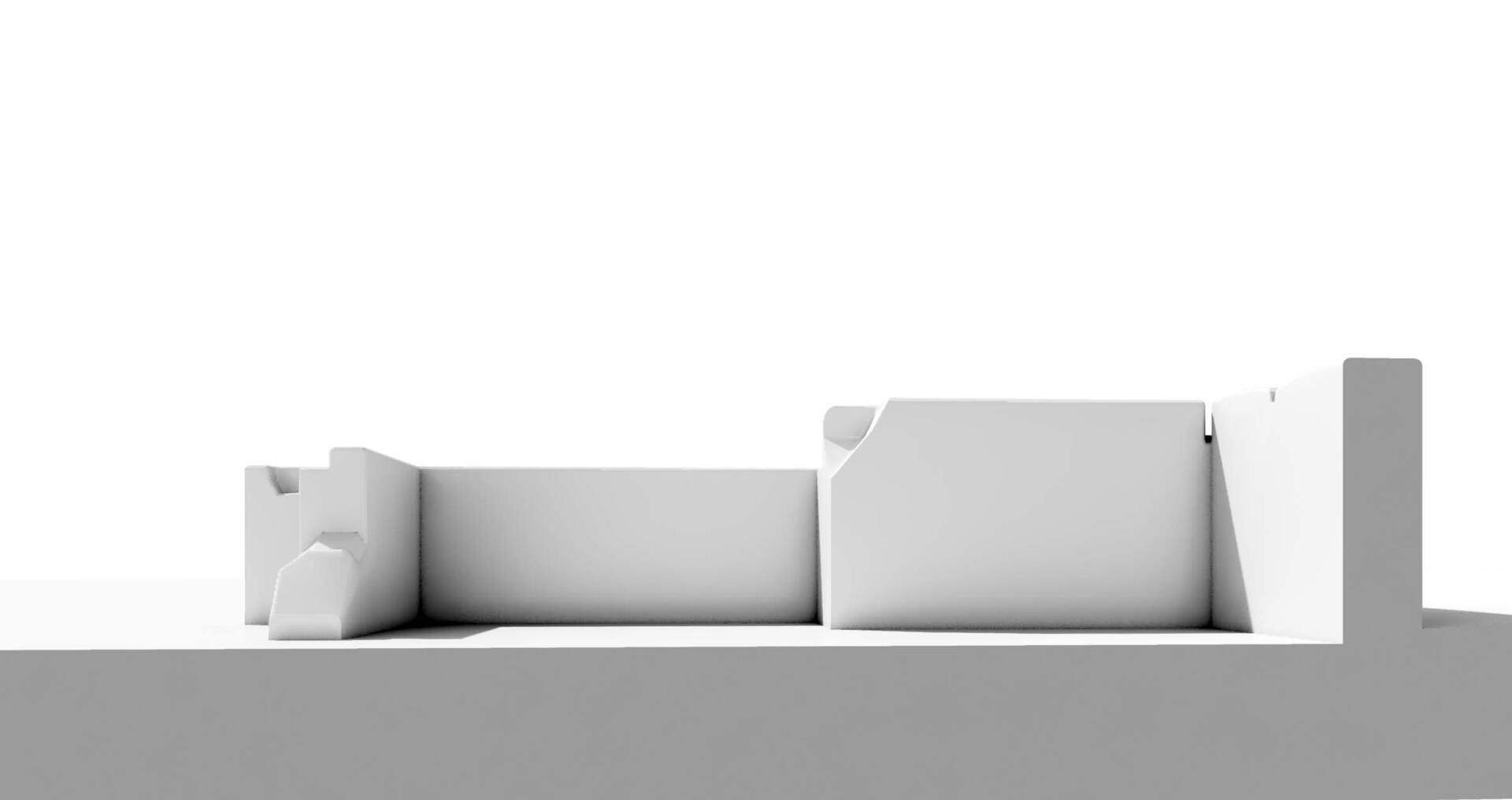
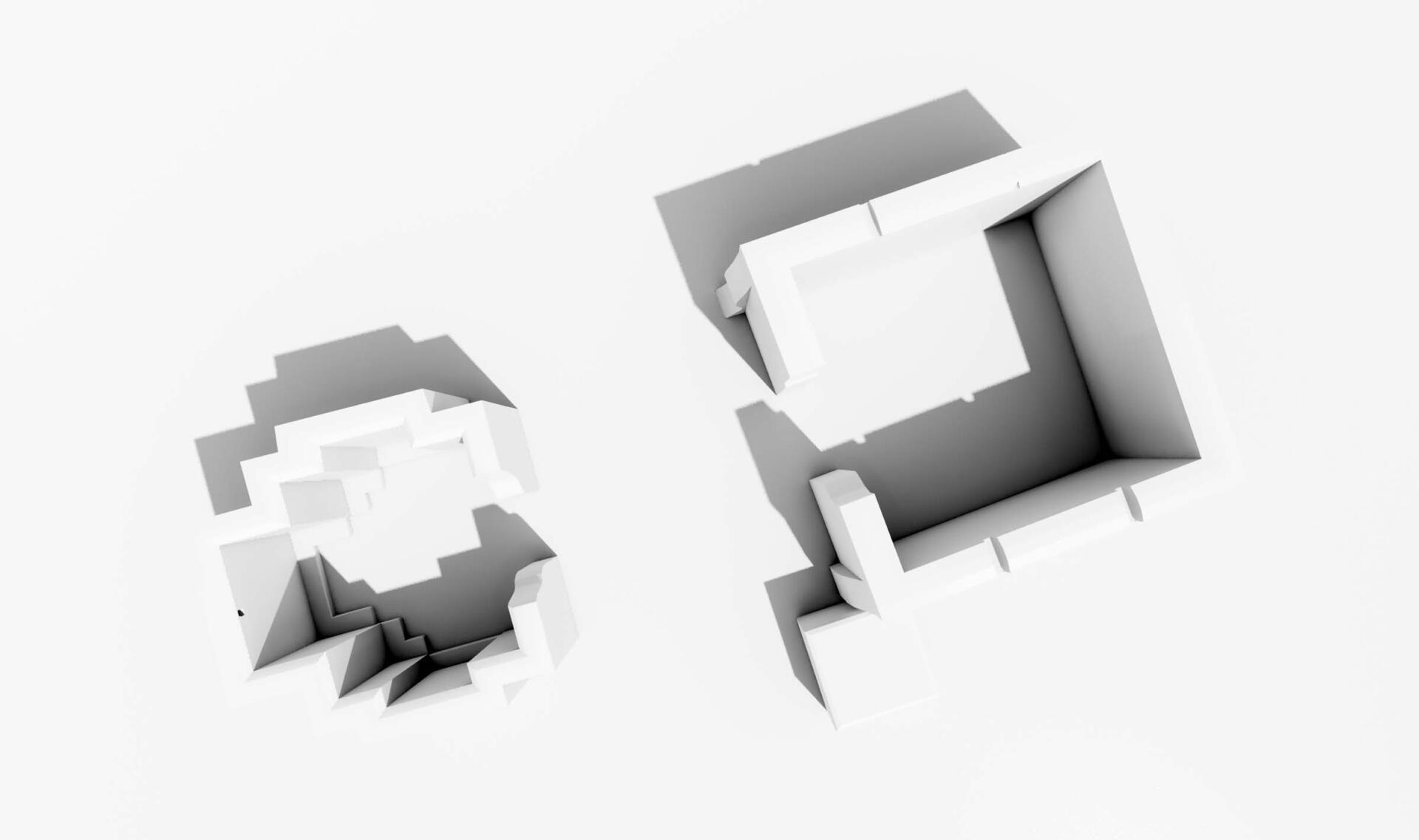
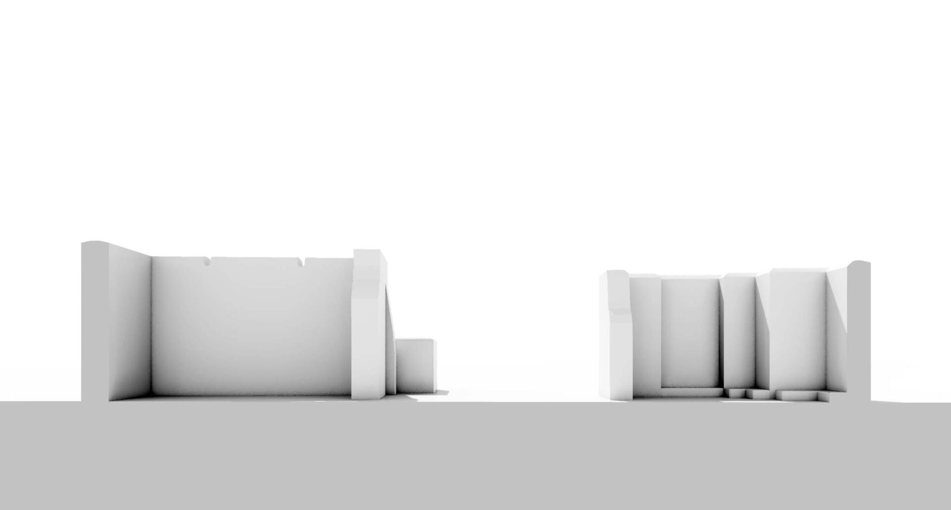
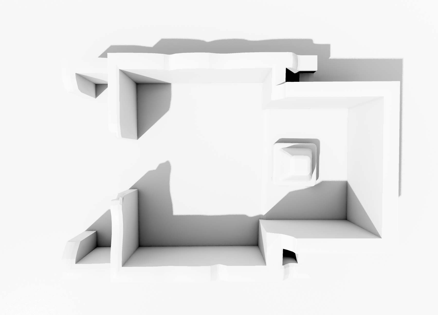
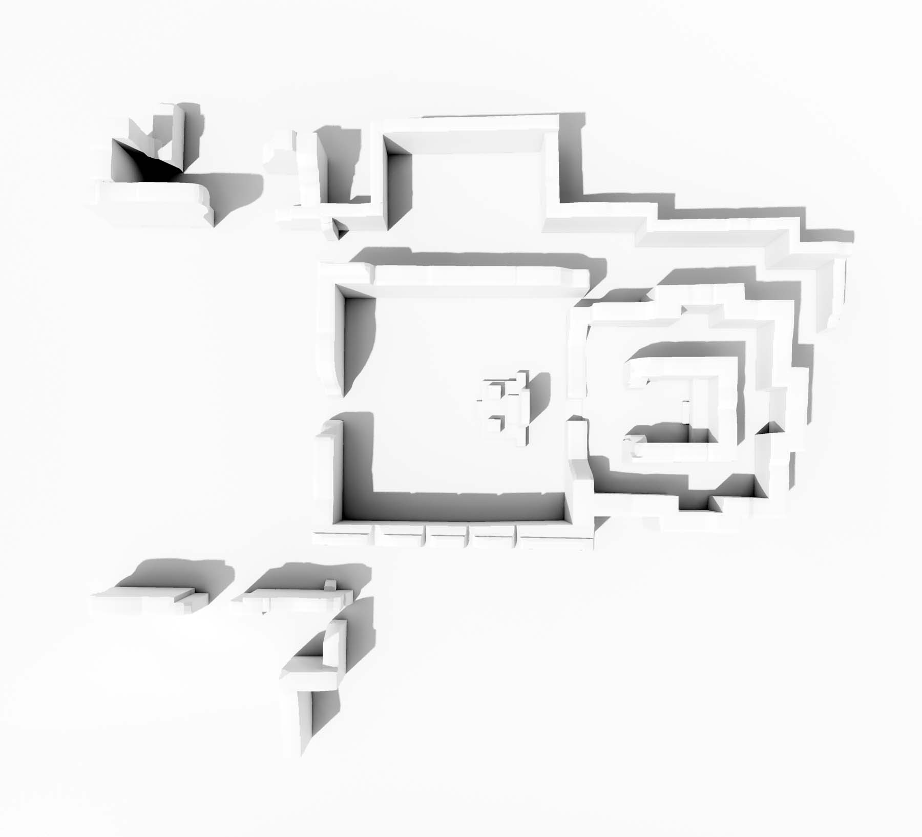
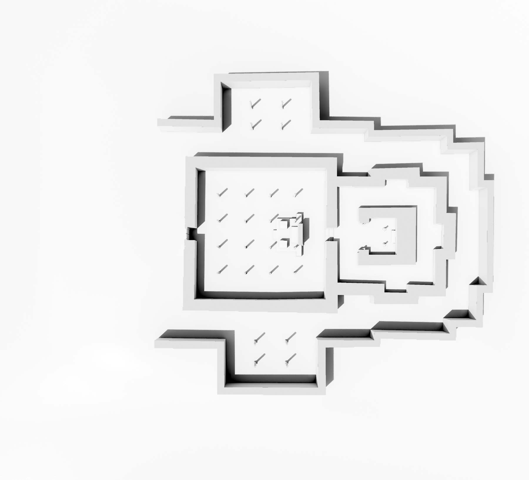
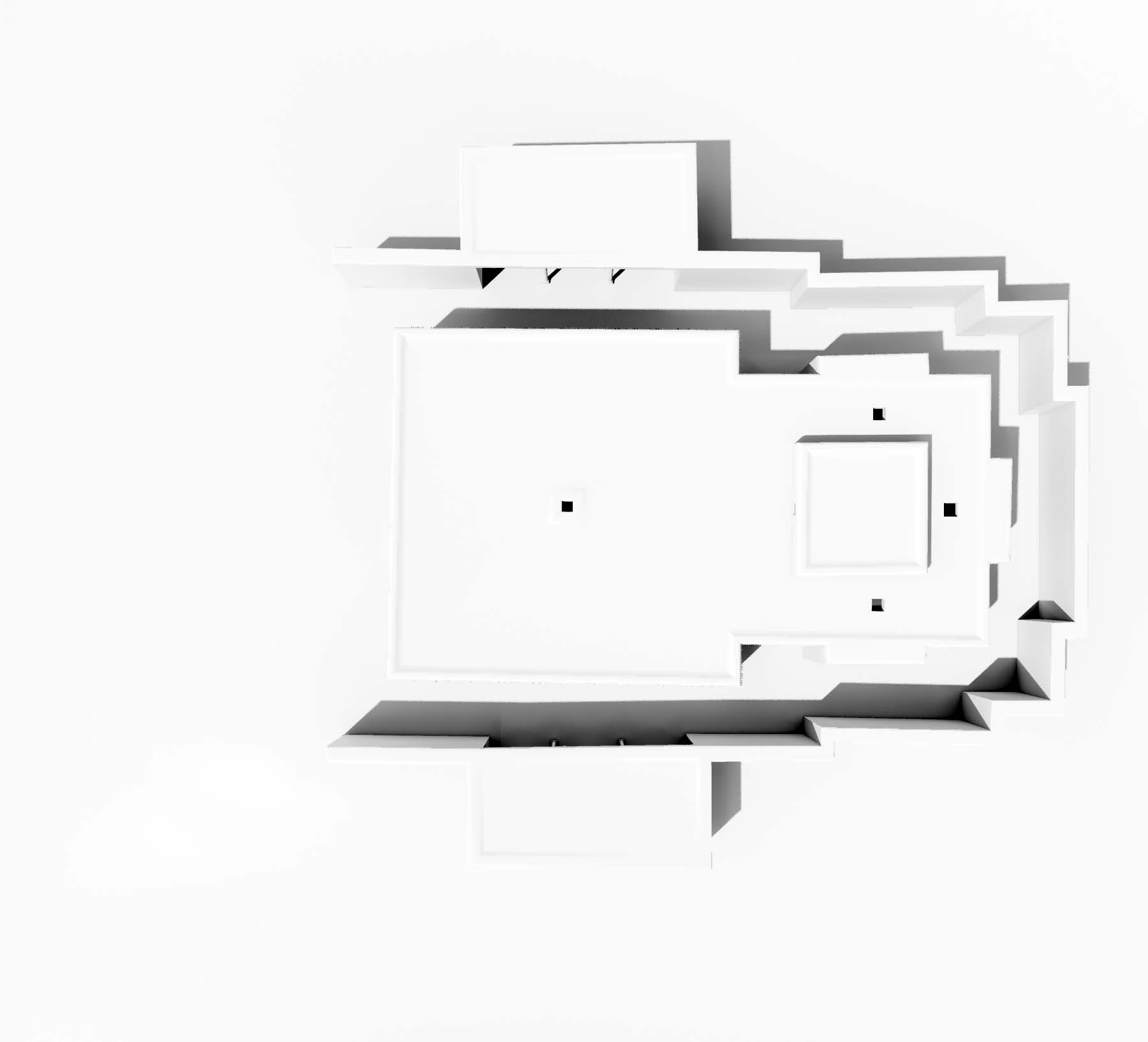
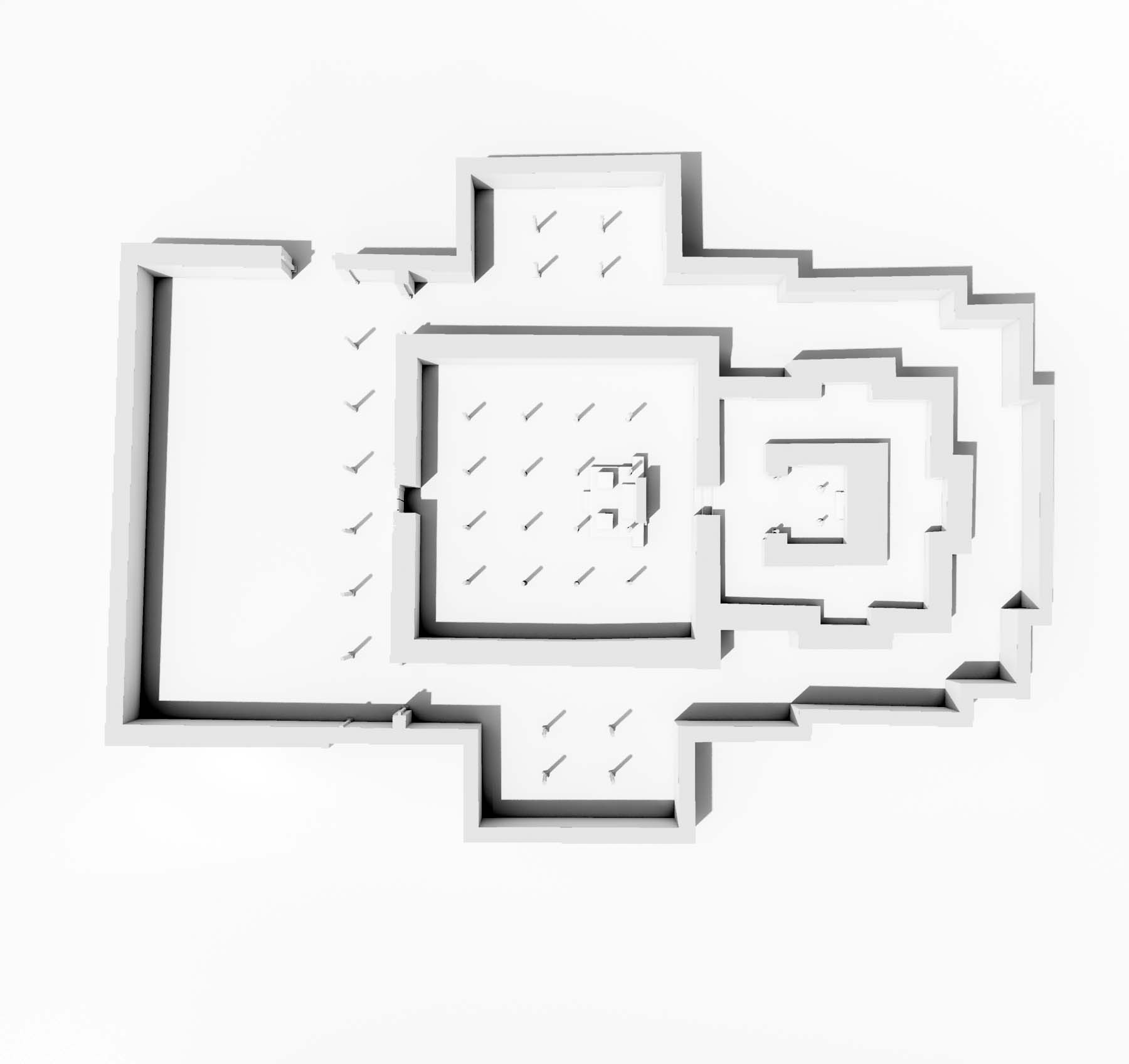
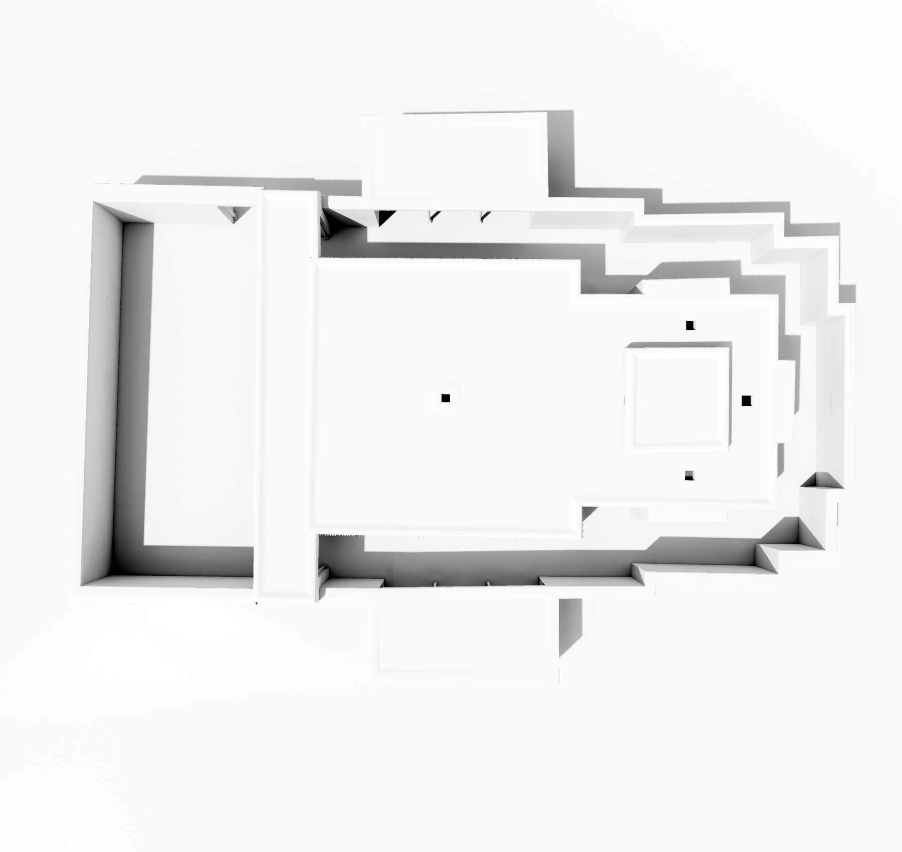
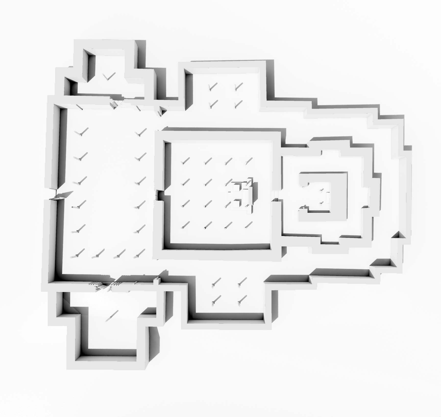
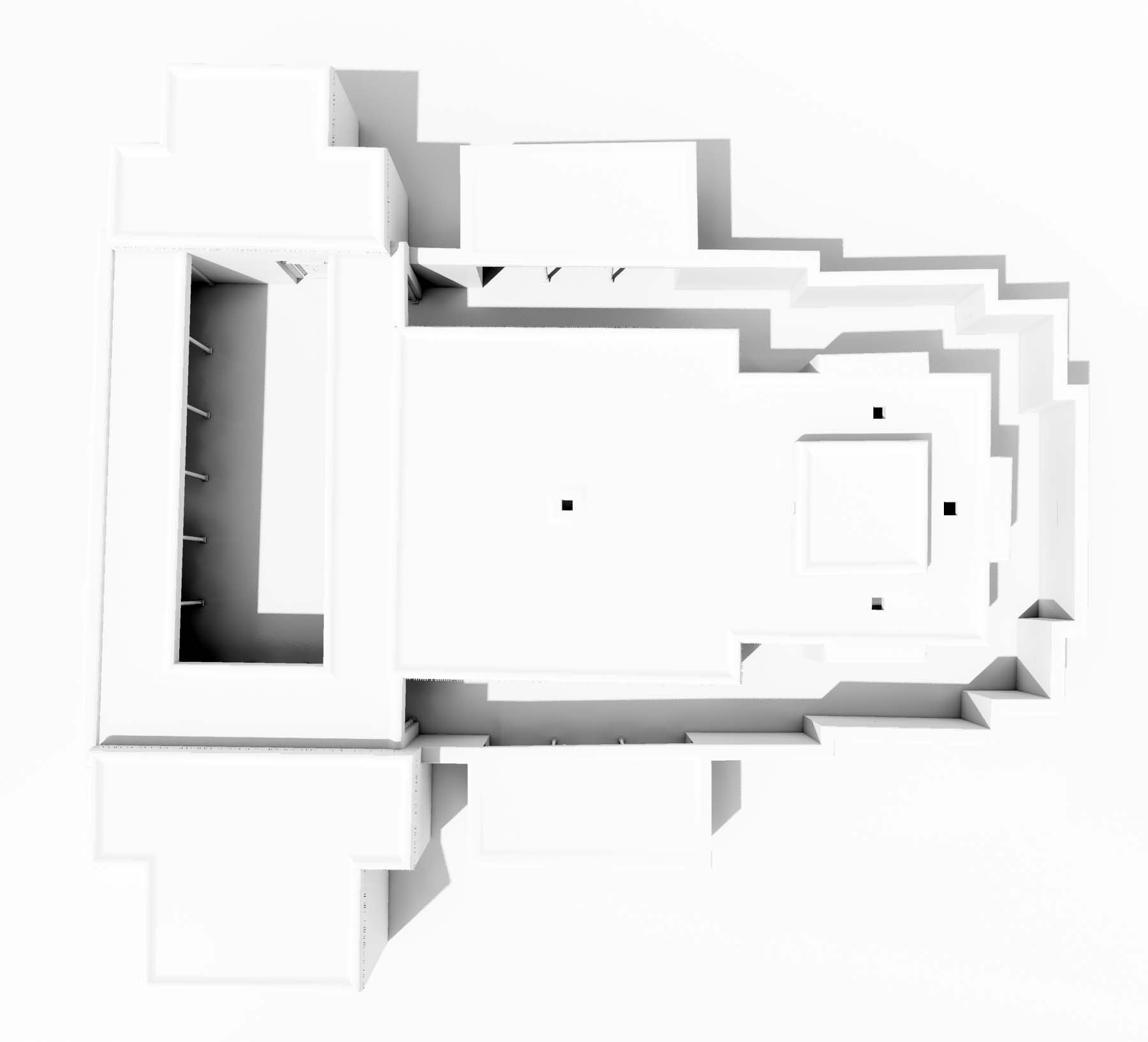
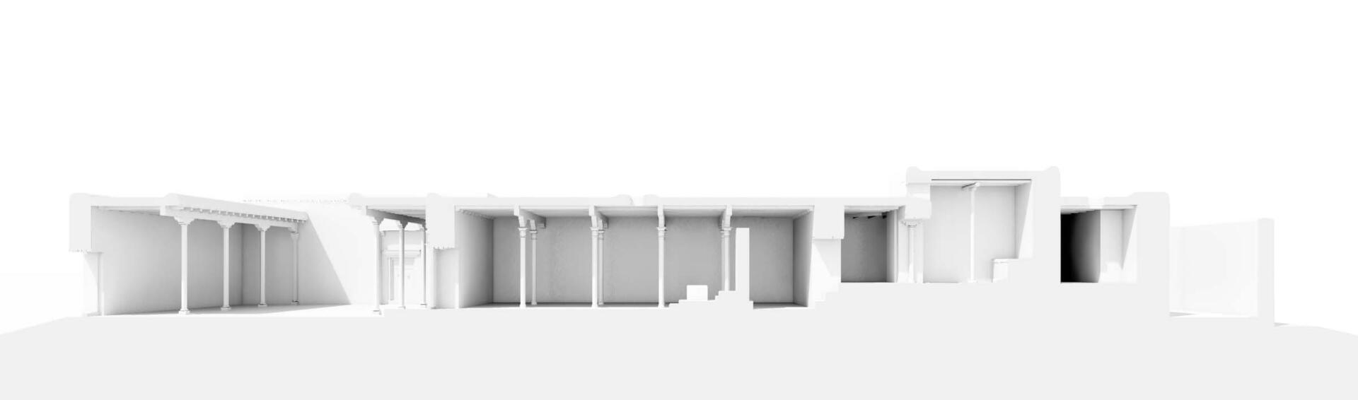
The former monastic compound of Nyarma is located about 16 kilometres (airline) southeast of Leh. The nearest village Rambipor lies within the vegetation belt of the Indus River, not far away from Thikse, and consists of about 25 houses. The spacious ruin field of Nyarma lies at the north-eastern edge of the settlement. This imposing ruins remain of Ladakh’s only monastery, which is undoubtedly attributable to Rinchen-tsangpo. The monastery was founded as one of three main monasteries in the initial phase of the kingdom of Guge in the late 10th and early 11th century. According to a narrative, Nyarma was abandoned only a few centuries later as a result of robbery and flooding. Today the complex consists of five ruinous temples and numerous chörten. Fragments of the external walls border the area at the southern and eastern side. On the north-western side of the area a small temple, dedicated to the protectress Dorje Chenmo is still in use. It was built on top of the cella of the largest temple ruin (no. 1). One of the remaining chörten (no. 6) in the western part of the area is decorated with painted layers and fragments of sculptures in the interior.
Cf. Neuwirth & Auer 2021: The Ancient Monastic Complexes of Tholing, Nyarma and Tabo, pp. 114-165, Open Access E-Book.
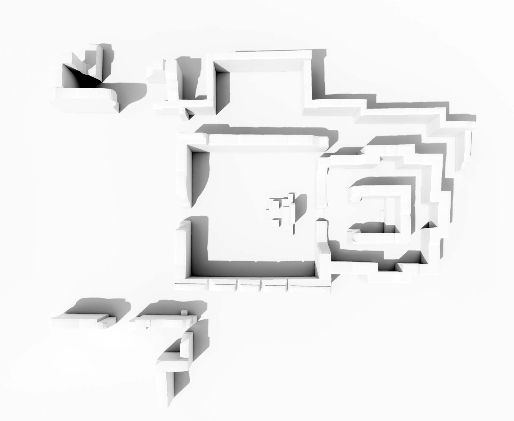
2D Plans
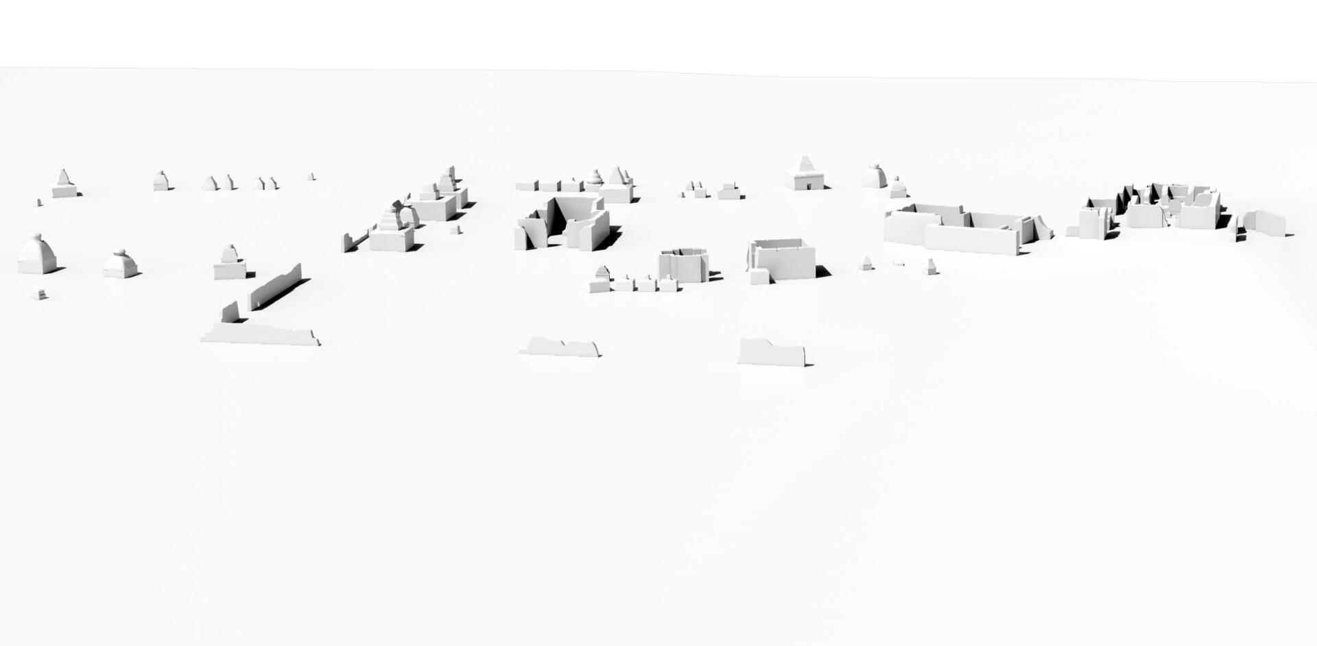
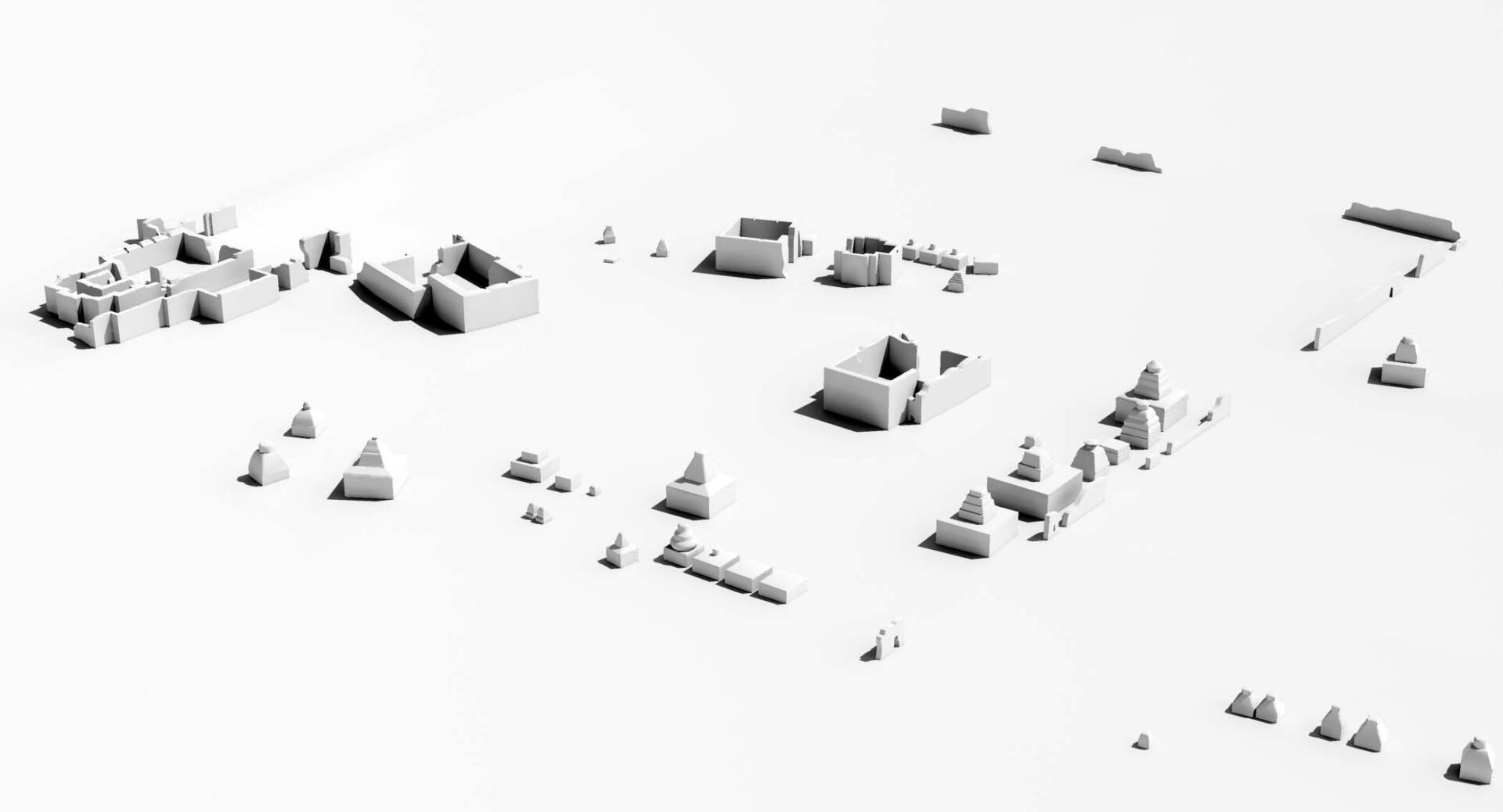
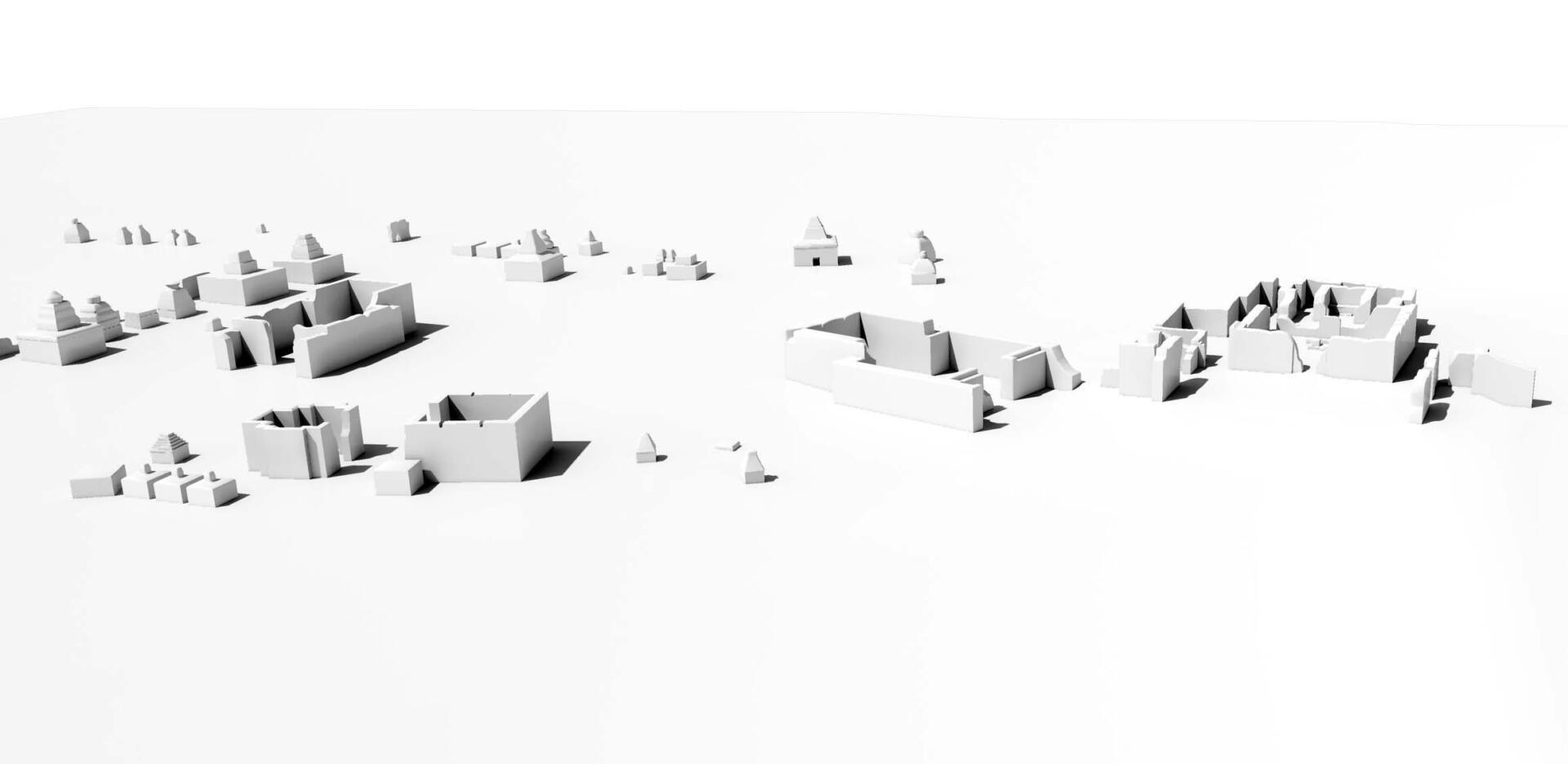
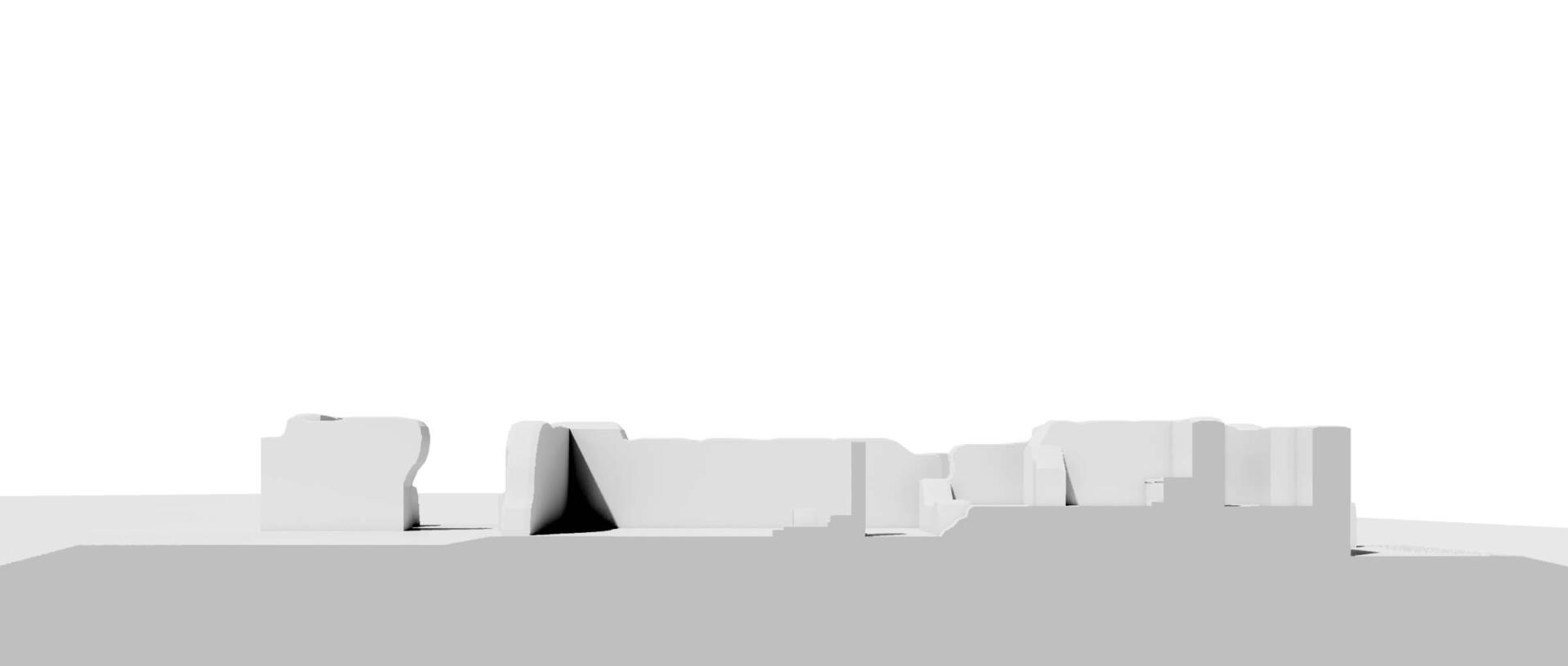
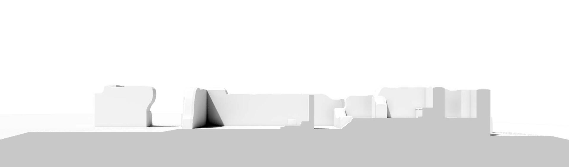
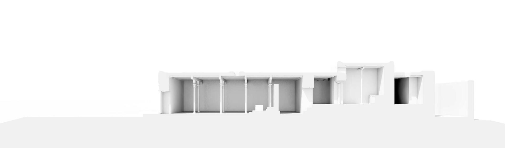
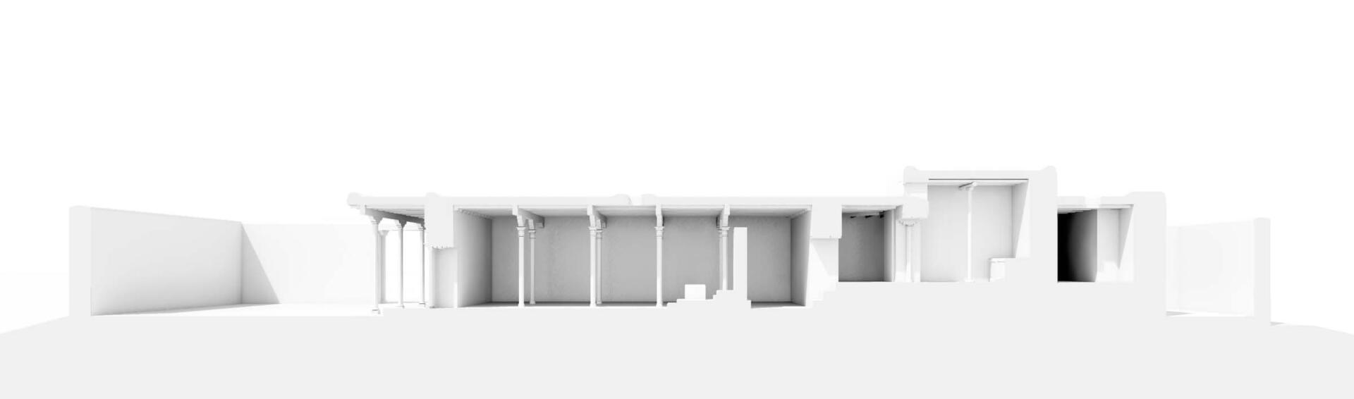
3D Model
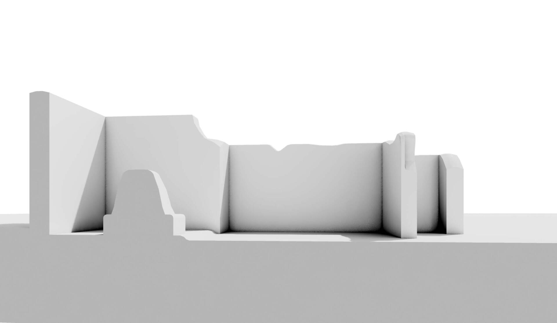

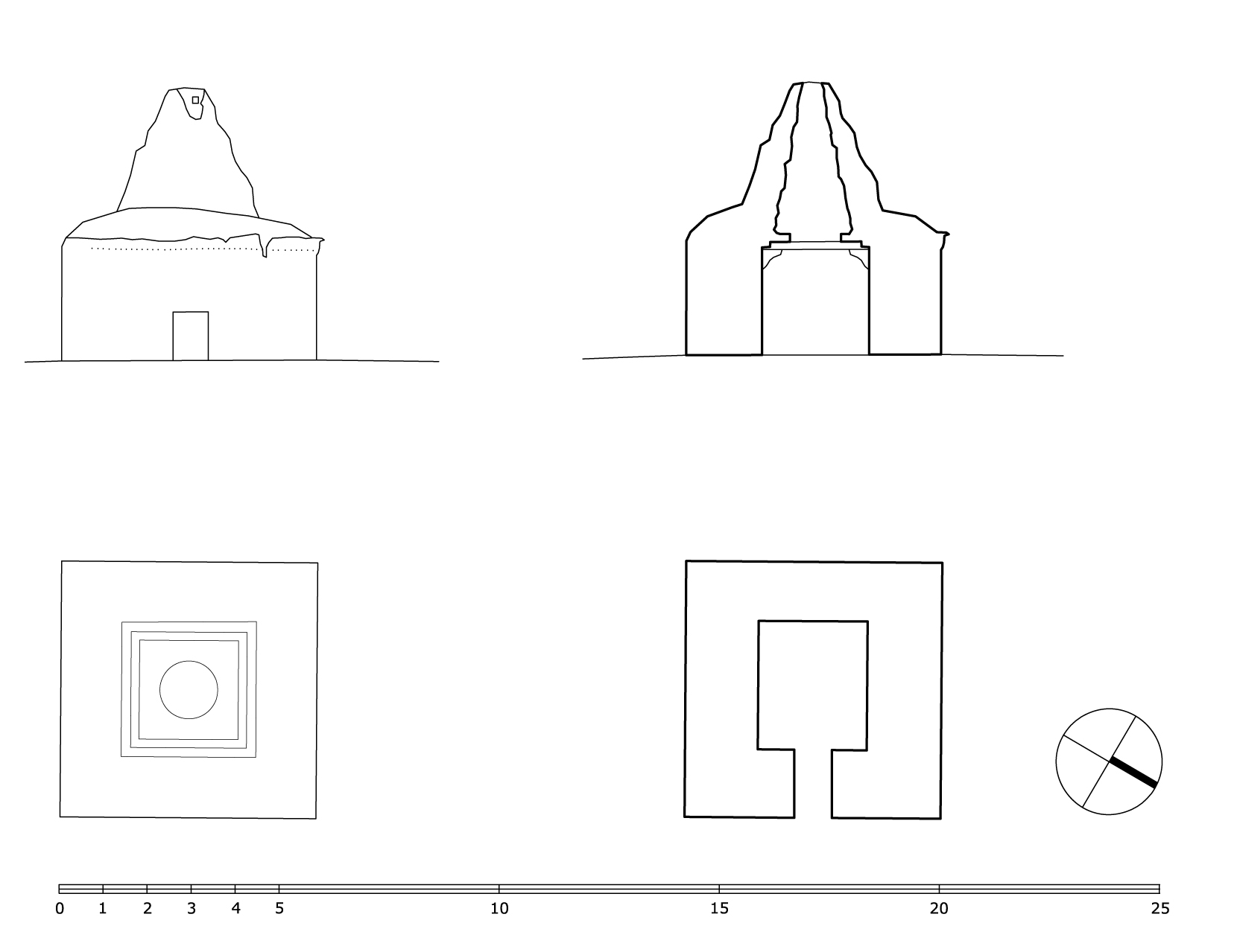
Reconstruction of the main temple
More from