Nepal
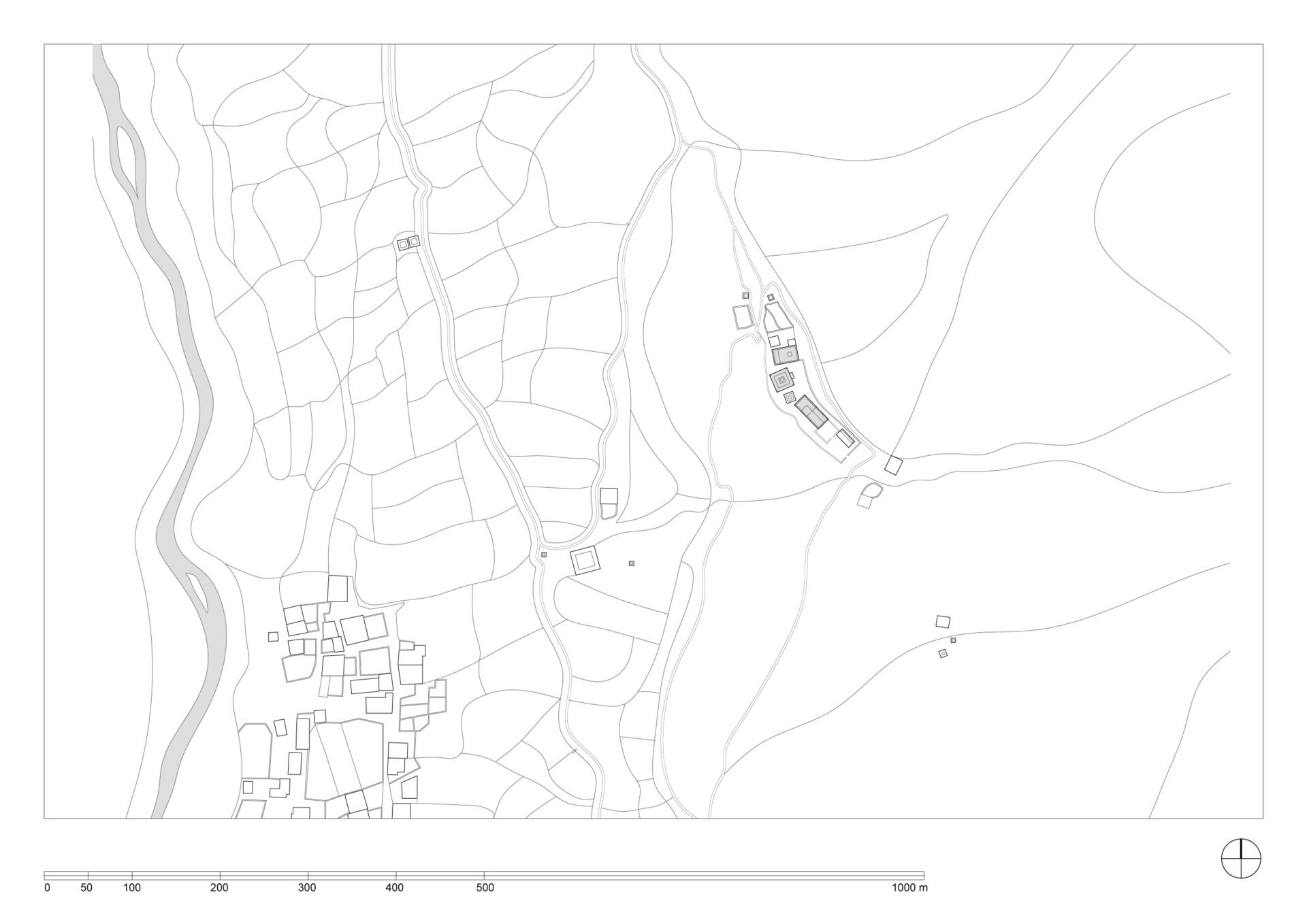
Dho Tarap
The Ribo Bhumpa Gompa of Dho Tarap
Coordinates: 29° 7’56.70”N, 83°11’18.84” E, elevation 4069 meters.
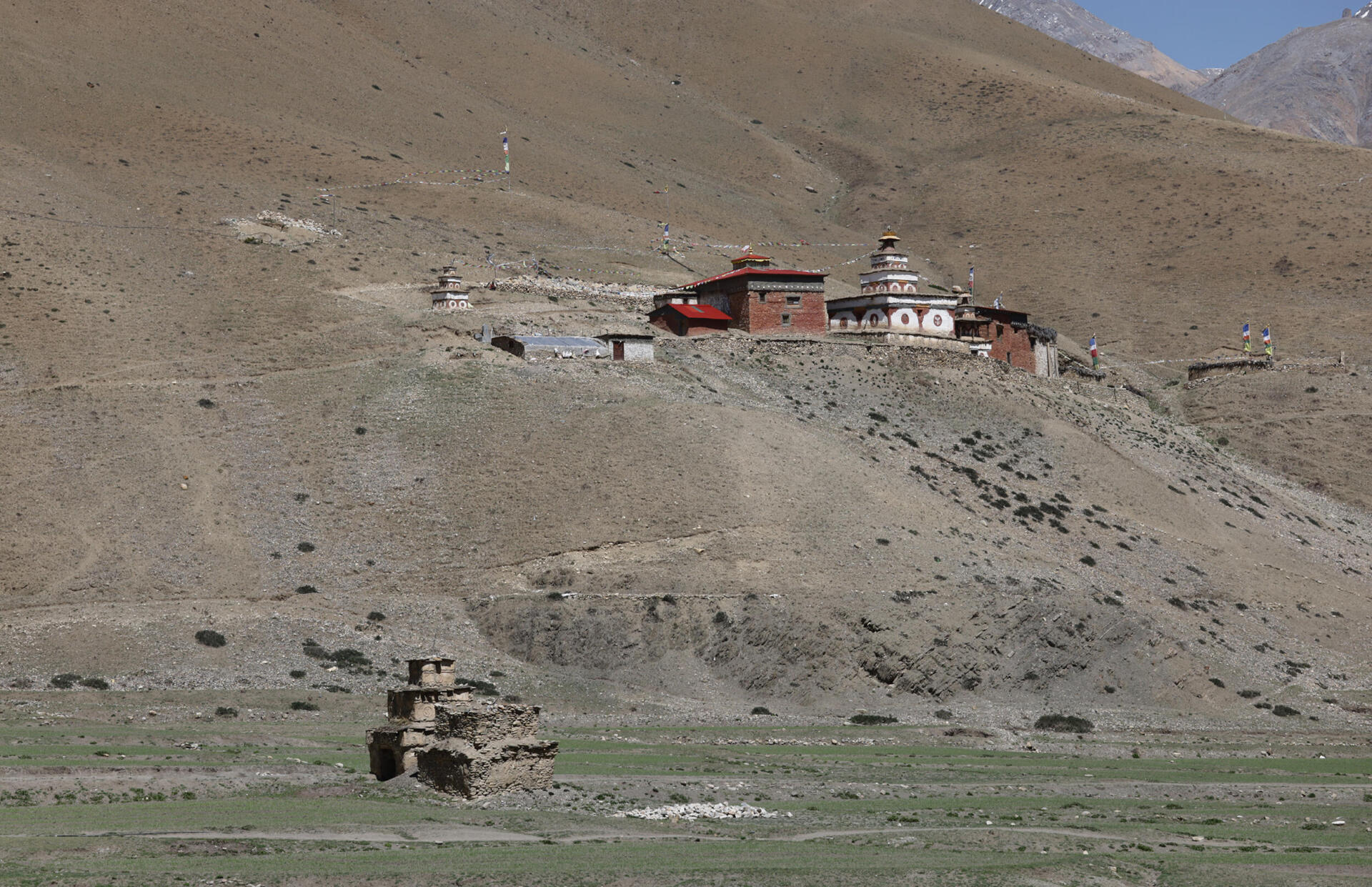
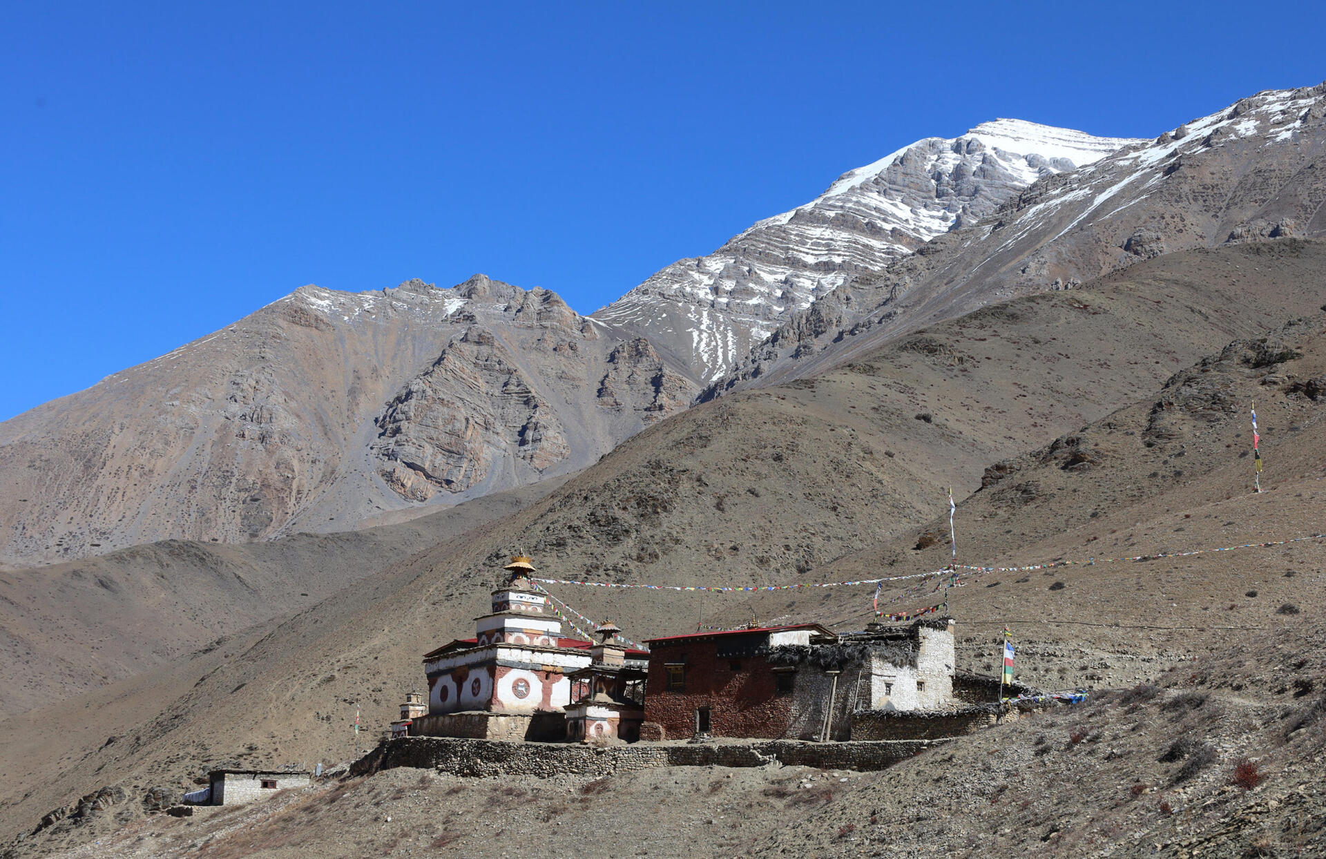
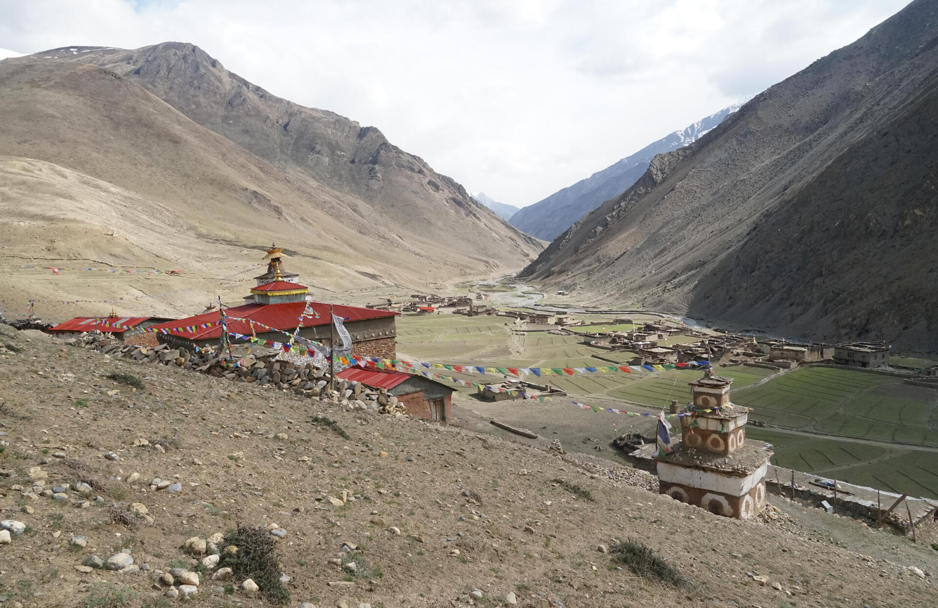
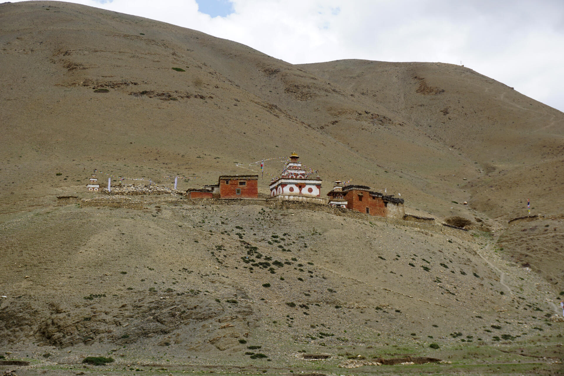
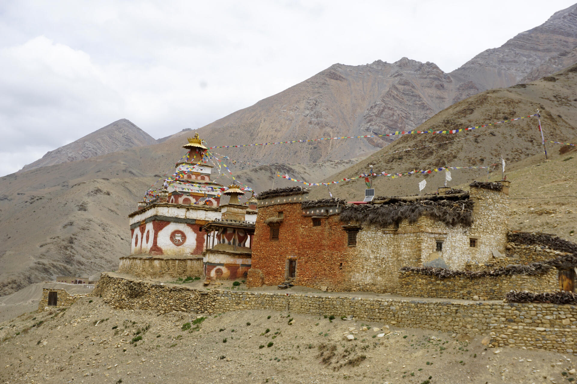
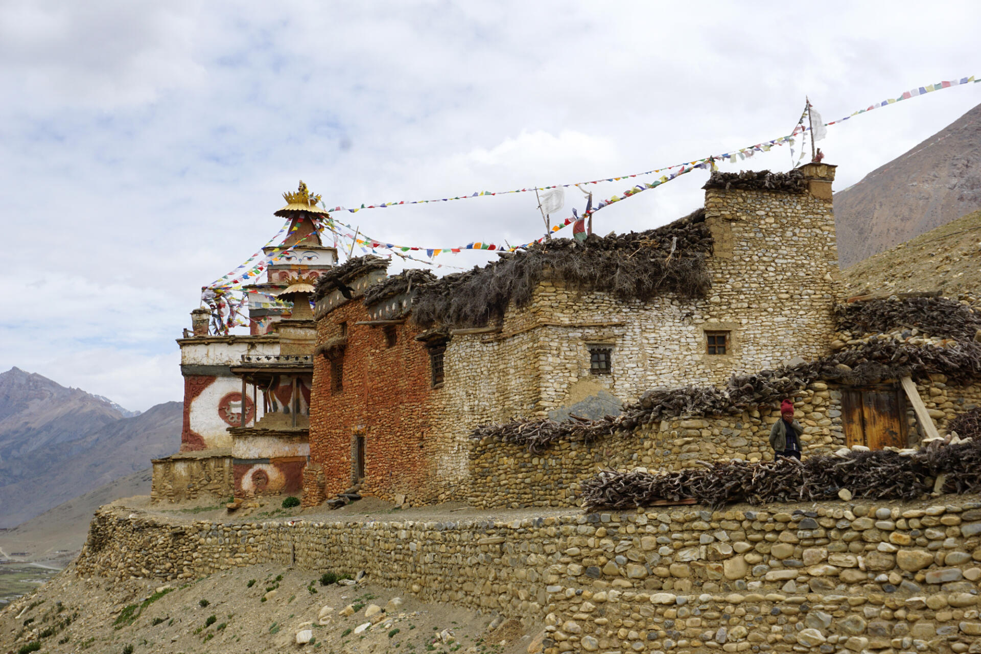
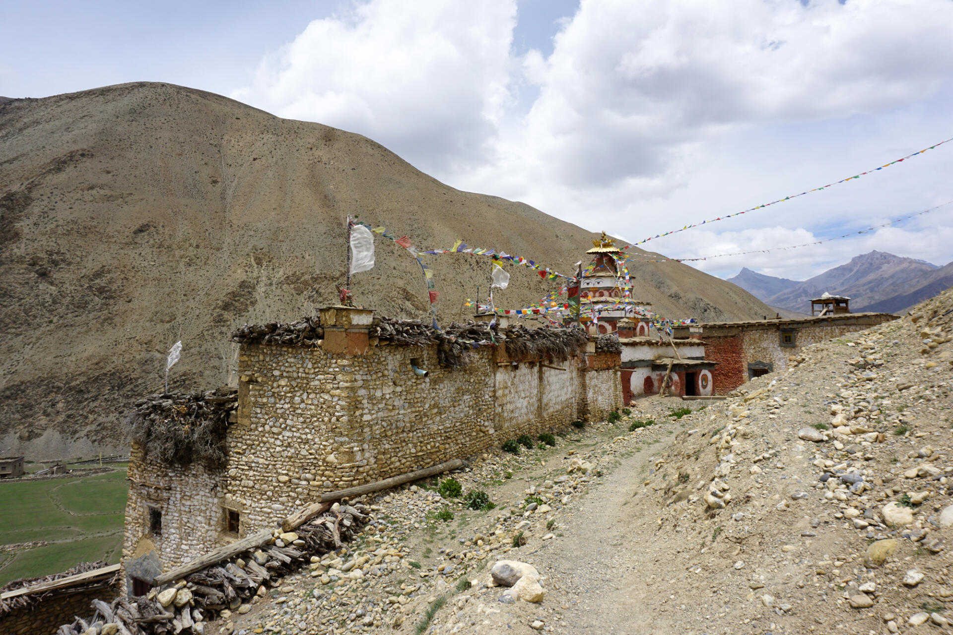
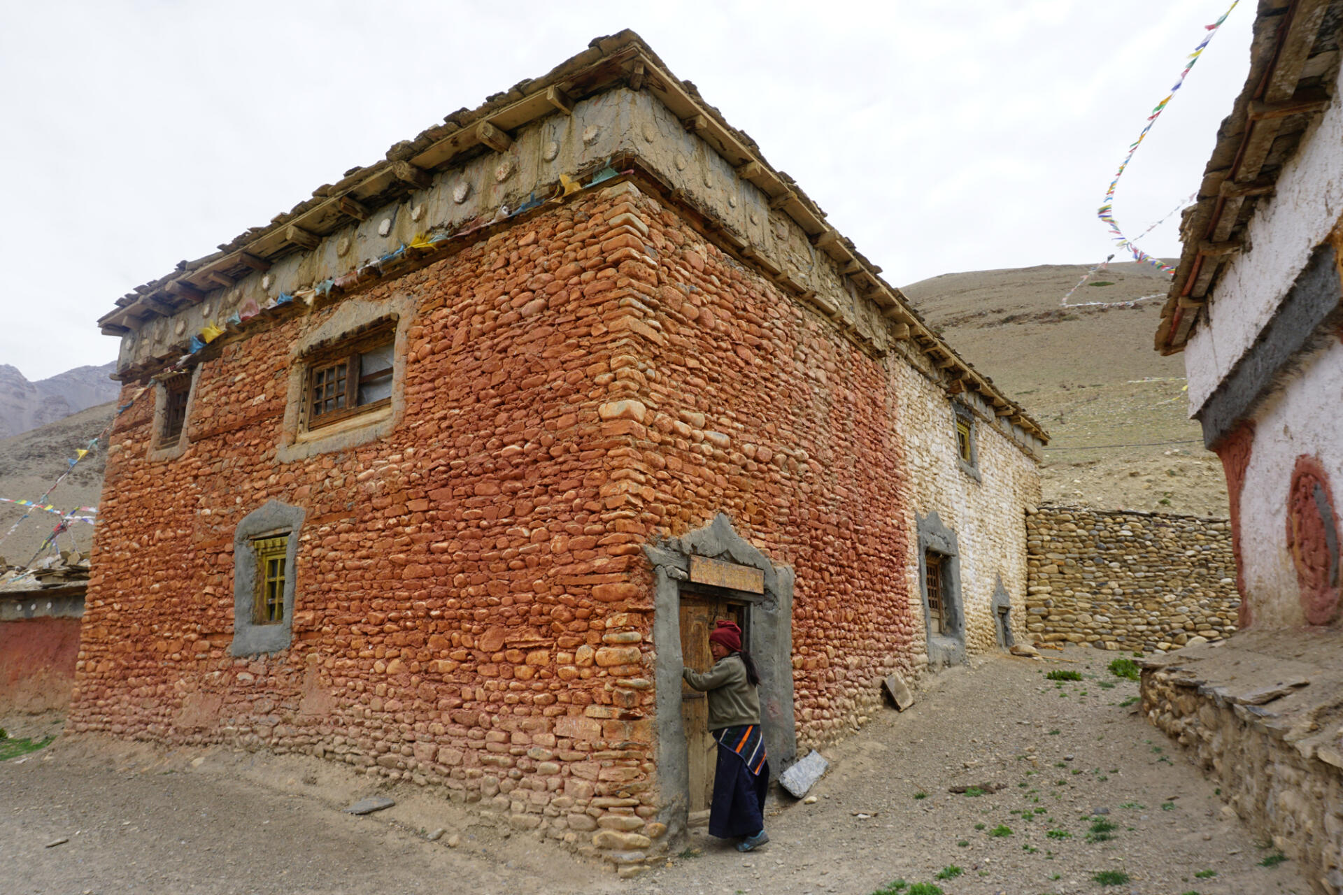
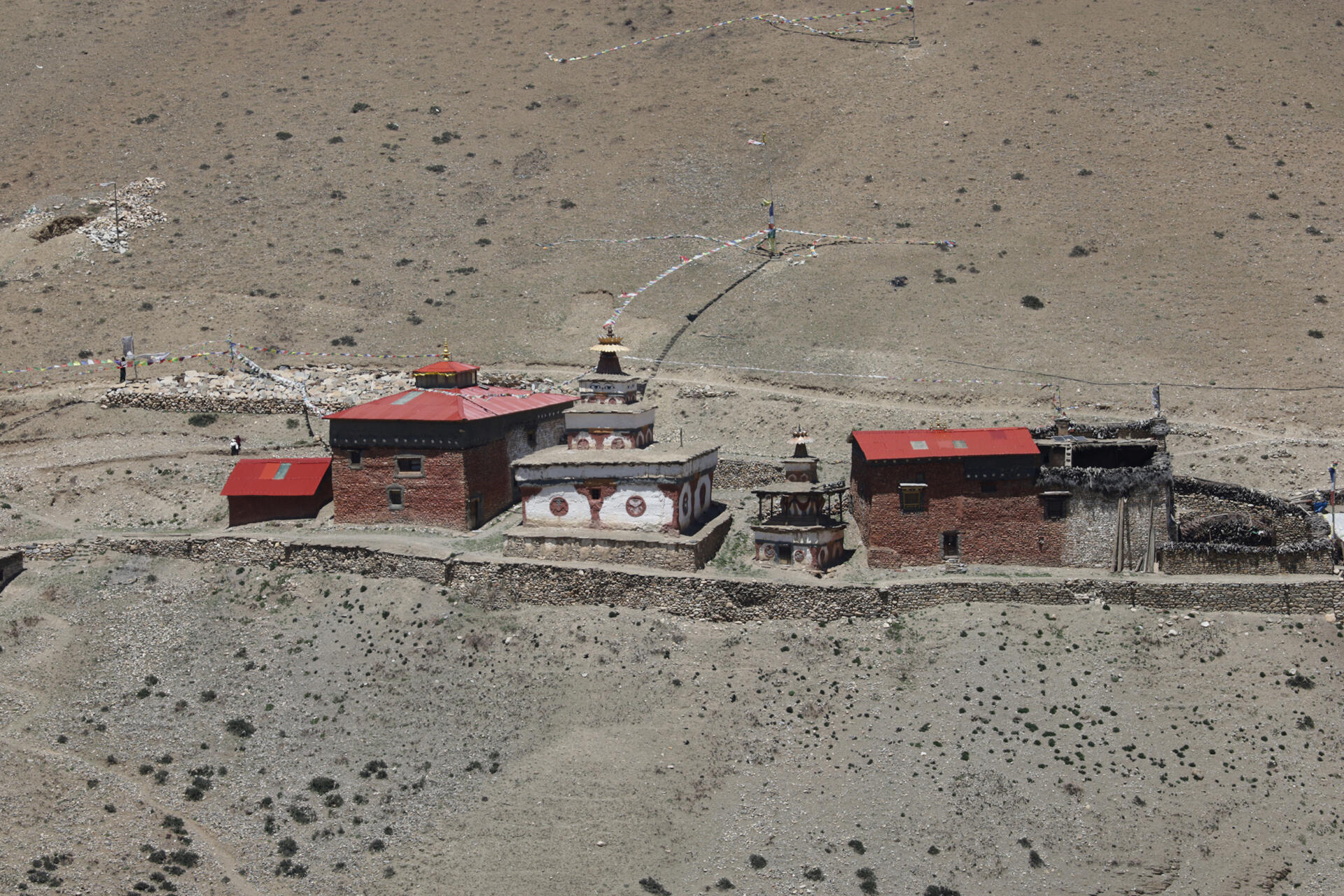
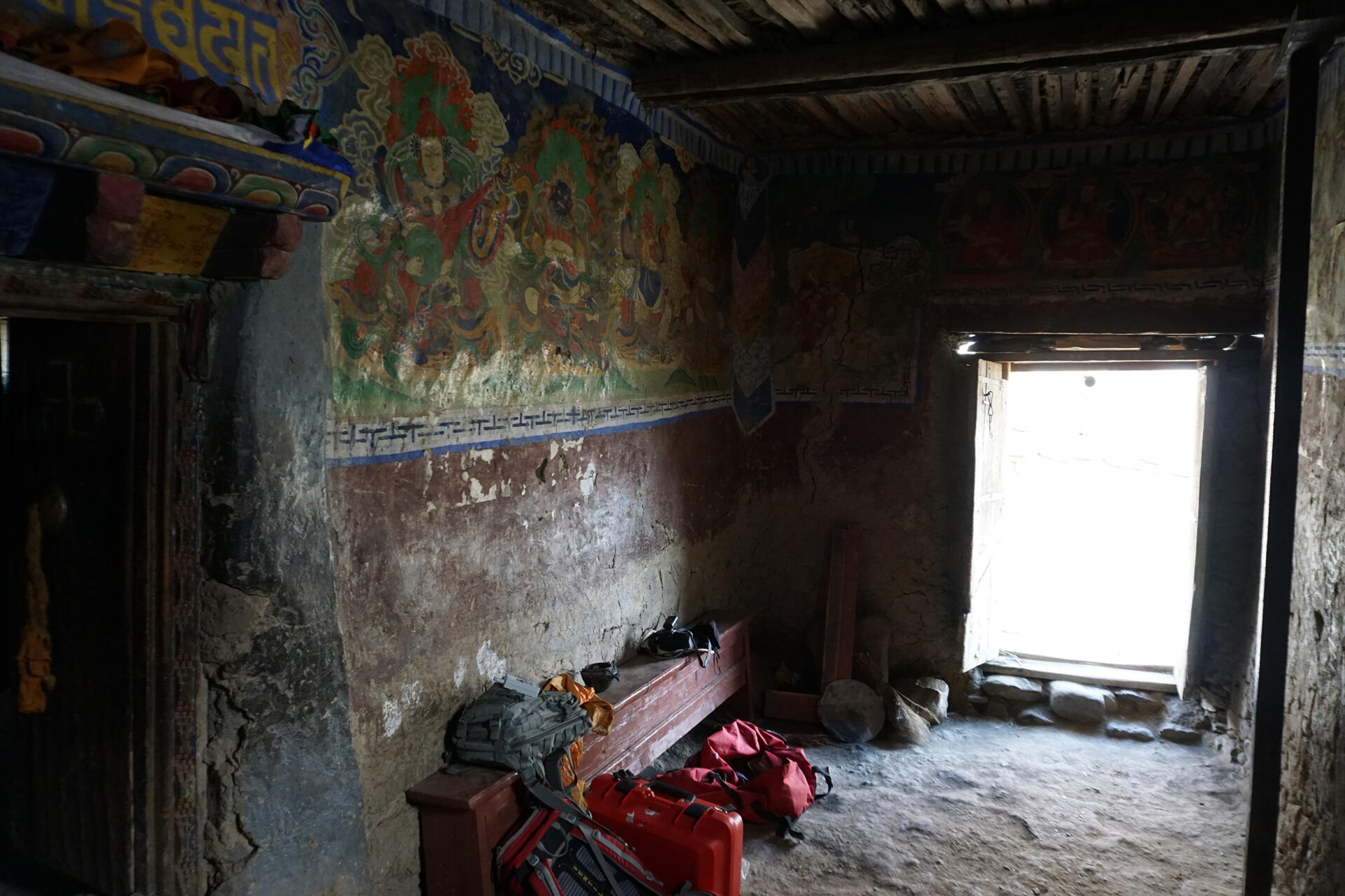
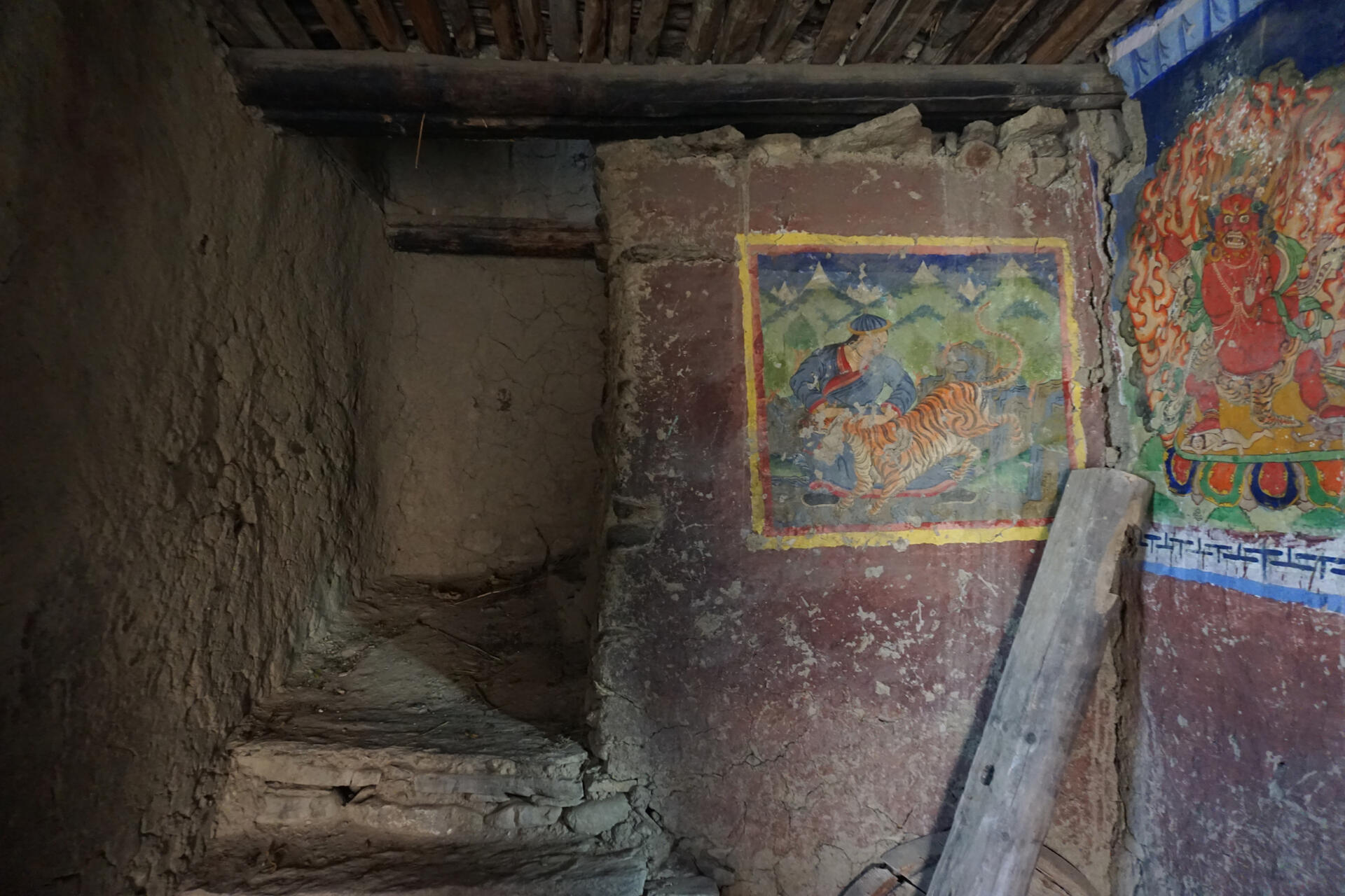
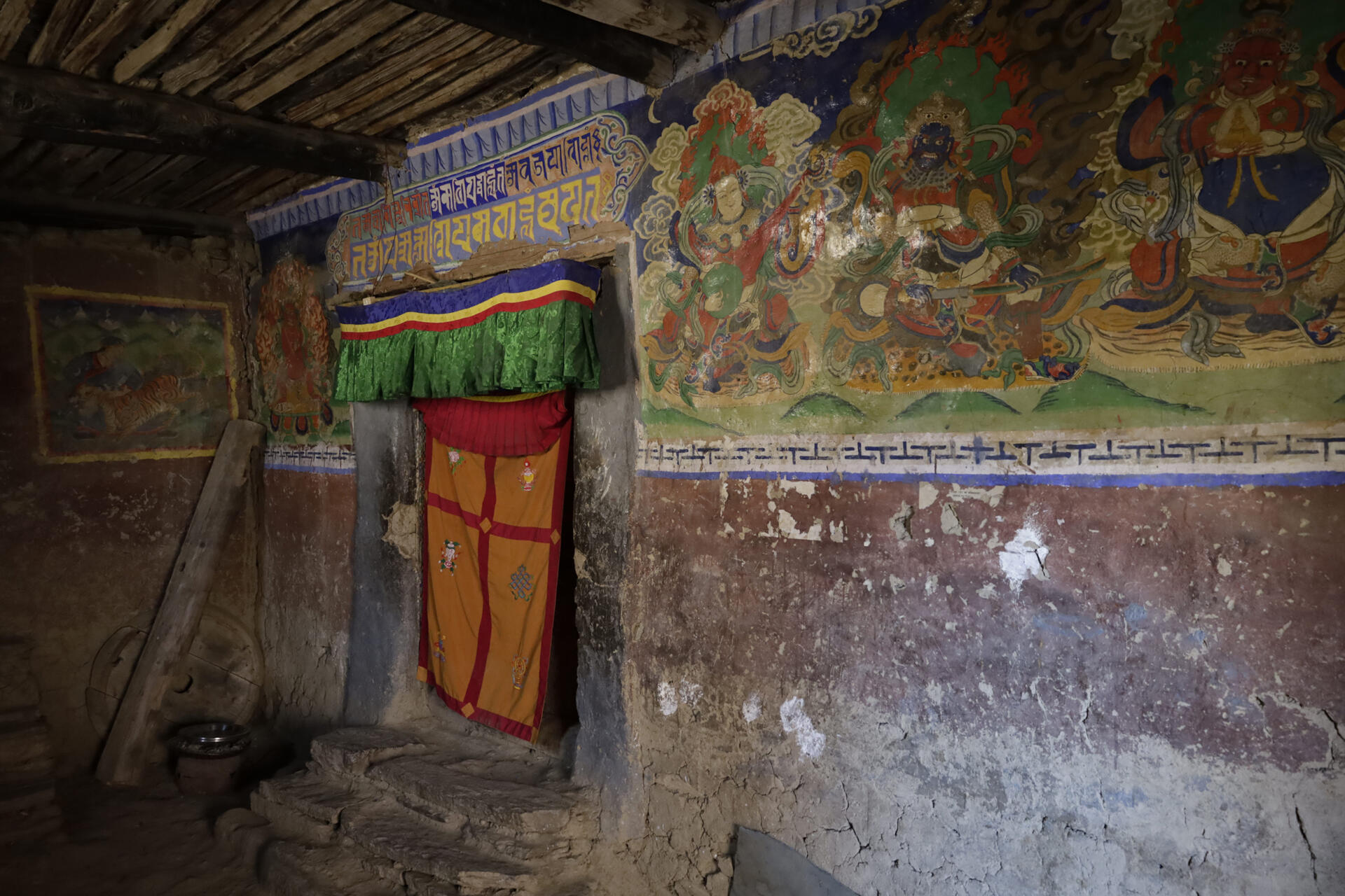
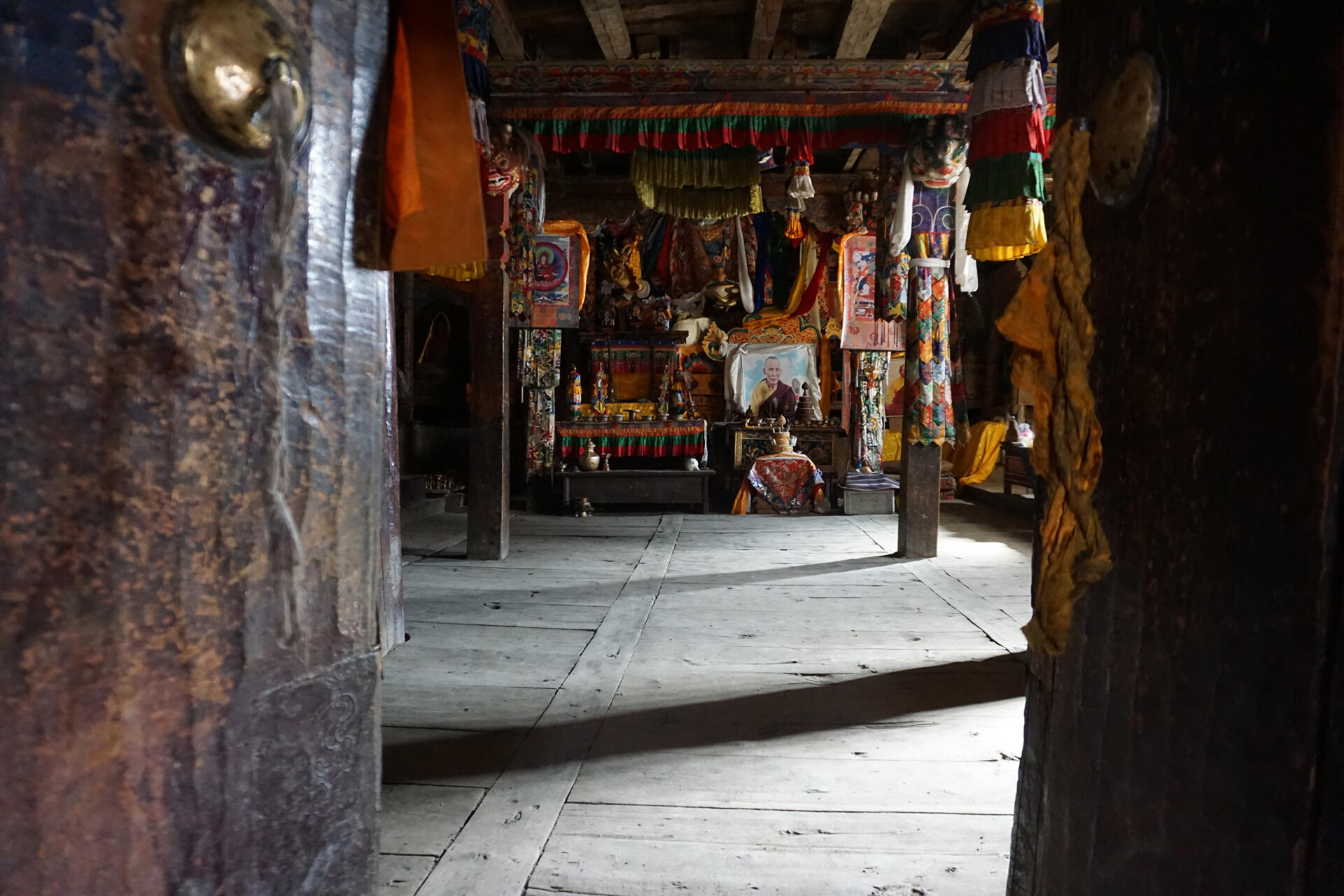
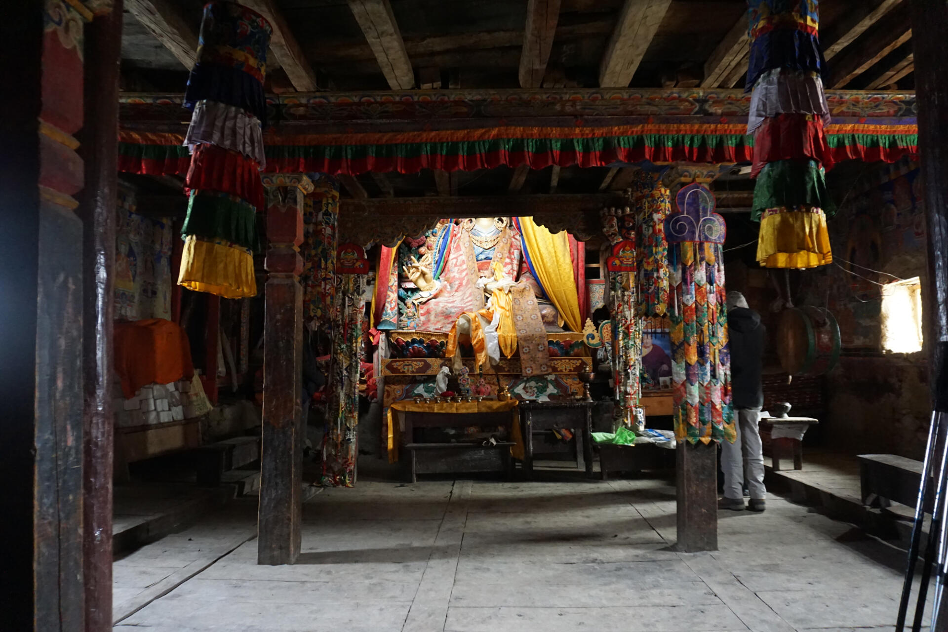
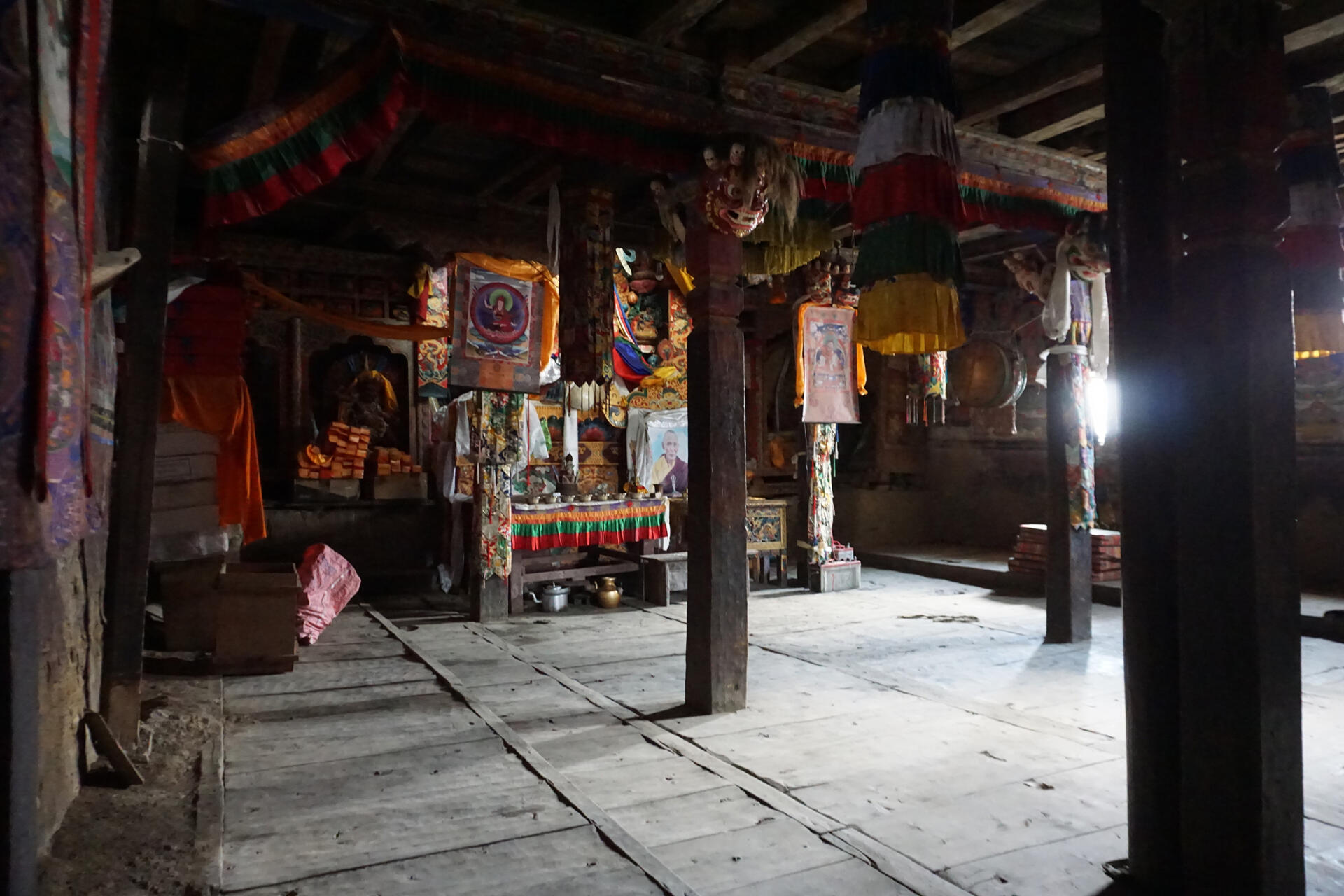
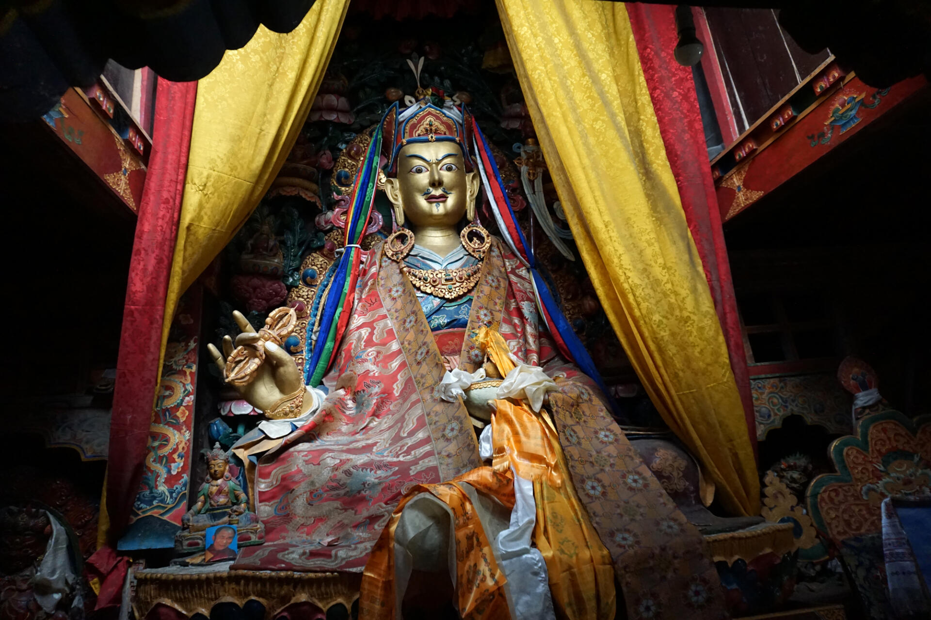
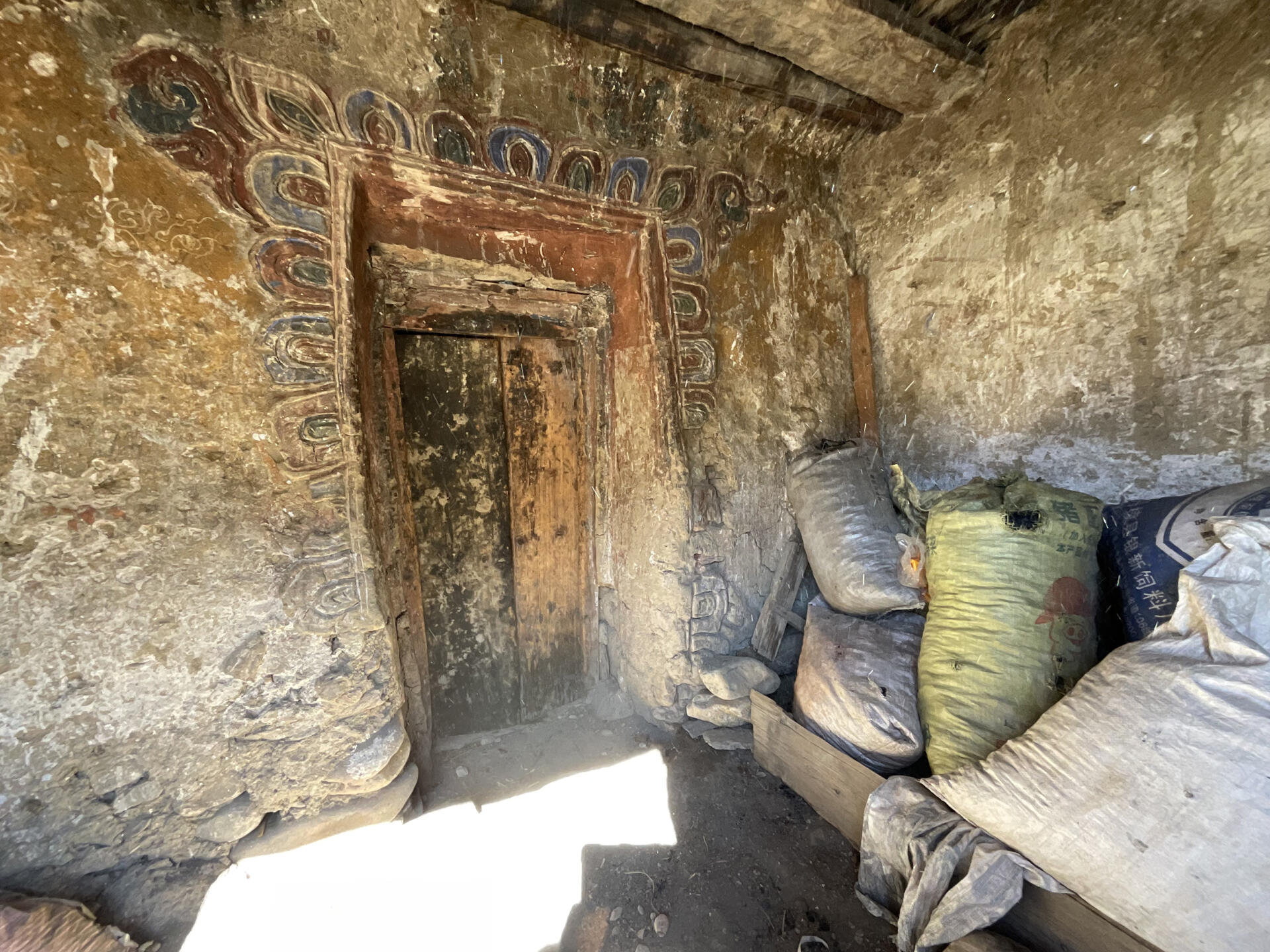
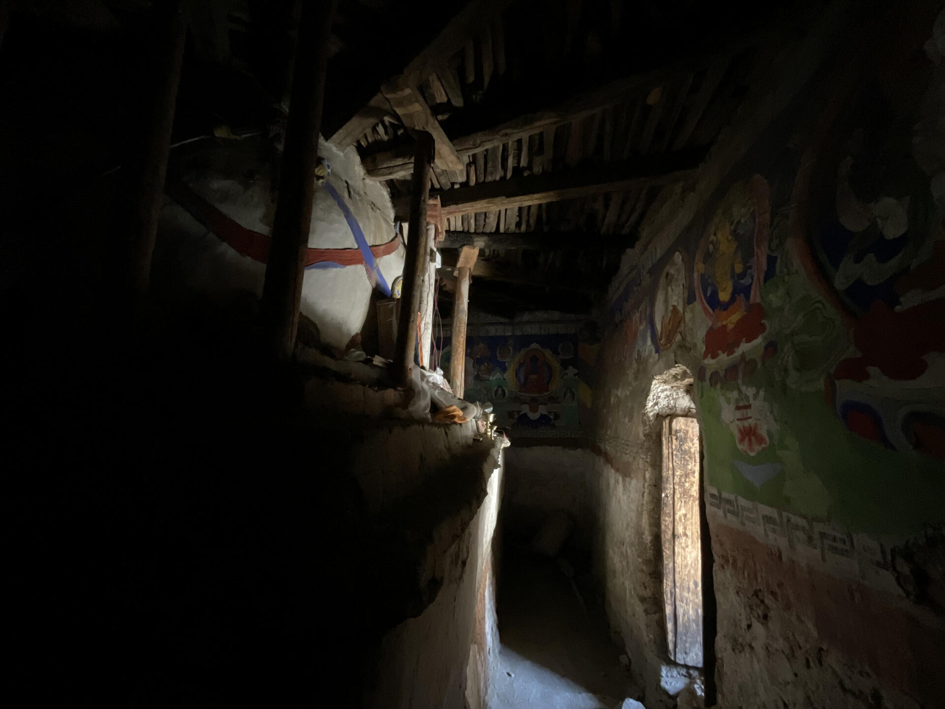
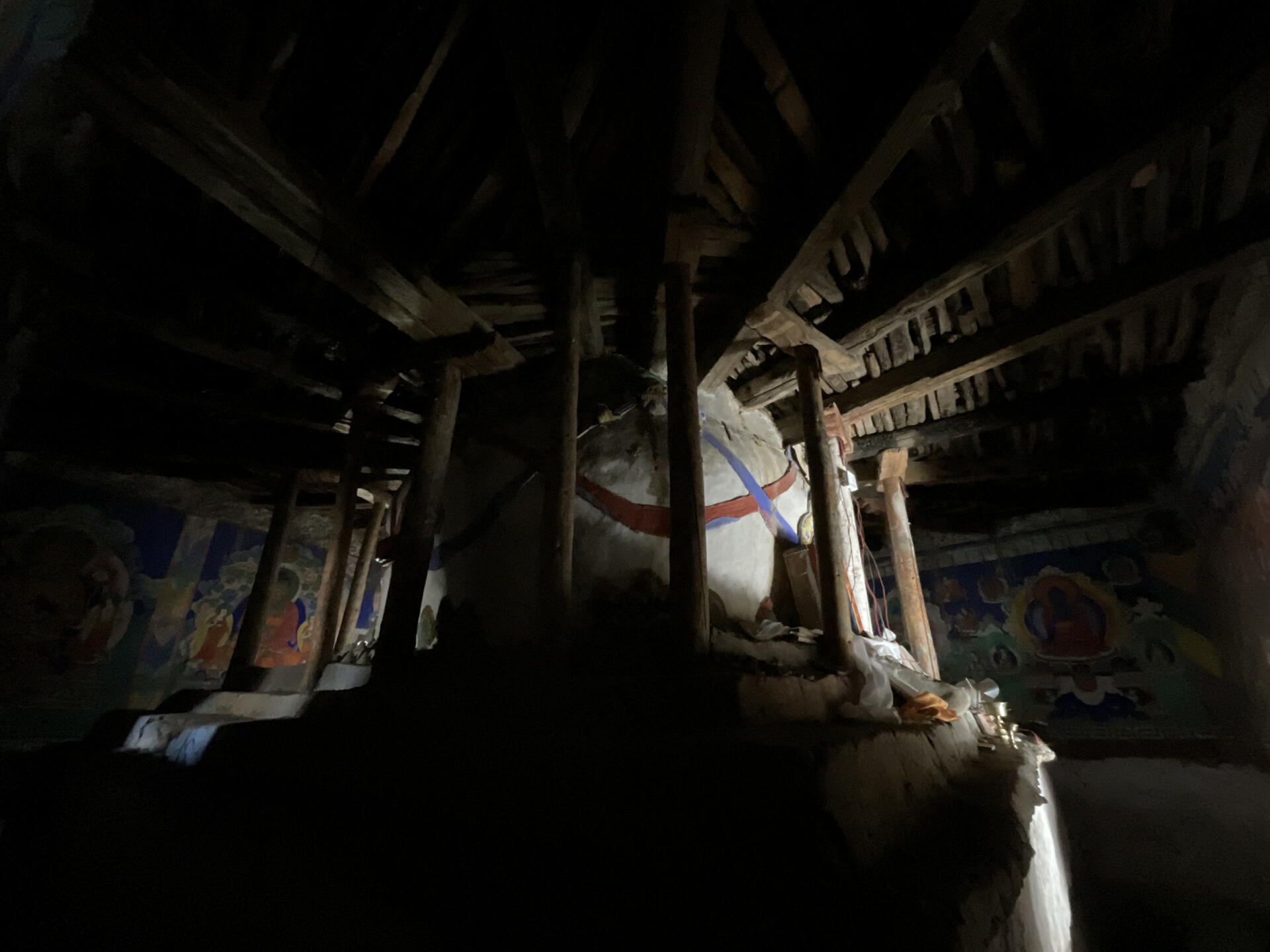
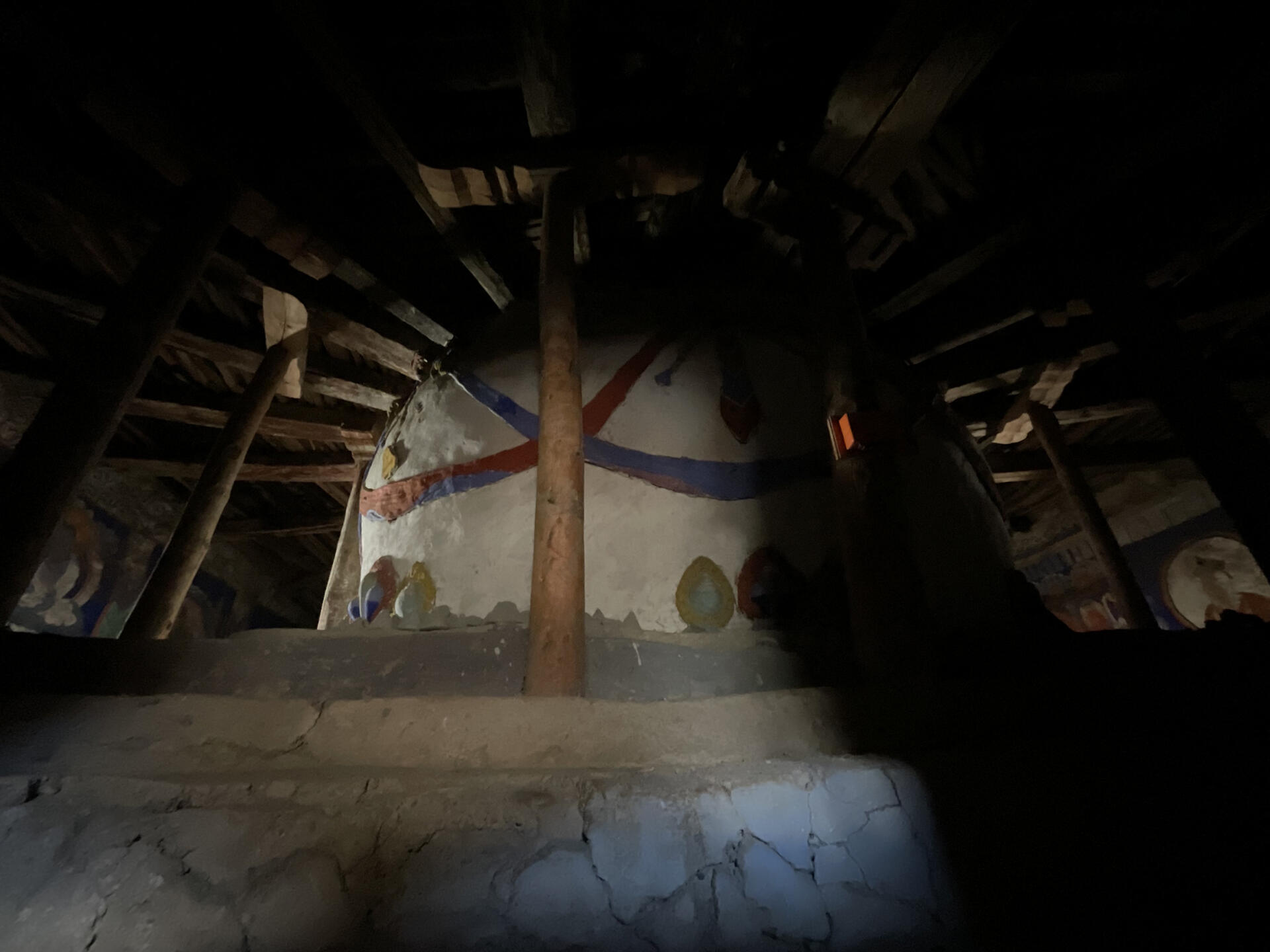
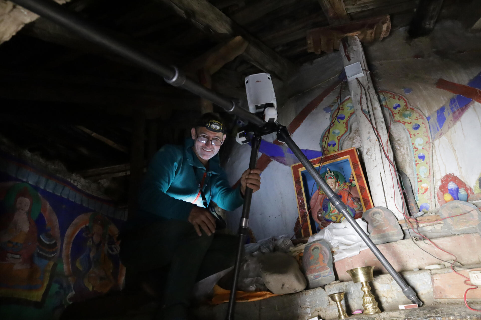
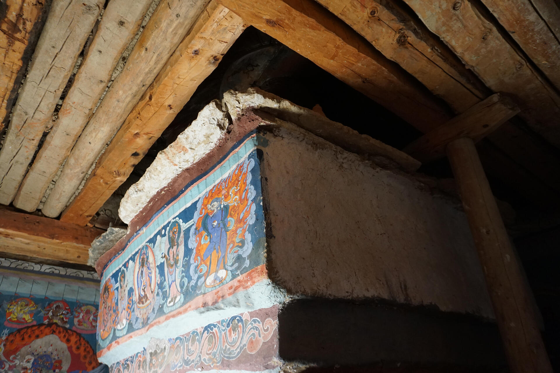
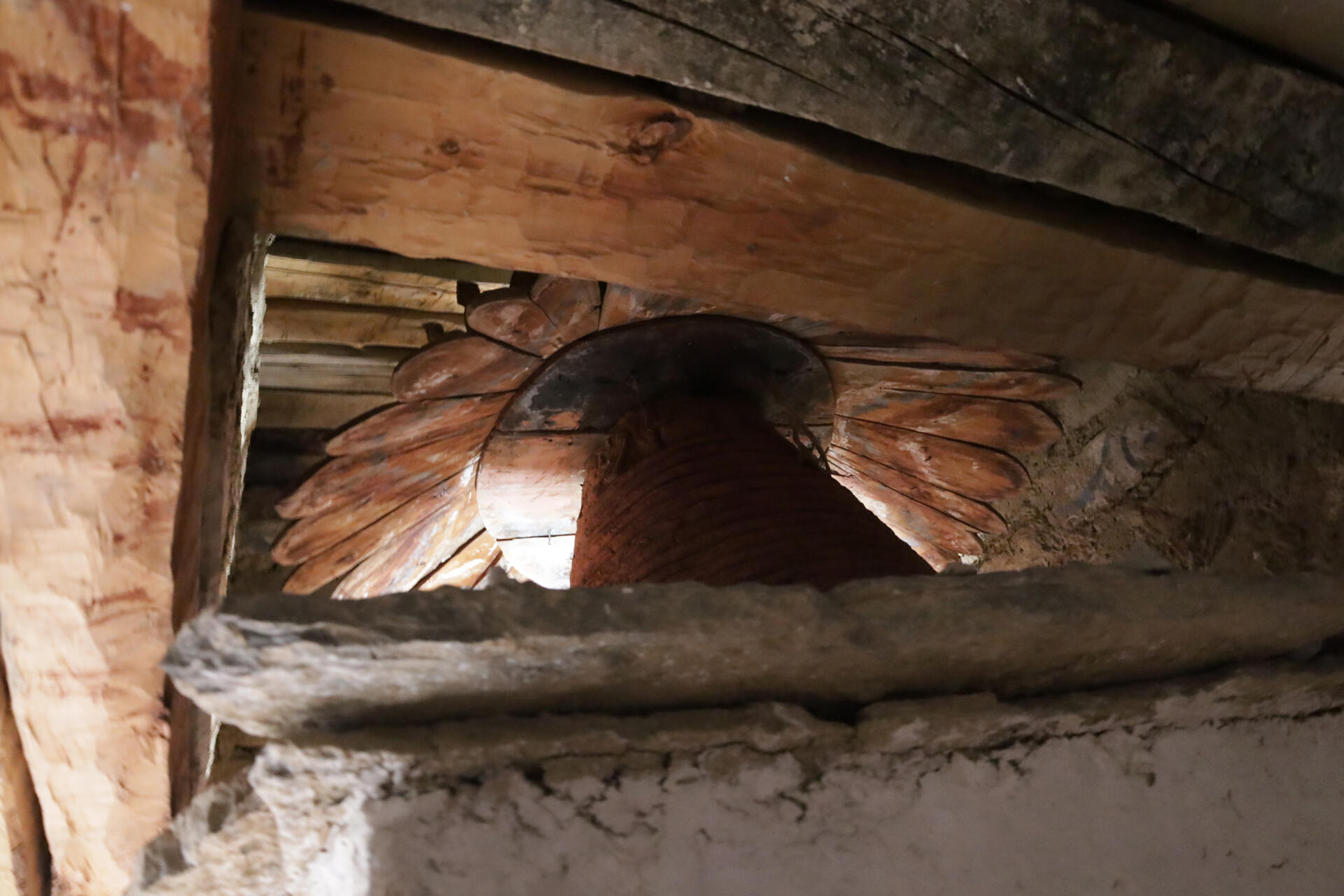
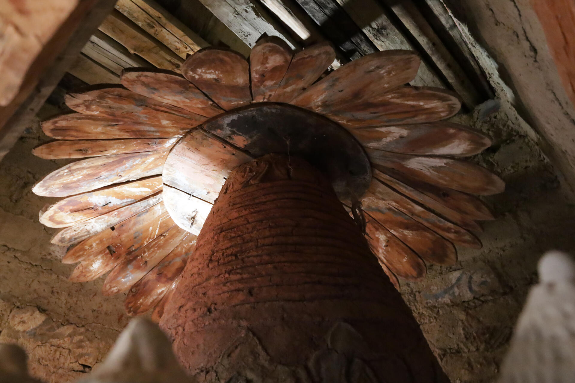
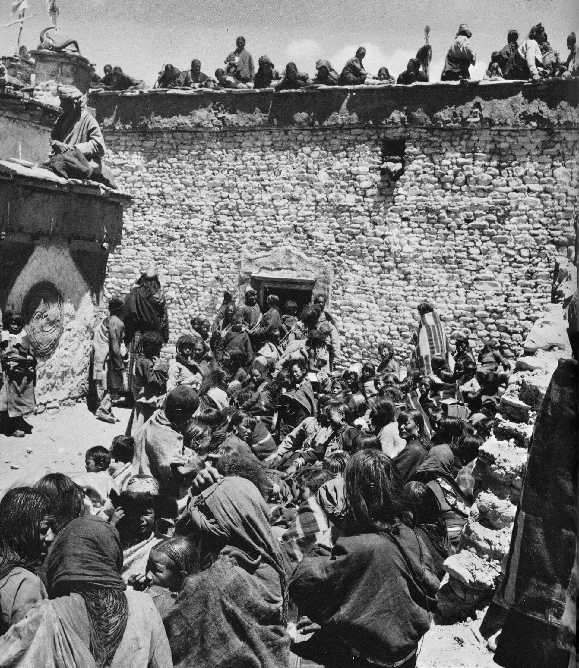
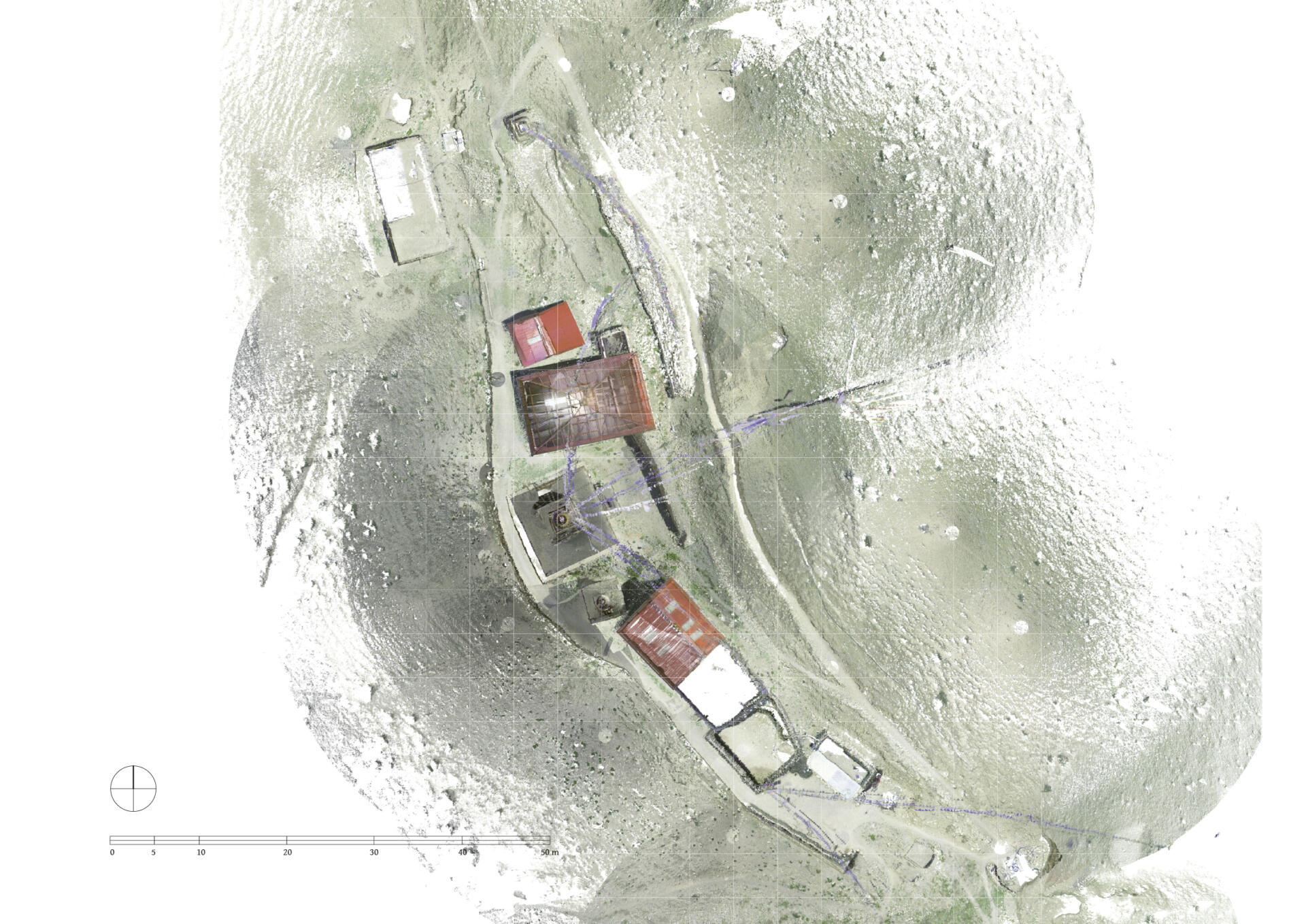
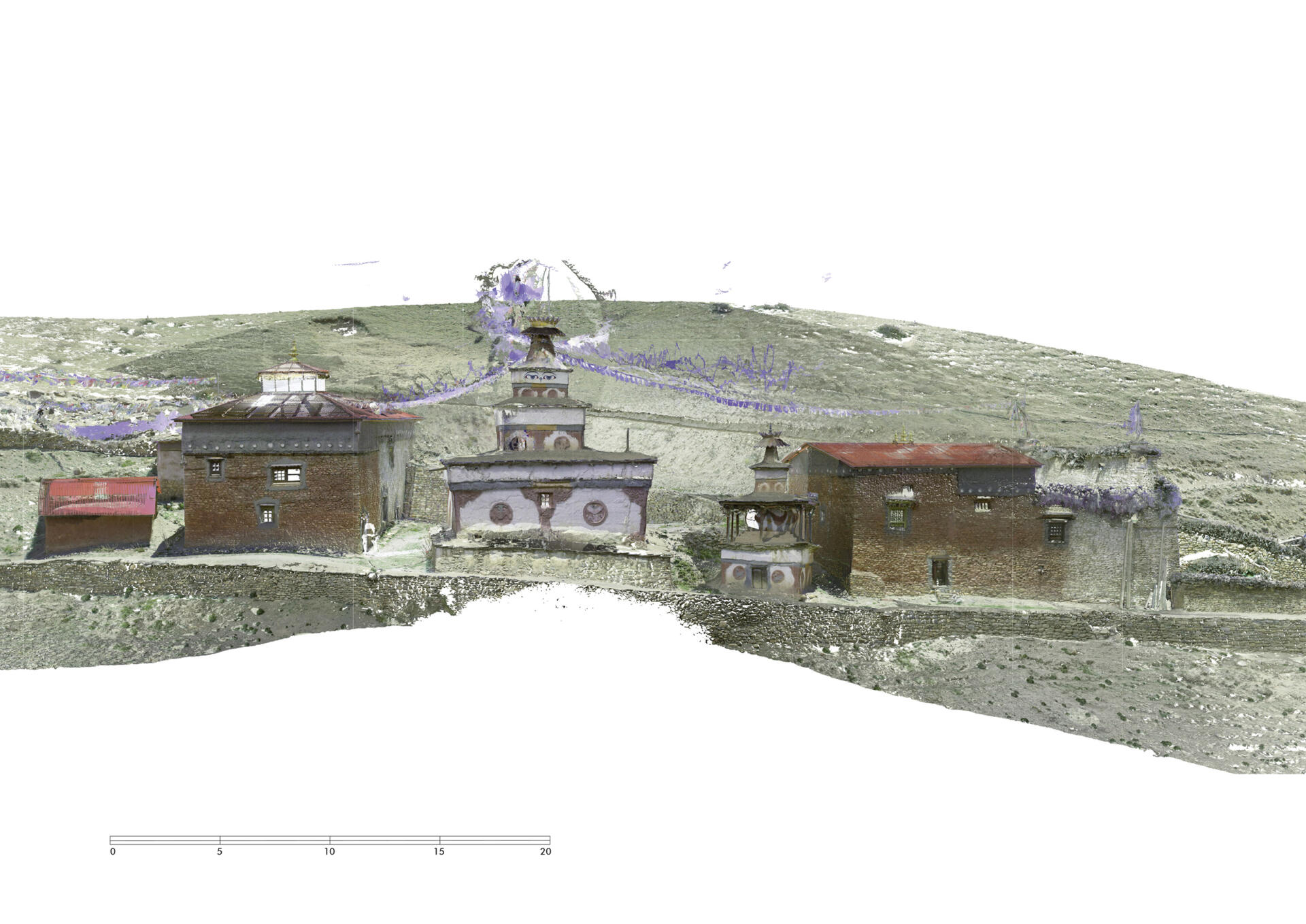
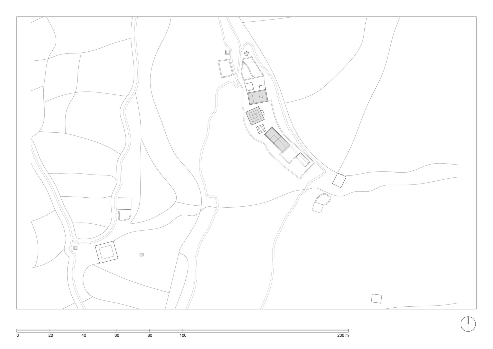
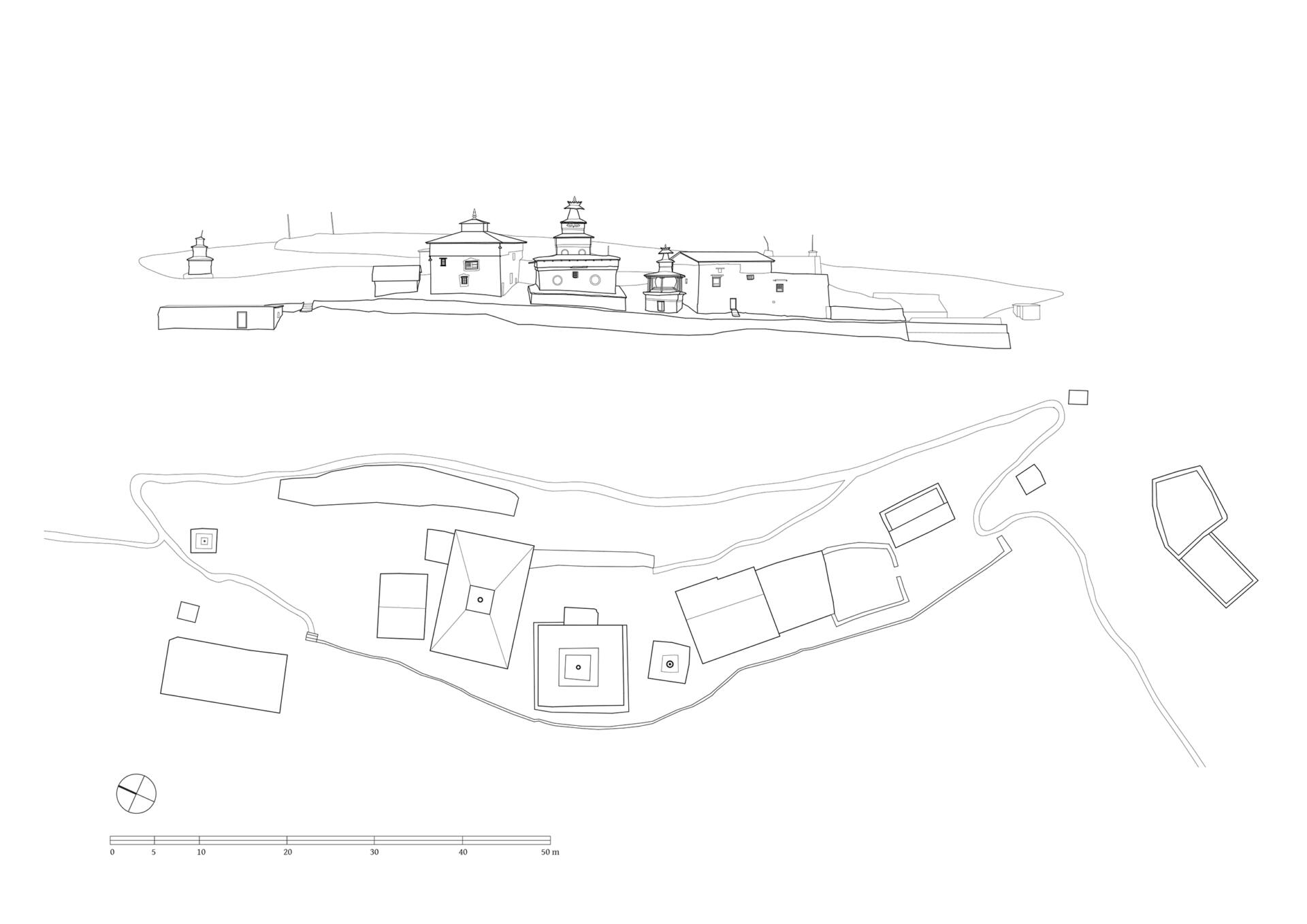
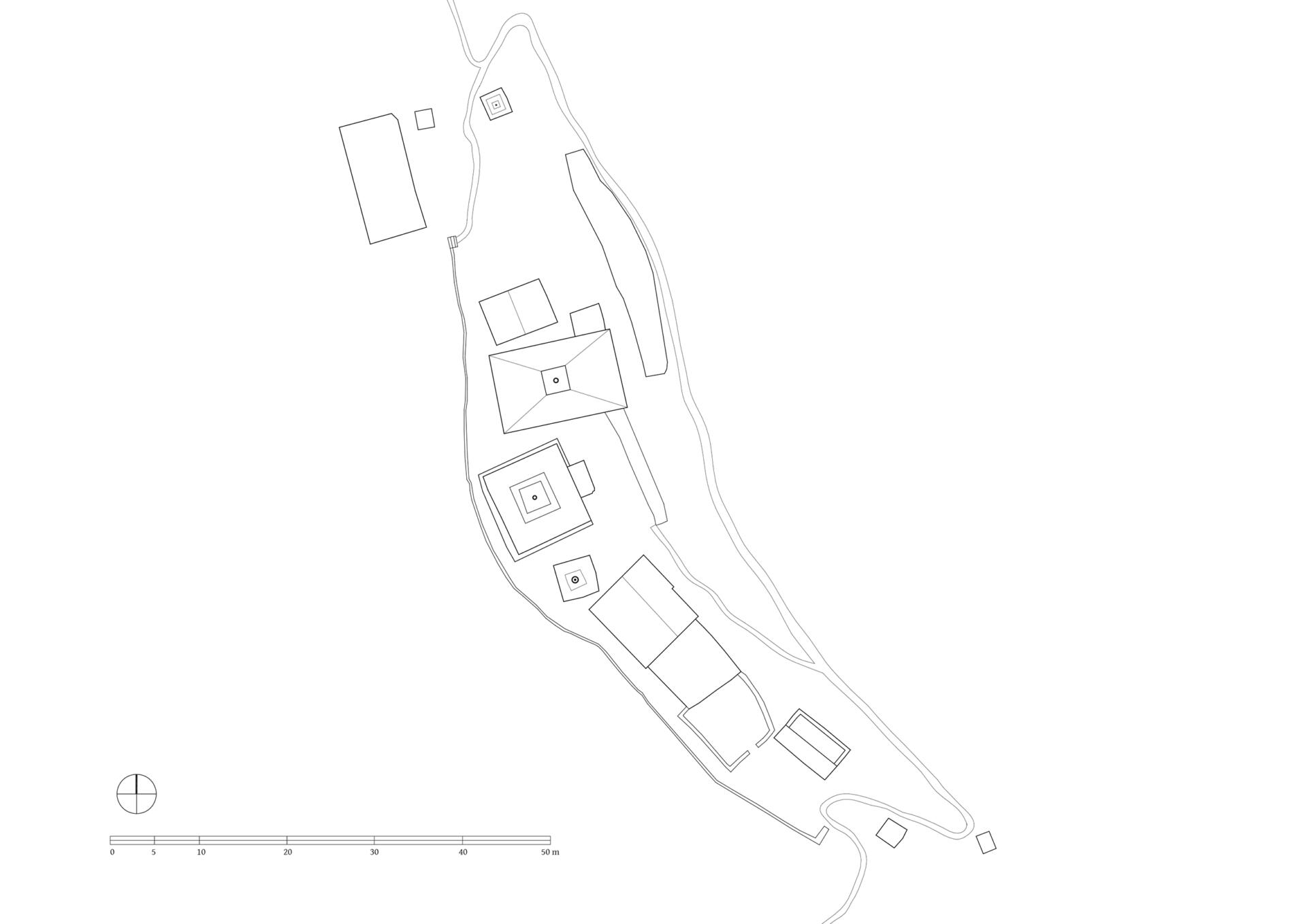
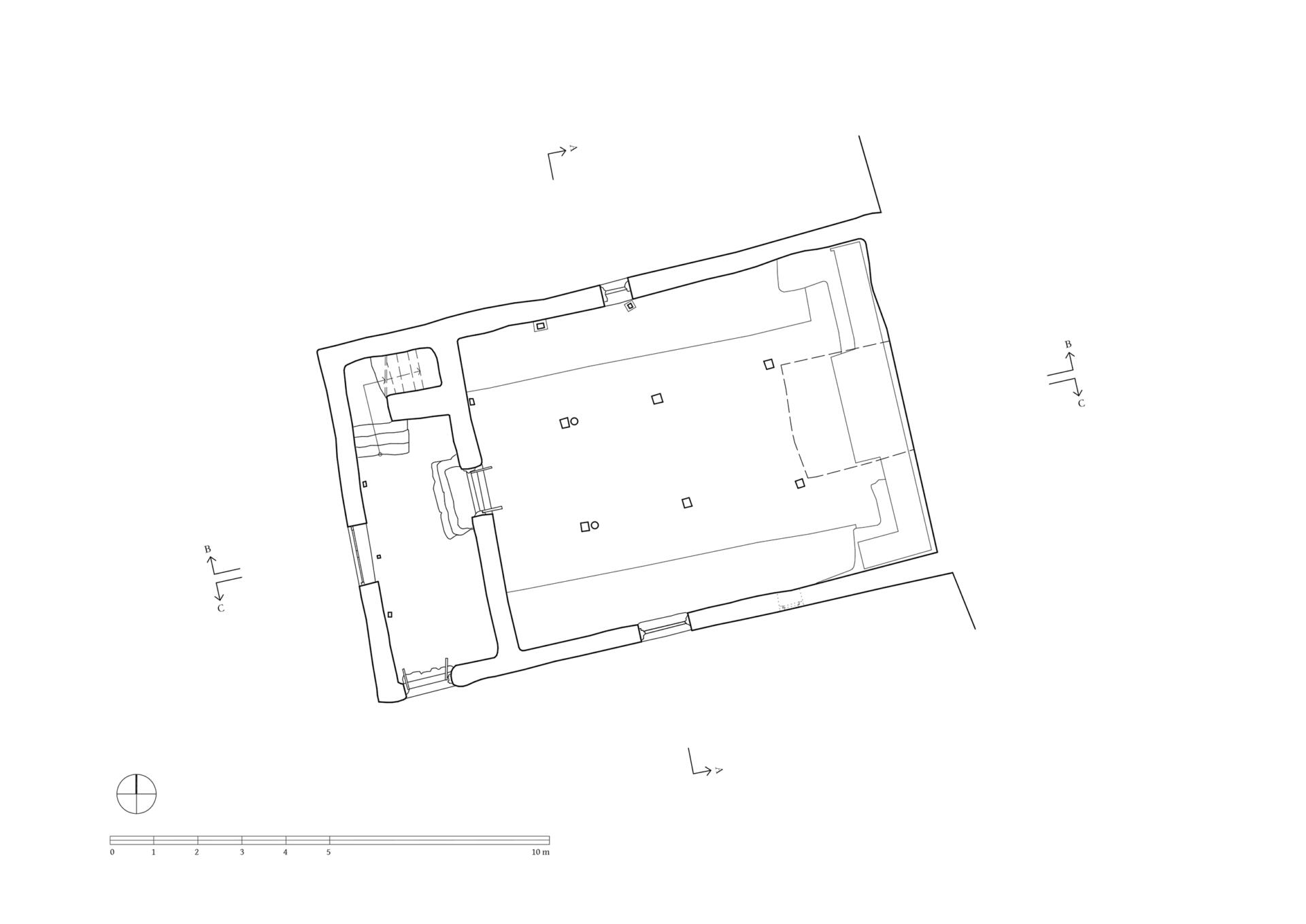
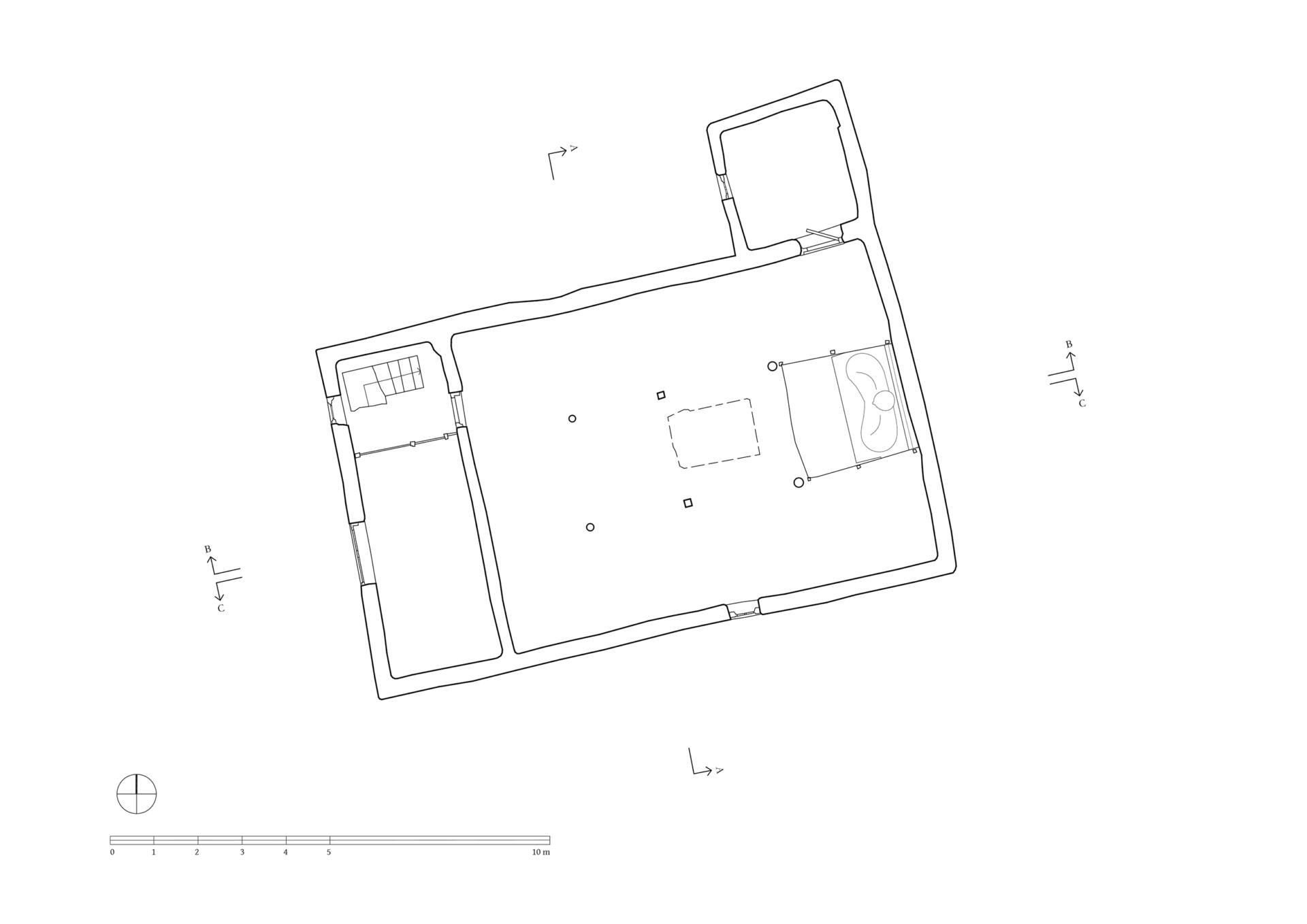
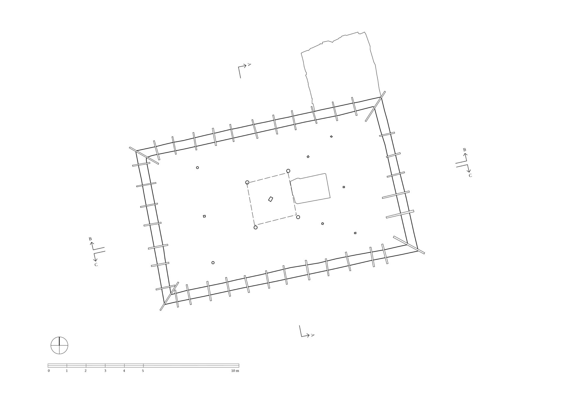
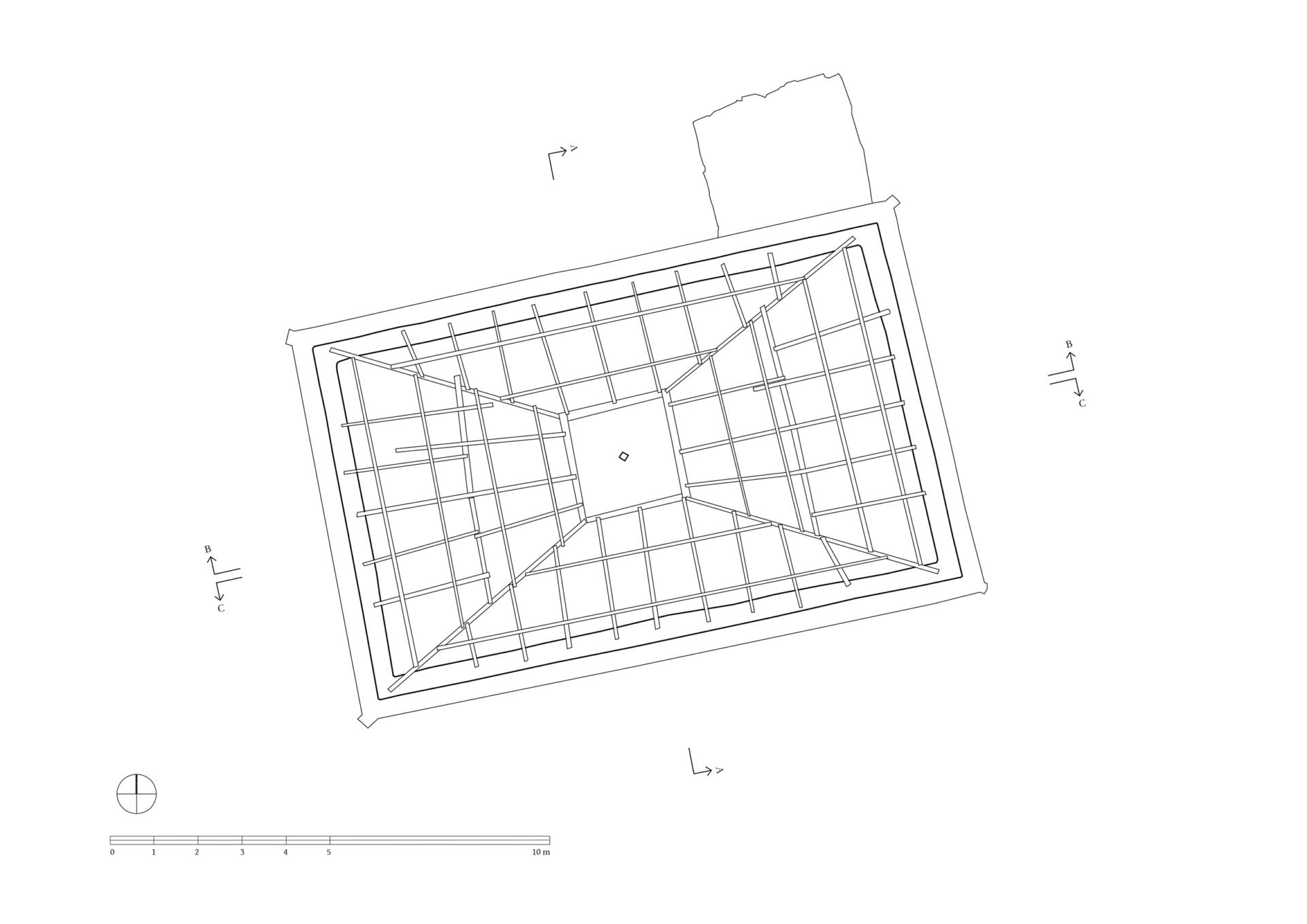
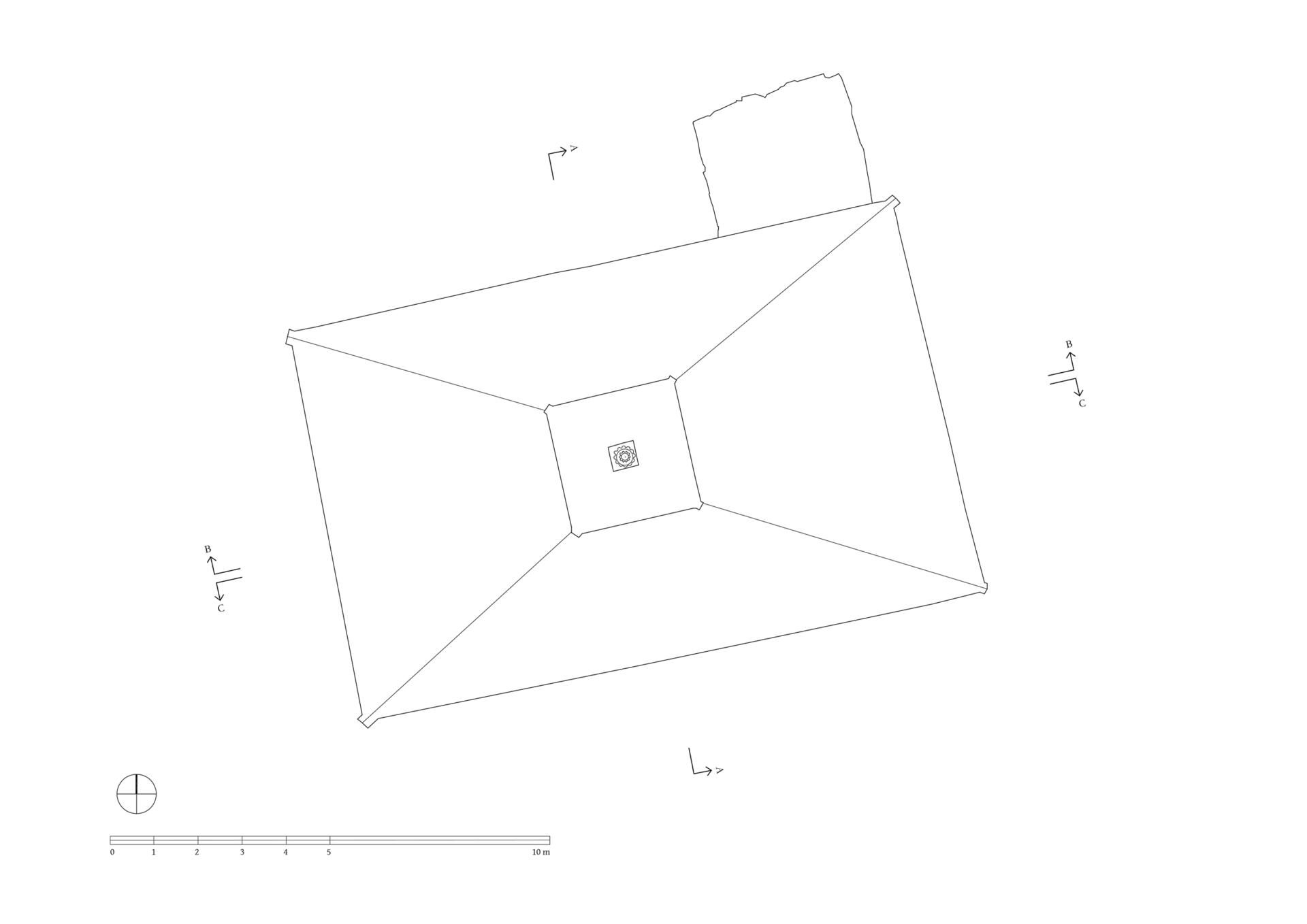
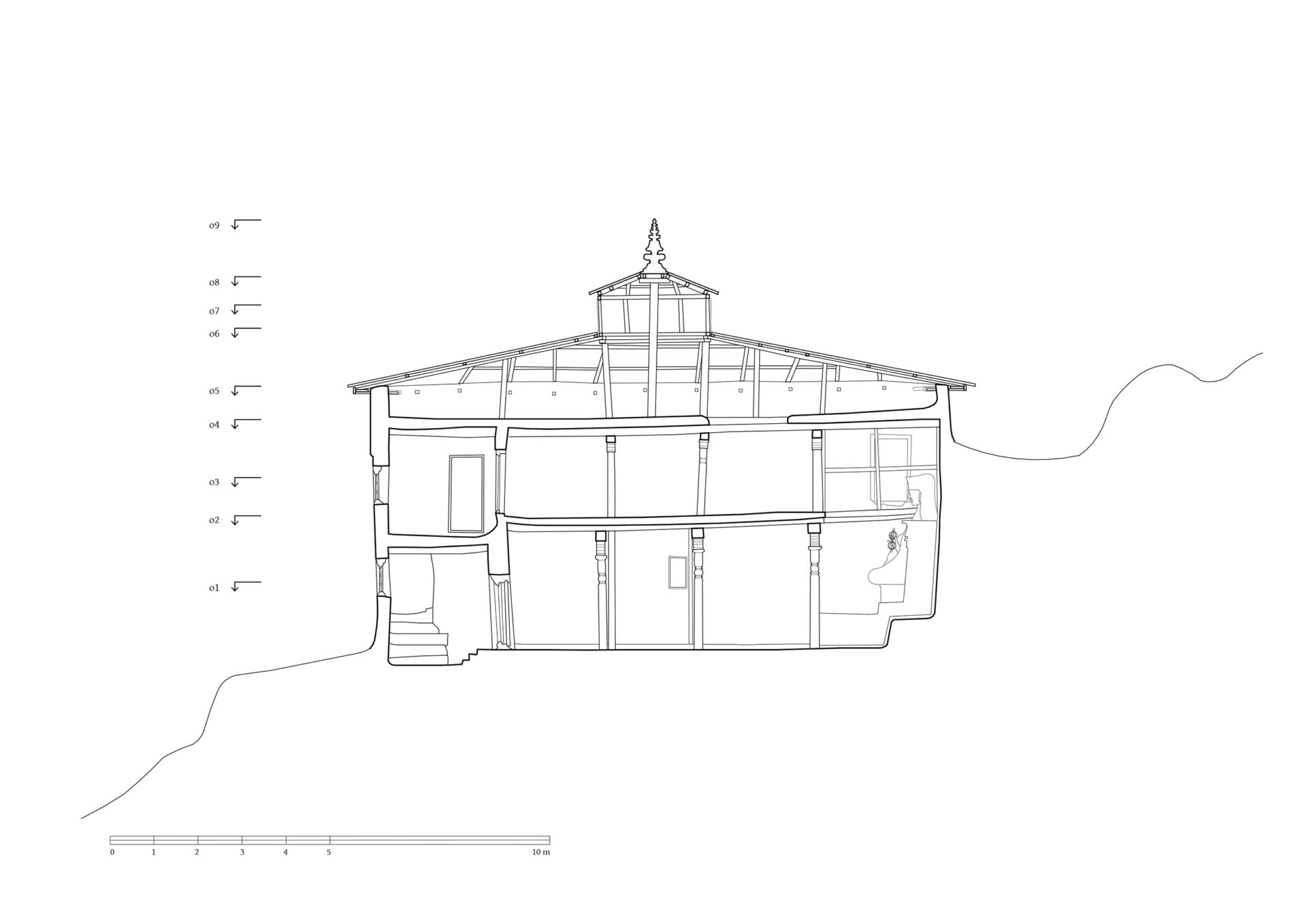
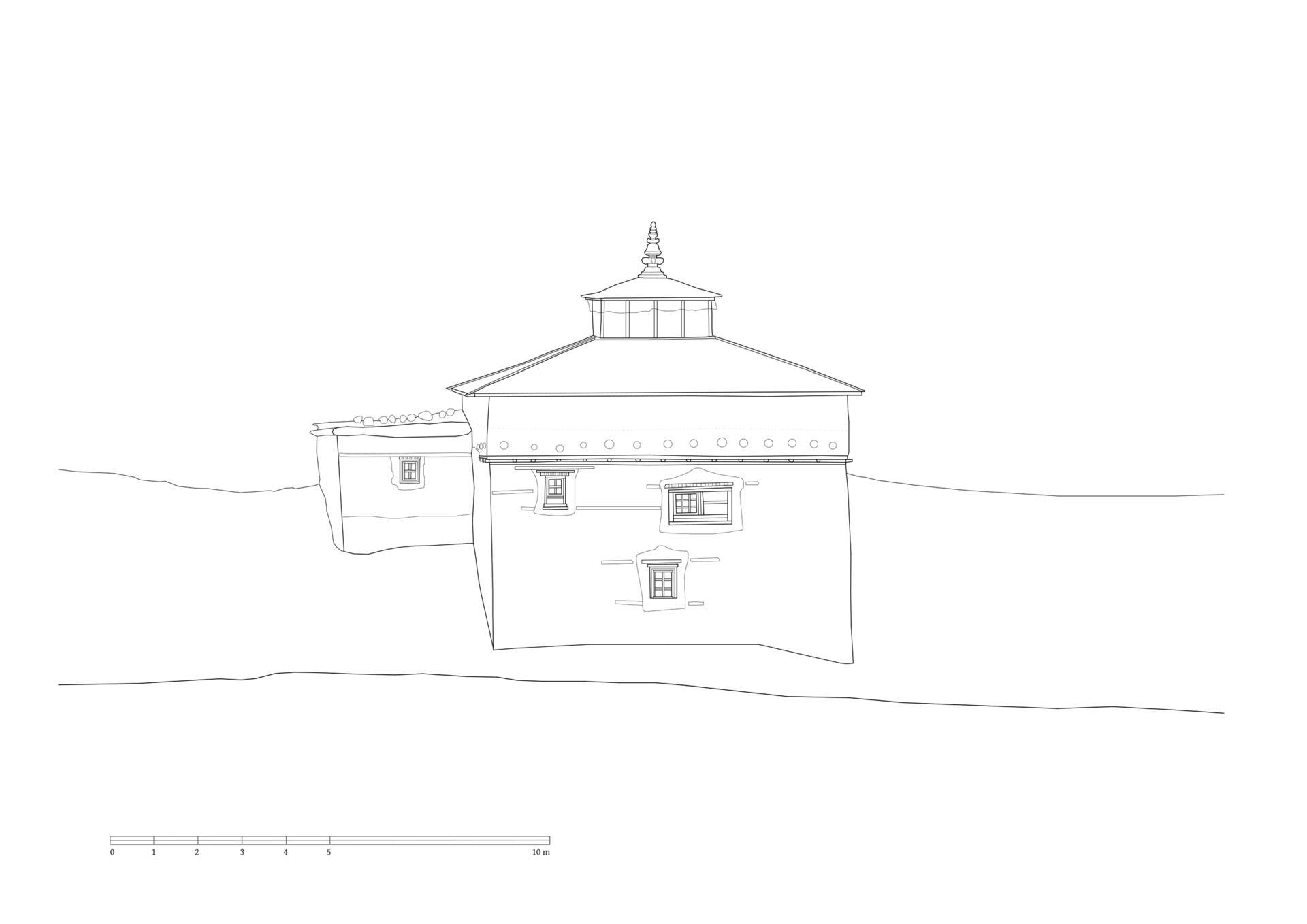
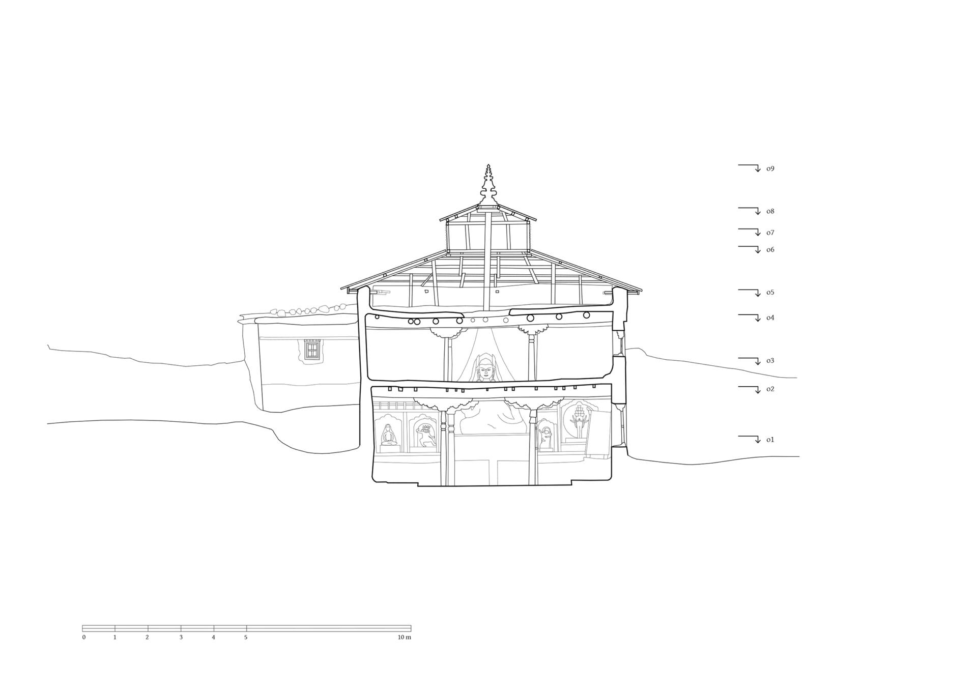
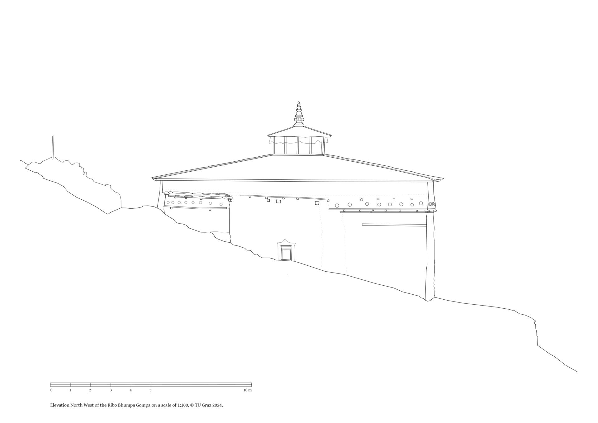
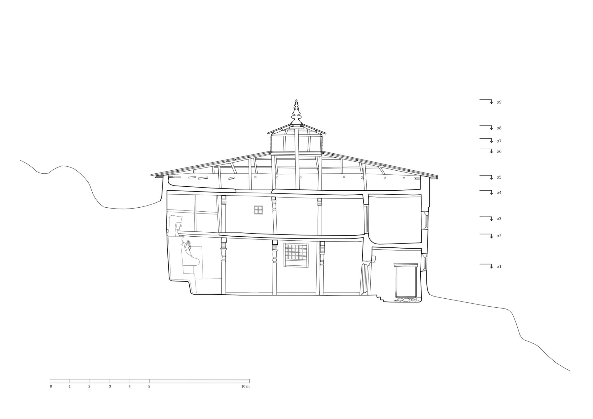
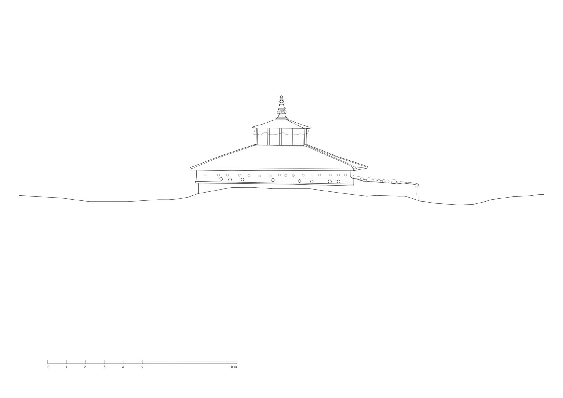
The settlement of Dho is located on the southern side of the Tarap Valley, slightly elevated above the confluence of the rivers where the eastern tributary meets the Tarap Valley. The Ribo Bhumpa Gompa lies north of the village on the slope, where you have a sweeping view of the southwest running, fertile Tarap Valley. The ensemble consists of several buildings which are lined up next to each other along a narrow terrace. The gompa is located on the northwest side. It has two floors with an external dimension of 13.50 x 8.30 meters (plus a small extension to the upper floor measuring 3.20 x 3.20). Its ground floor reaches into the slope on the east side. The entrance to the temple is located on the southern corner of the building. From here a 3.40 metres narrow vestibule leads to the entrance door of the assembly hall on the ground floor and via a staircase to the floor above. The interior of the assembly hall is 7.40 meters wide, 9.80 meters deep and around 2.80 meters high. The ceiling is supported by six wooden columns. The walls are decorated with murals, two windows on the southern wall lights up the room. Opposite the entrance door, in the centre of the altar, stands a large figure of Guru Rinpoche, framed by room-high painted shelves. His head towers up to the second floor and is illuminated by overhead windows.
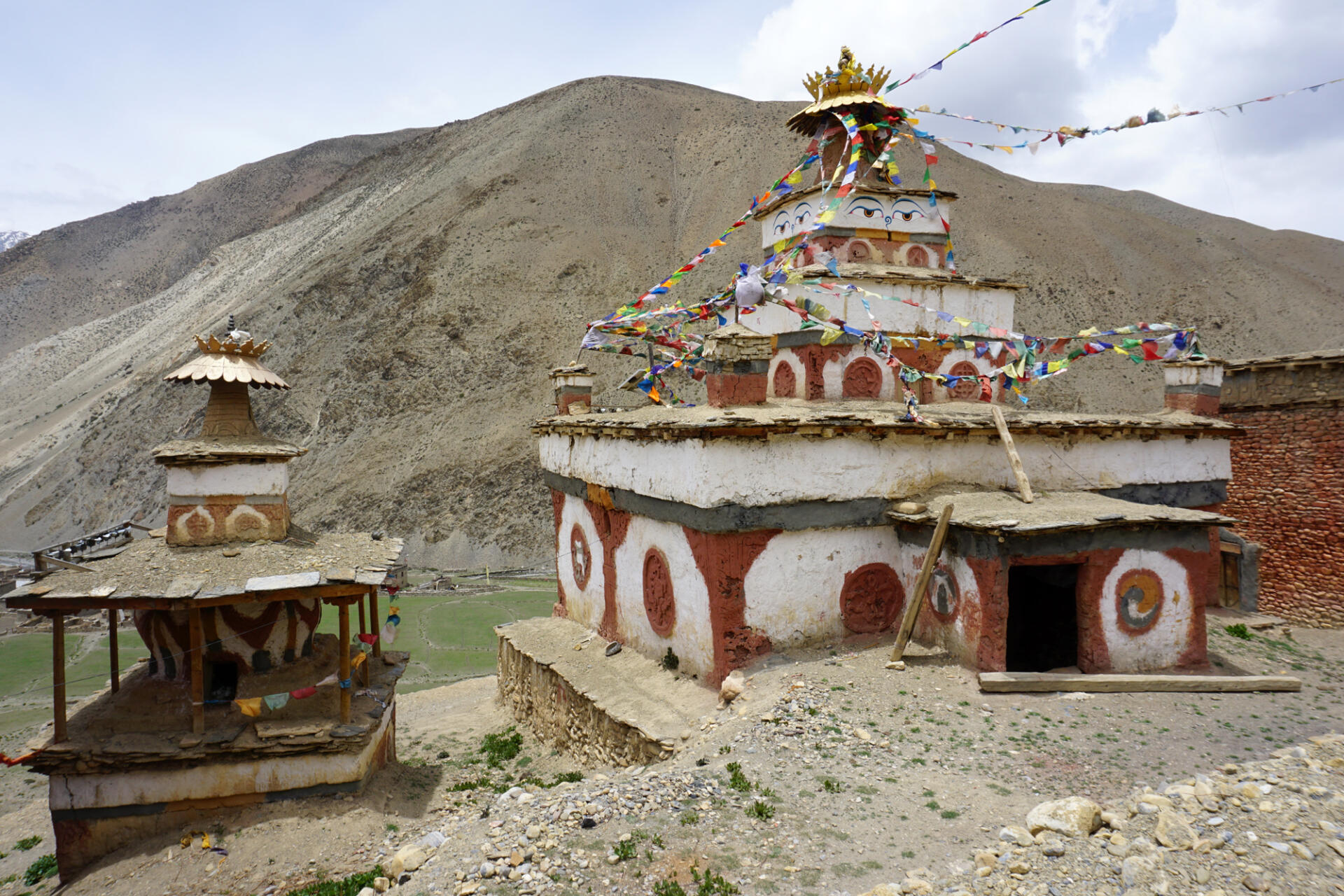
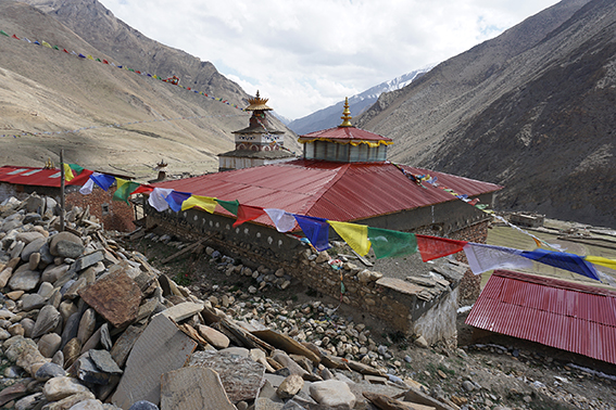
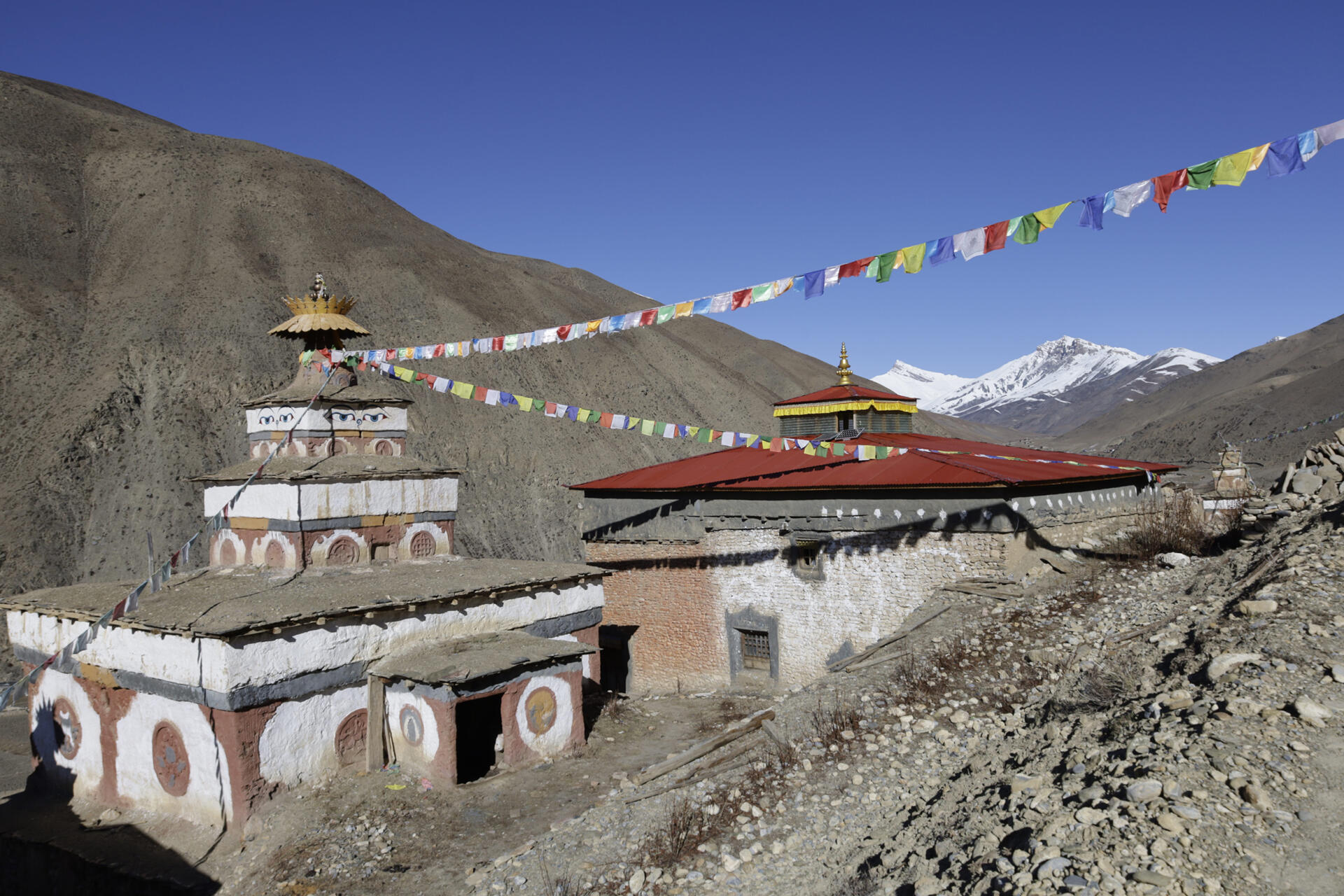
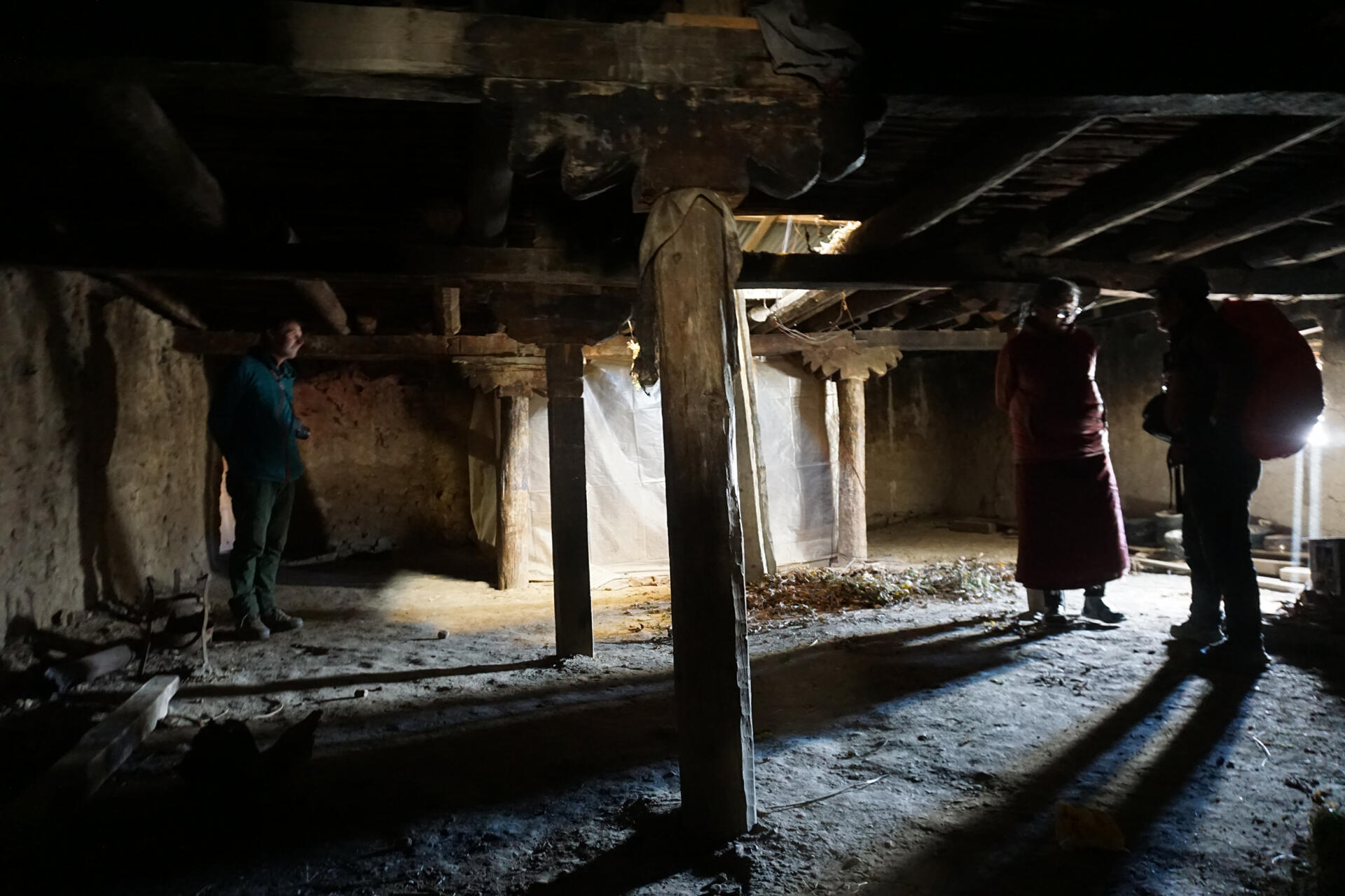
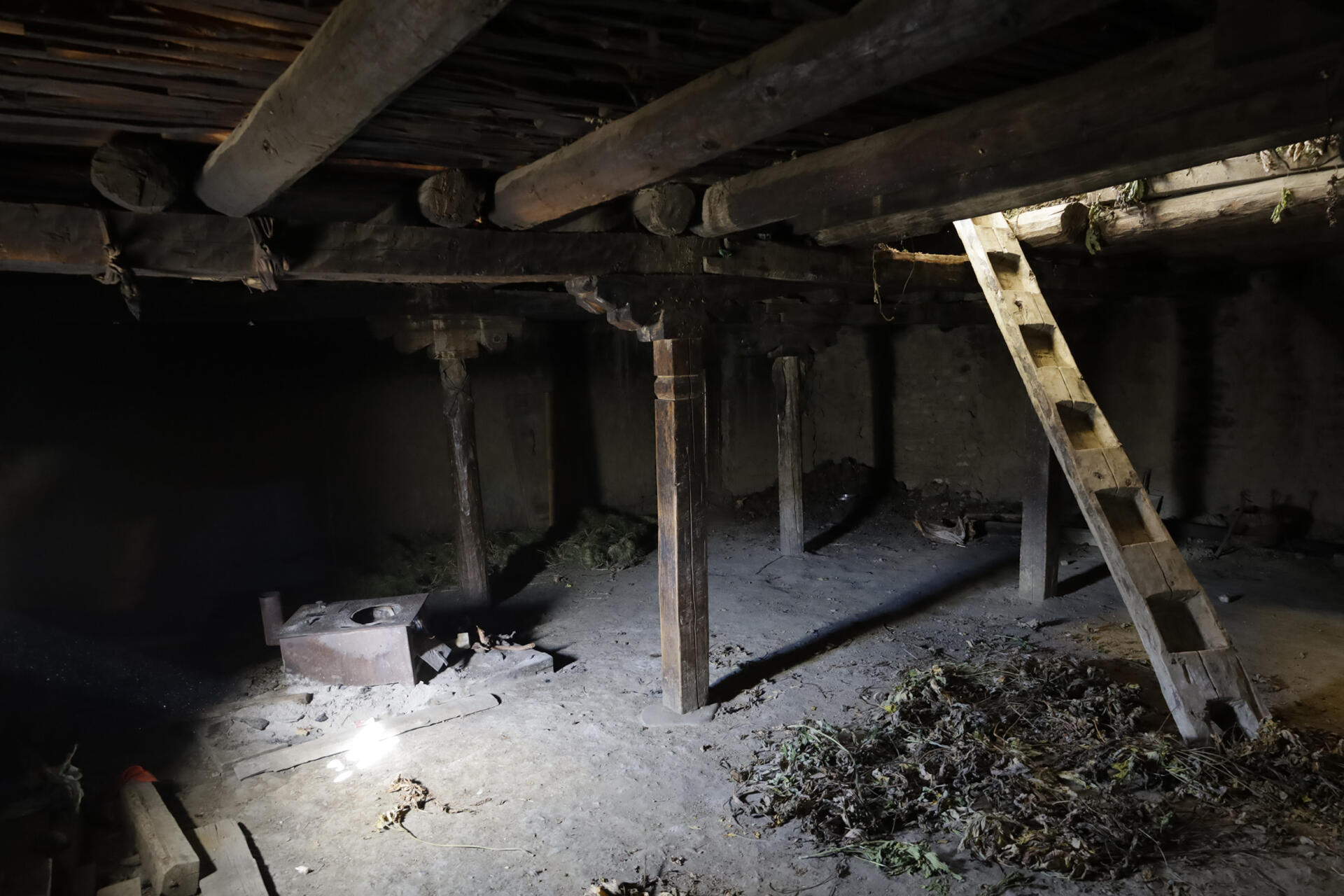
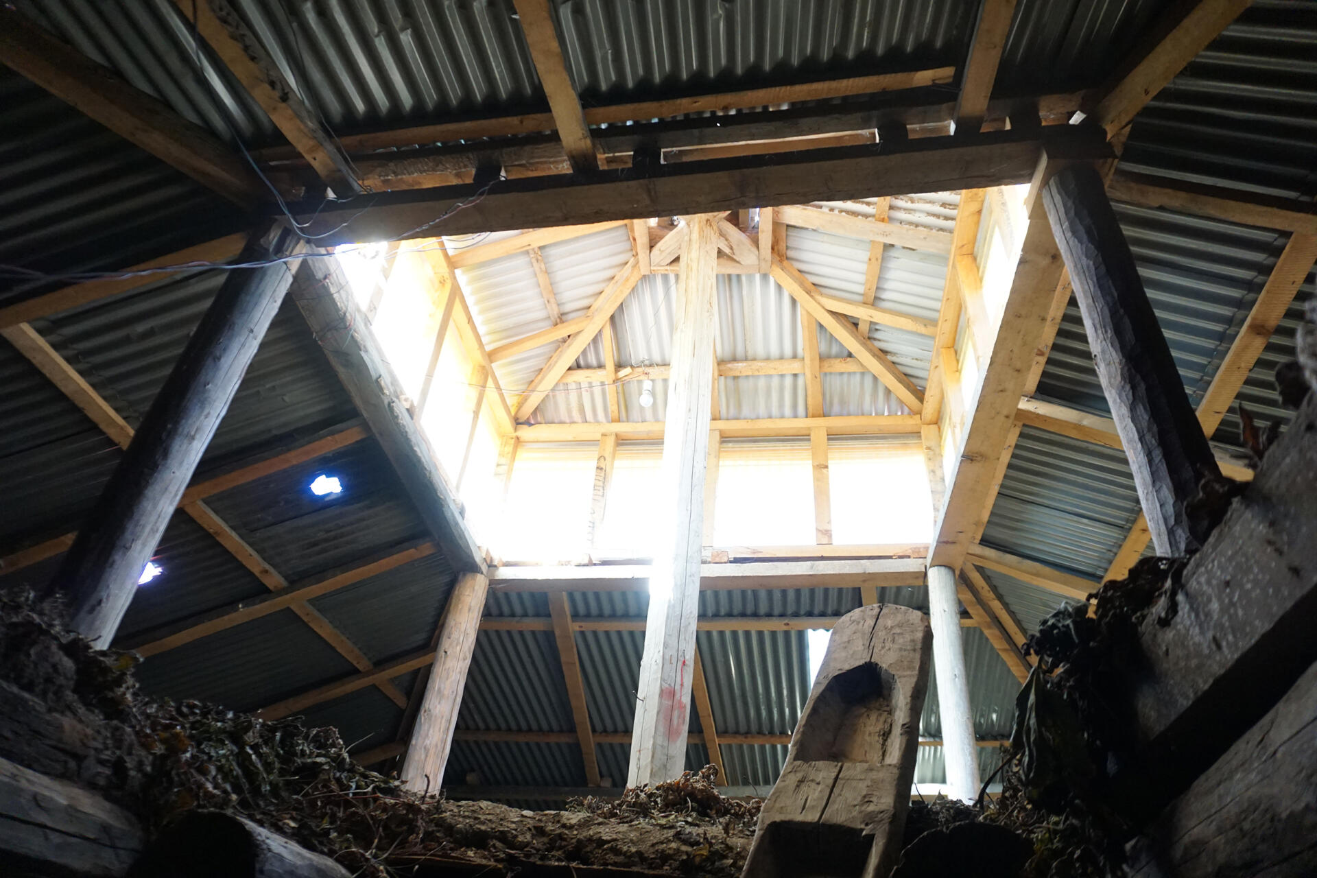
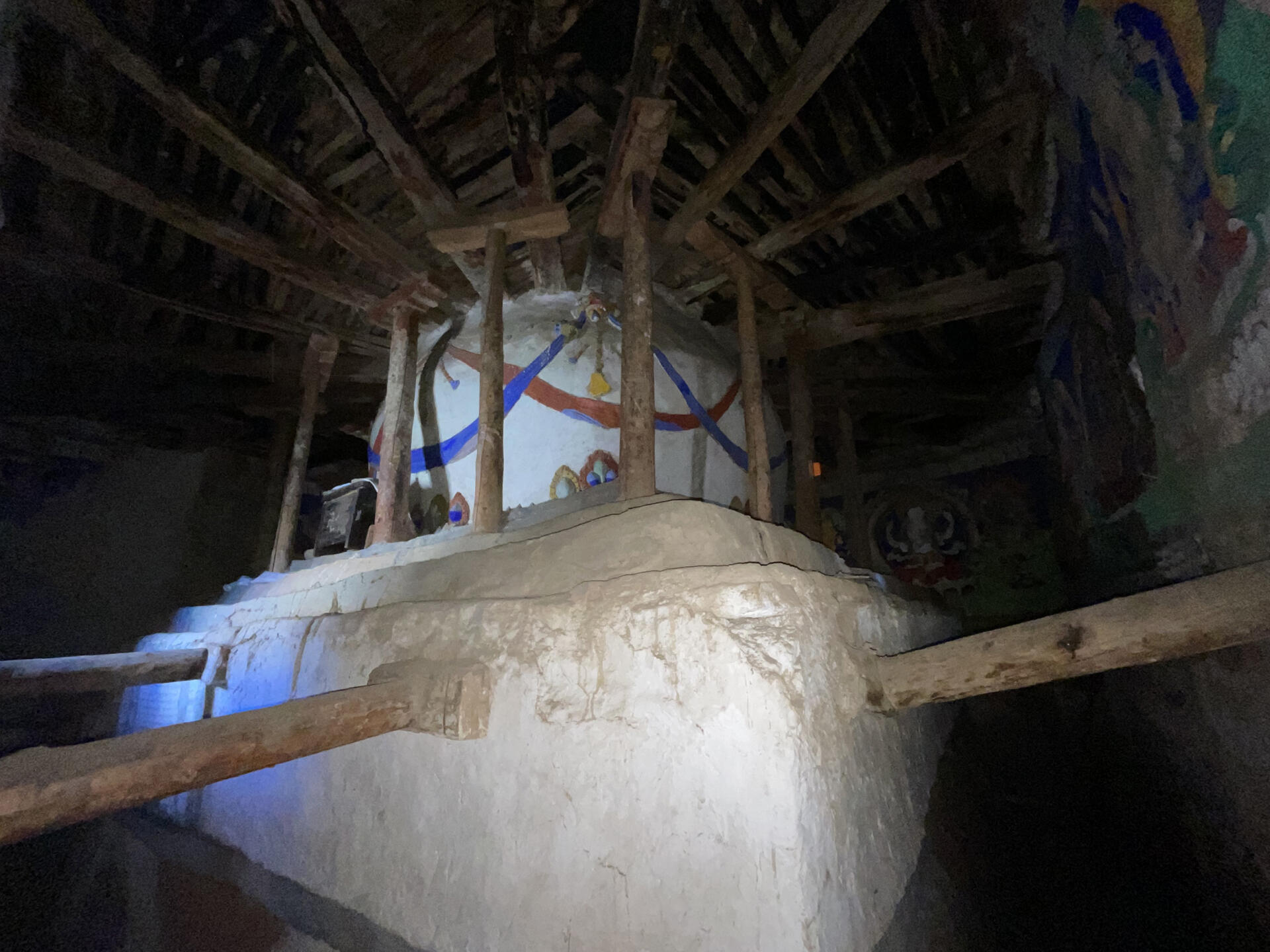
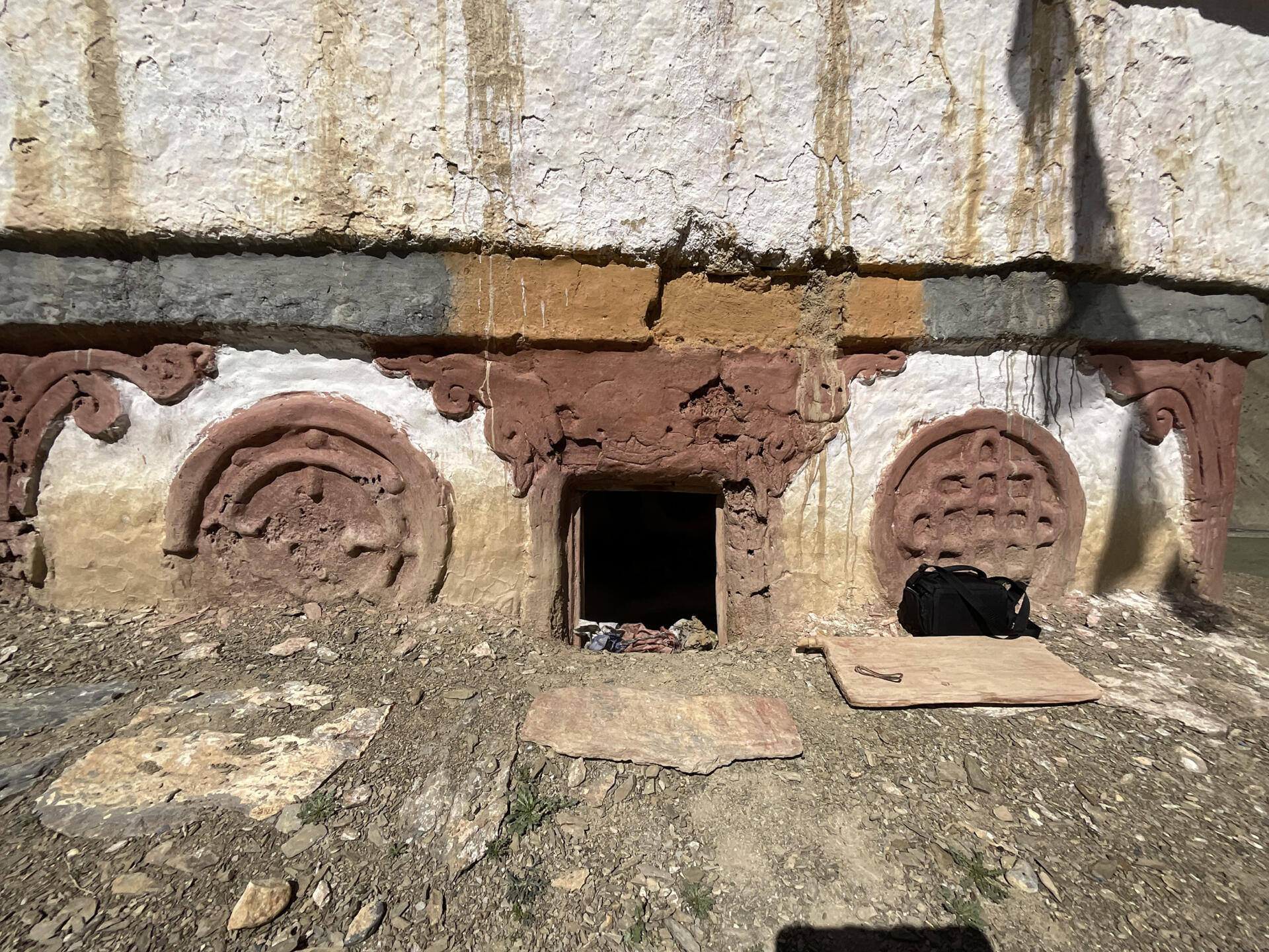
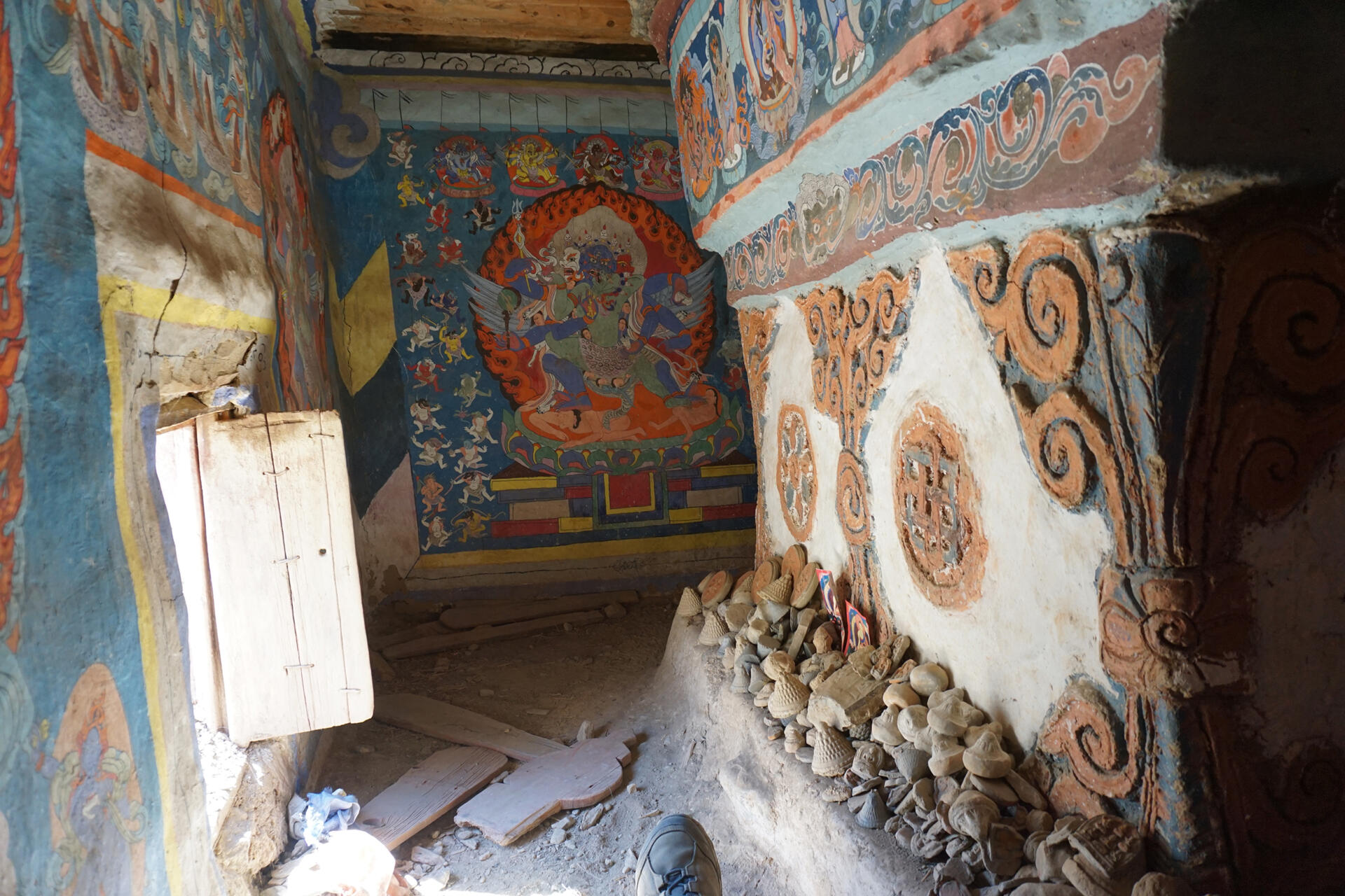
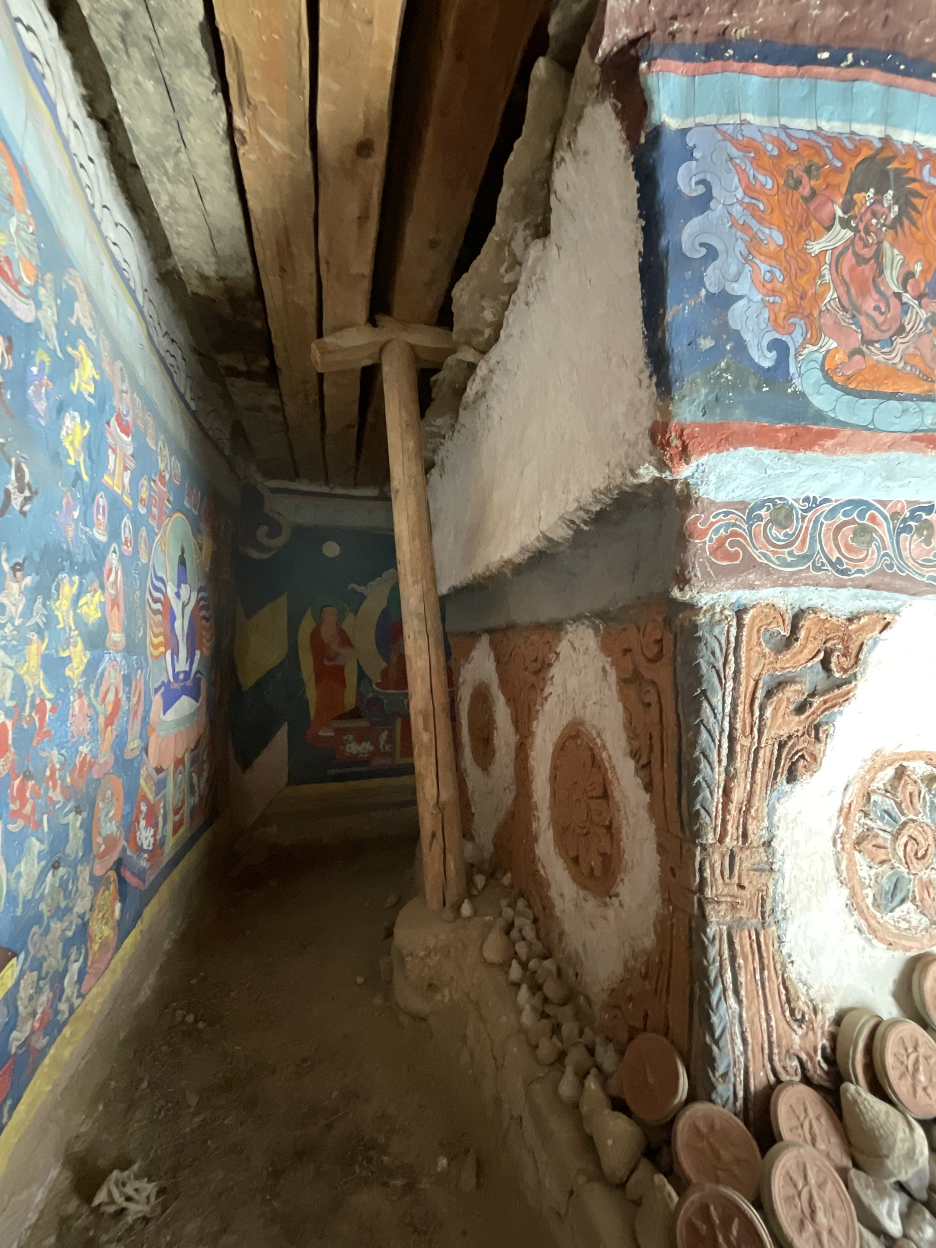
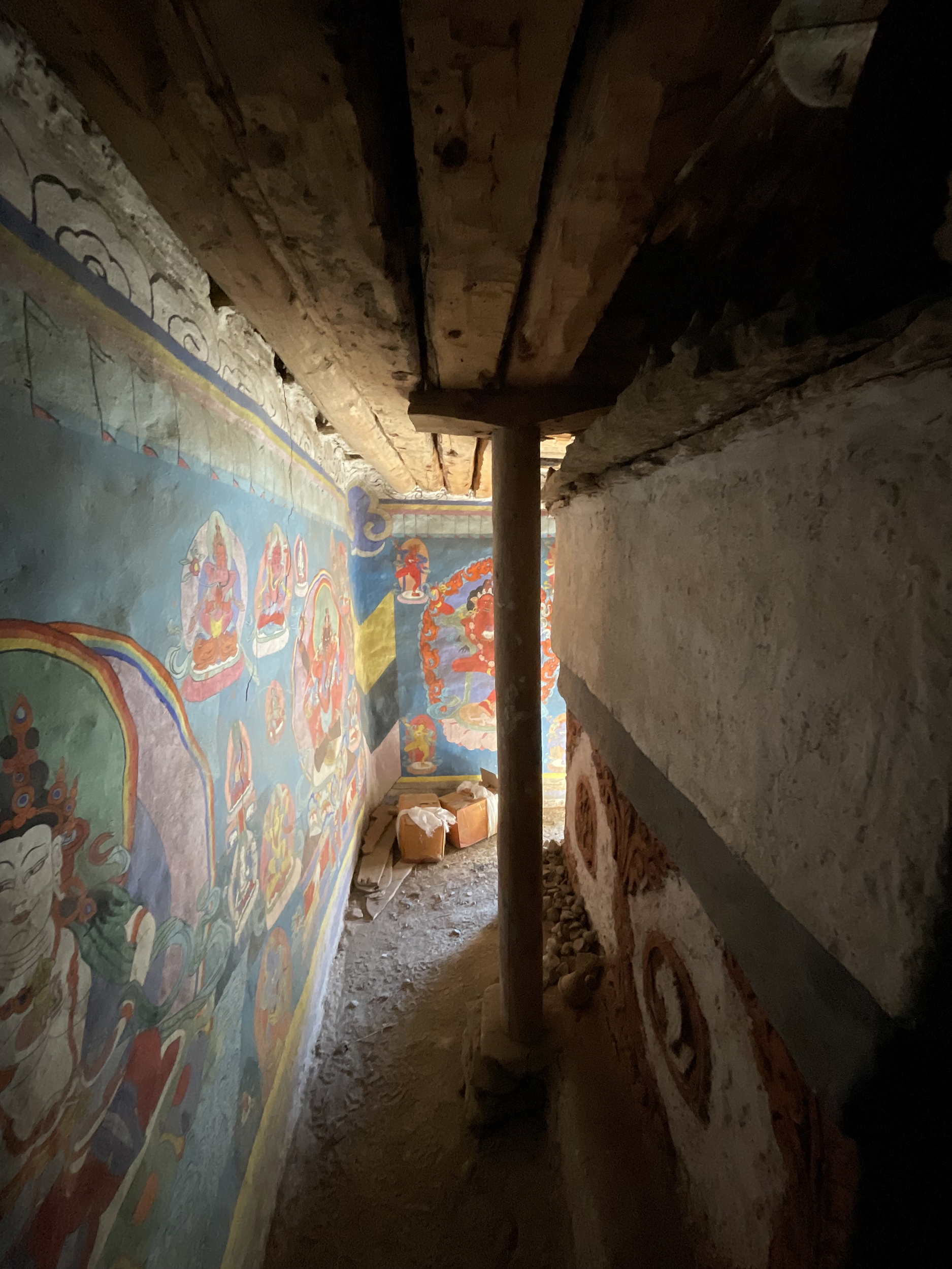
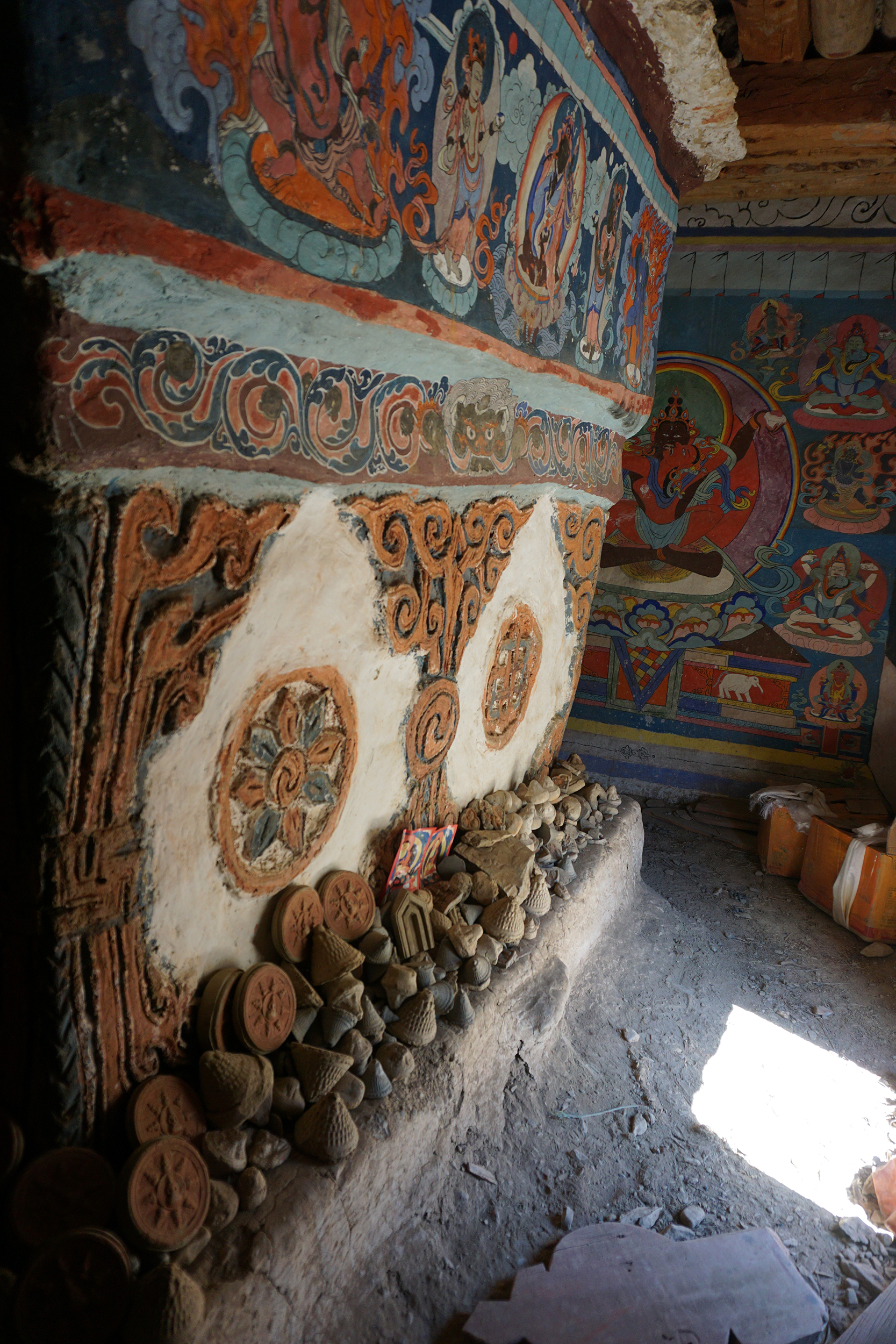
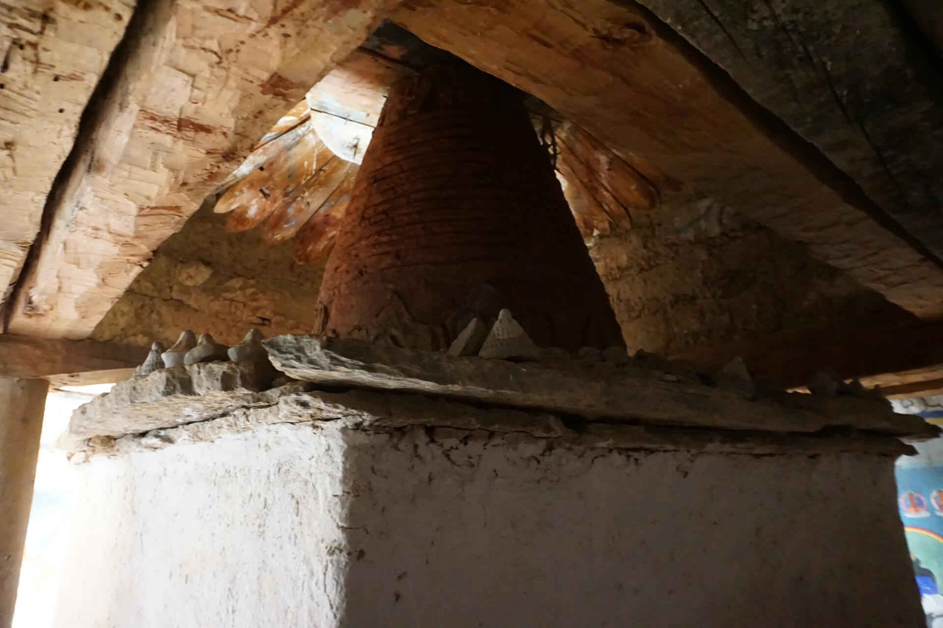
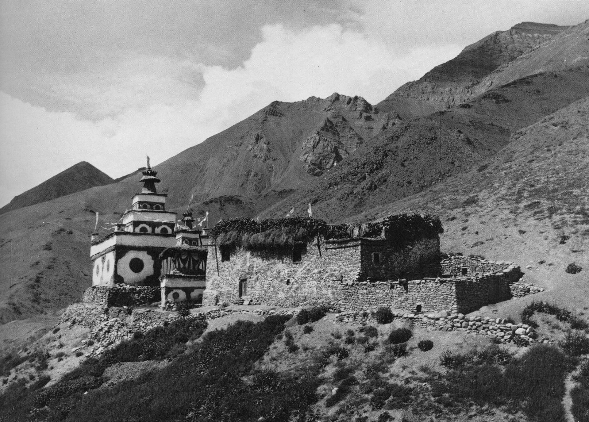
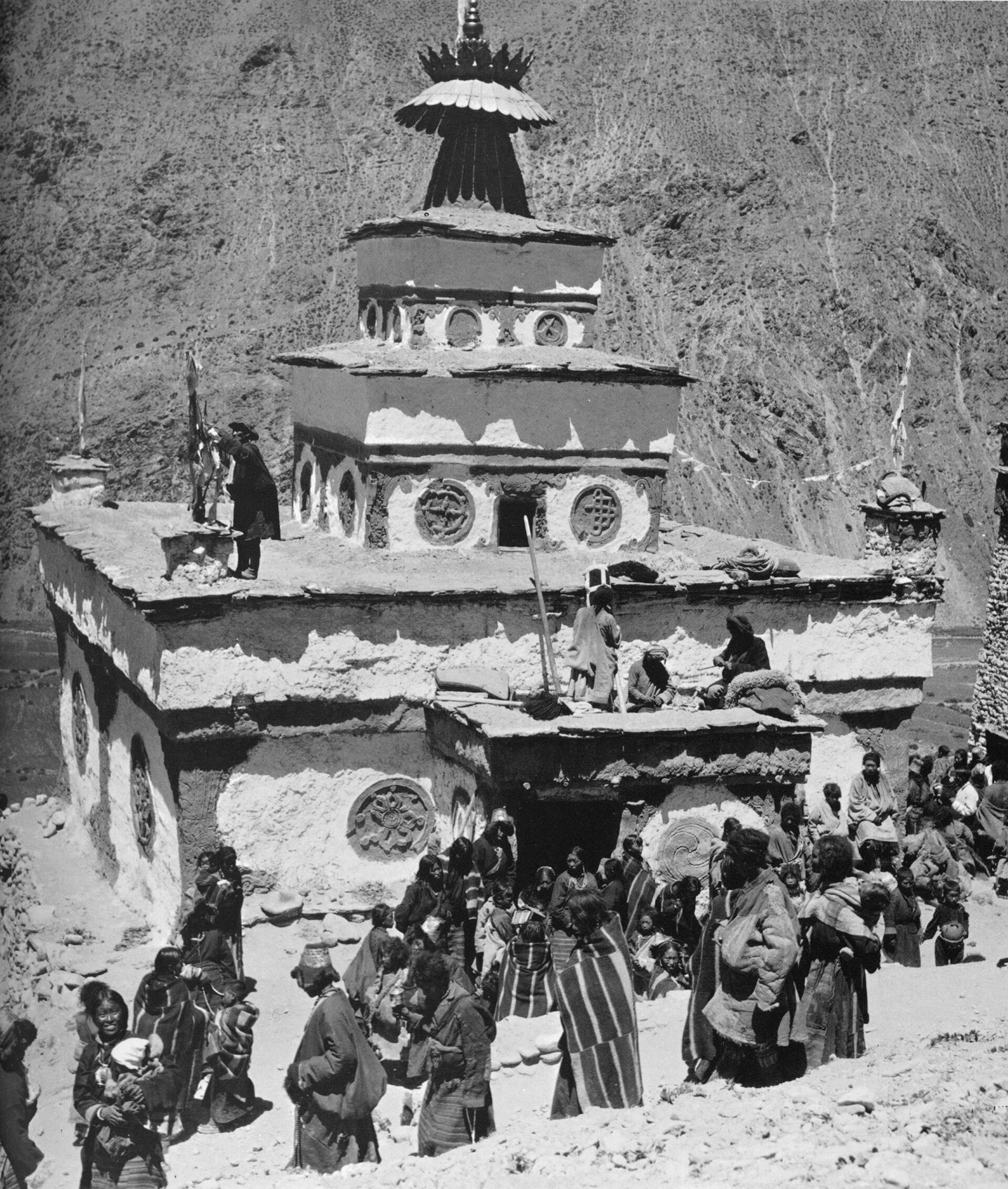
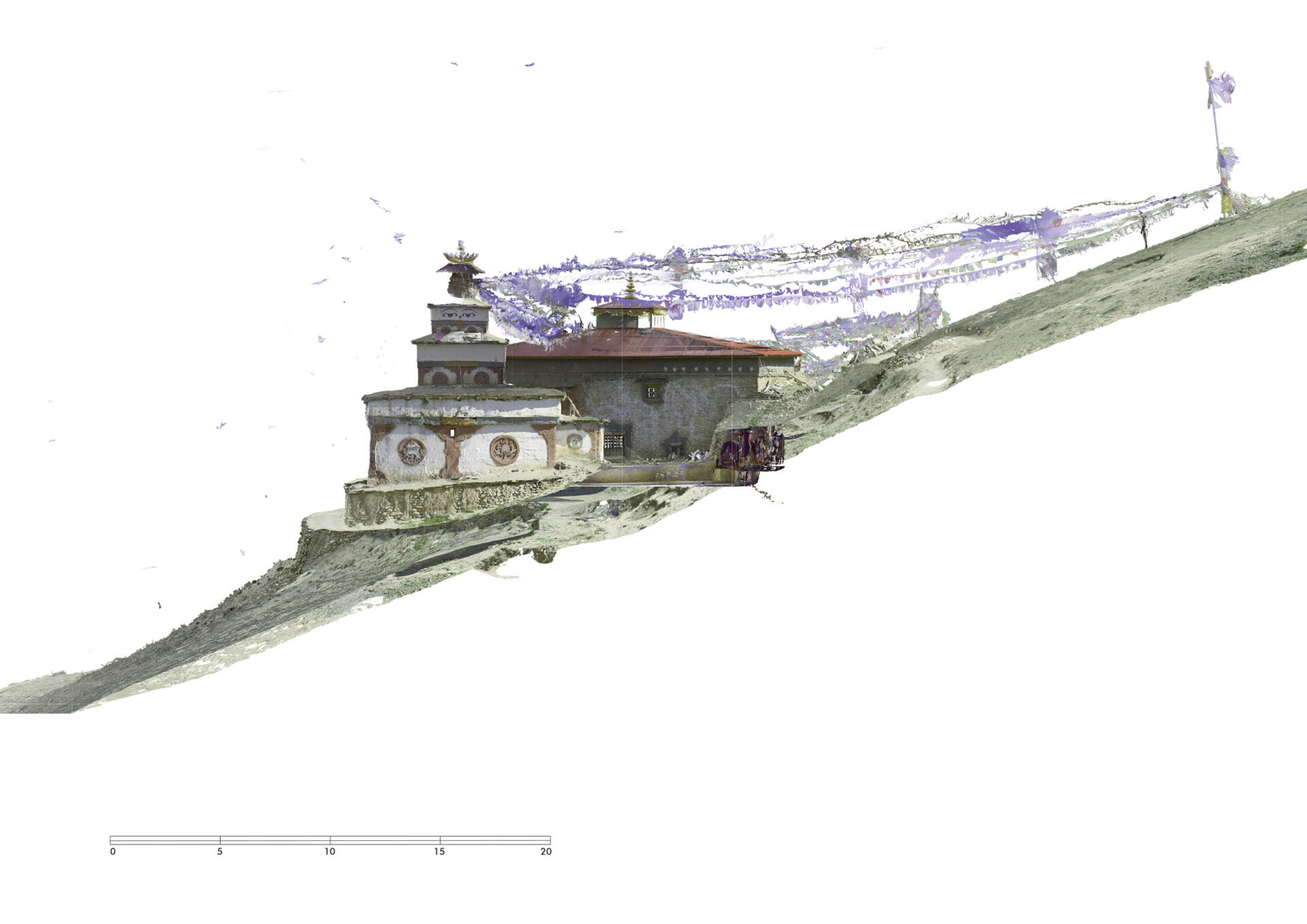
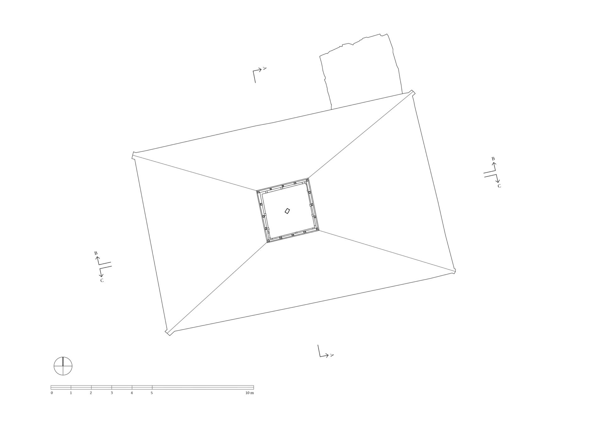
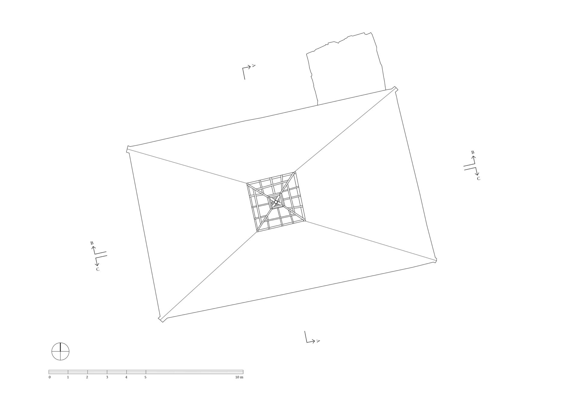
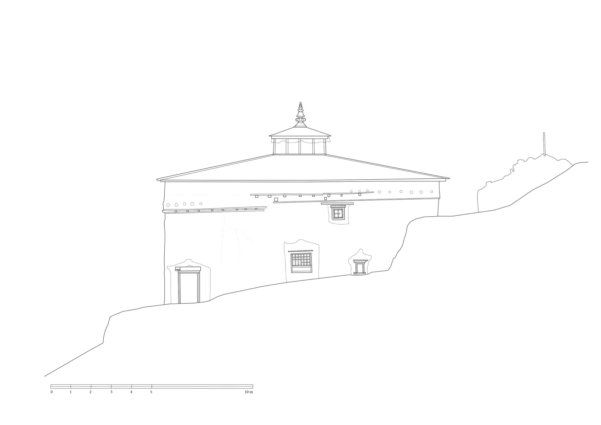
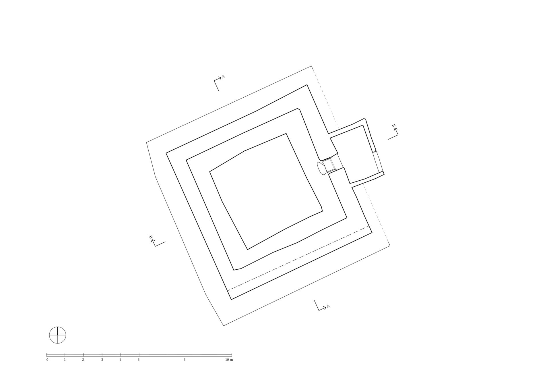
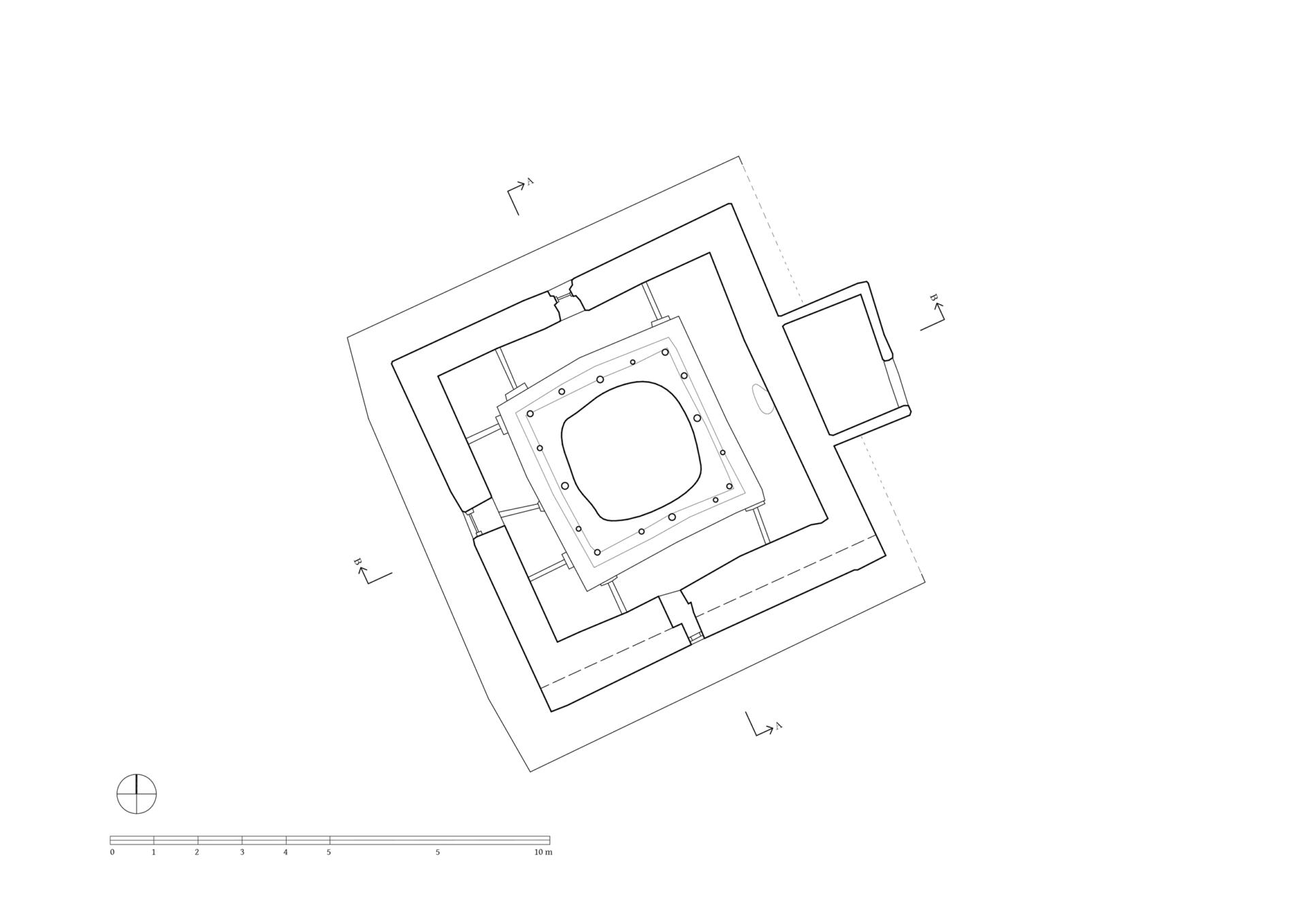
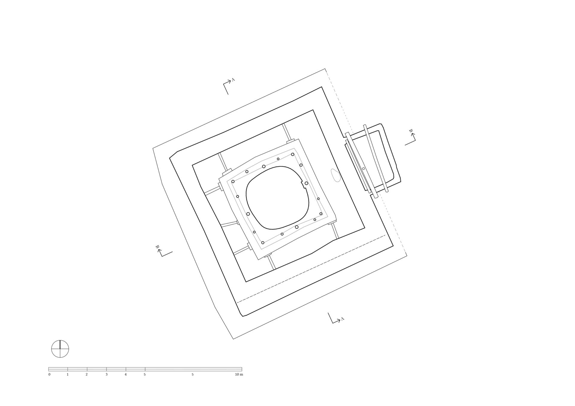
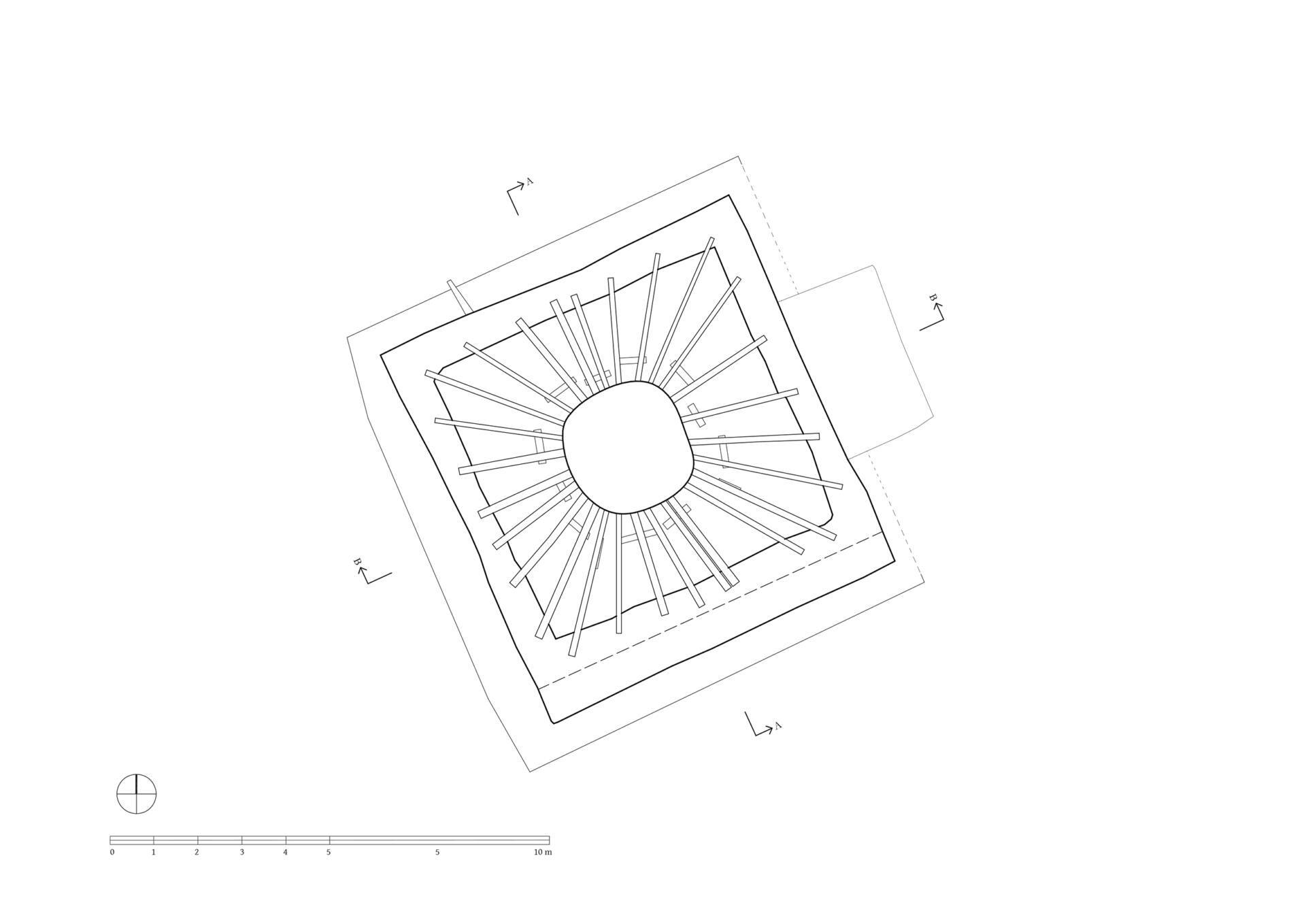
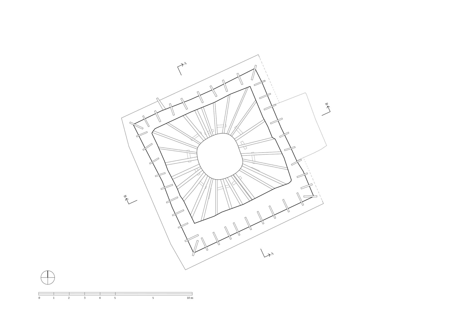
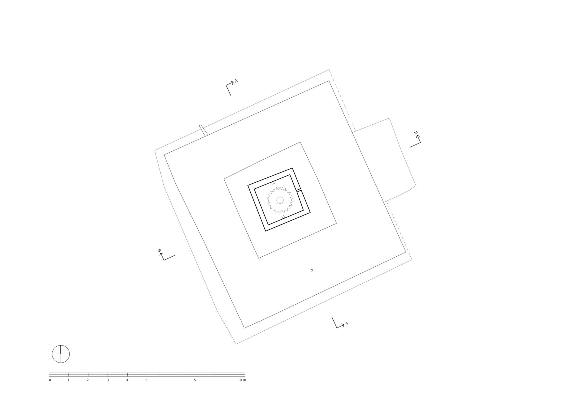
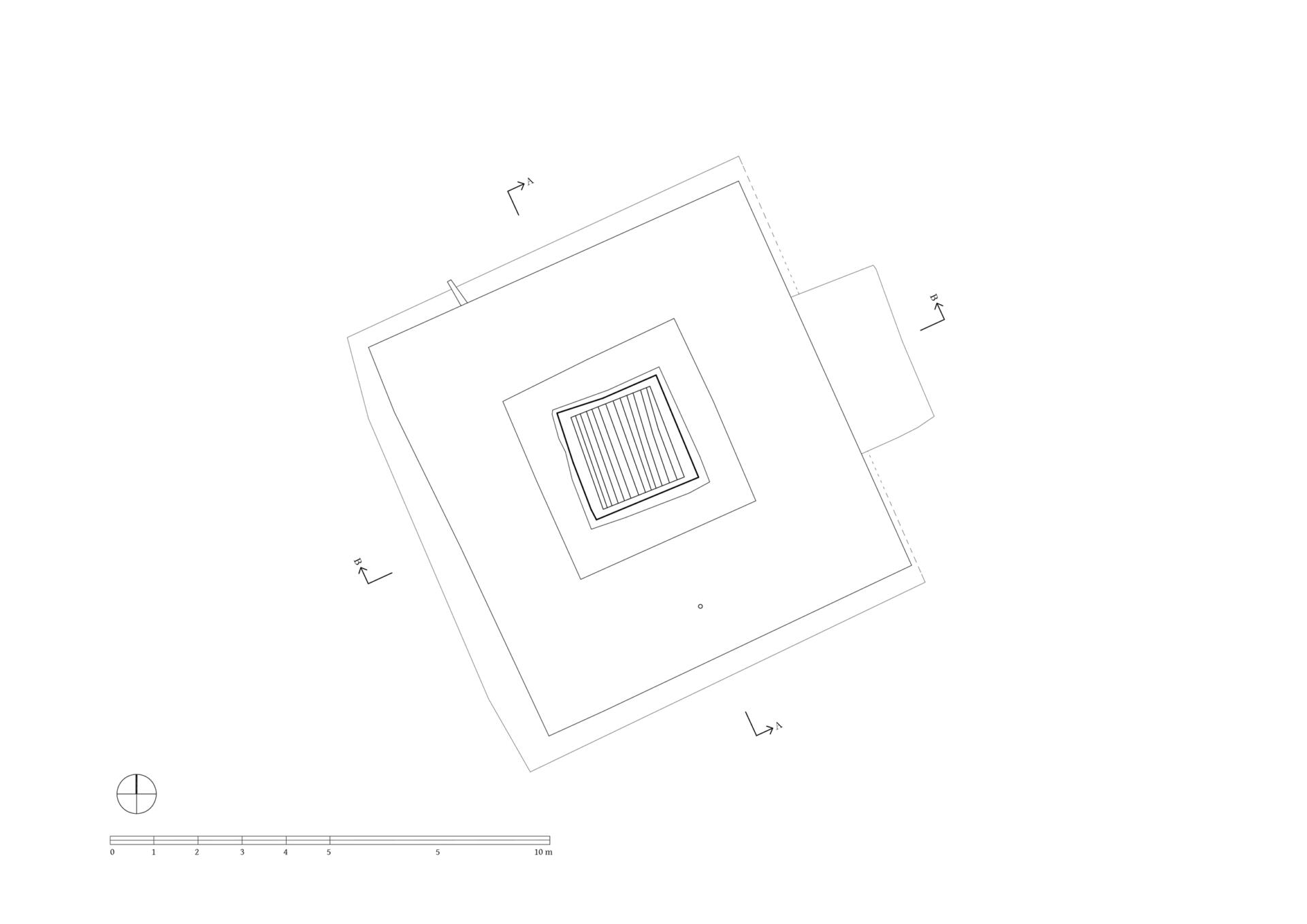
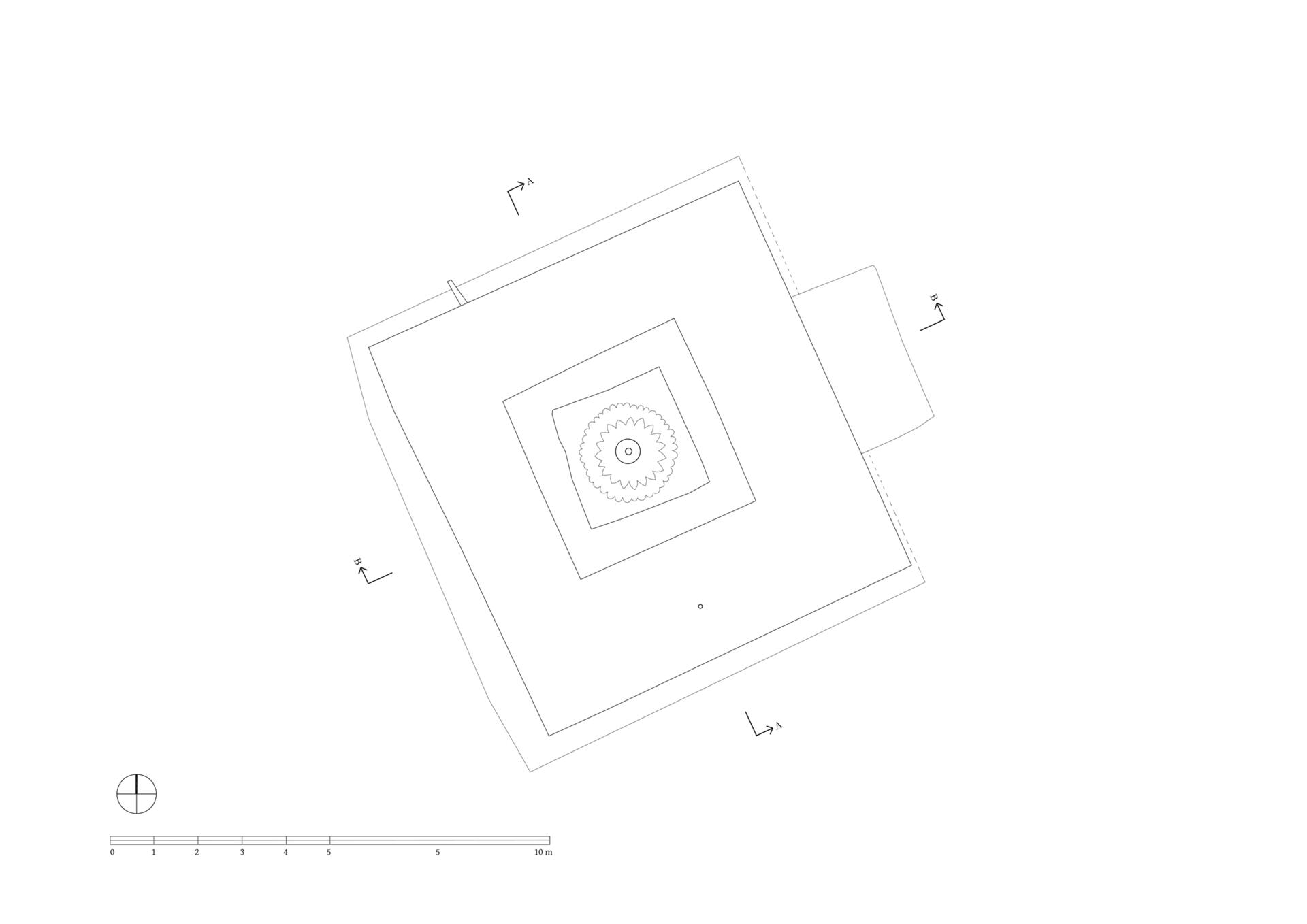
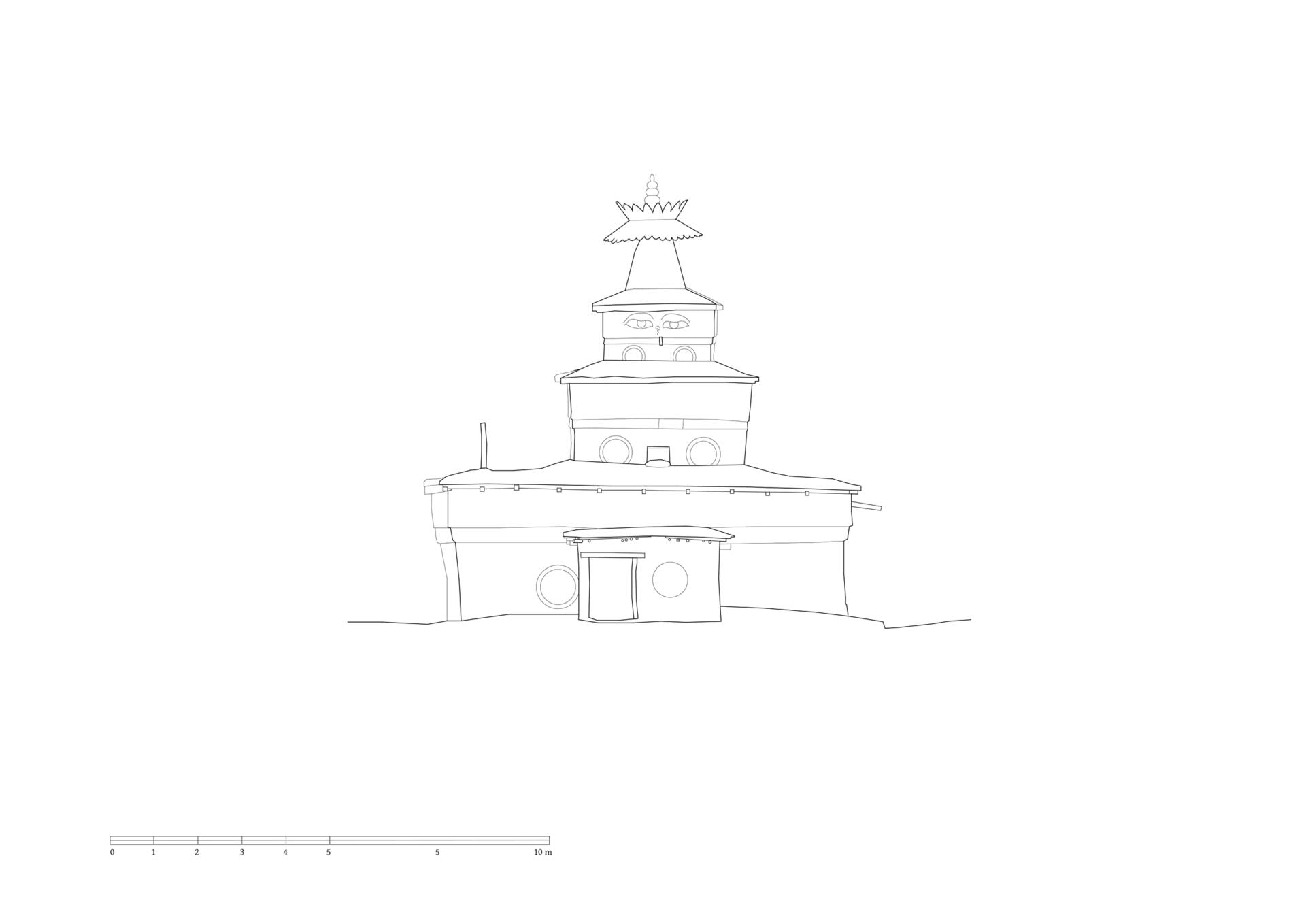
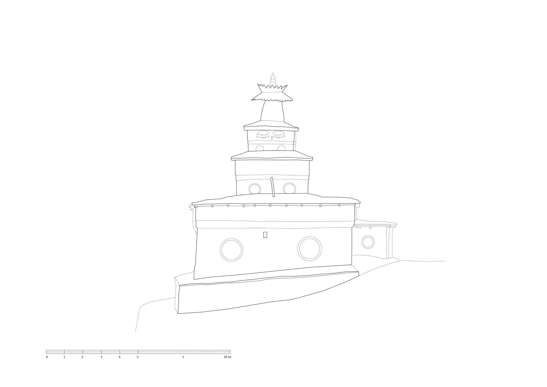
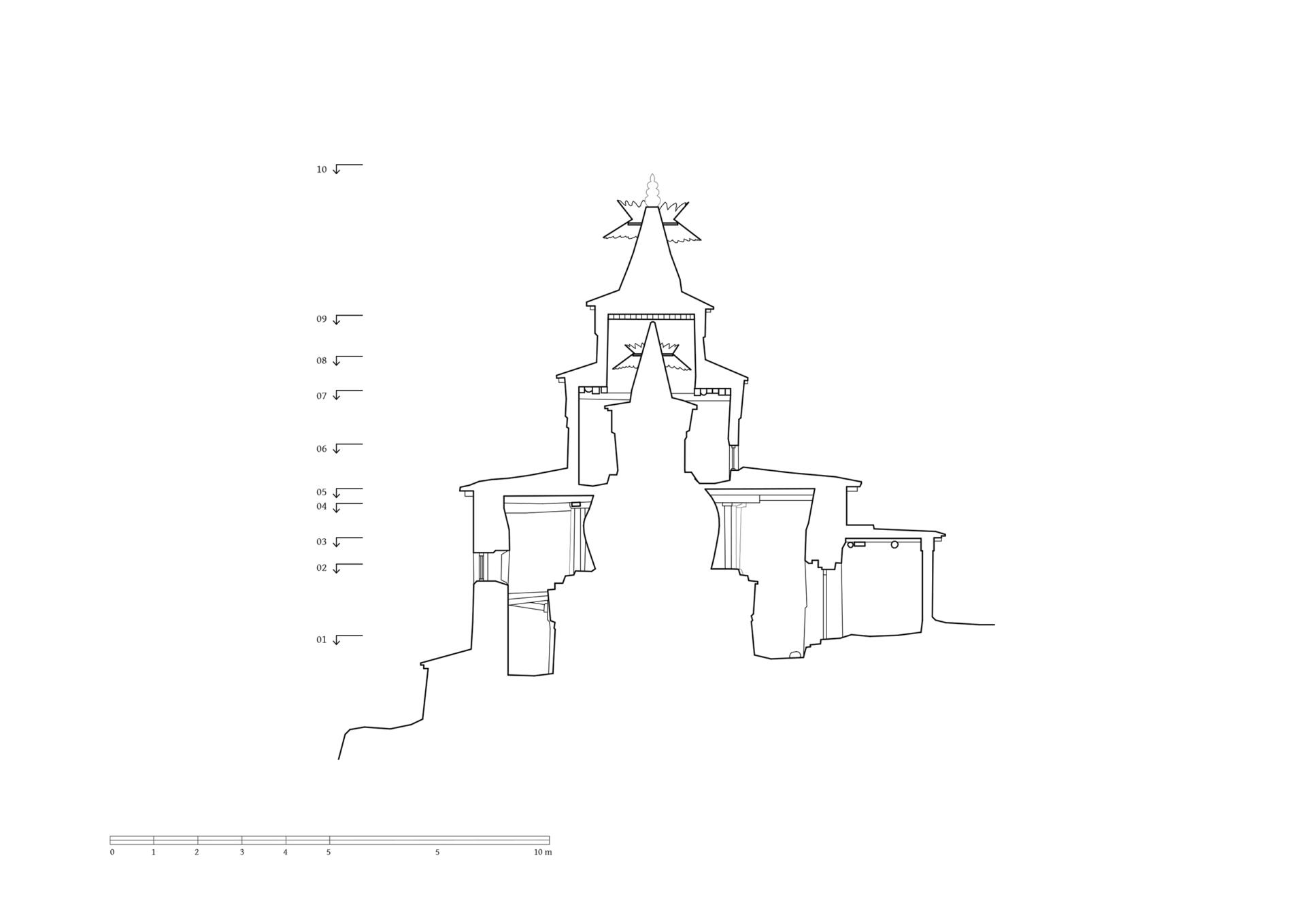
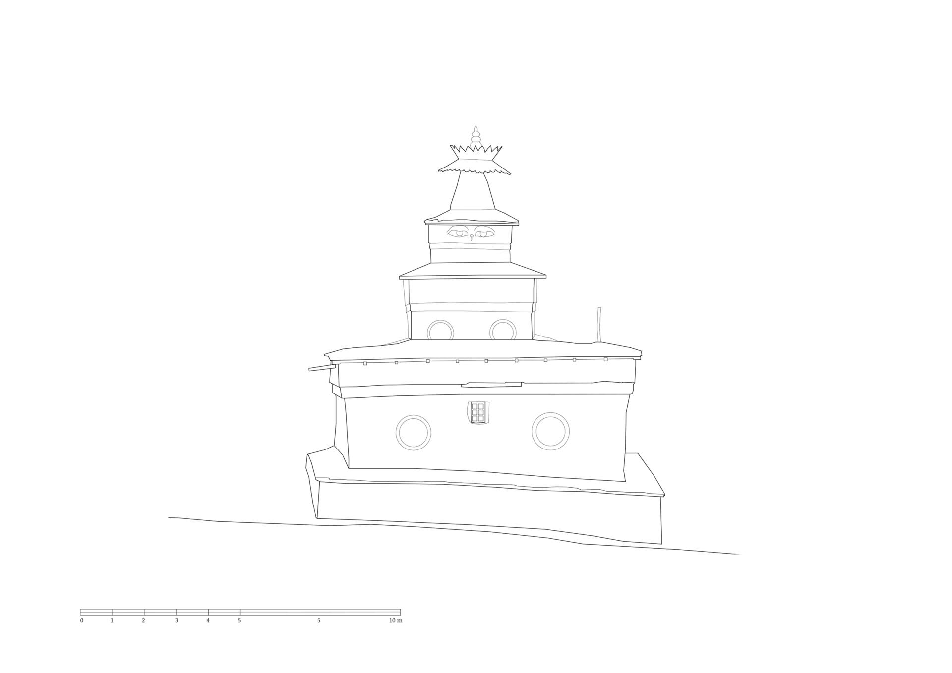
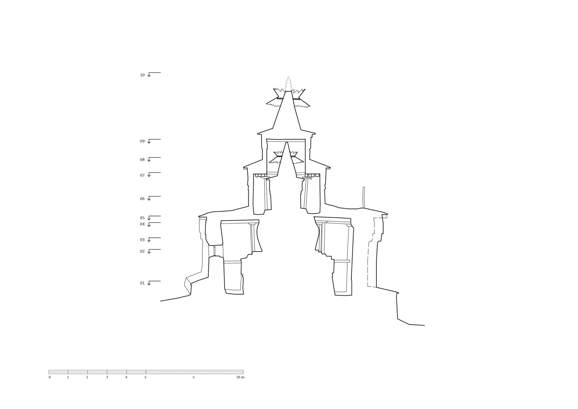
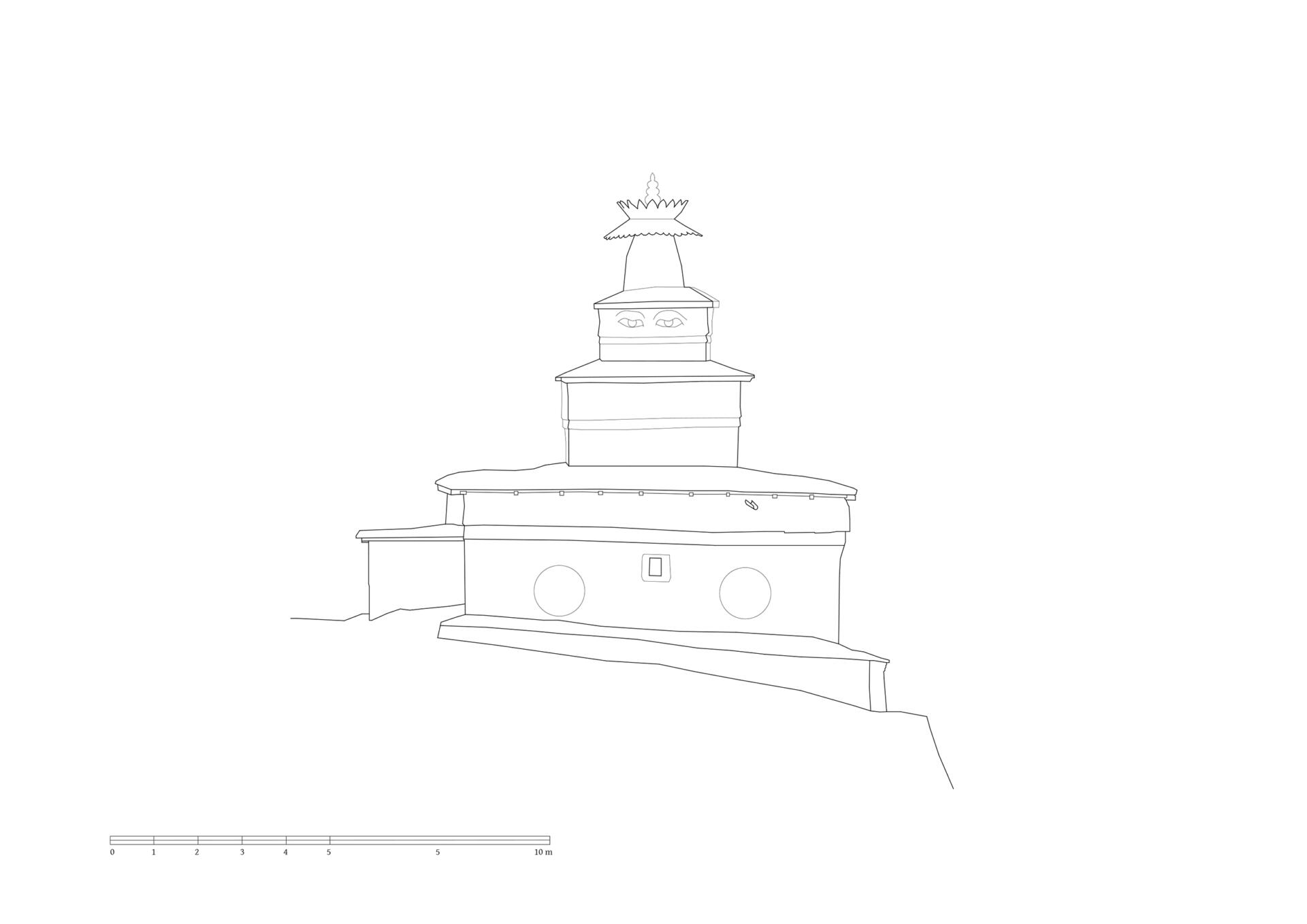
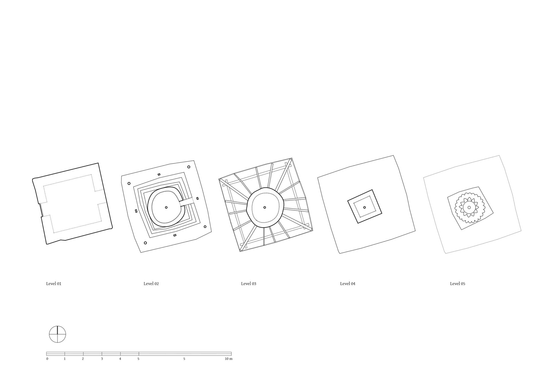
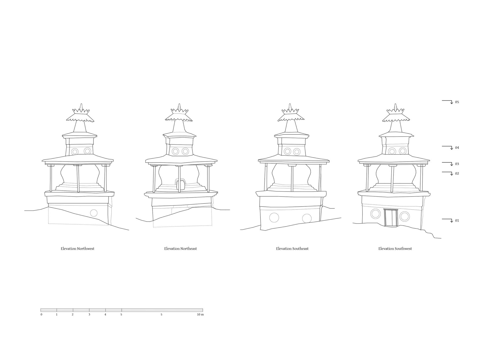
On the southern side of the gompa stands a extraordinary chörten chapel, whose external dimensions are 8.50 x 8.60 meters. The chörten consists of three stepped cubes crowned with an umbrella element above the top. A massive plinth zone compensates the slope of the terrain. The total height from the pathway on the valley side to the top is 13 meters. The entrance lies on the opposite north-east side, combined with a forecourt for gatherings. Right to the south of the chörten chapel is another smaller chörten. The main cube covers an area of 3.60 x 3.60 and is about 2.50 meters high on the west side where there is also an entrance door. The total height on this side is 7.80 meters. The residential house of the Lama, where two further chapel rooms are located on the upper floor, completes the ensemble with a walled courtyard and an open porch on the southeast side. Towards the valley to the southwest and along the mountain side in the northeast, natural stone walls fortify the graded terrain and allow a circumambulation of the area. On the north side of the gompa there are two single-storey outbuildings, above it a mani wall and another chörten. Betweeen 2019 and 2022 the roof of the structures was re-covered with corrugated sheet metal. The increasing rainfall in the region is causing problems with the mud flat roofs, both on temples and residential buildings.
TU Graz – IGMS, Woschitz, H. & Bauer, P. (2024): 3D Model of the survey in 2023.
References: Kind, Marietta. The Bon Landscape of Dolpo: Pilgrimages, Monasteries, Biographies and the Emergence of Bon. Berlin, Peter Lang 2012: 140-141, 150-151, 308, 379. Snellgrove, David. Himalayan Pilgrimage. A study of Tibetan religion by a traveller through Western Nepal. Oxford 1961: 154-157. Snellgrove, David. Four Lamas of Dolpo: Autobiographies of Four Tibetan Lamas (15th–18th Centuries). Volume I, Oxford 1967: 2, 3, 4, 6, 15. Jest, Corneille. Communautés de langue tibetaine du Népal. Paris 1975: 298.
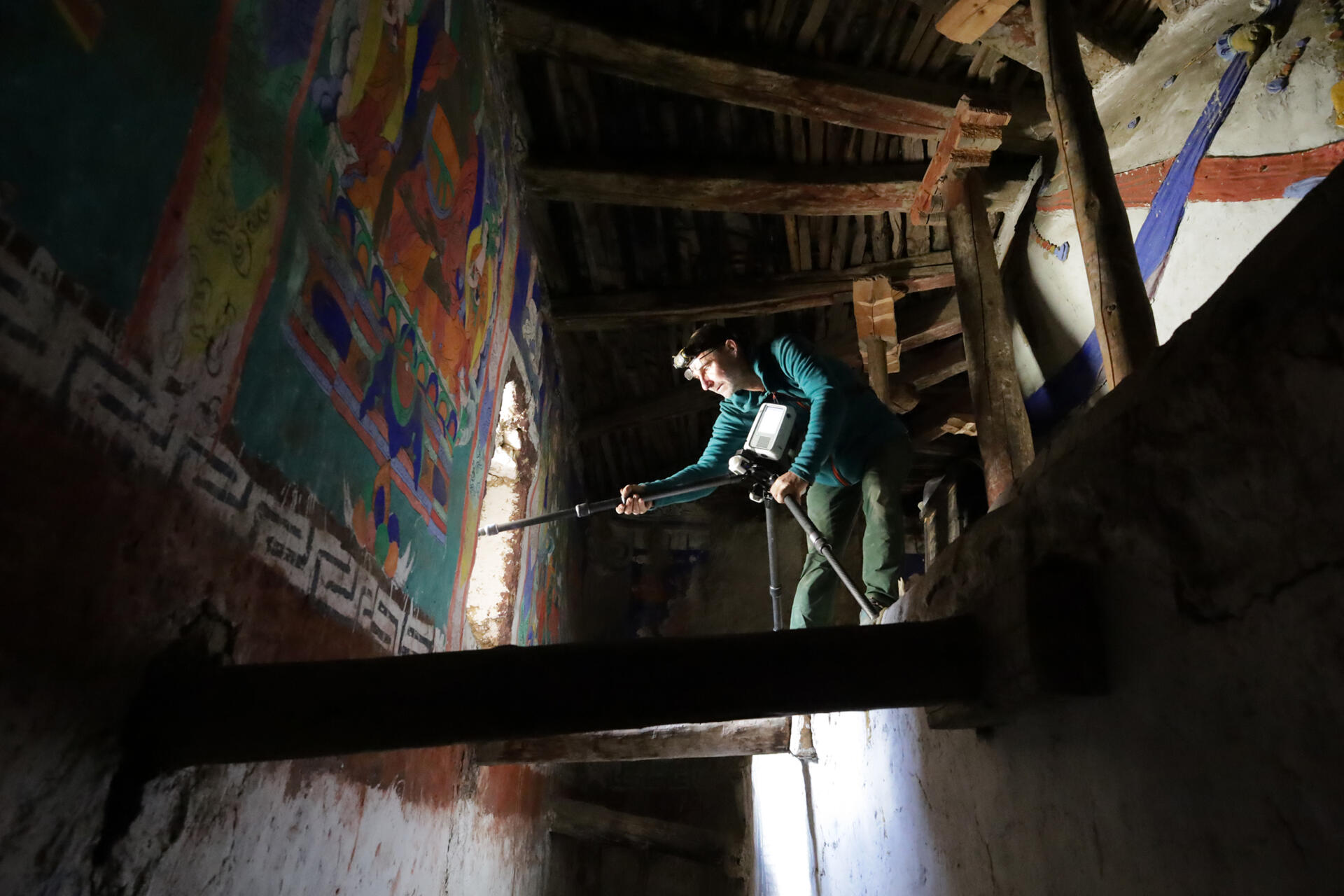
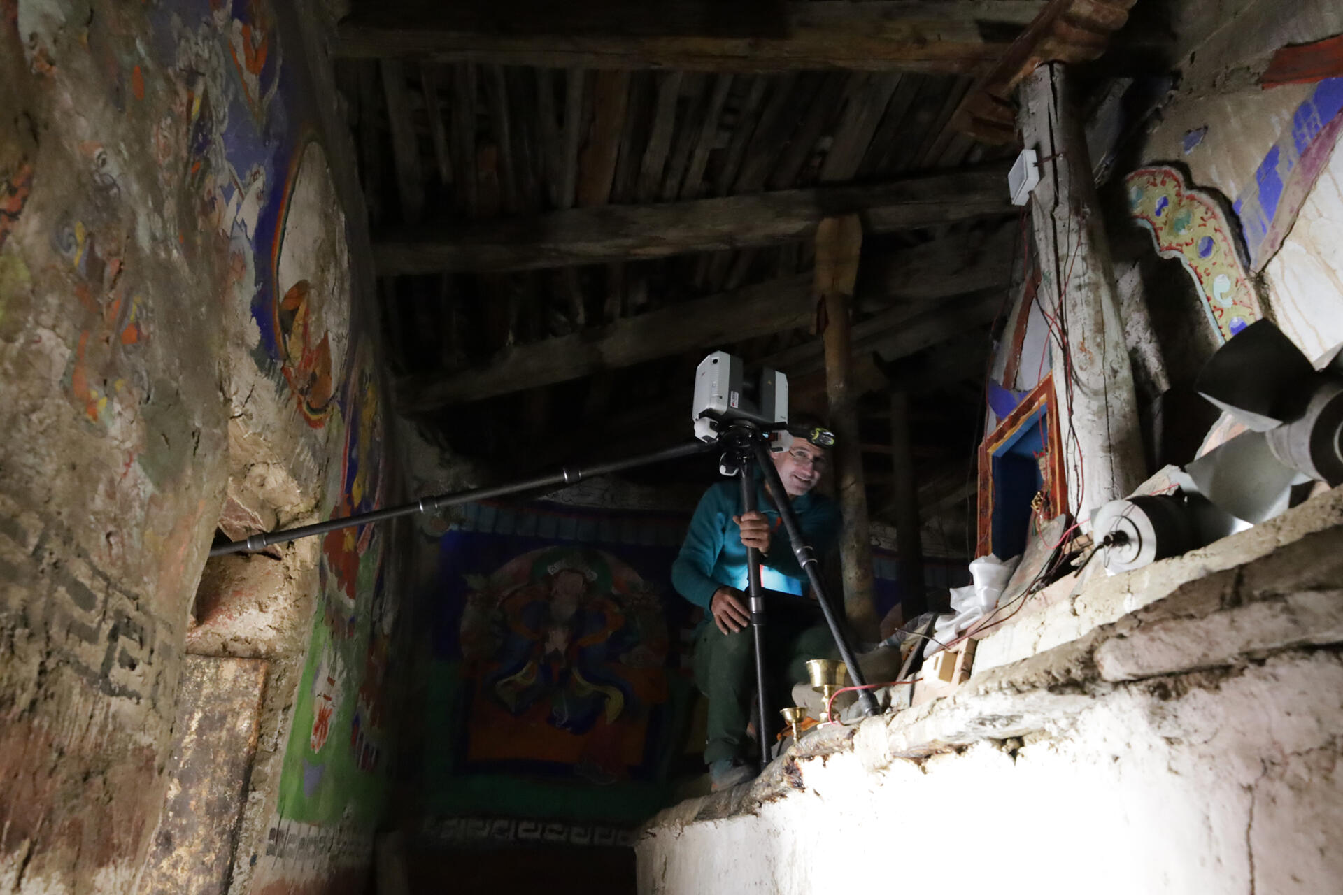
Photo documentation
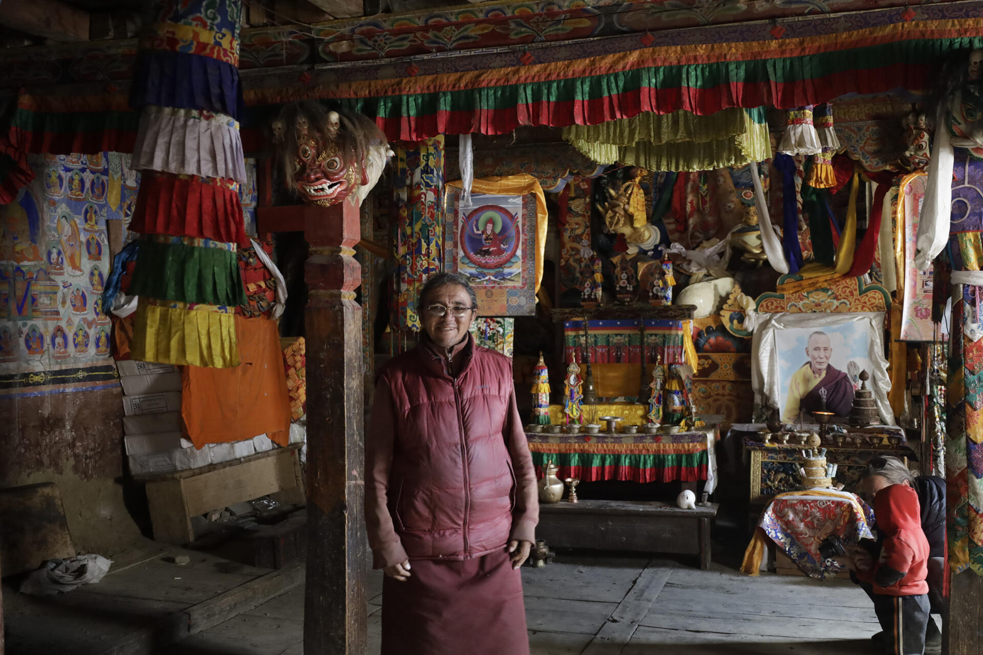
Interior of the gompa
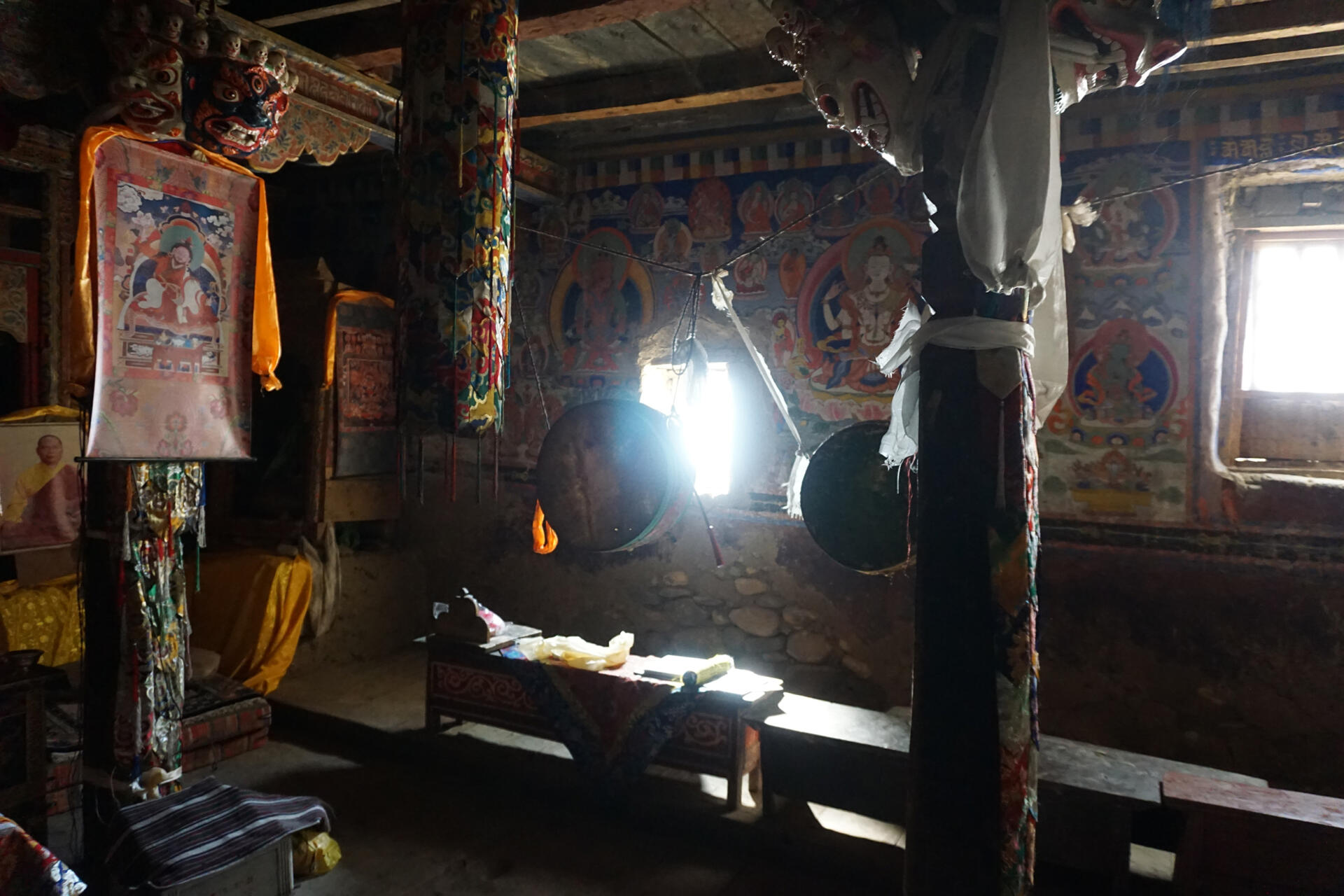
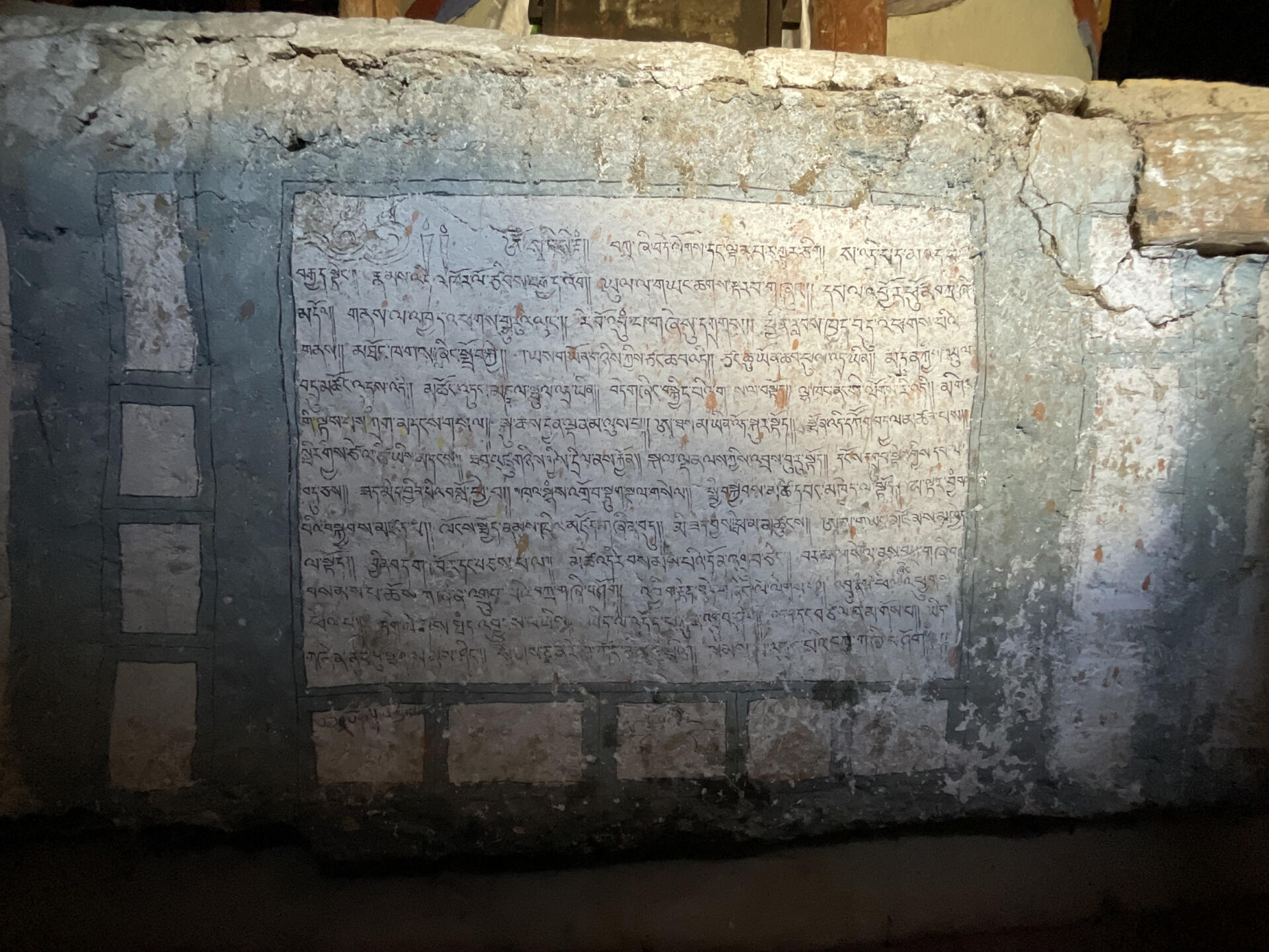
Intrior of the chörten-chapel
Historic material
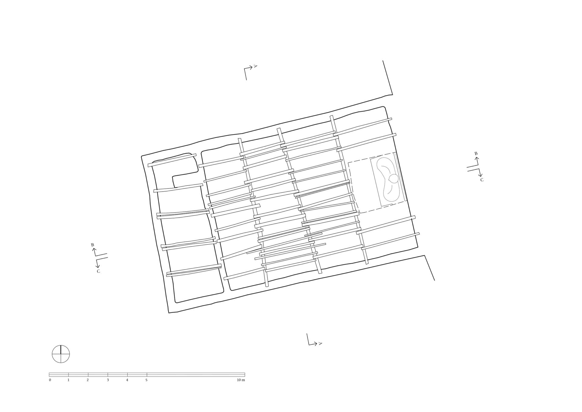
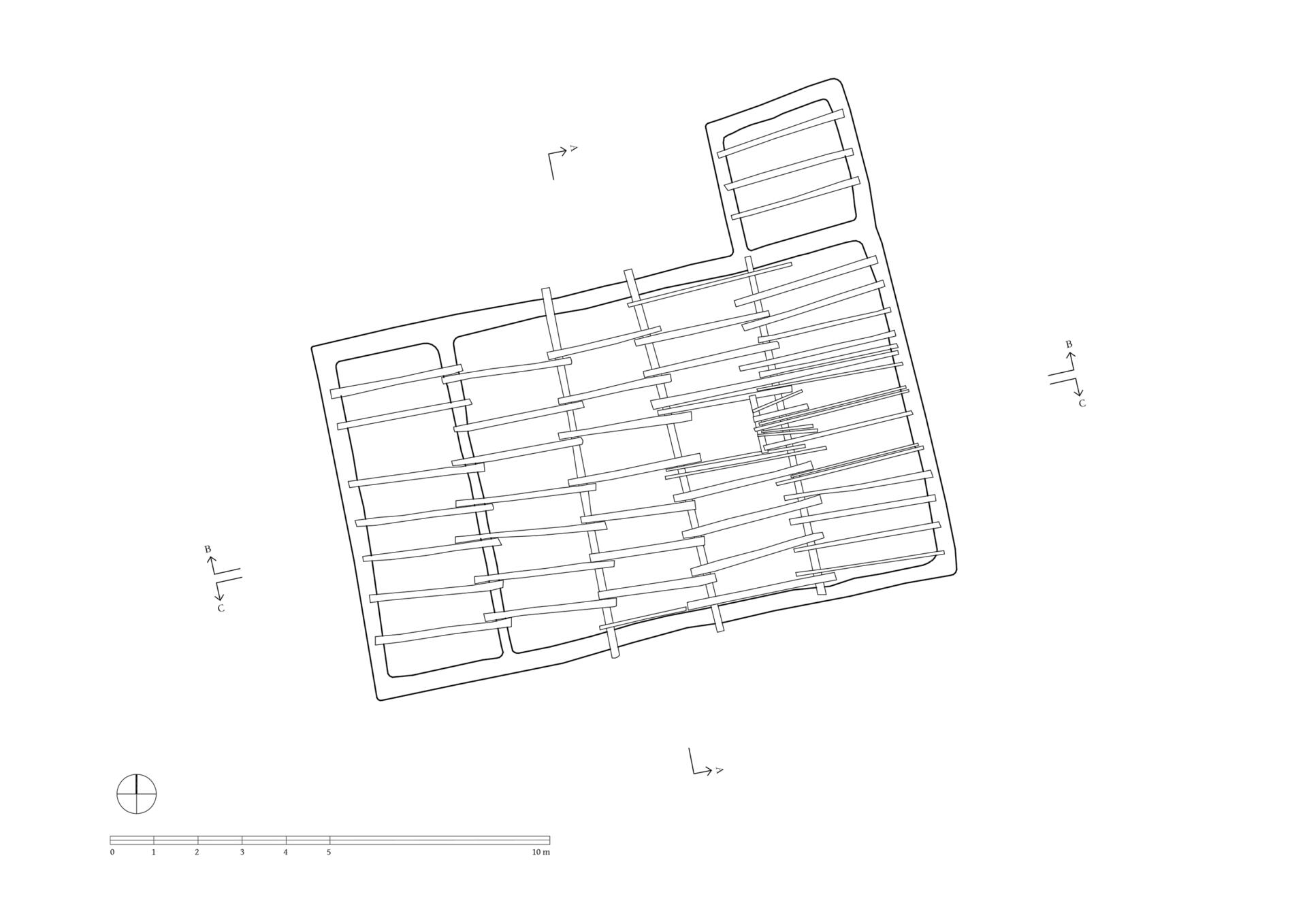
3D Views
2D Plans


More from


