Nepal
Tsa_Hrab
Hrab Monastery
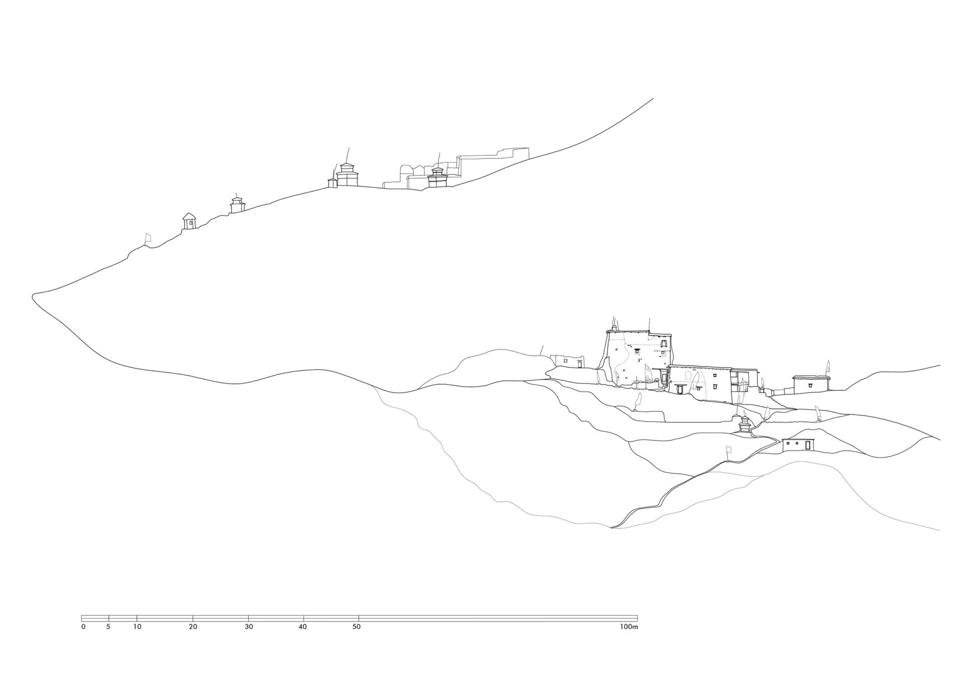
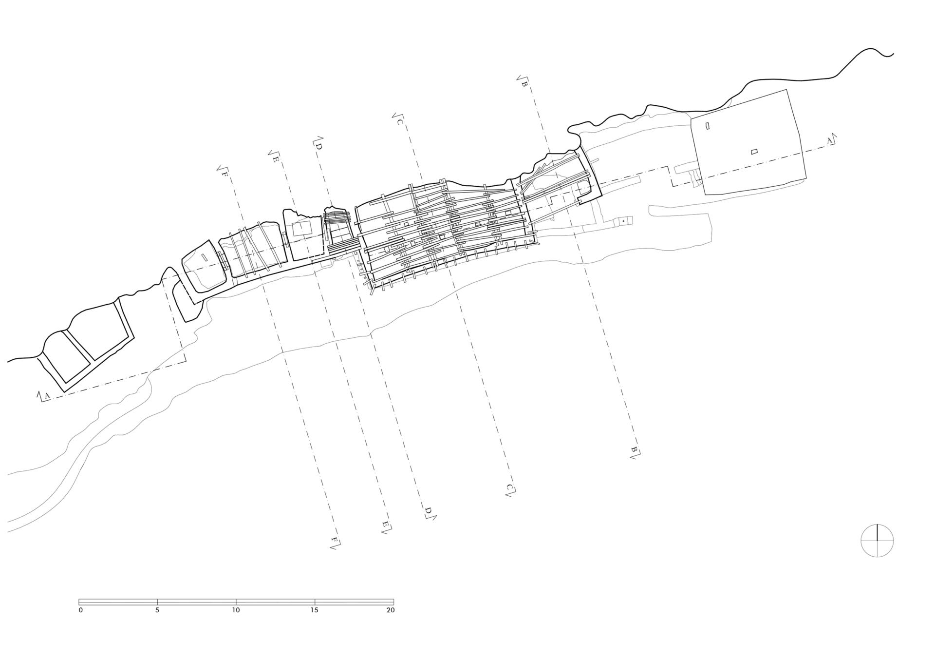
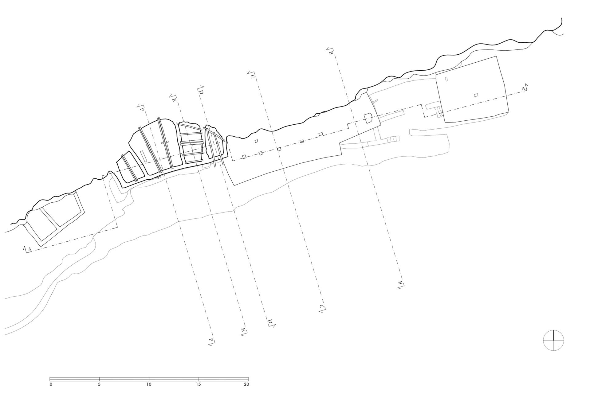
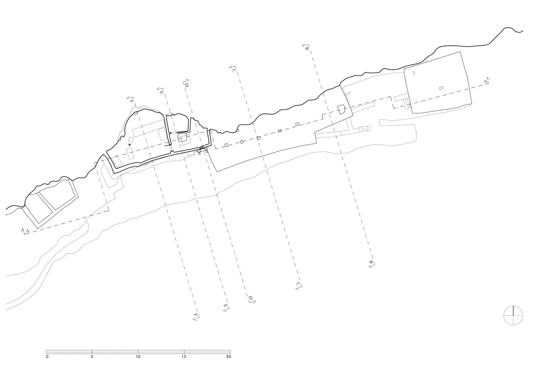
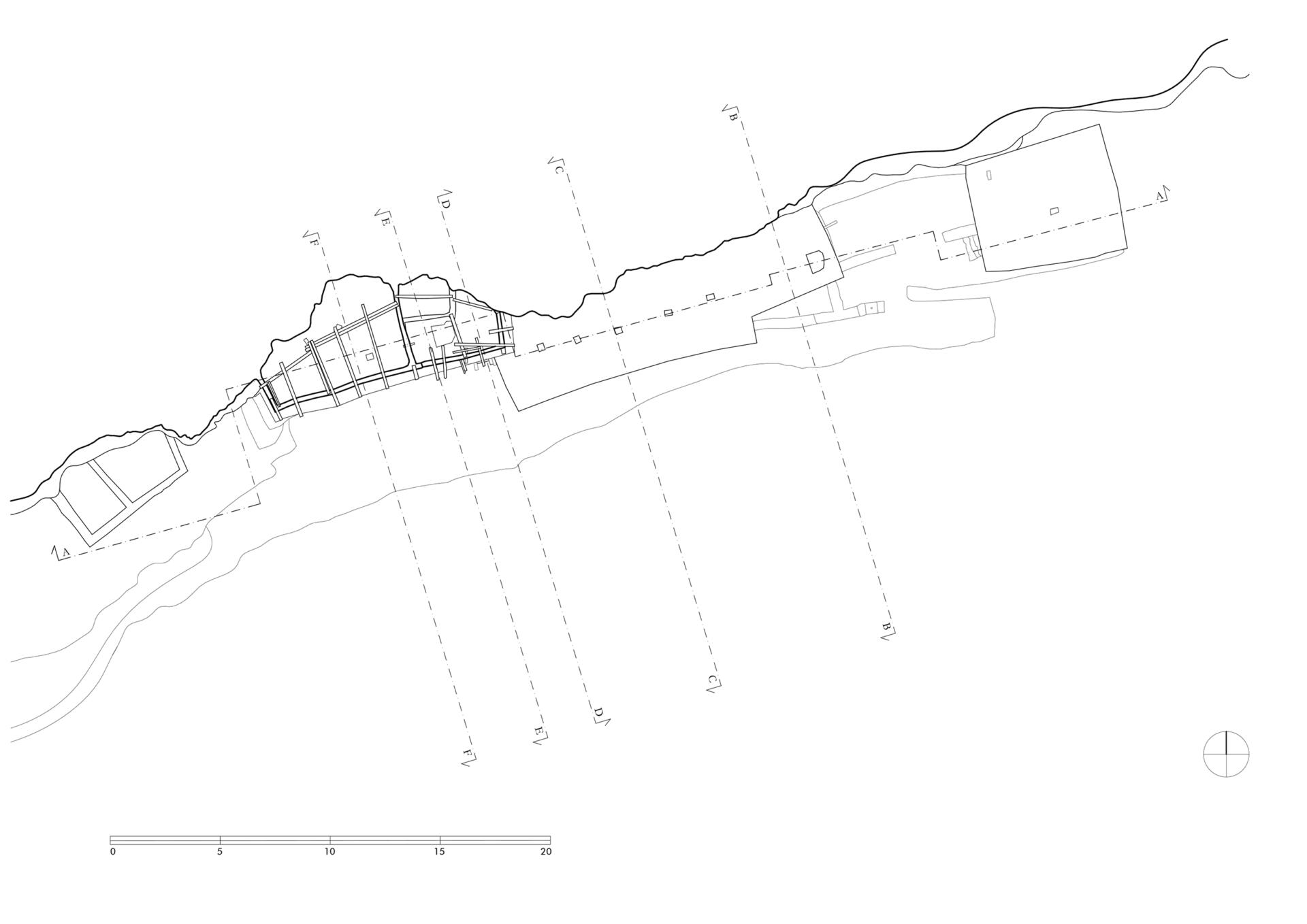
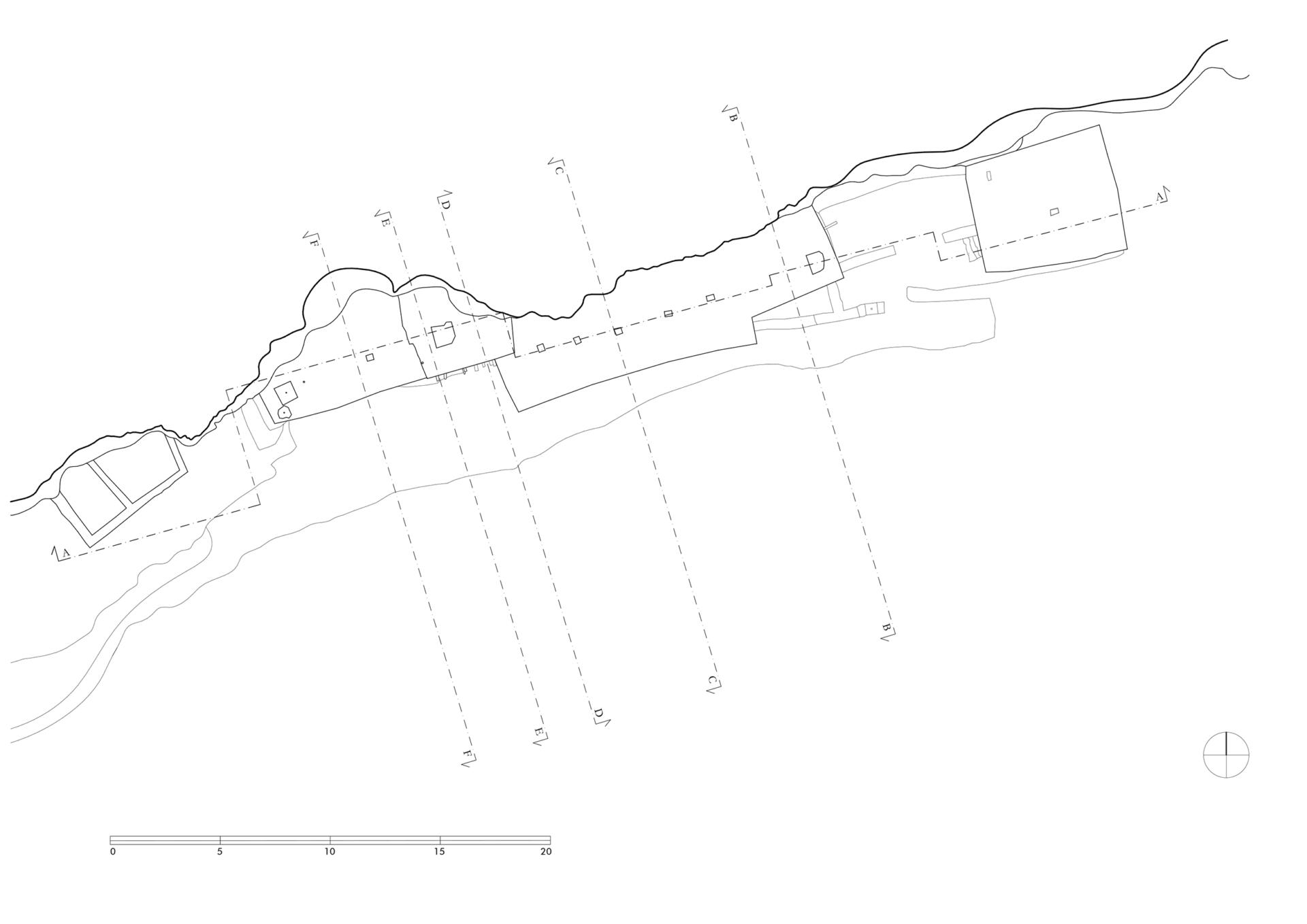
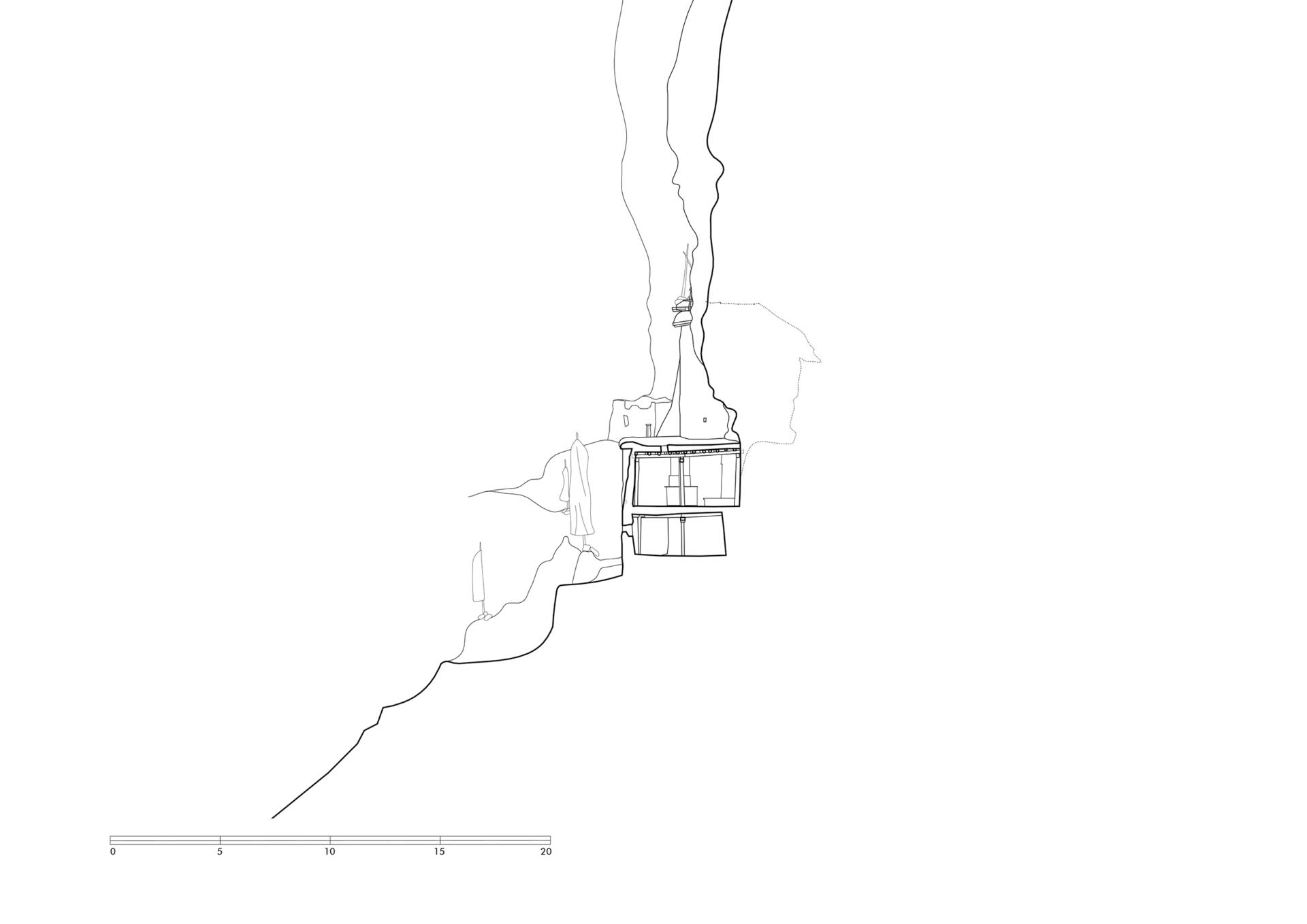
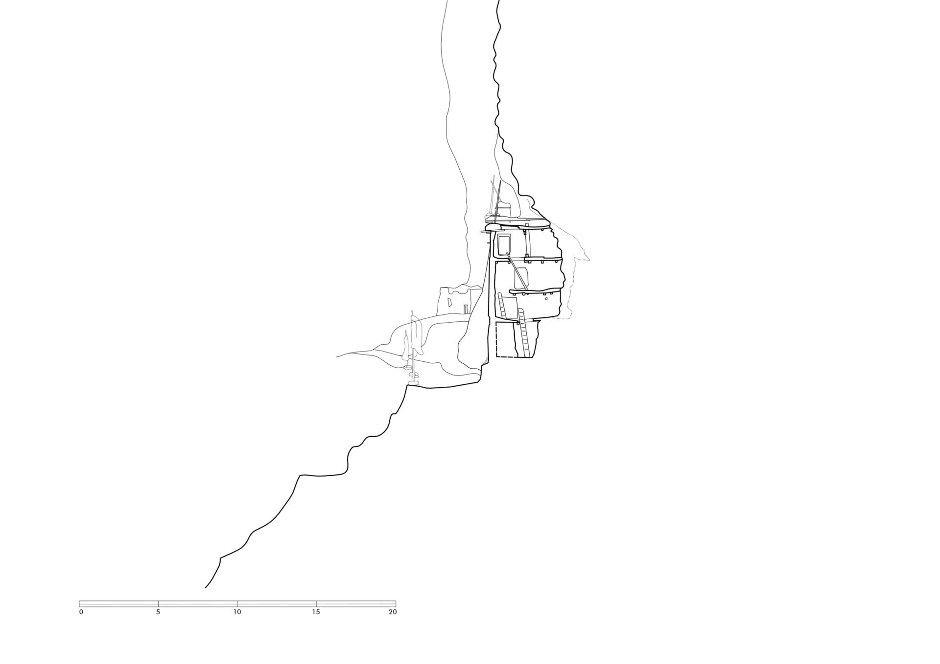
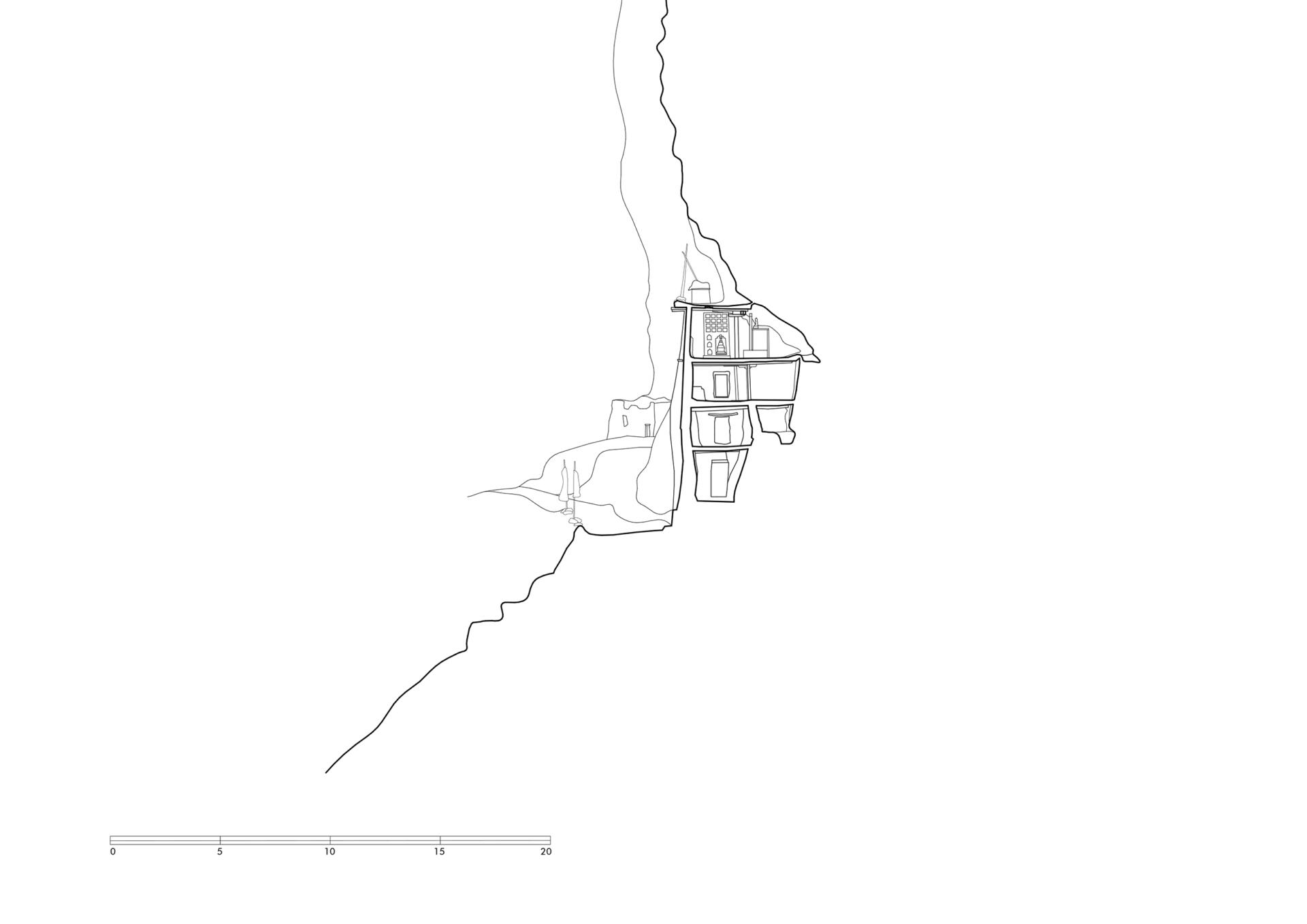
Coordinates of the site: 29°22’30.61” N, 83° 7’8.28” E, elevation 4283 meters.
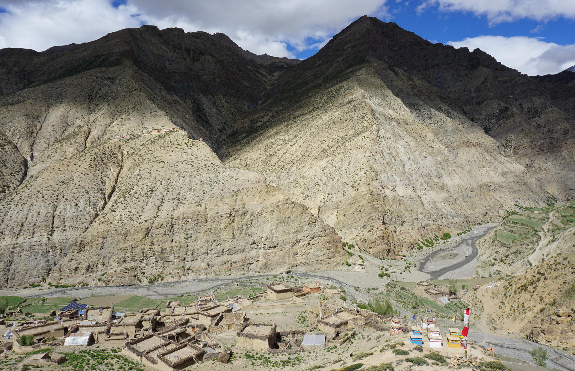
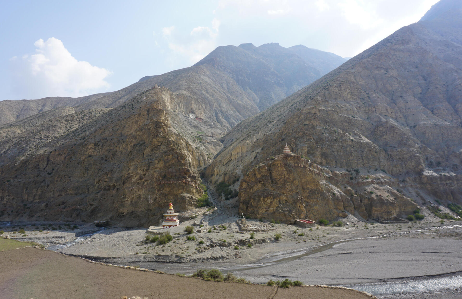
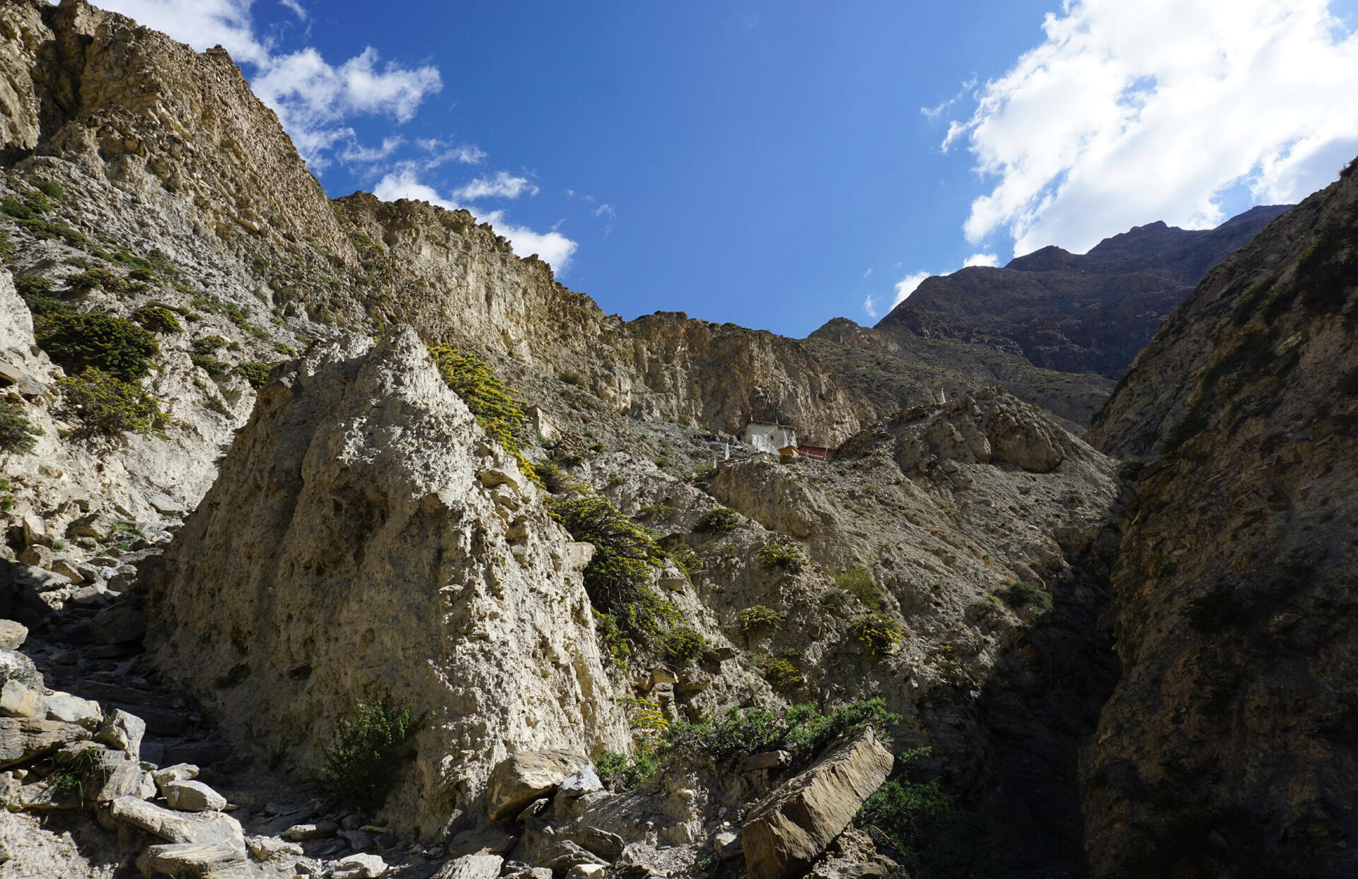
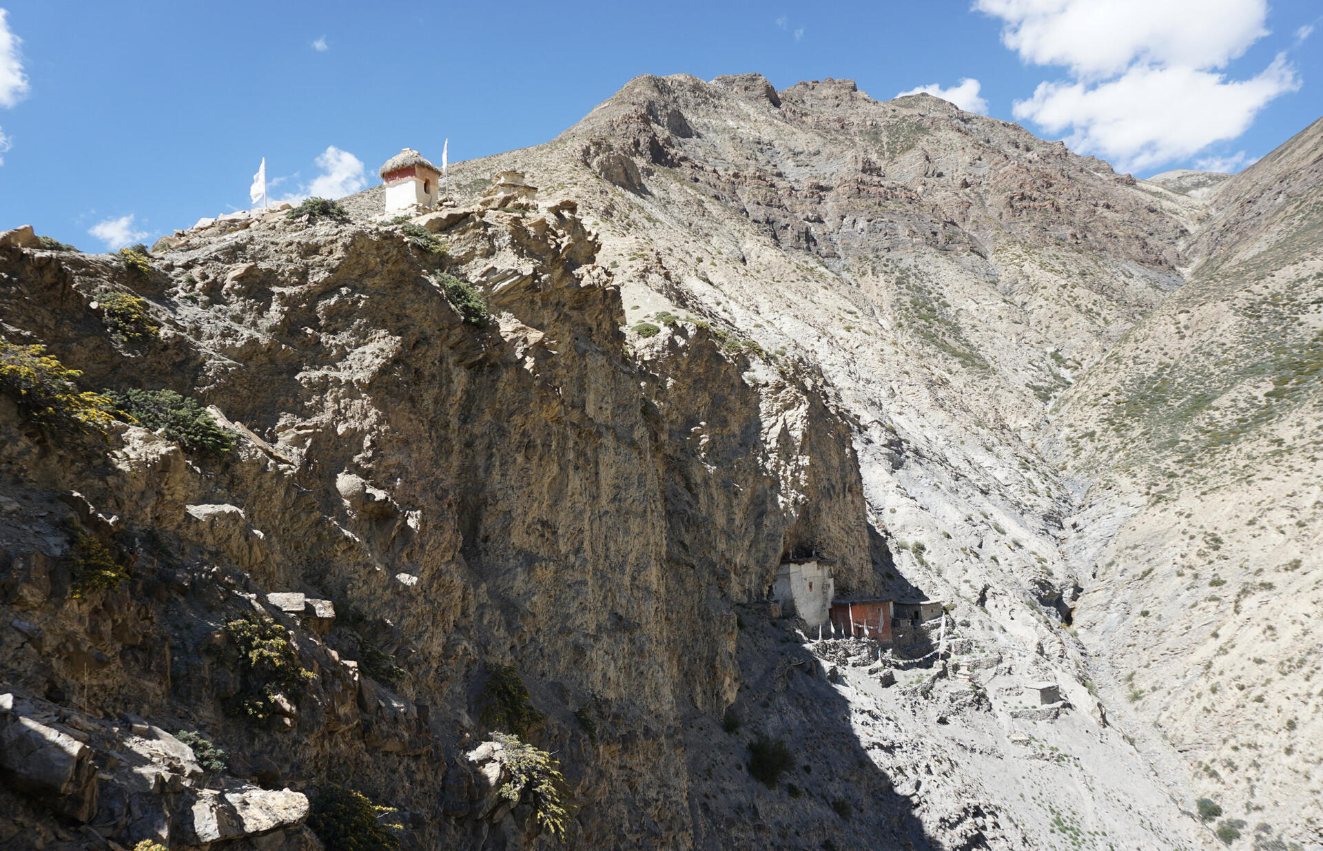
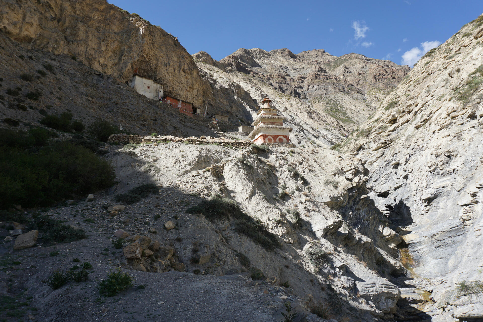
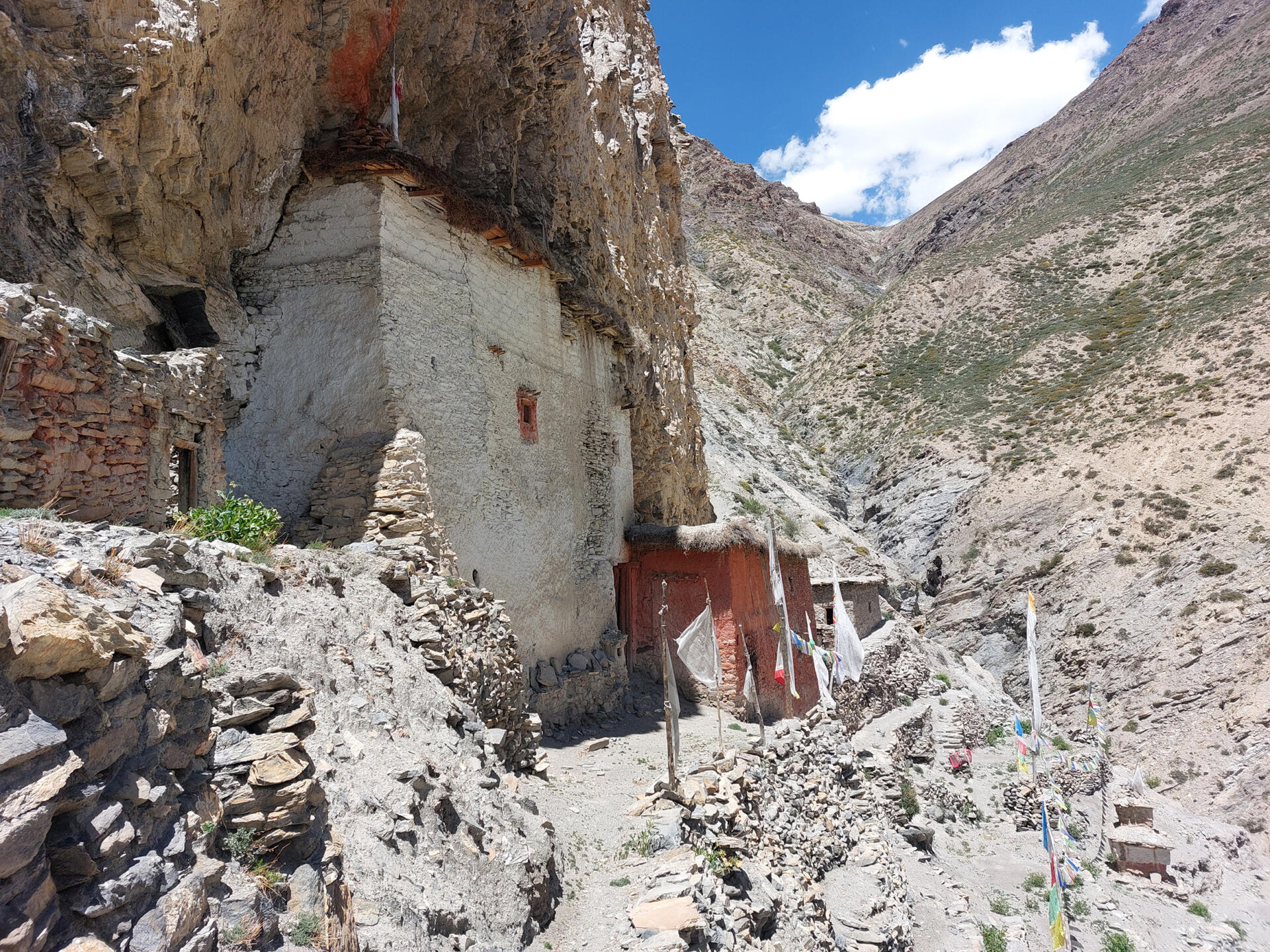
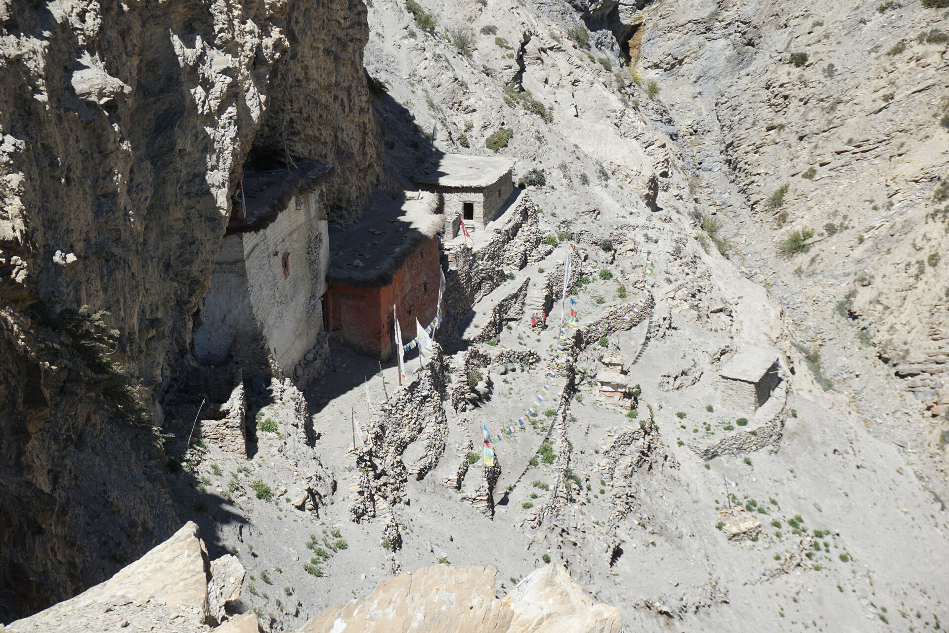
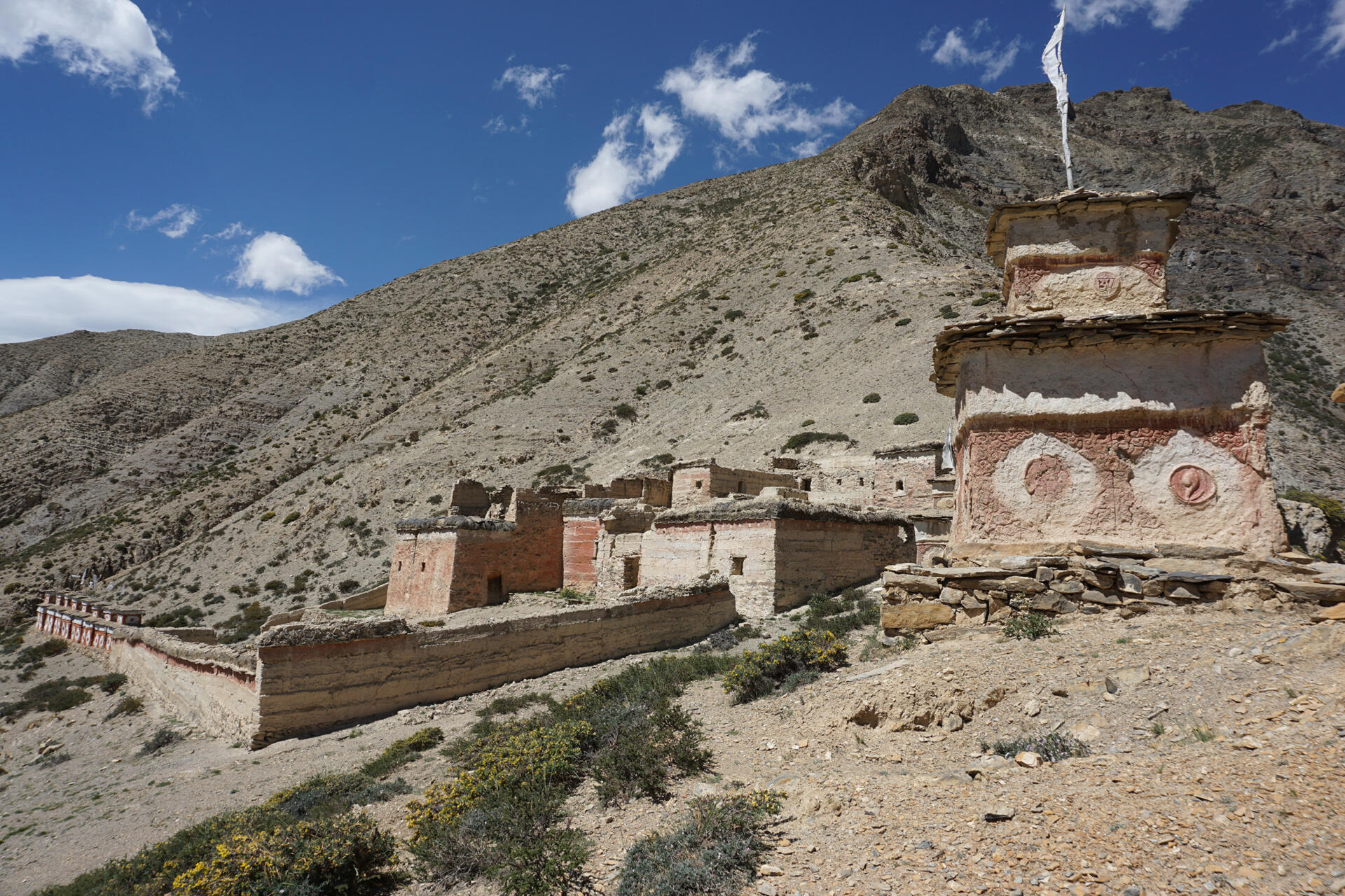
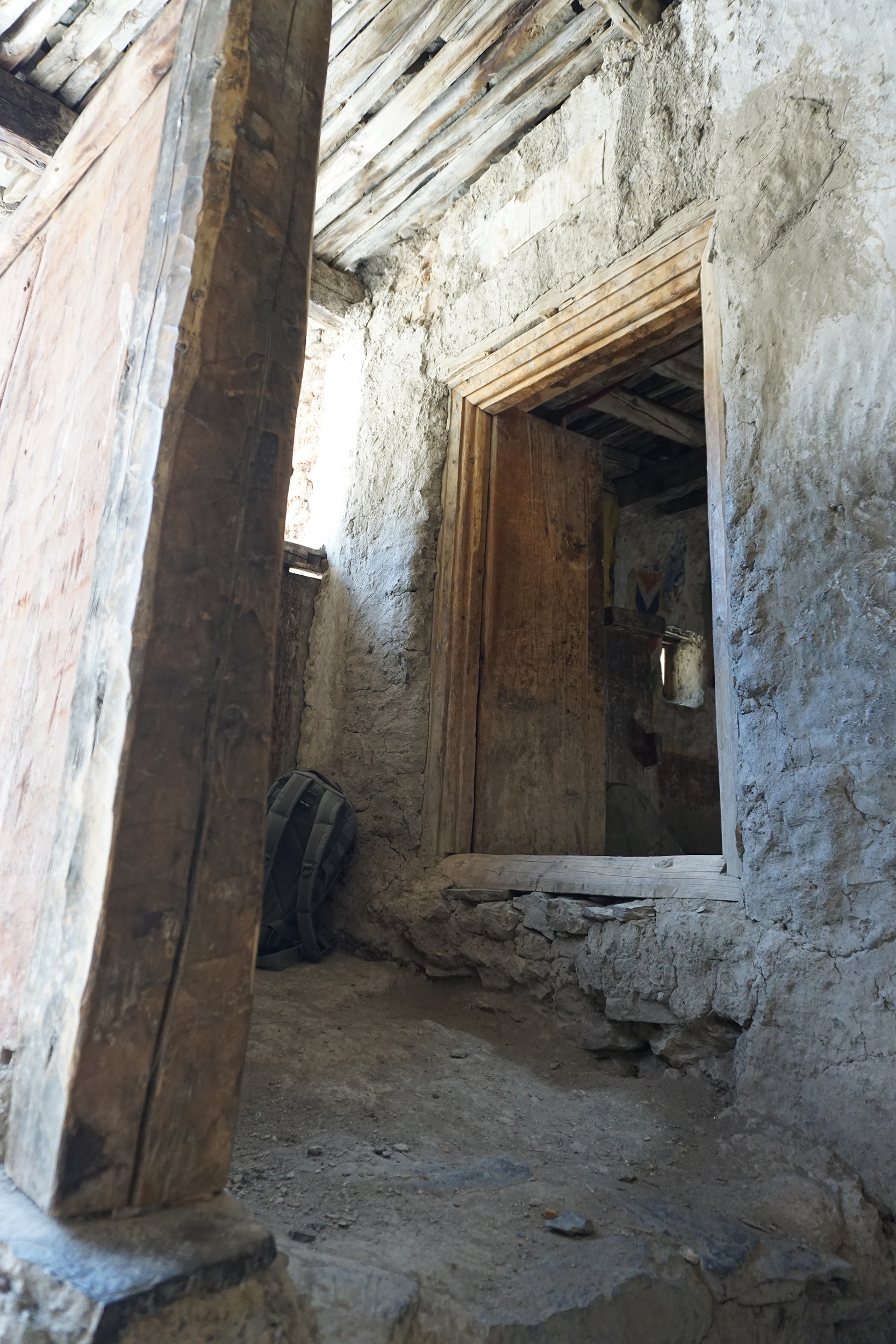
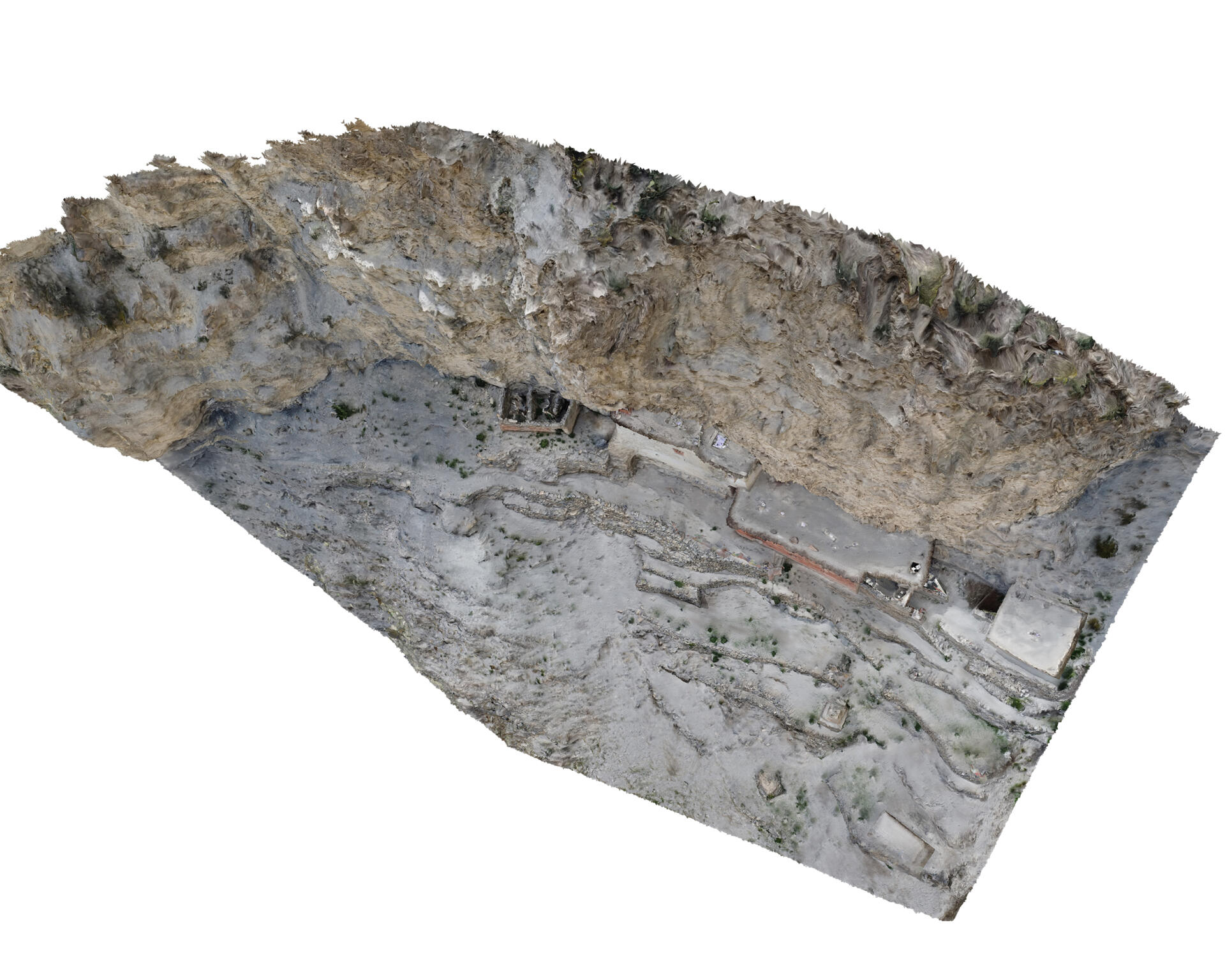
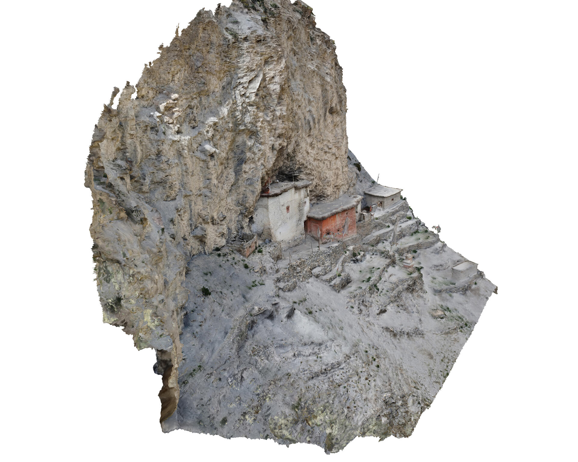
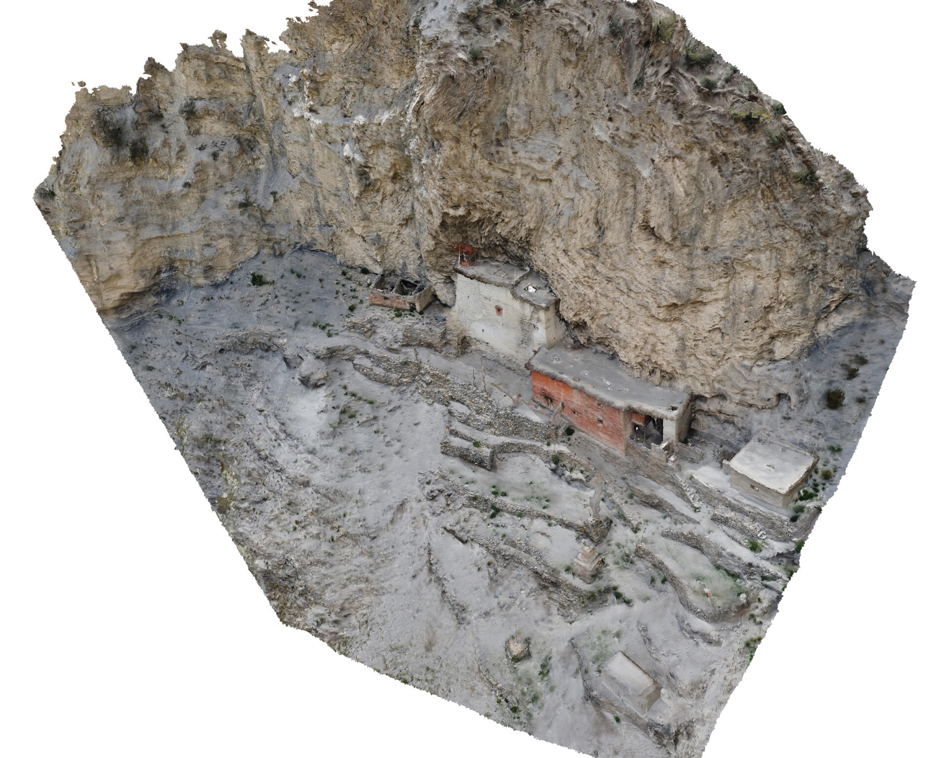
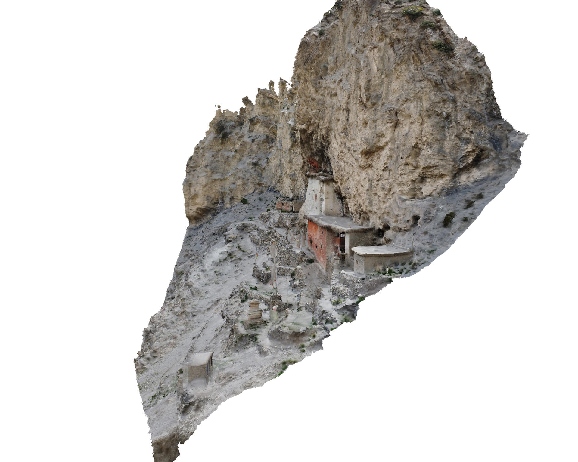
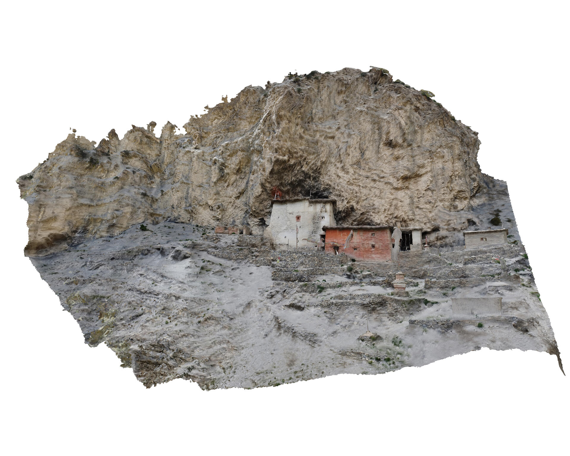
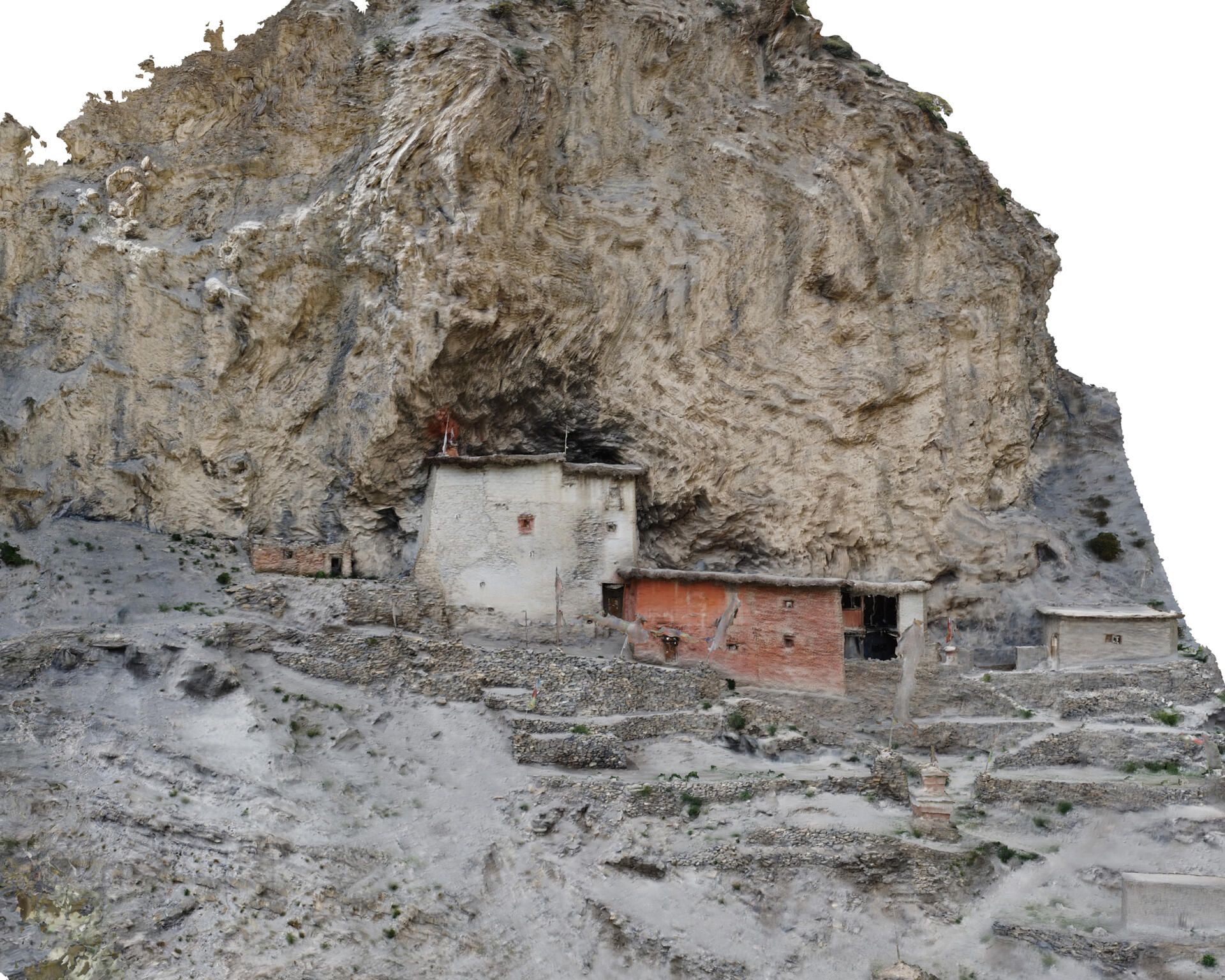
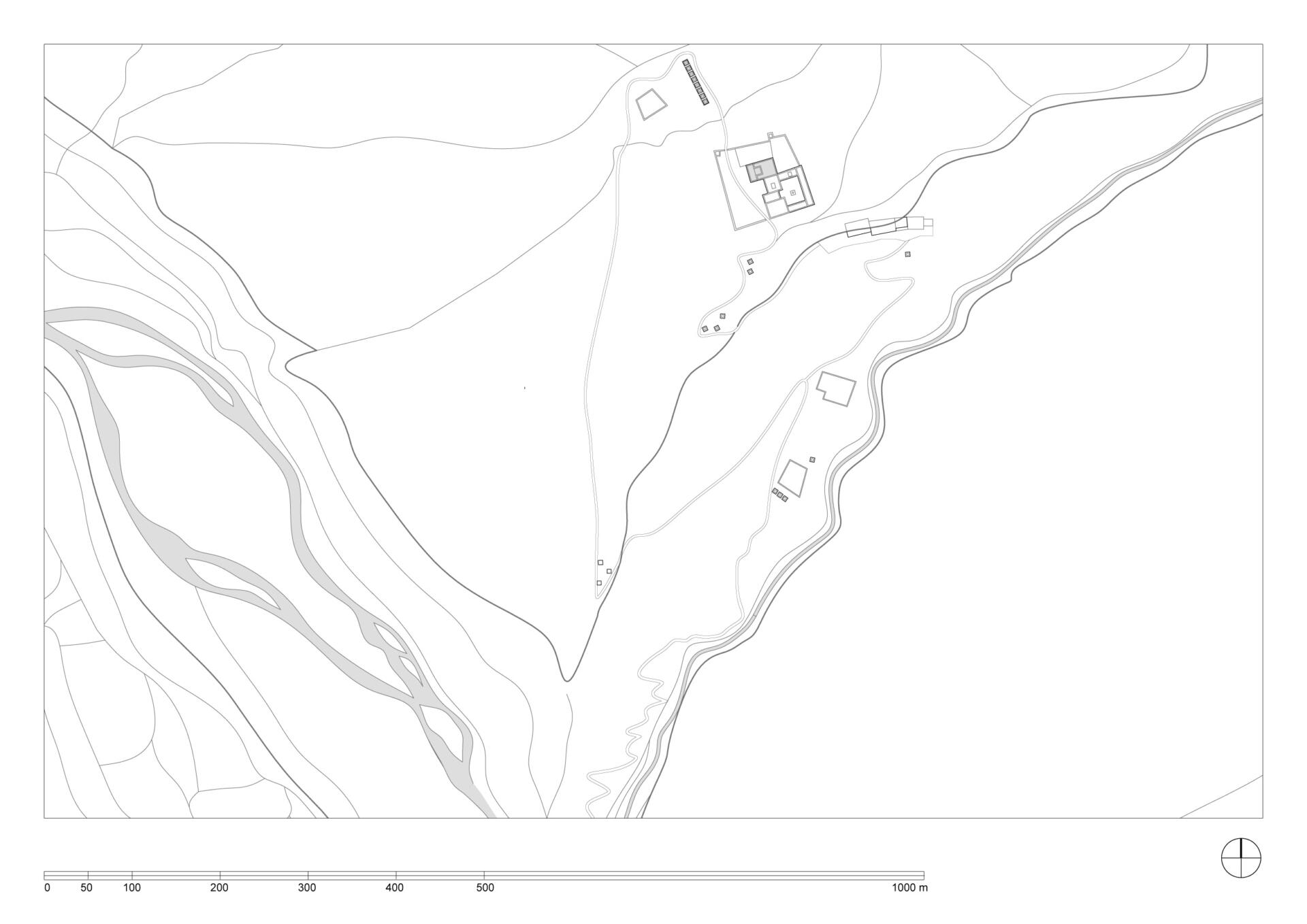
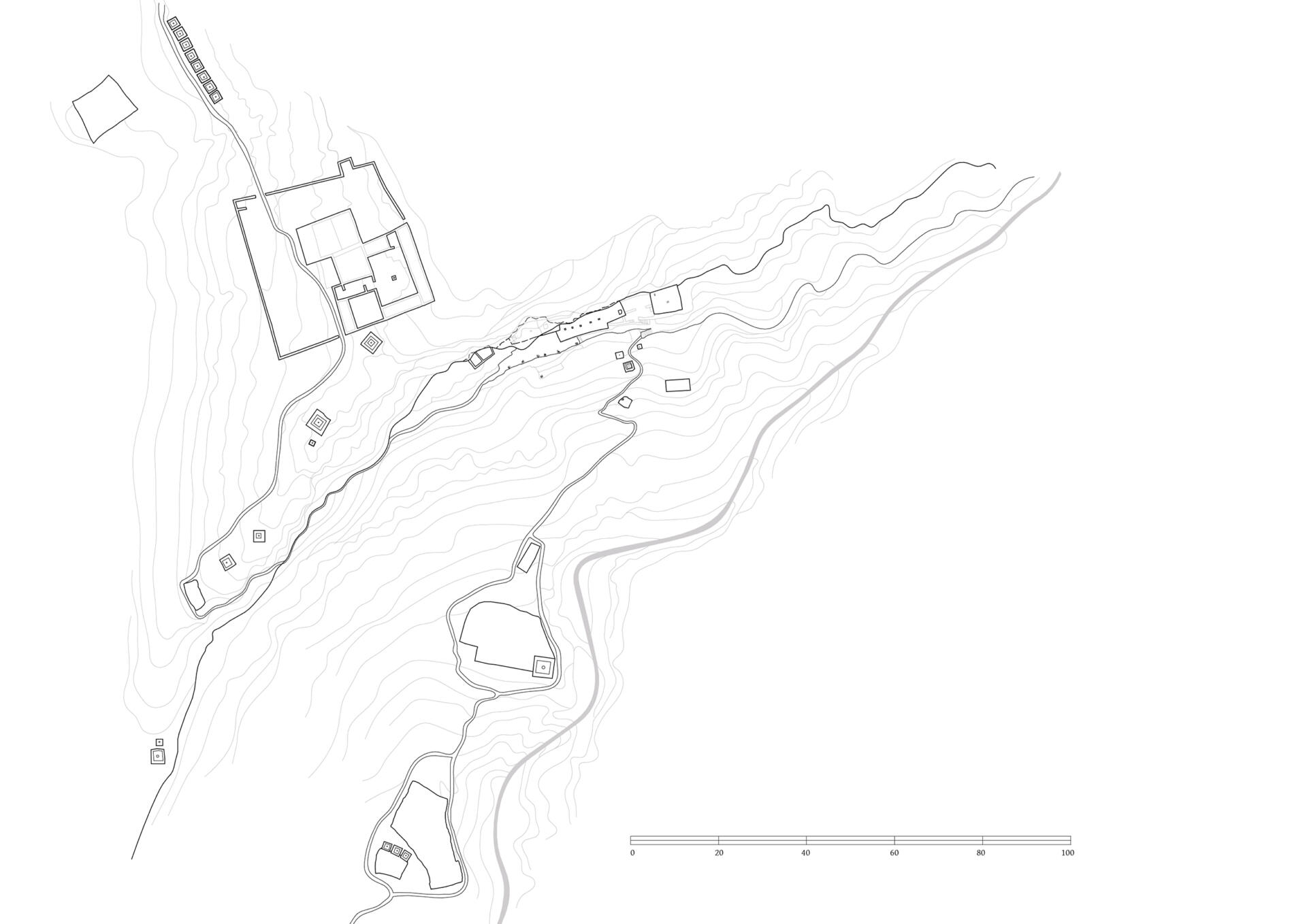
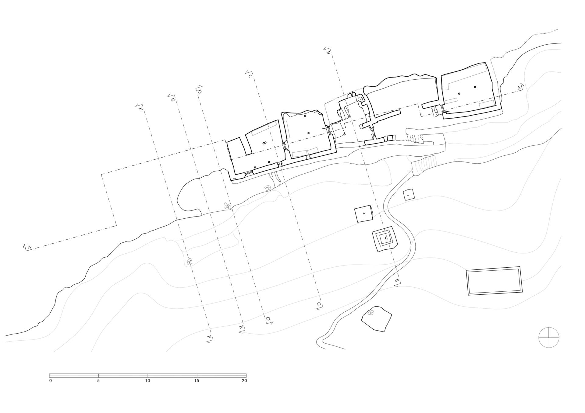
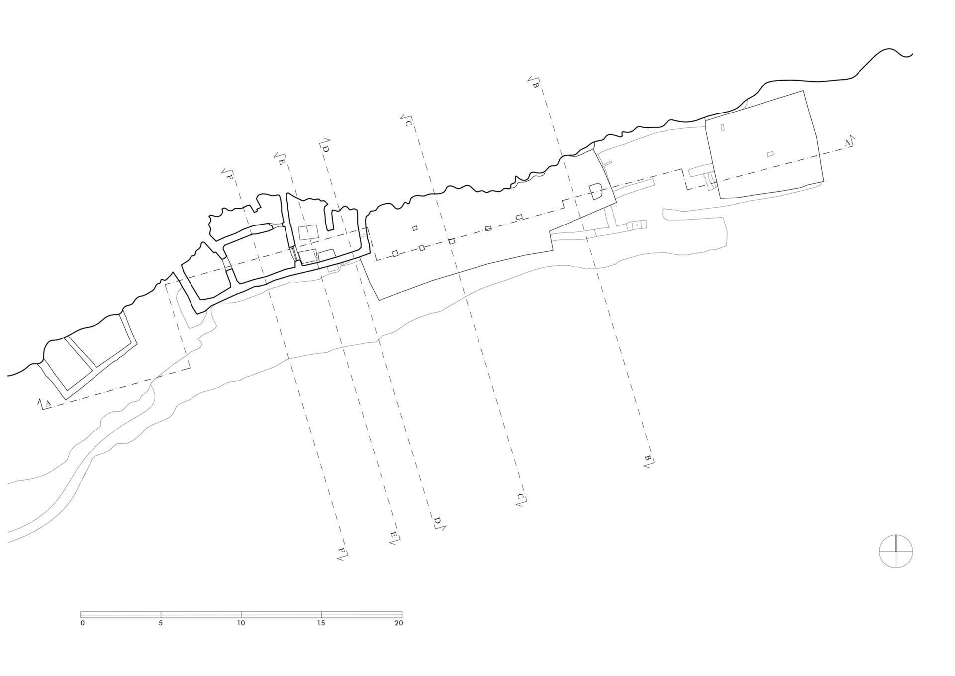
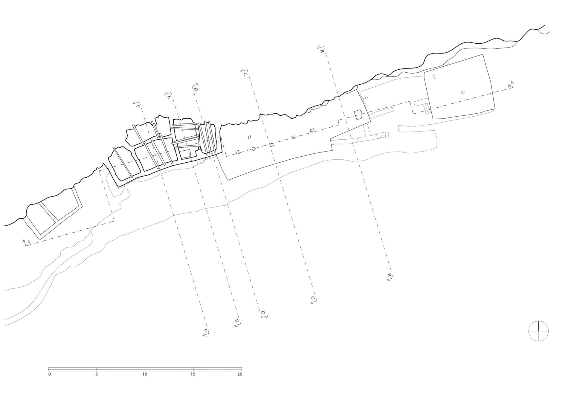
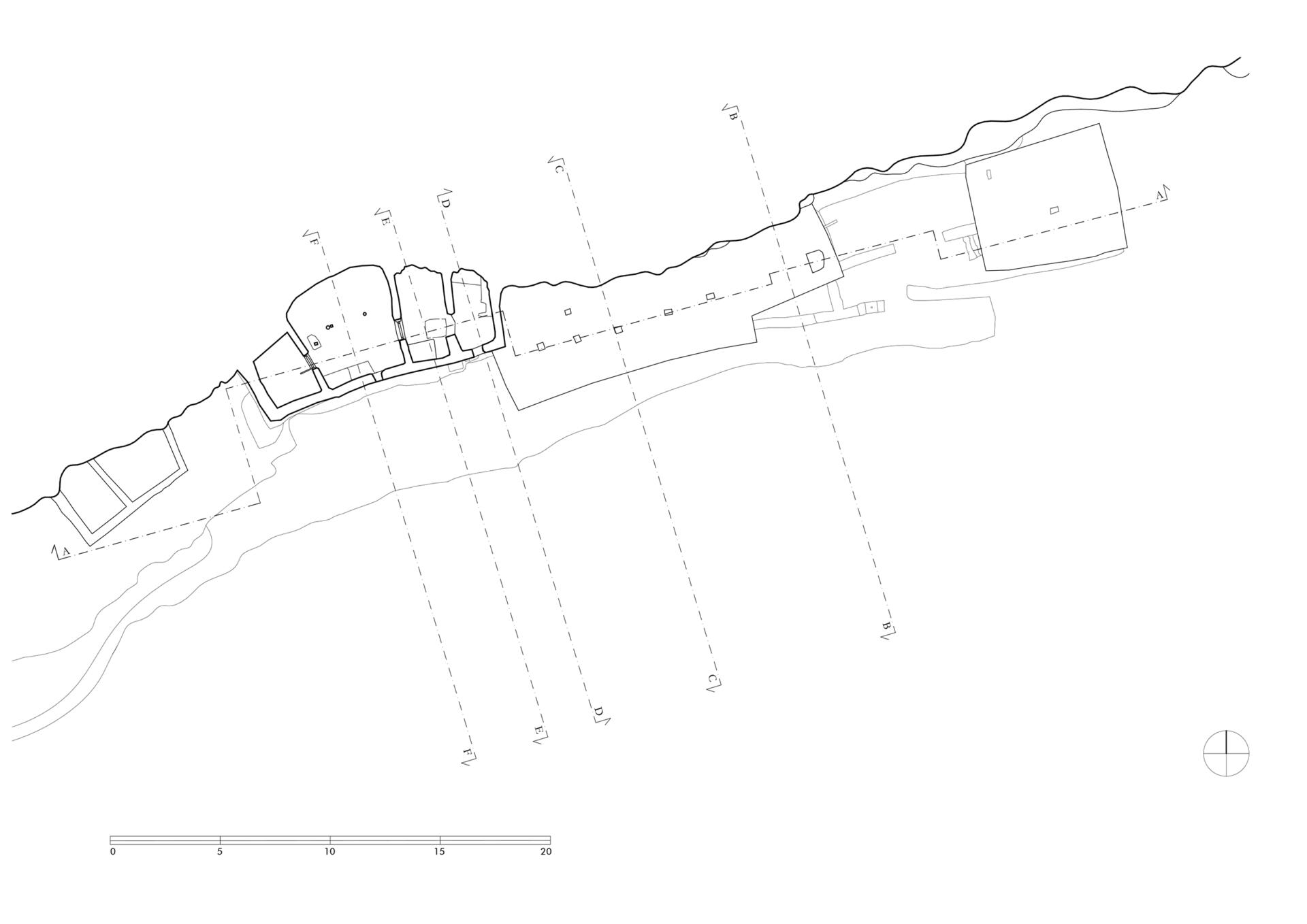
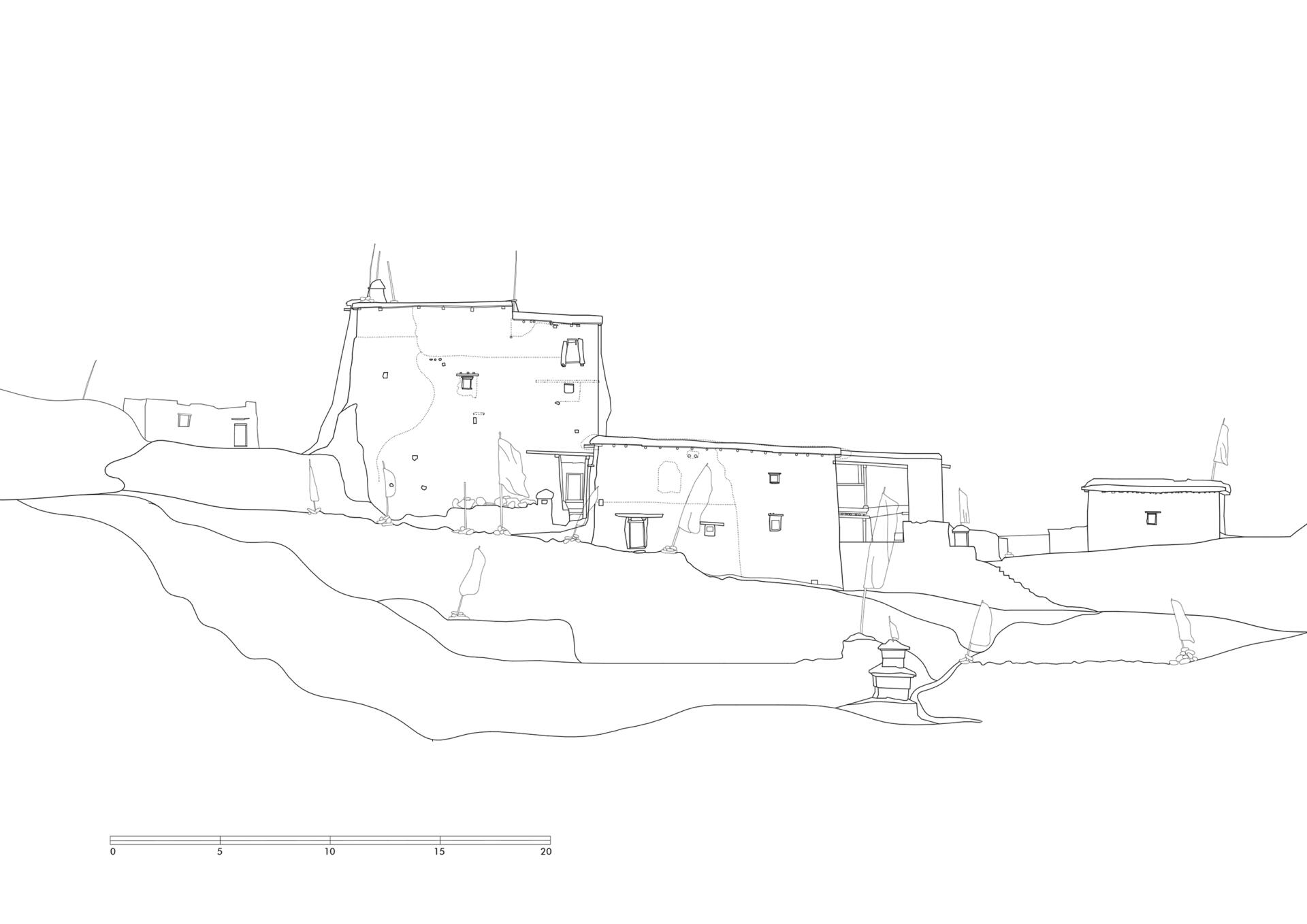
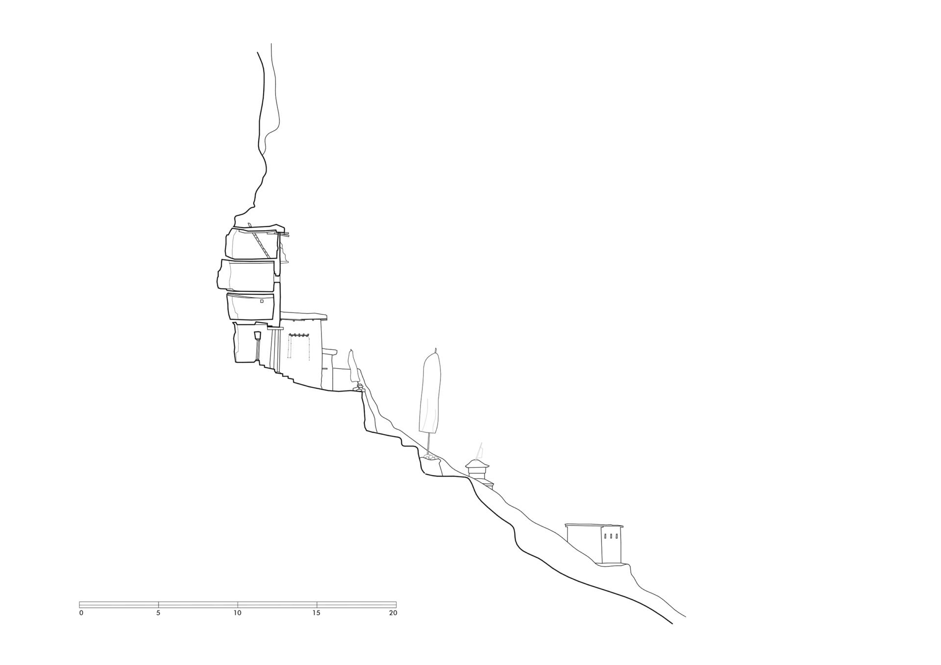
The monastery of Hrab is located on the northern hill range in the Nang-khong valley, opposite the village of Tsa. The access path starts at the bank of the river – next to a chörten and a mani-wall – and leads along a narrow gorge up to the monastery. Passing two large mani-fields and groups of chörten, the visitor reaches the monastery, that was built directly in front of the cliff.
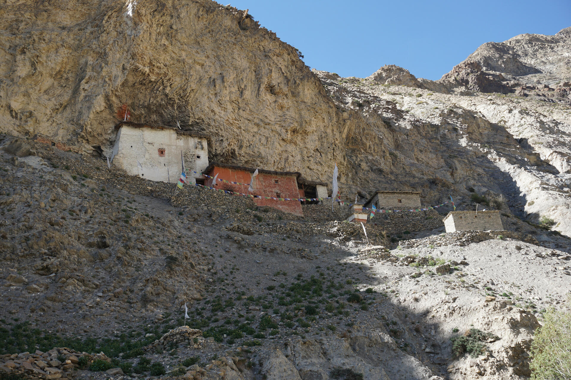
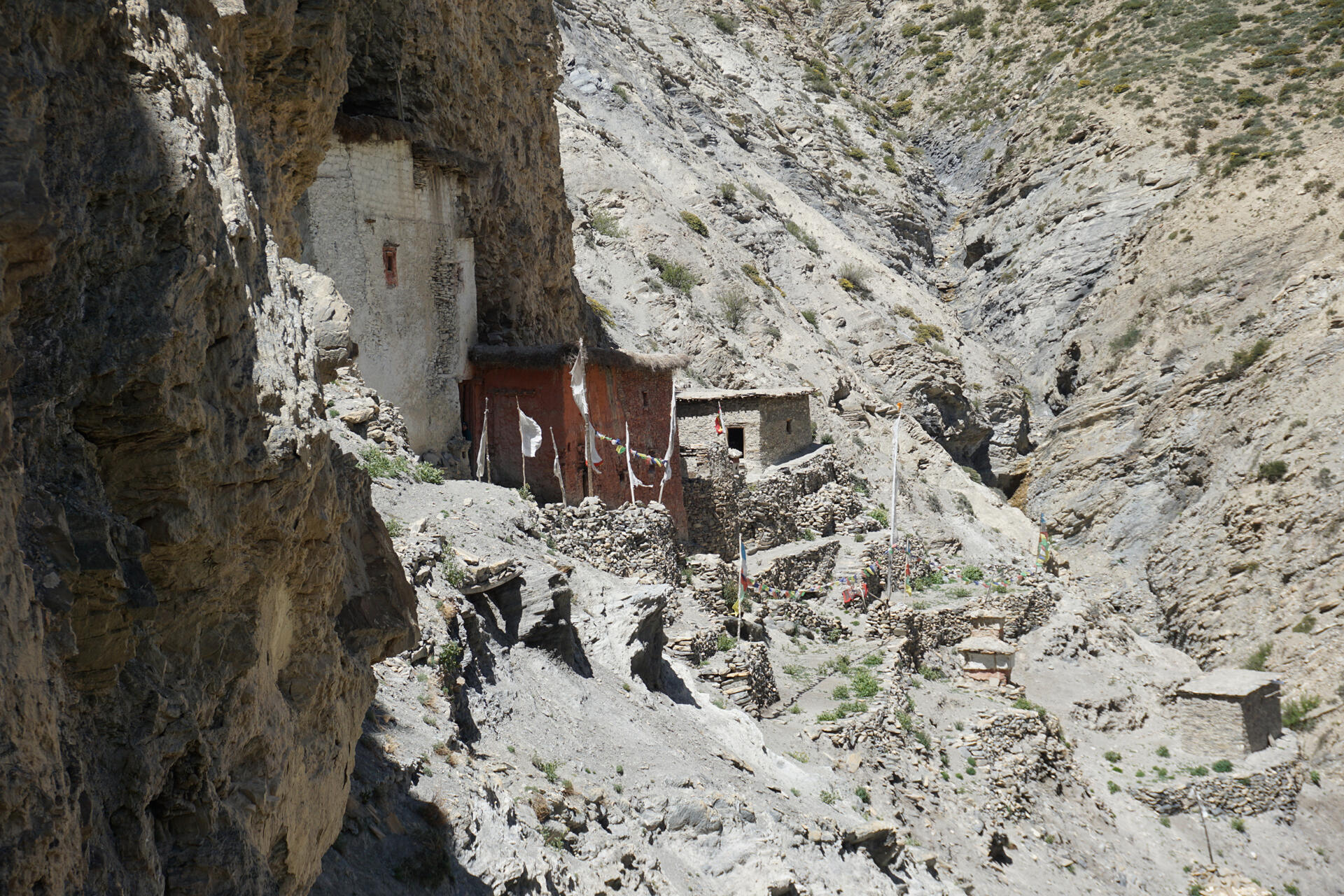
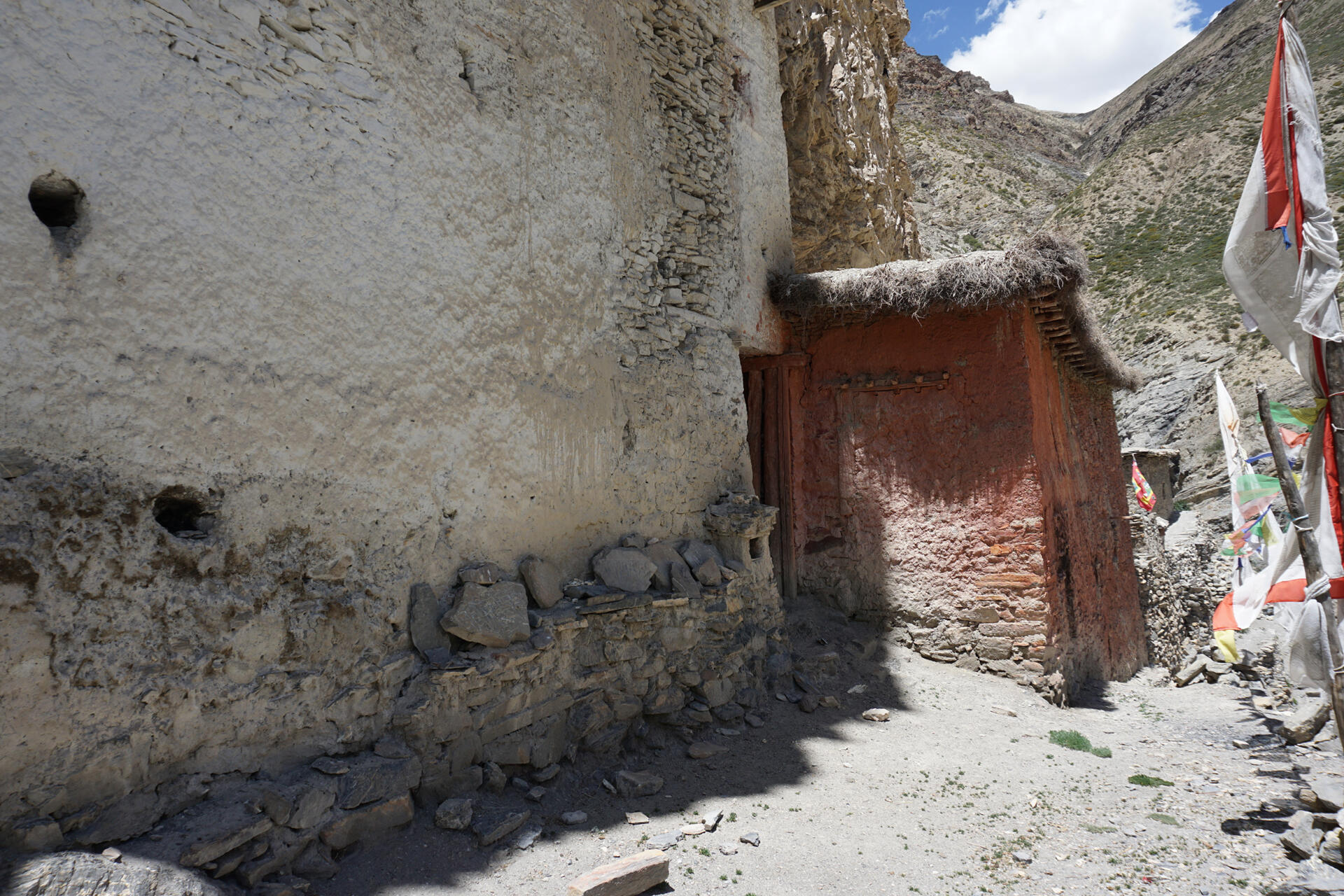
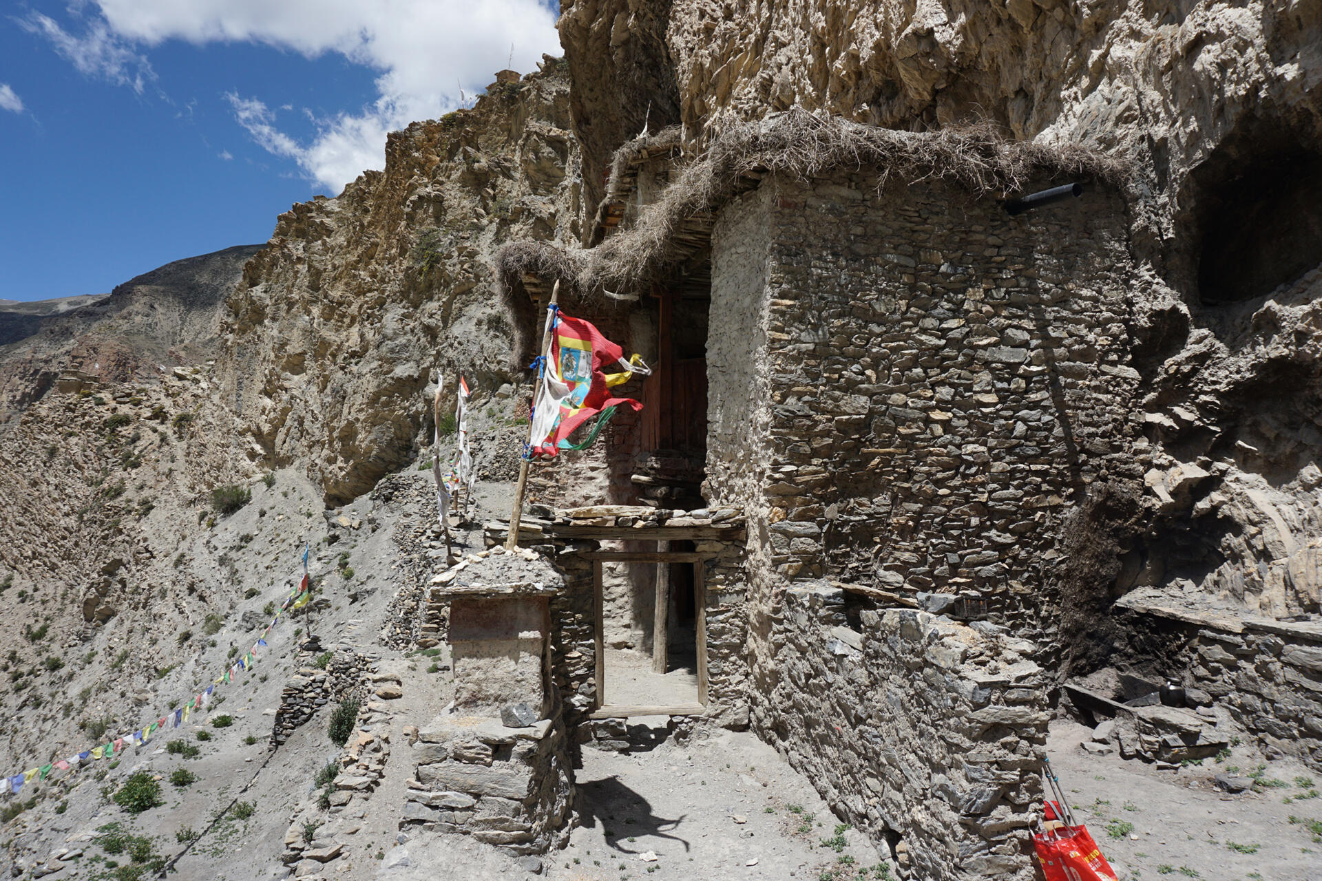
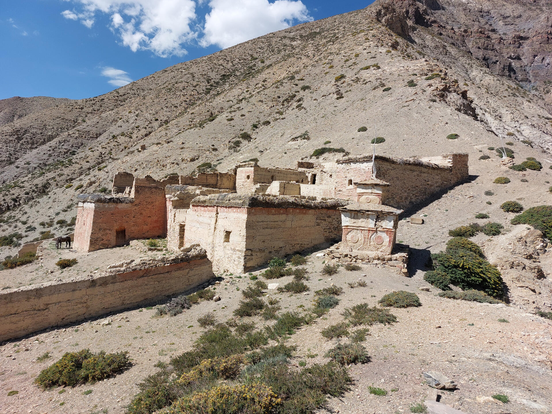
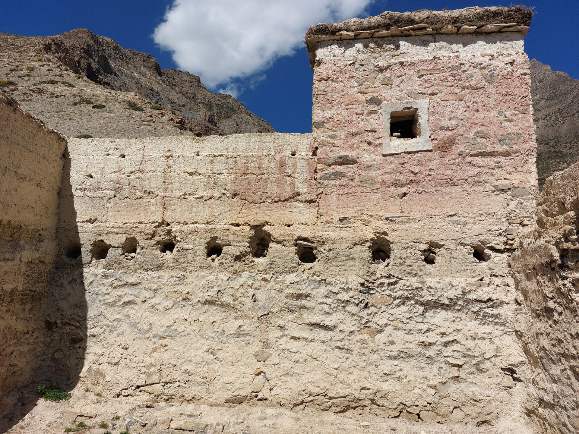
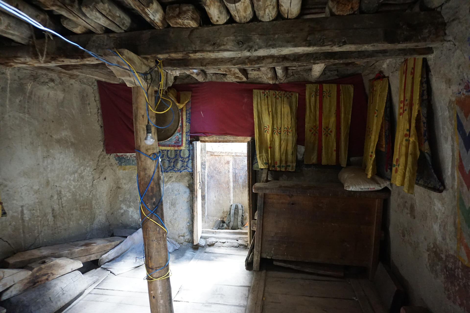
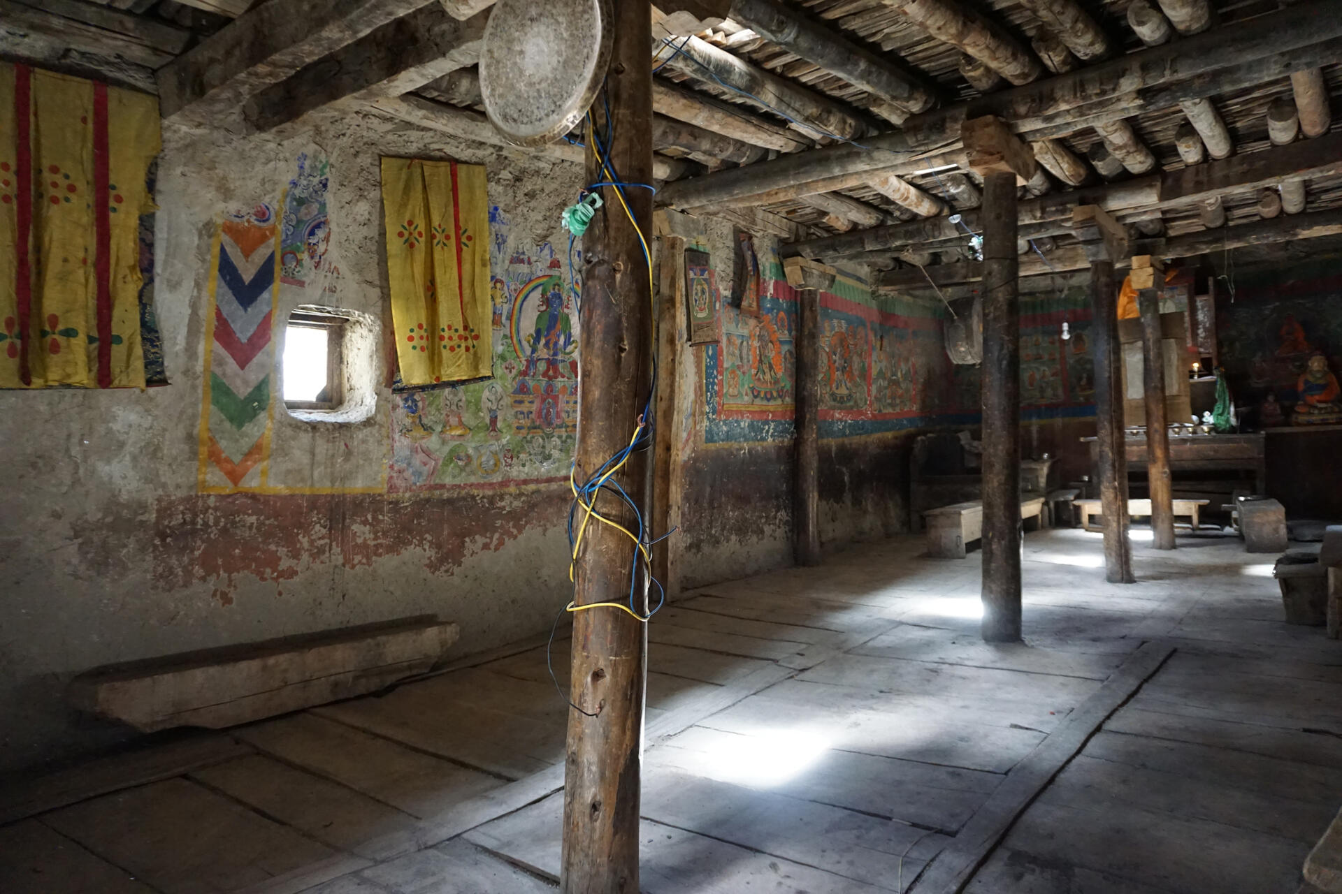
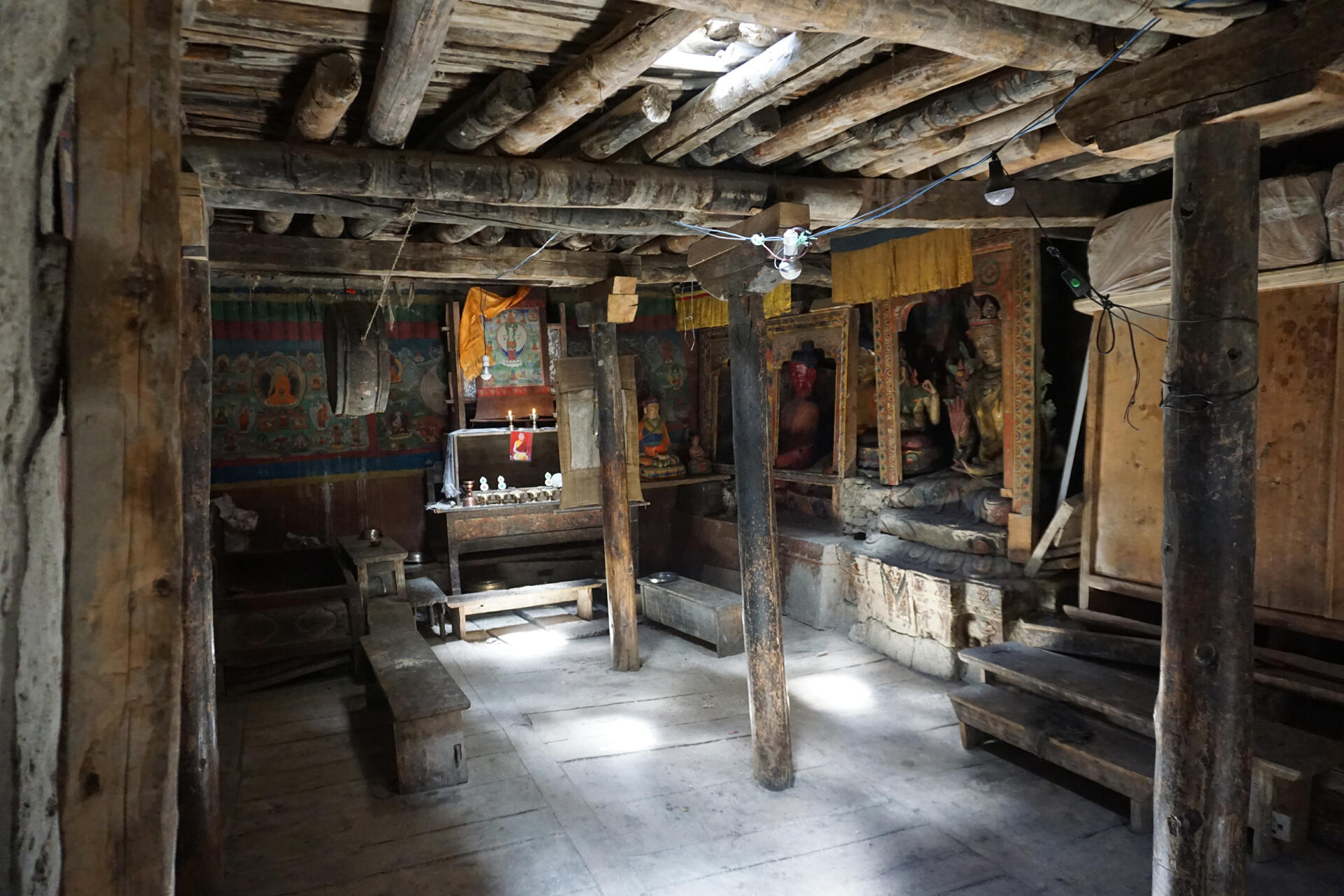
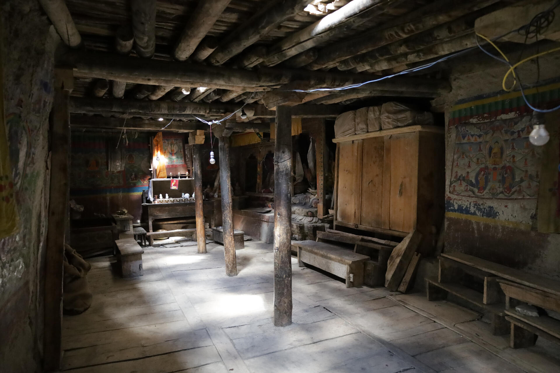
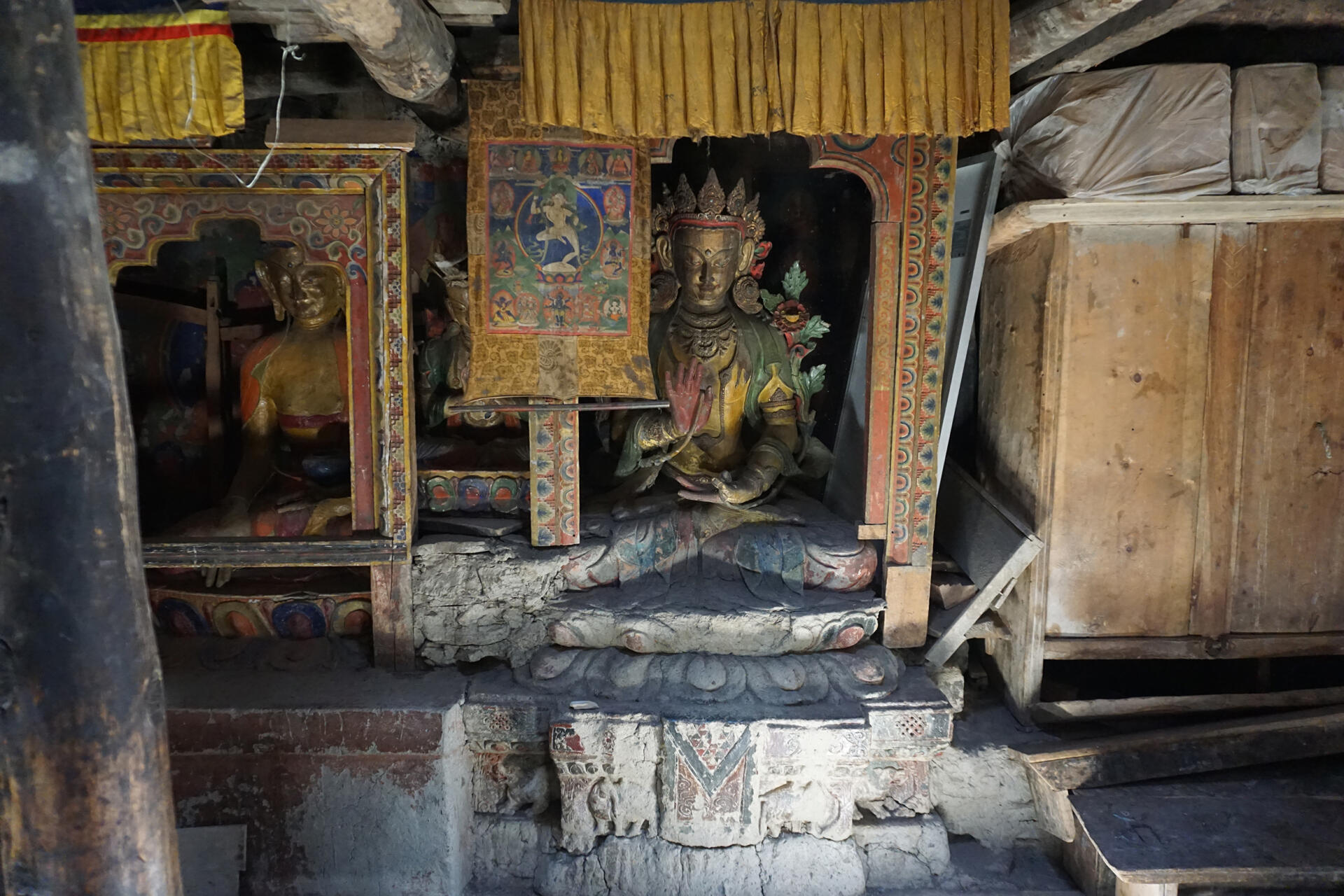
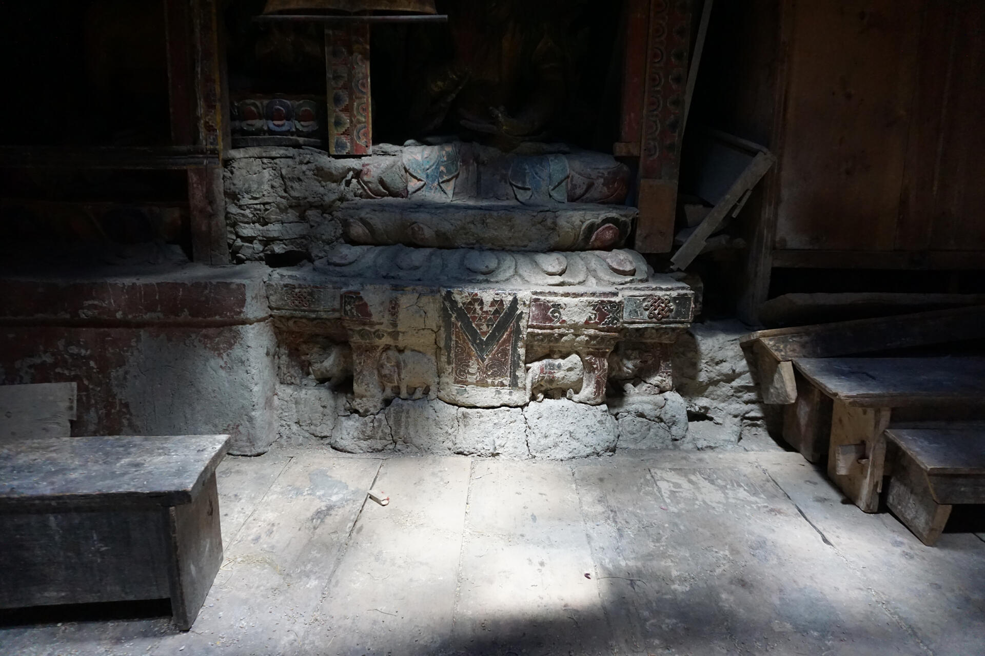
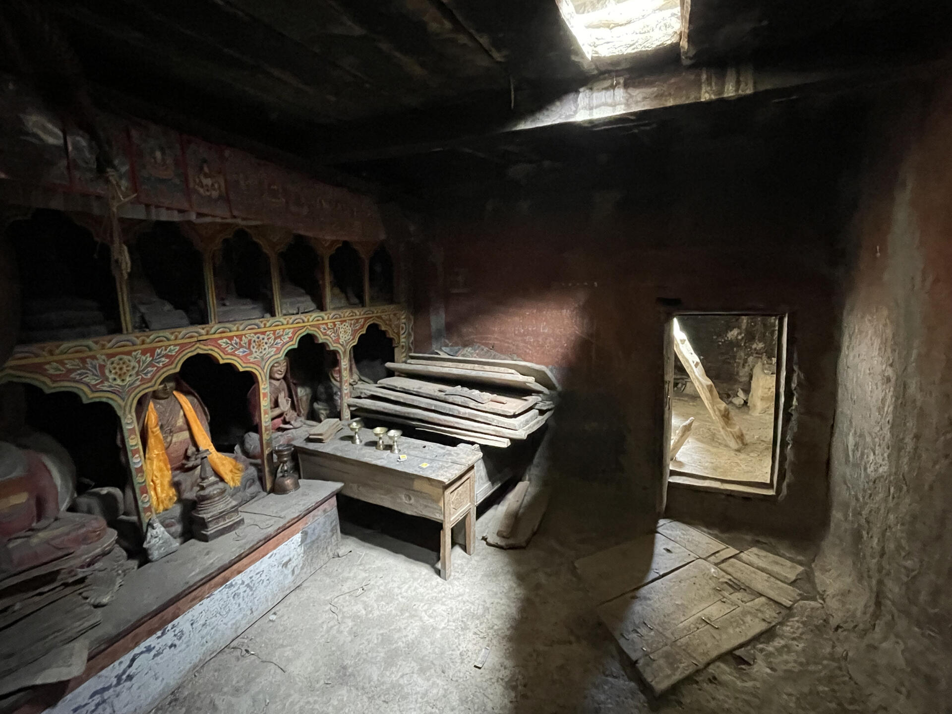
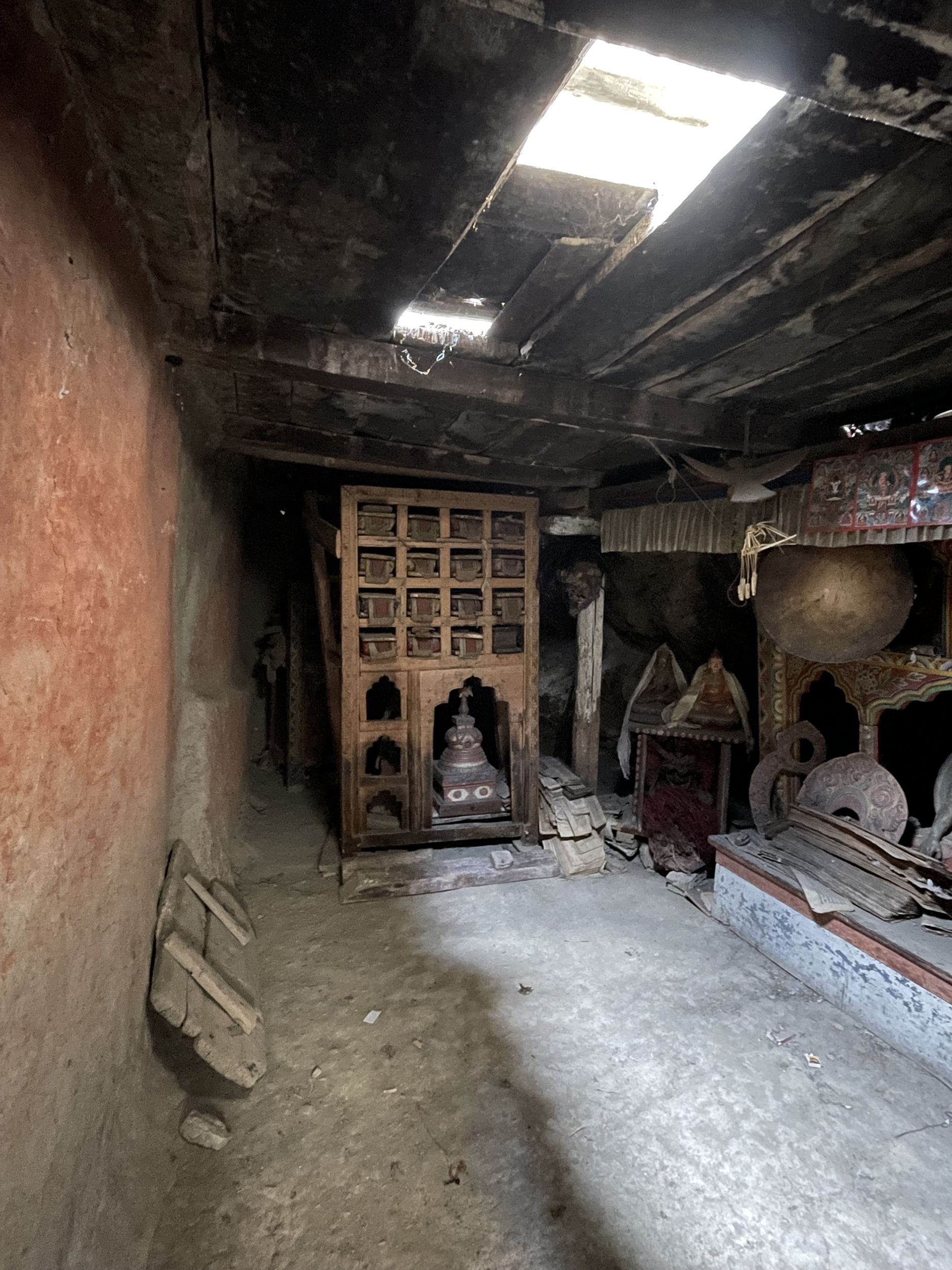
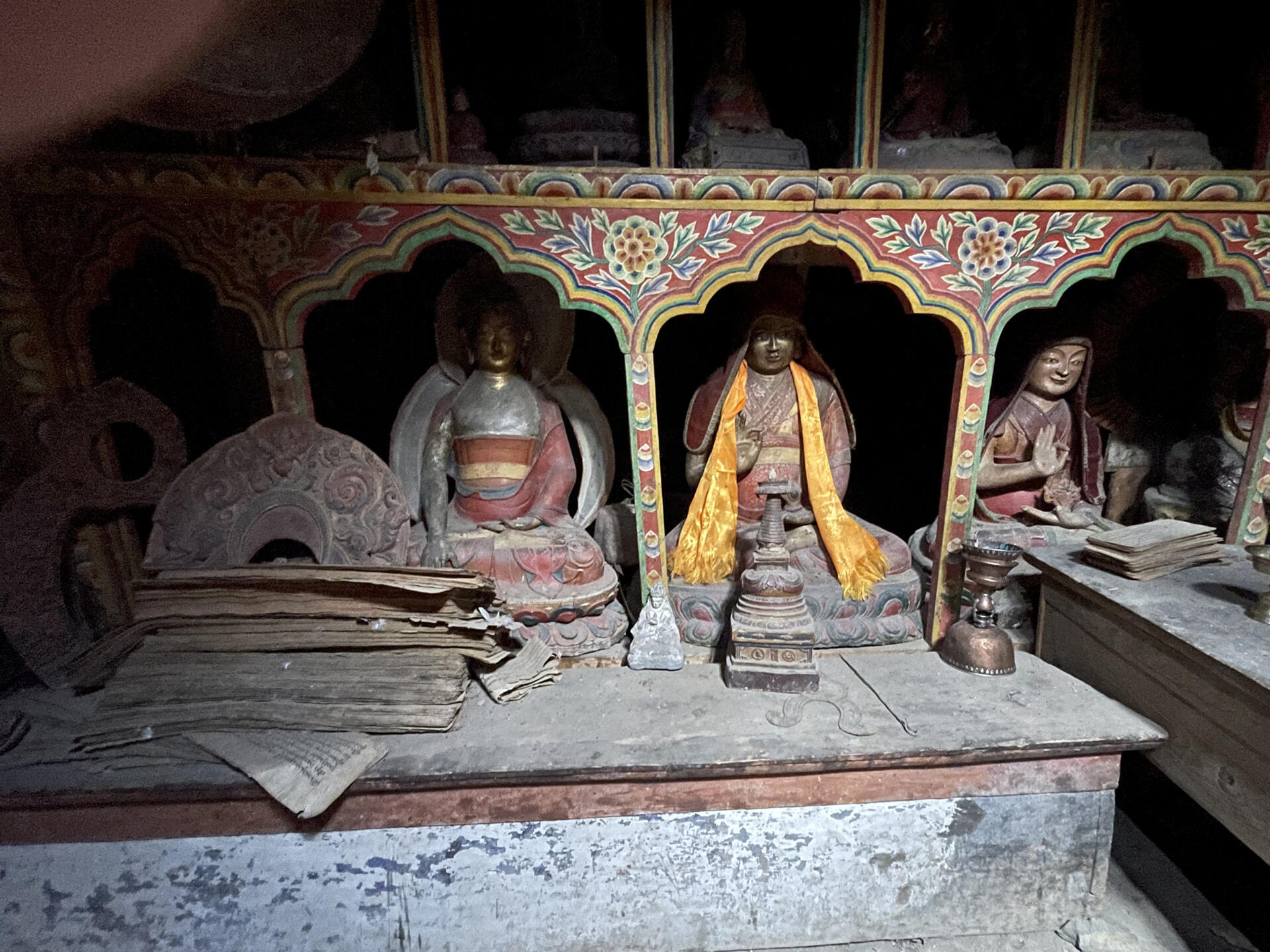
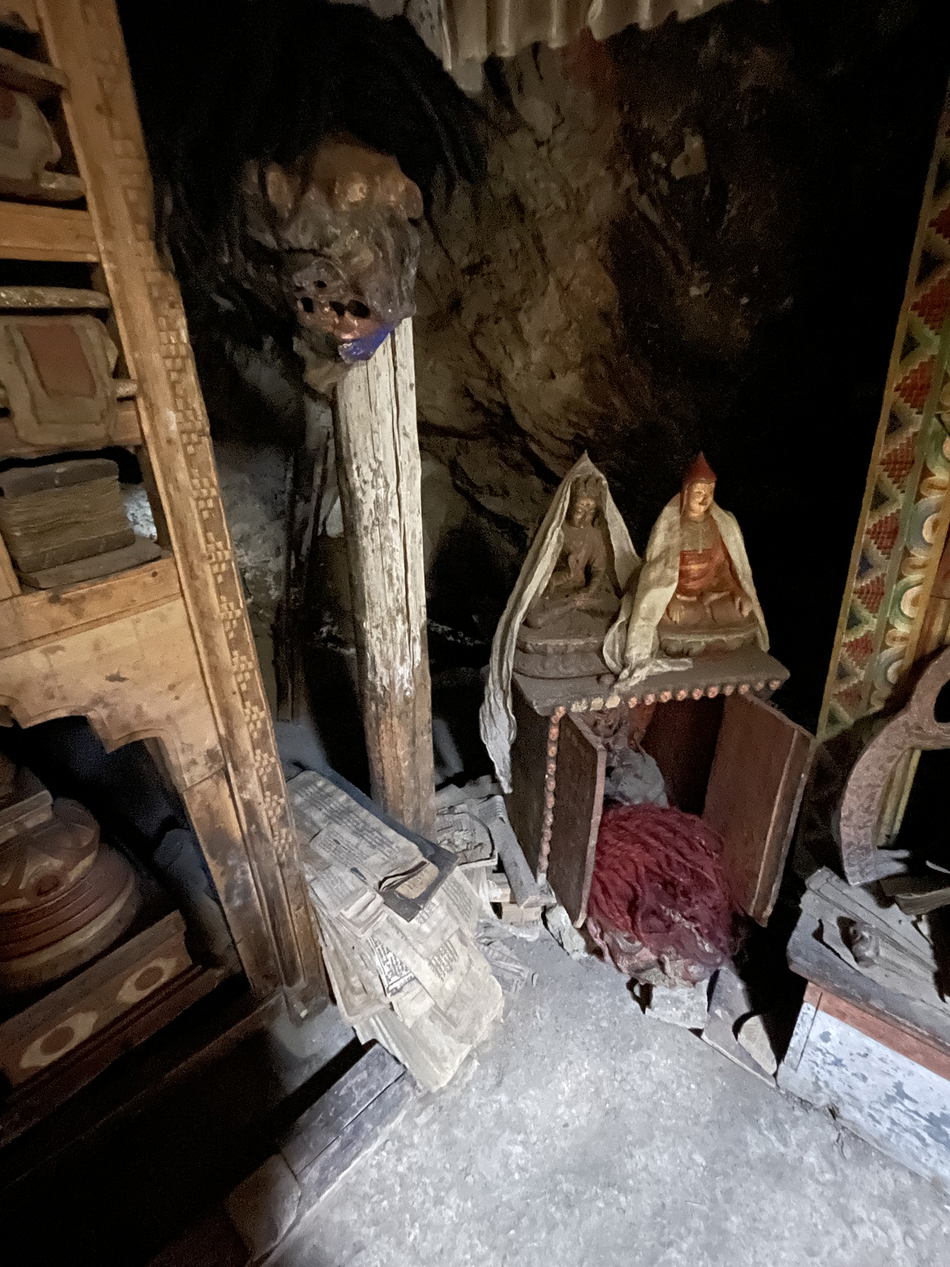
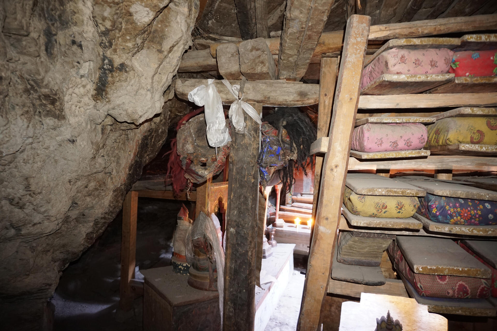
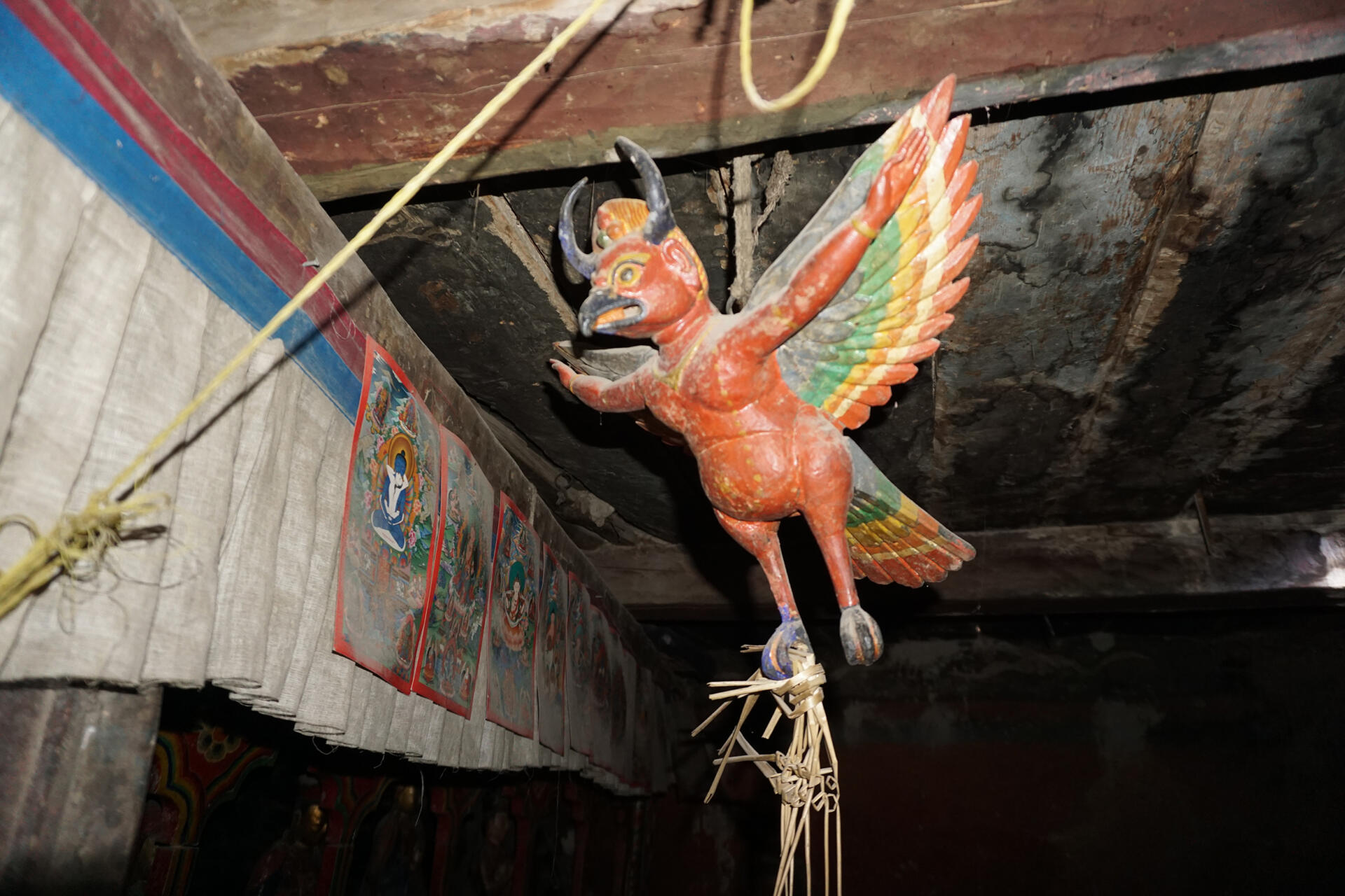
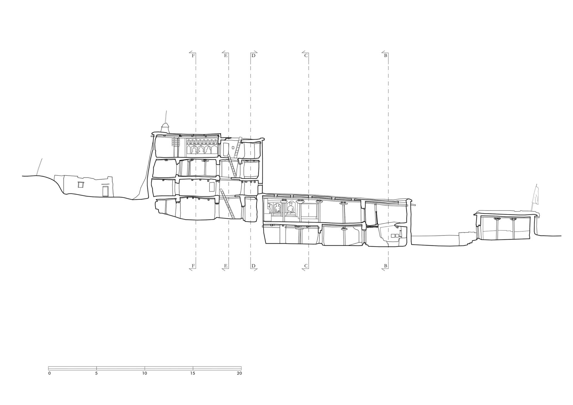
The monastery was founded by Lama Glorious Intellect (1467-1536) and consists of two buildings standing directly in front of the steeply rising rock face. In front of the buildings is a narrow terrace with a parapet wall, which can be reached via steps on the east side. A communal kitchen was built a little higher next to the monastery. The red-painted gompa is located on the east side. The assembly hall is situated on the upper floor and can be accessed from a small courtyard on the east side via a staircase with a wooden roof. The room is 3.50 metres wide, 10.30 metres deep and 2.20 metres high. One small window lits up the room. Four pillars in the middle of the room support the ceiling. The main sculptures on its pedestrals are standing on the north side of the room, where a niche in front of the rock extends the room to a width of 4.90 meters.
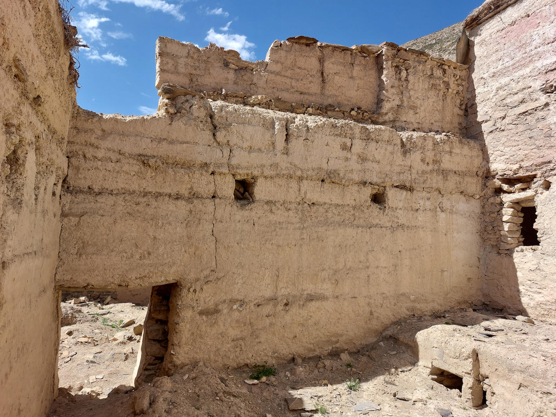
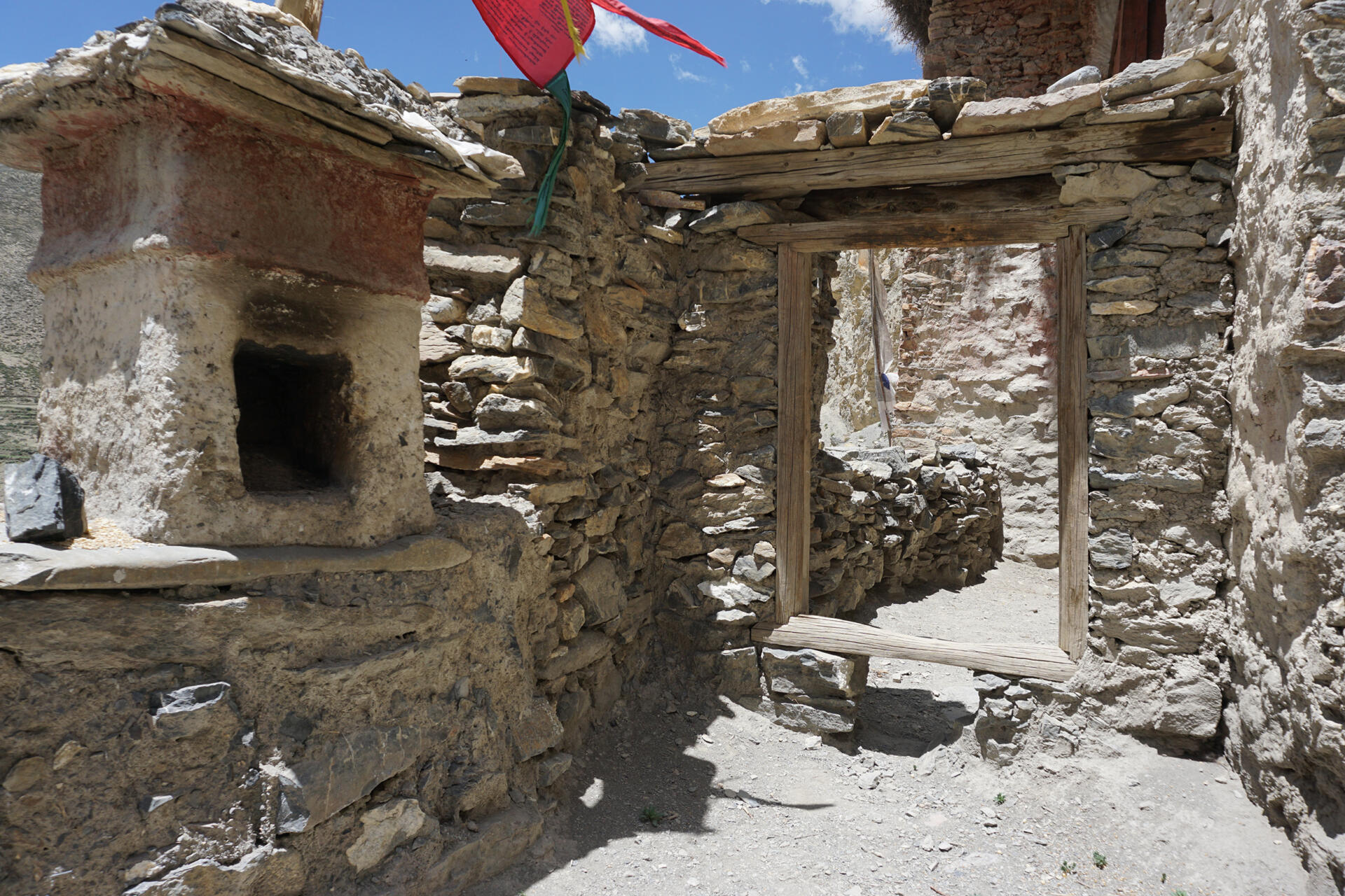
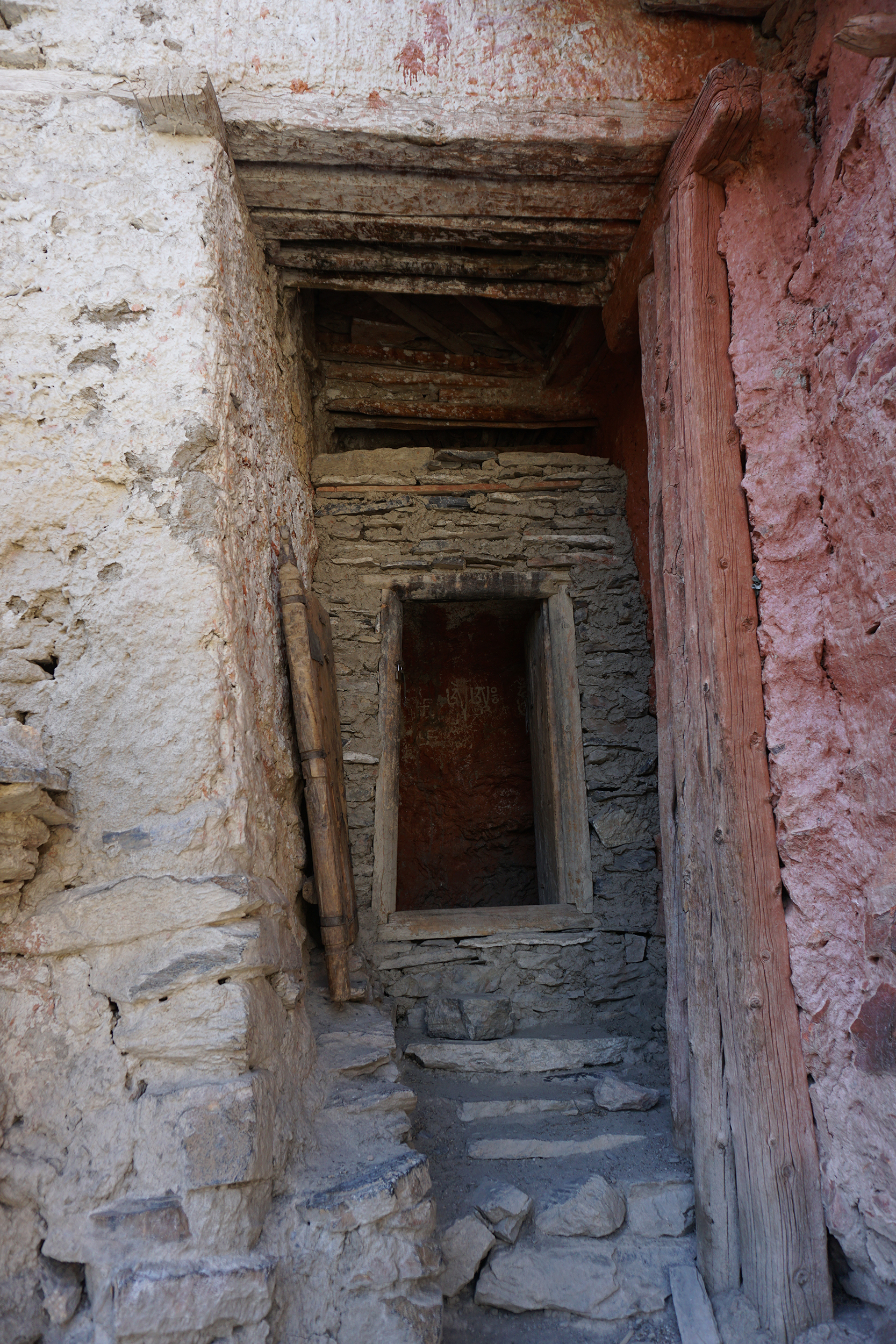
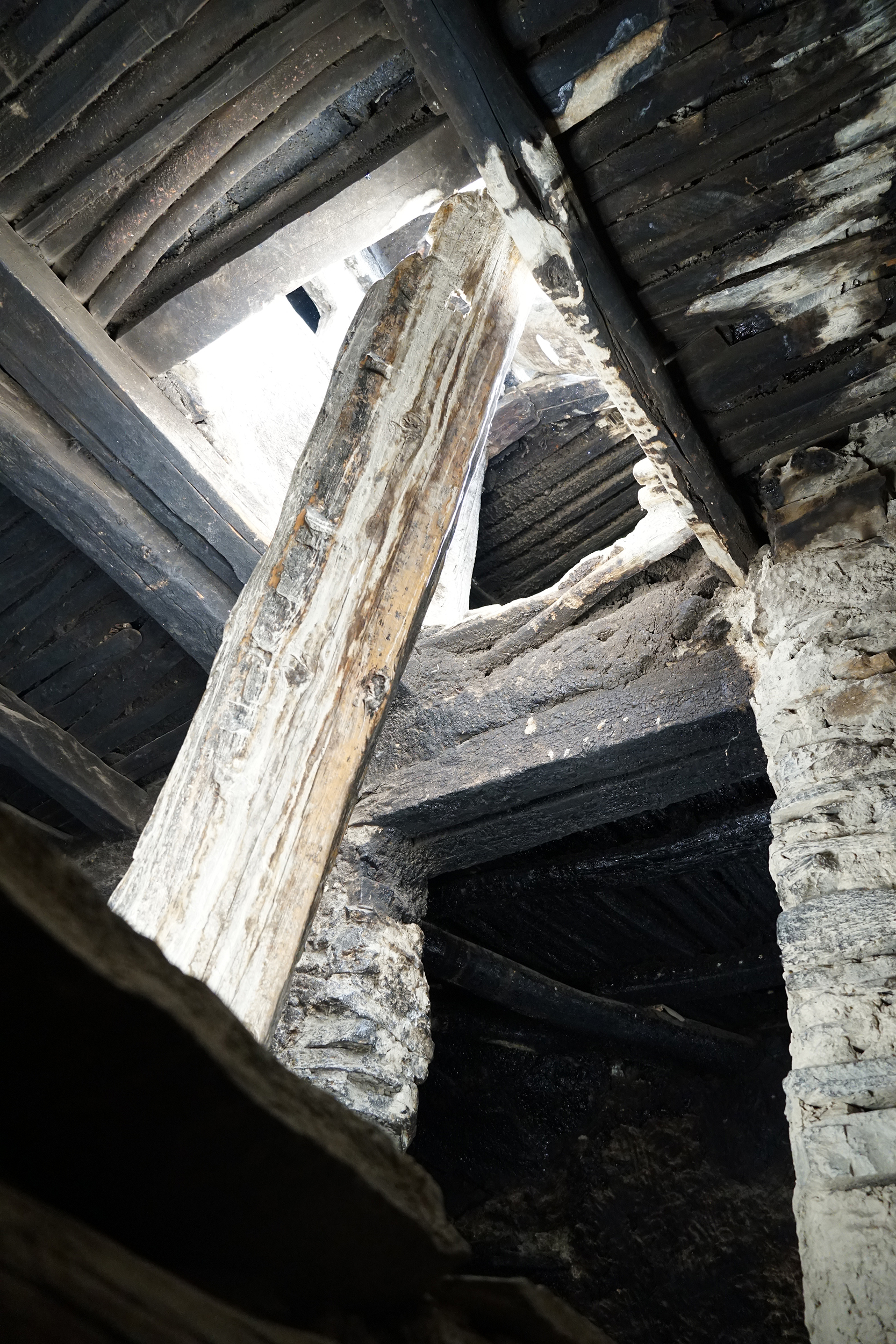
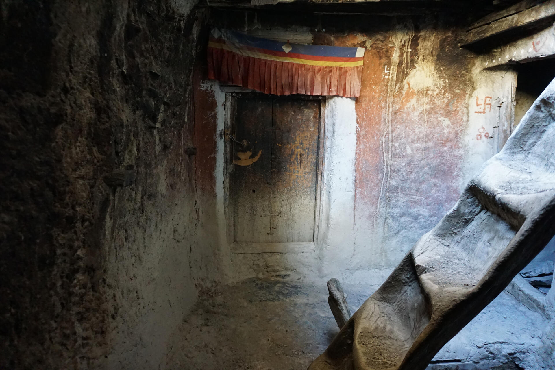
The directly adjoining white-washed residential building has four floors with narrow rooms and can be accessed on the south side. It houses stables, storage rooms and living quarters as well as a private chapel on the top floor.
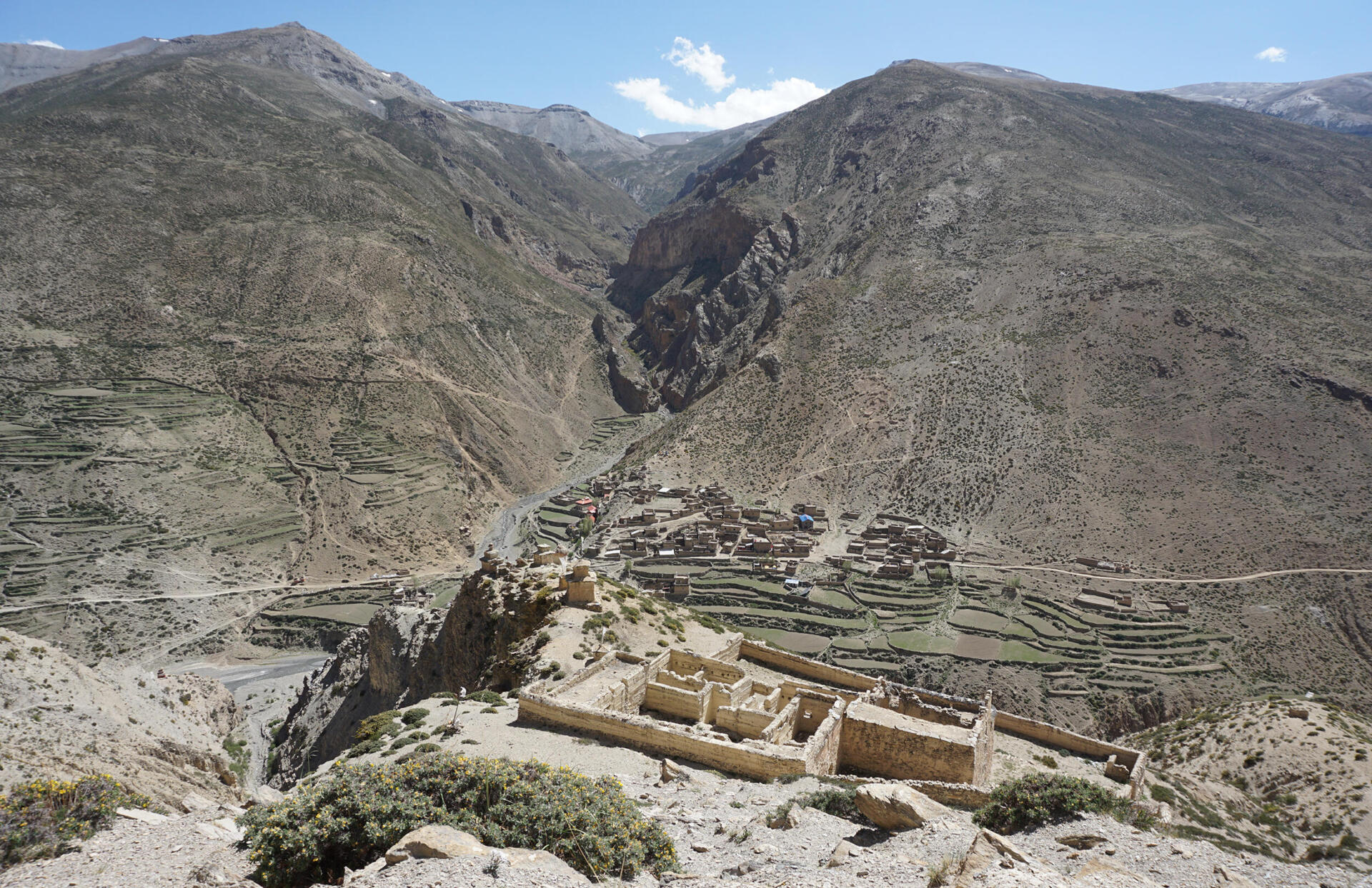
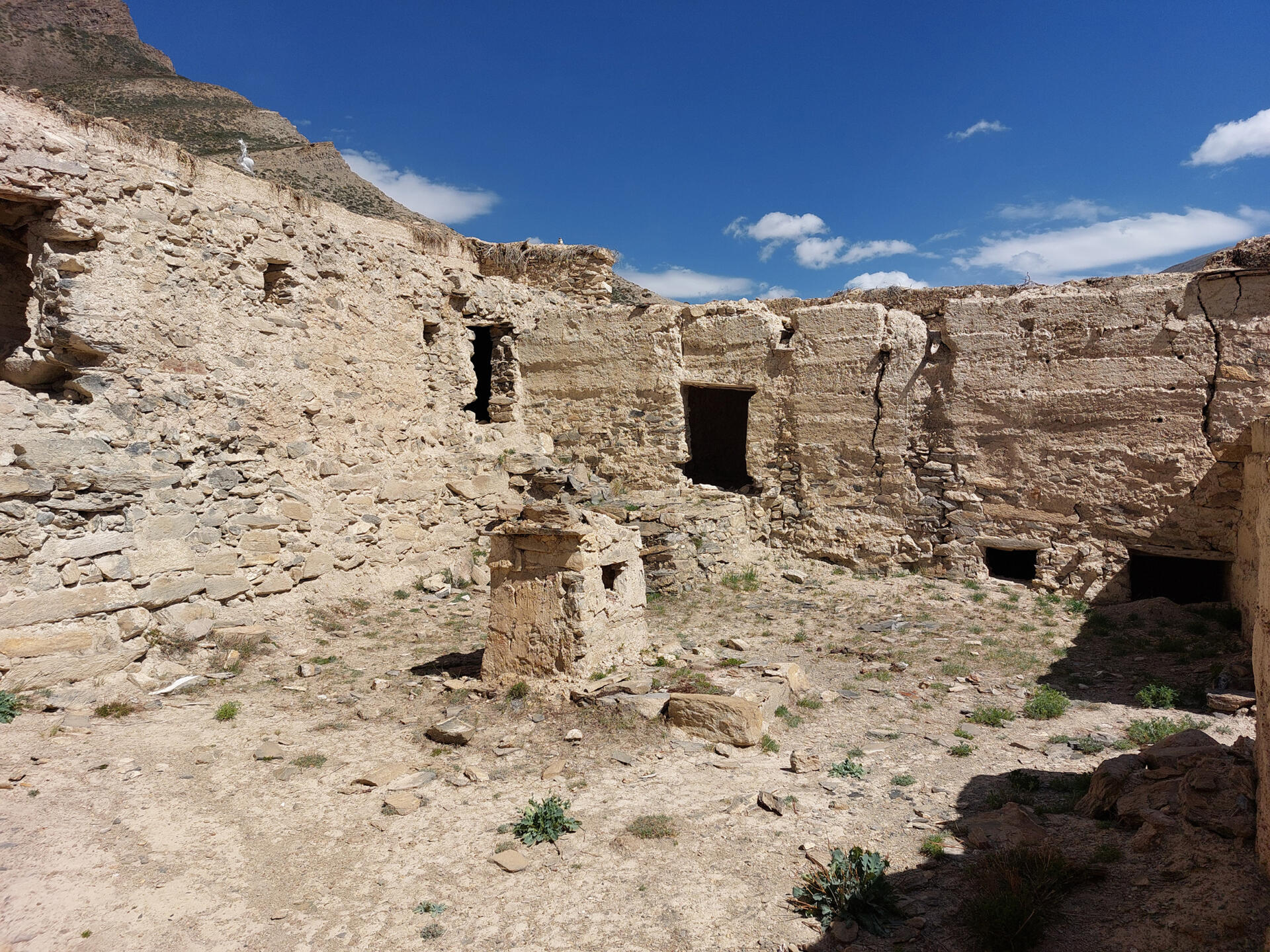
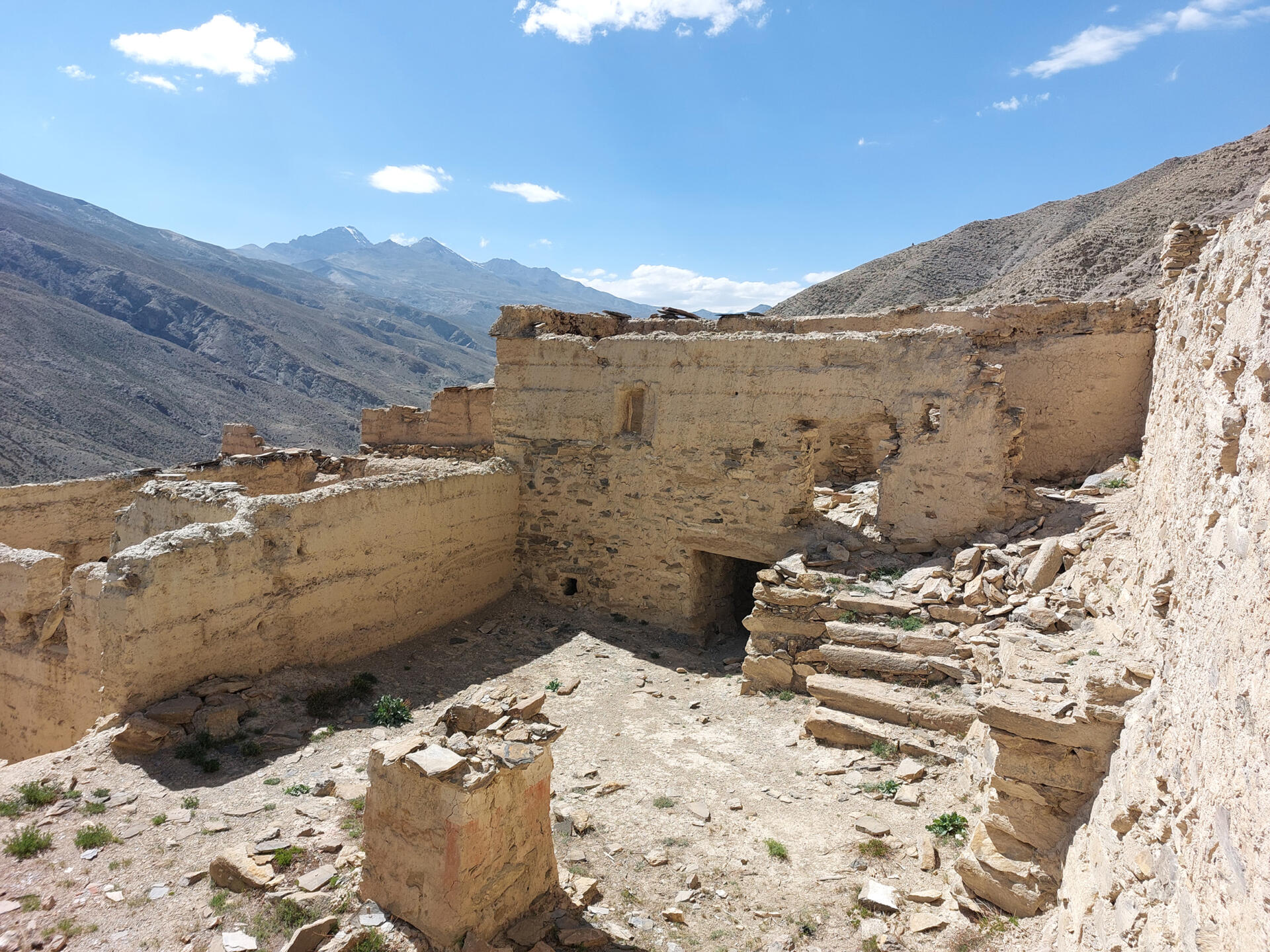
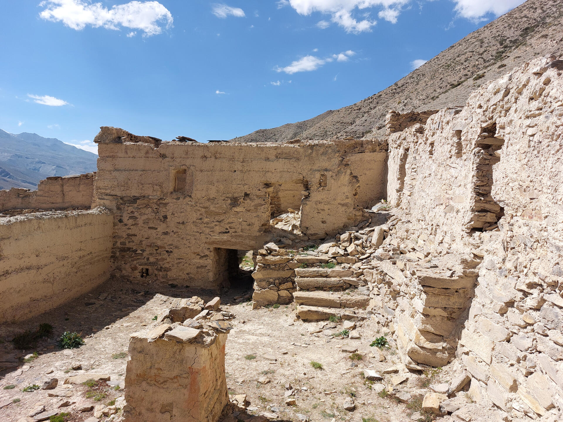
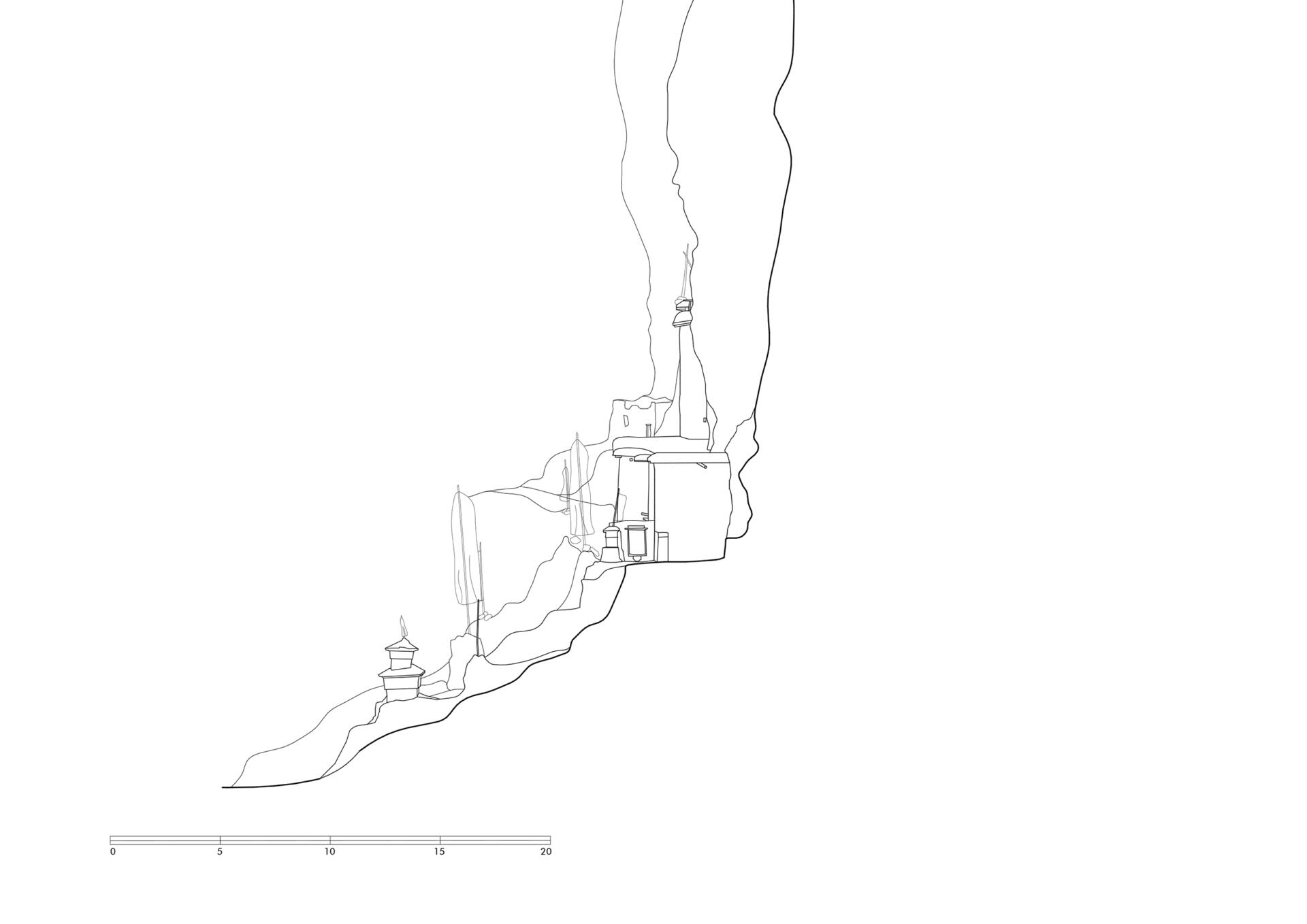
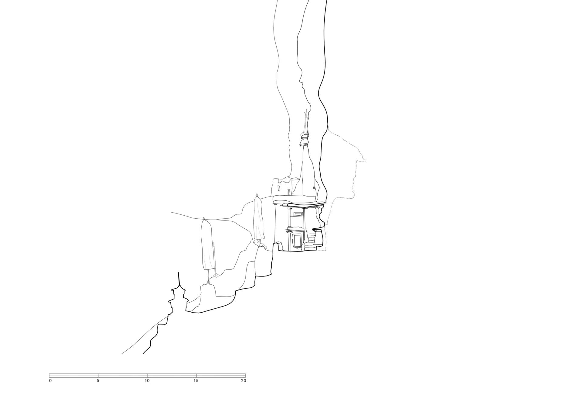
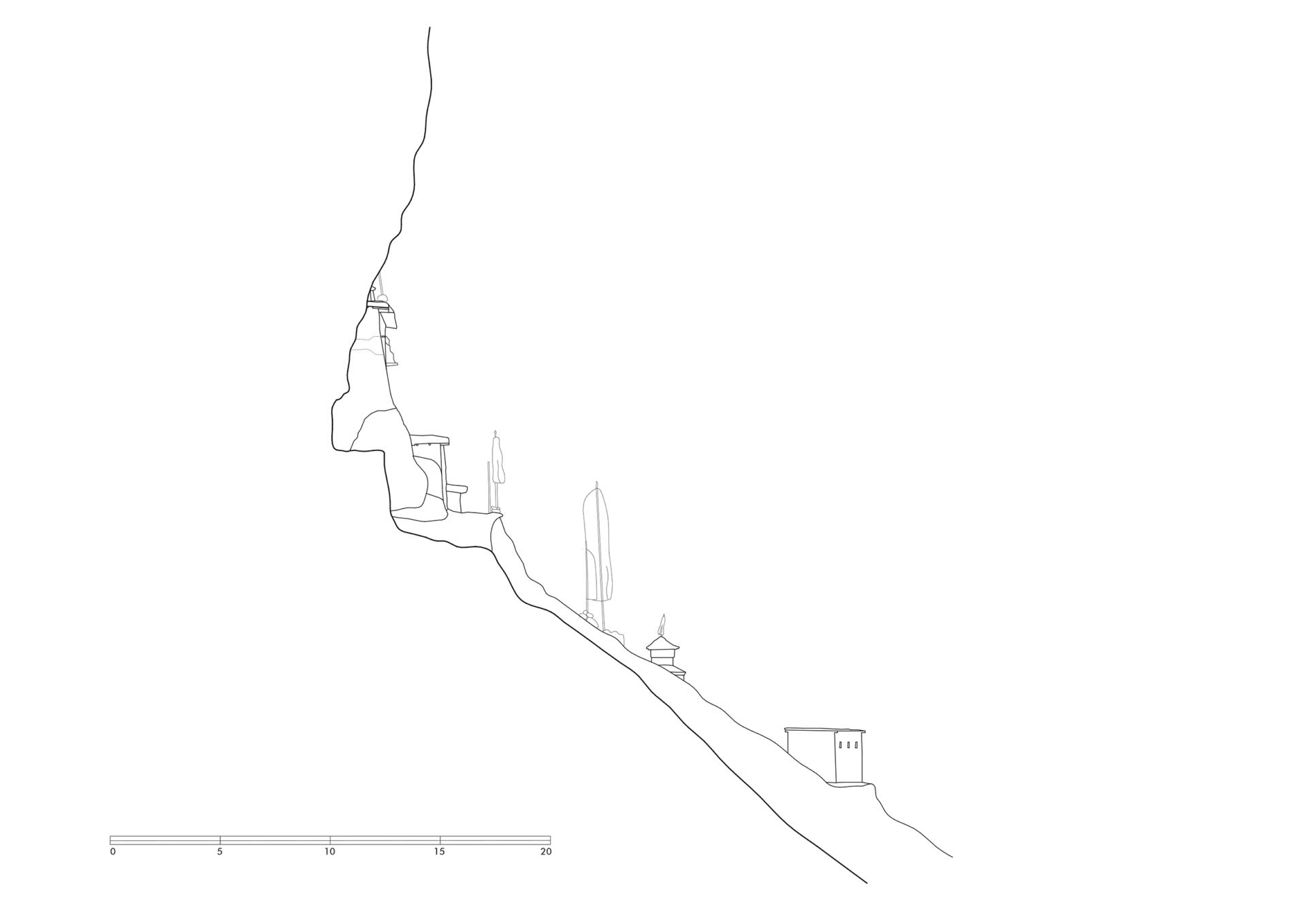
Above the monastery the structure of the former monastic school with a row of chörten on its western side is widely visible on the mountain slope above the valley. The school complex (supposedly founded by Margom Rinpoche) was built around 1980 and operated for about 25 years. From the monastery a path leads along the rock face, further up to the plateau on which the ruins of the school are located. The trail leads past several groups of chörten, another mani-field and a striking row of eight stupas to the north-western corner of the walled area.
While the monastery and the residental building are structurally in good condition, the structures of the former school are mainly unroofed and no longer in use. Nonetheless, from a typological point of view, the ruin is a very impressive example of a monastic school-building.
TU Graz – IGMS, Woschitz, H. & Bauer, P. (2024): 3D Model of the survey in 2023.
References: Snellgrove, David. Four Lamas of Dolpo: Autobiographies of Four Tibetan Lamas (15th–18th Centuries). Volume I, Oxford 1967: 2, 5, 11.
Photo Documentation
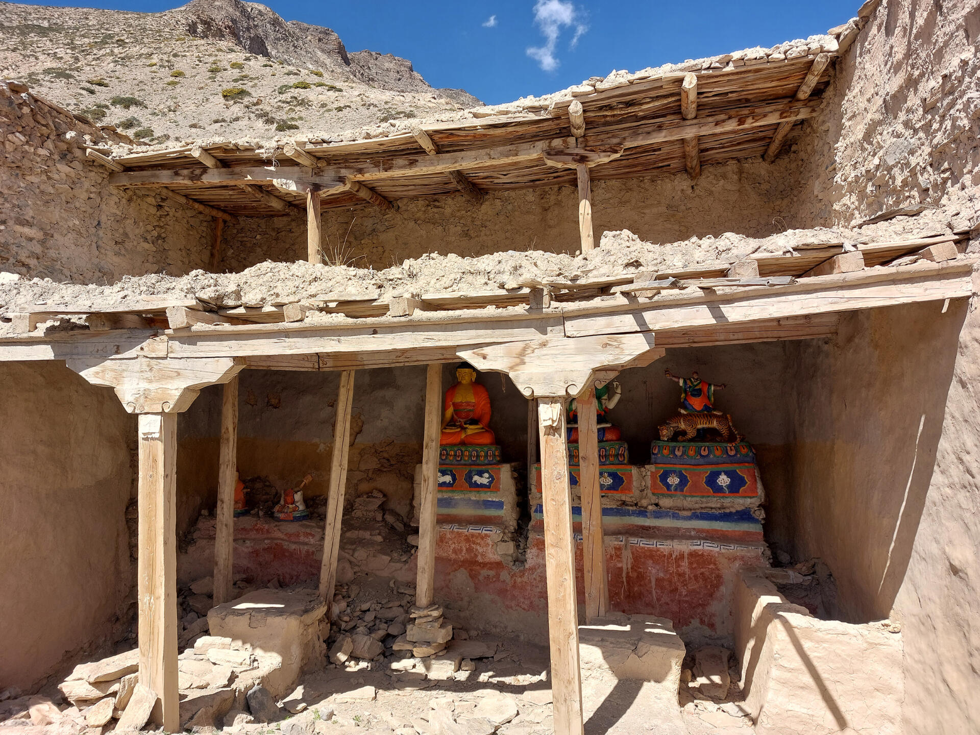
Interior of the gompa

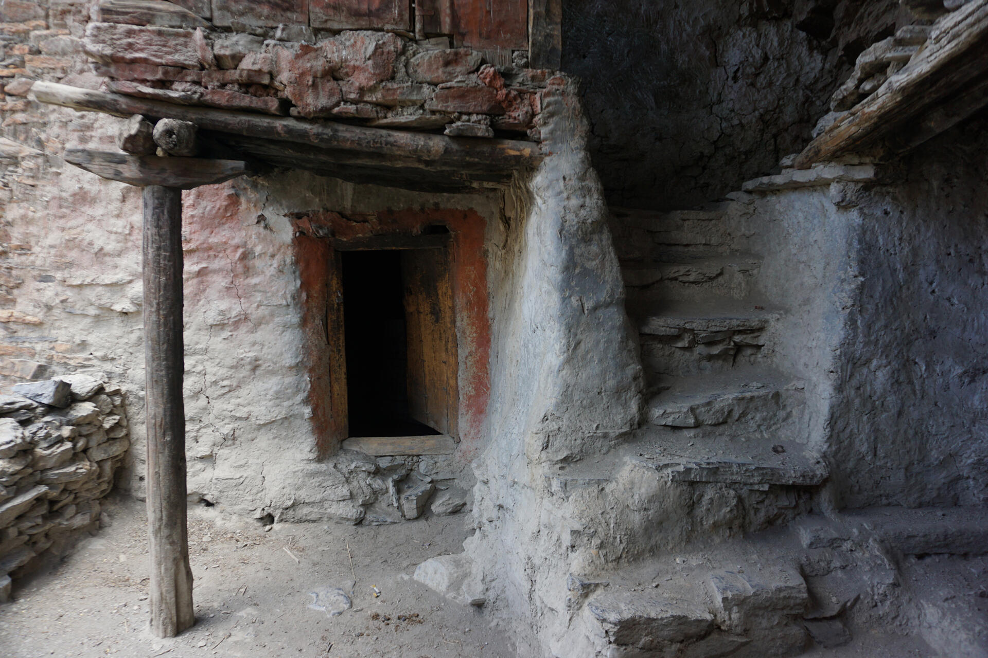
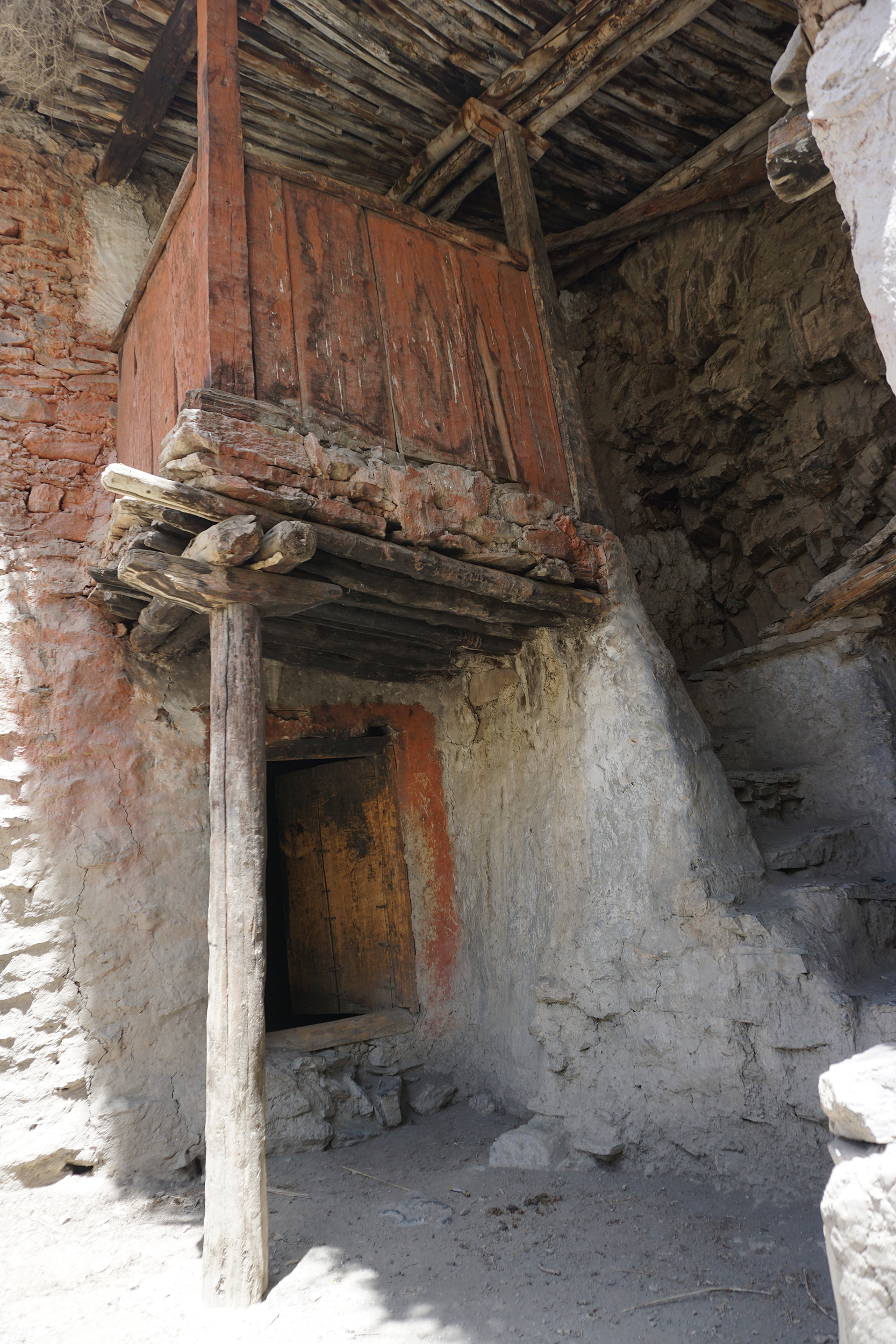
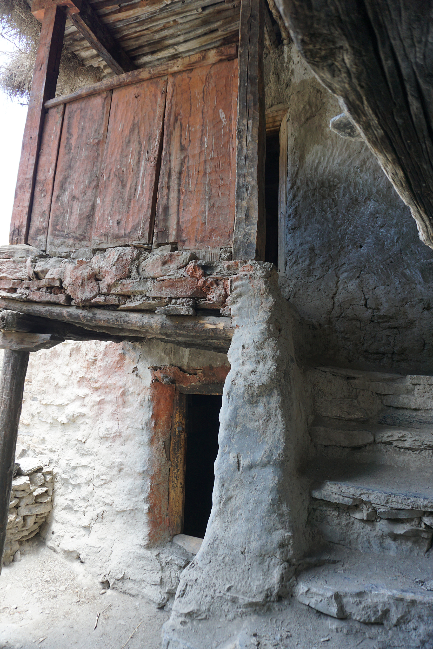
Interior of the residental building
3D Views
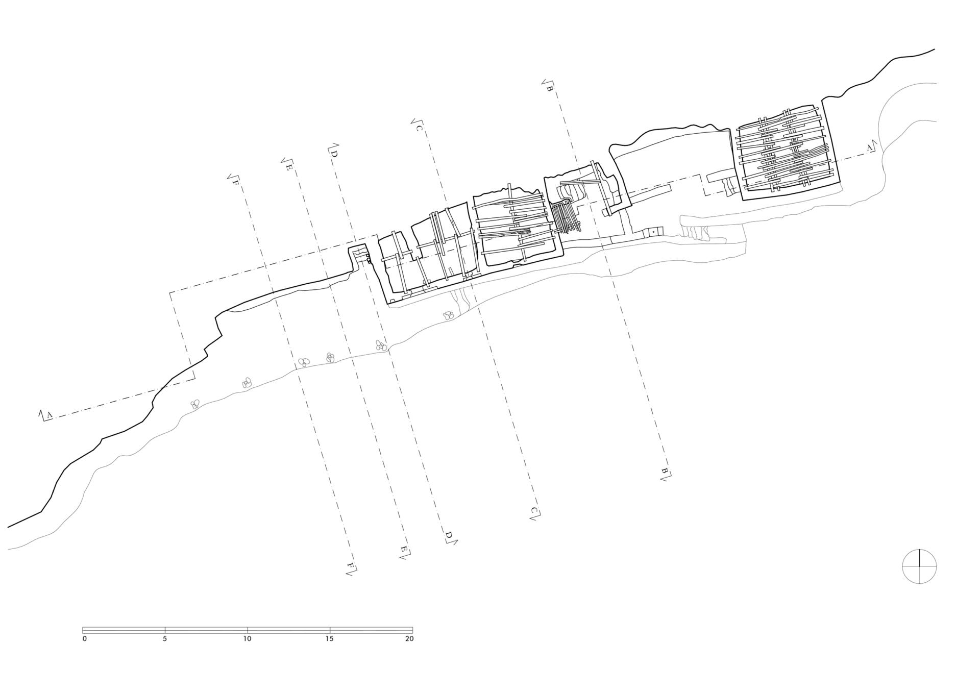
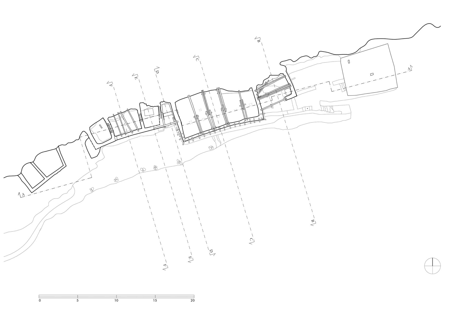
2D Plans

More from


