Nepal
Samling
Samling Monastery
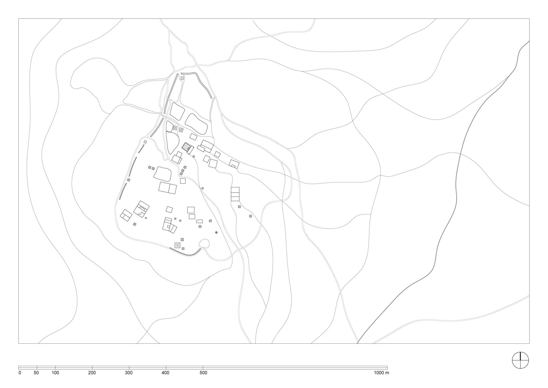
Coordinates: 29°25’52.59” N , 82°54’27.44” E, elevation 4166 meters.
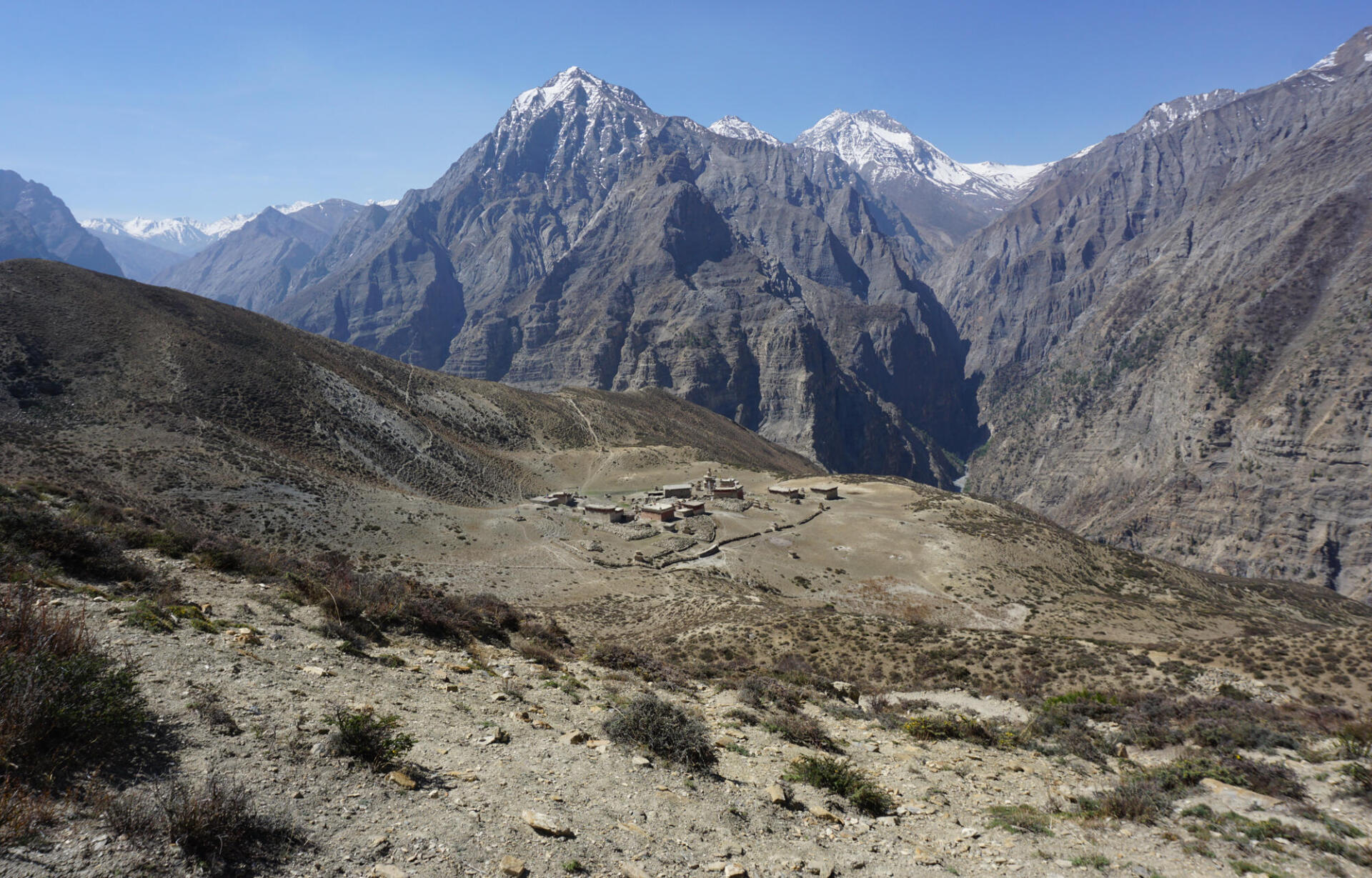
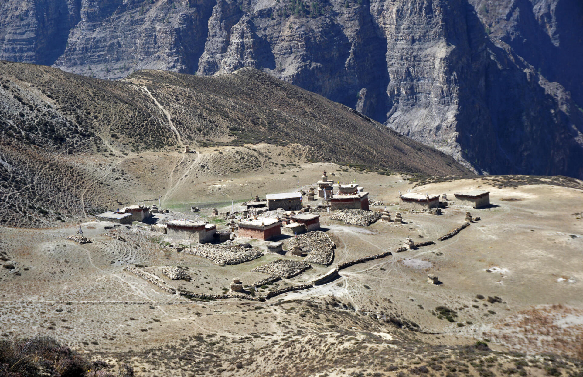
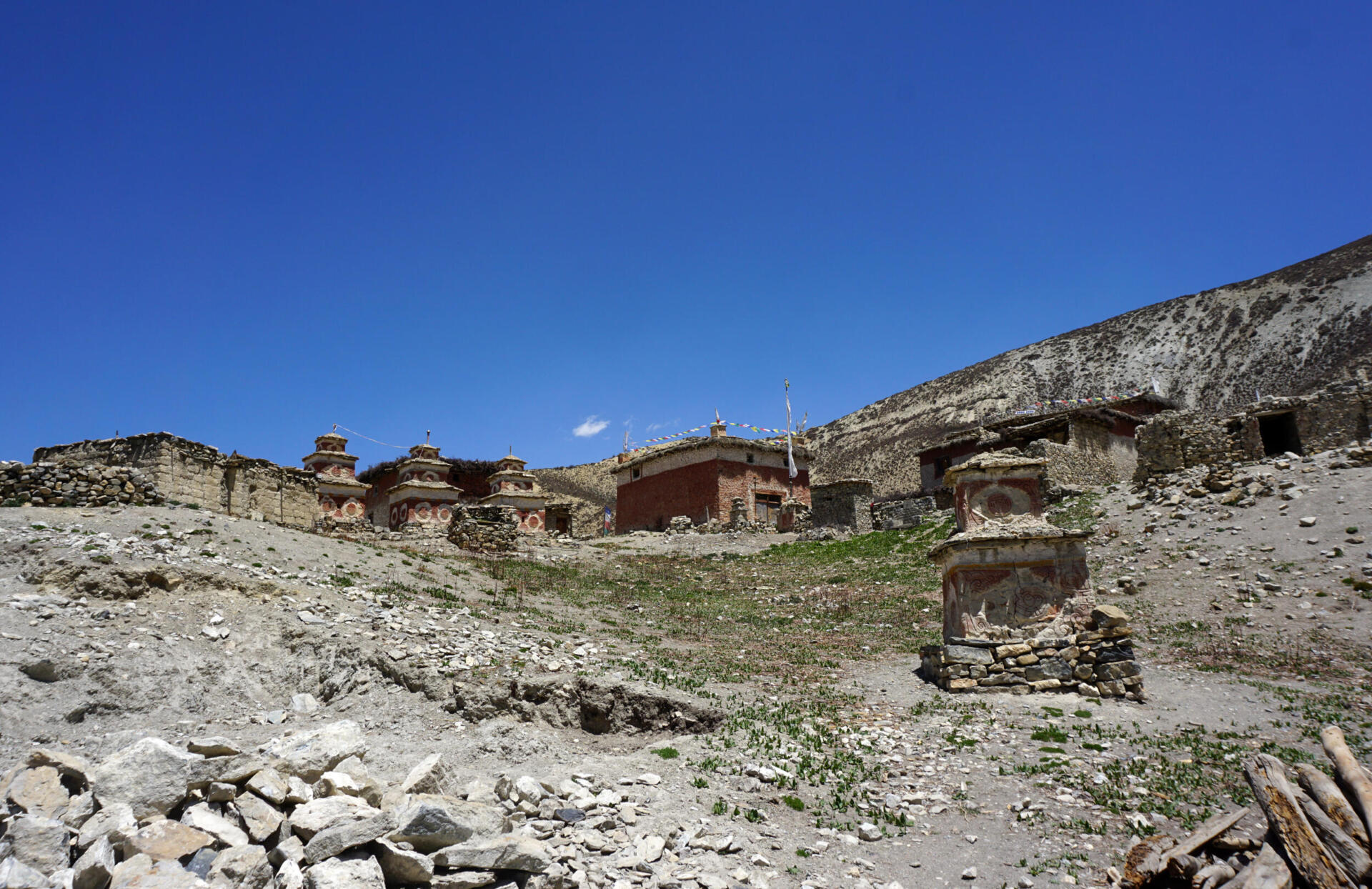
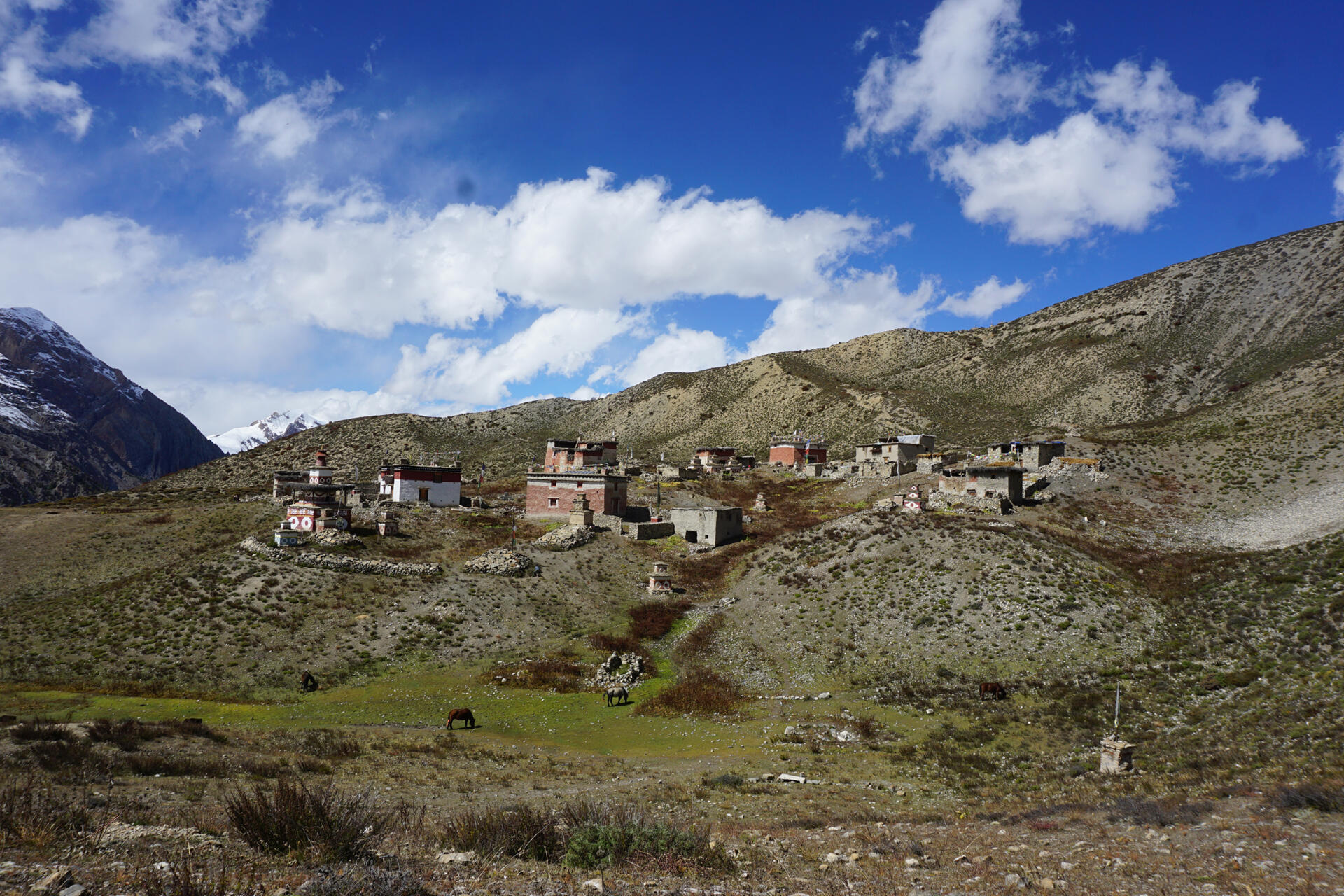
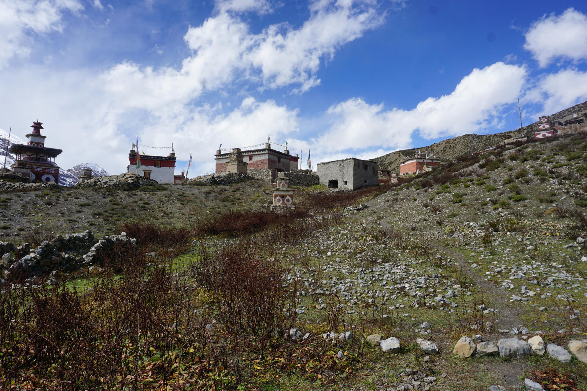
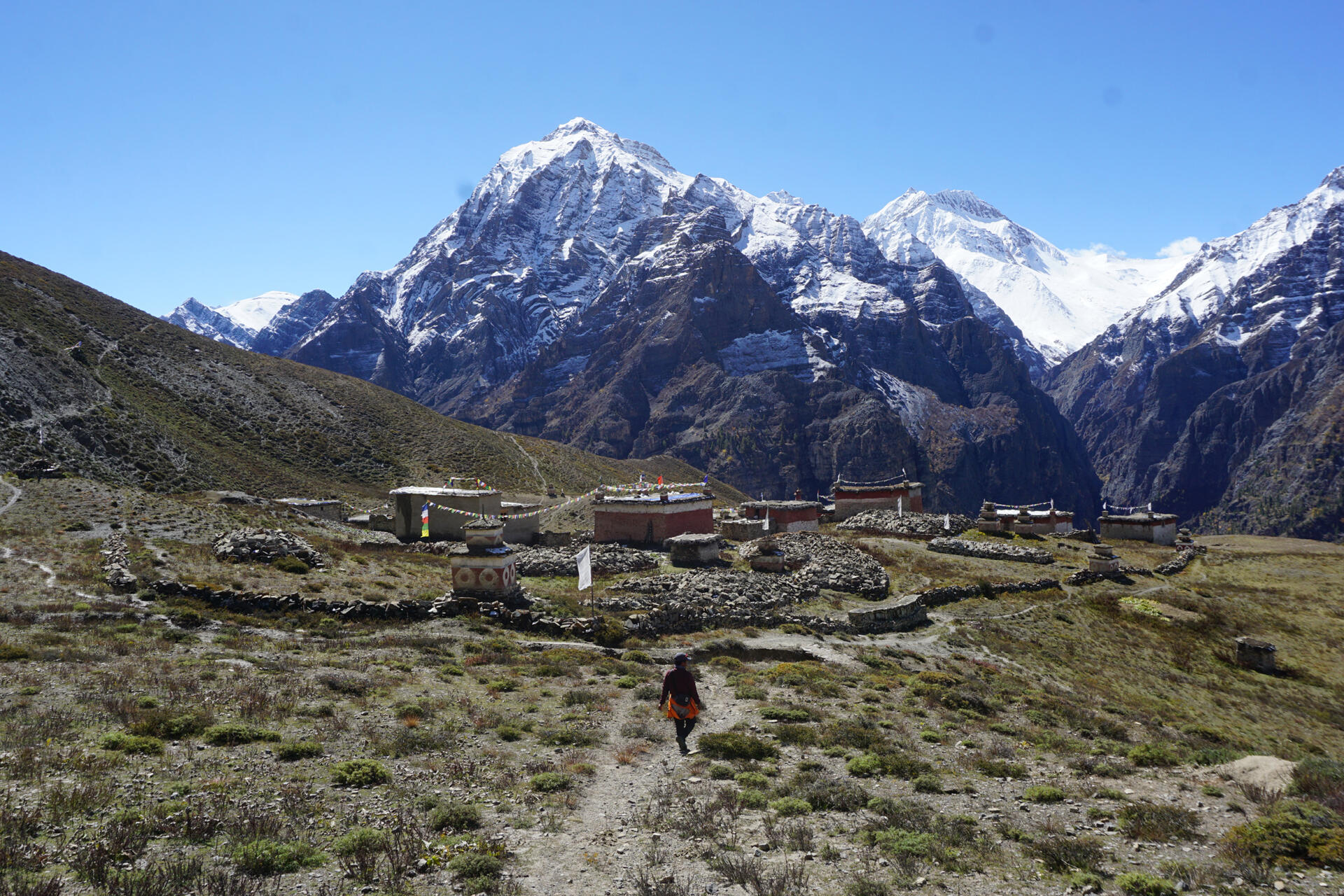
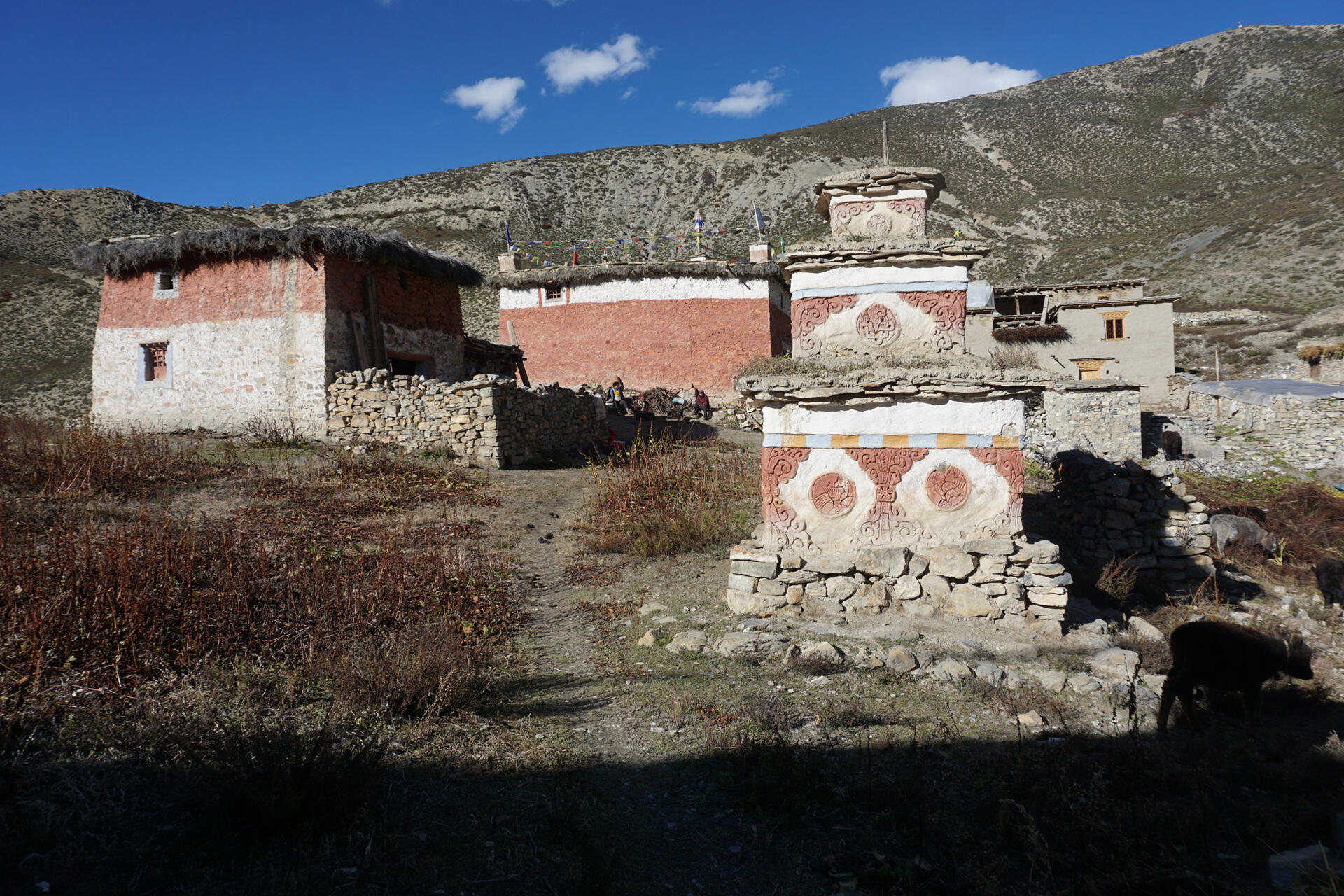
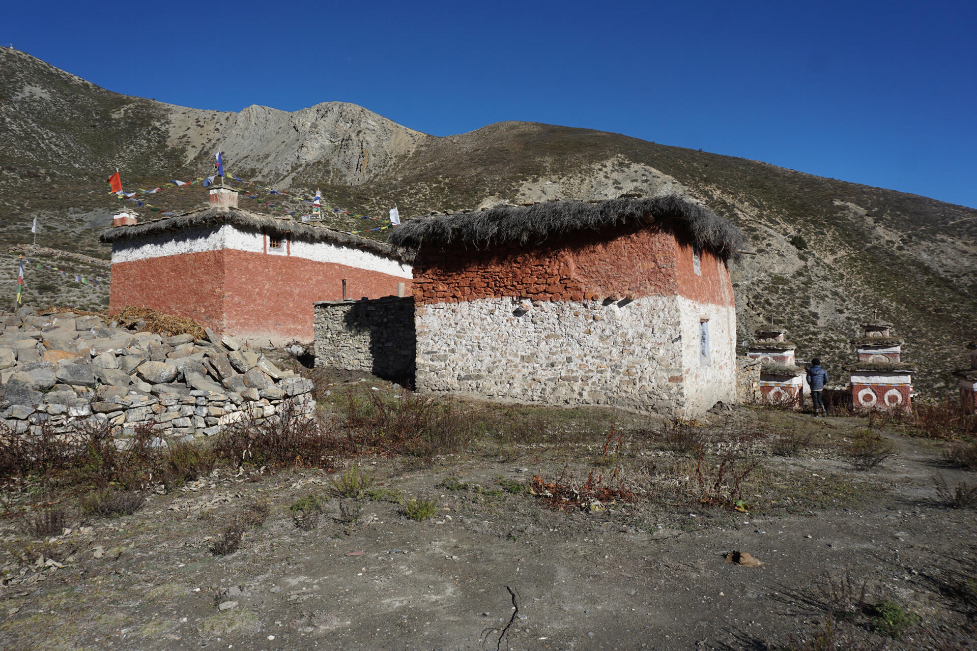
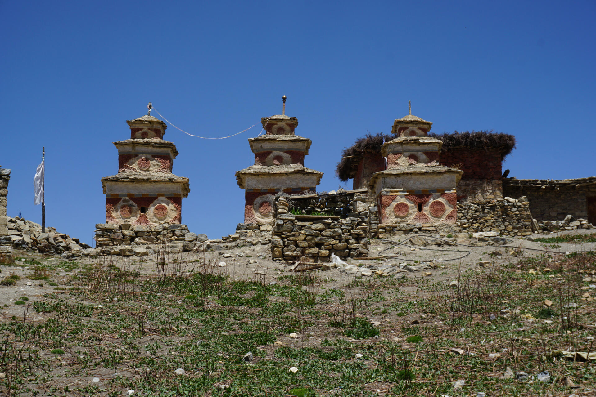
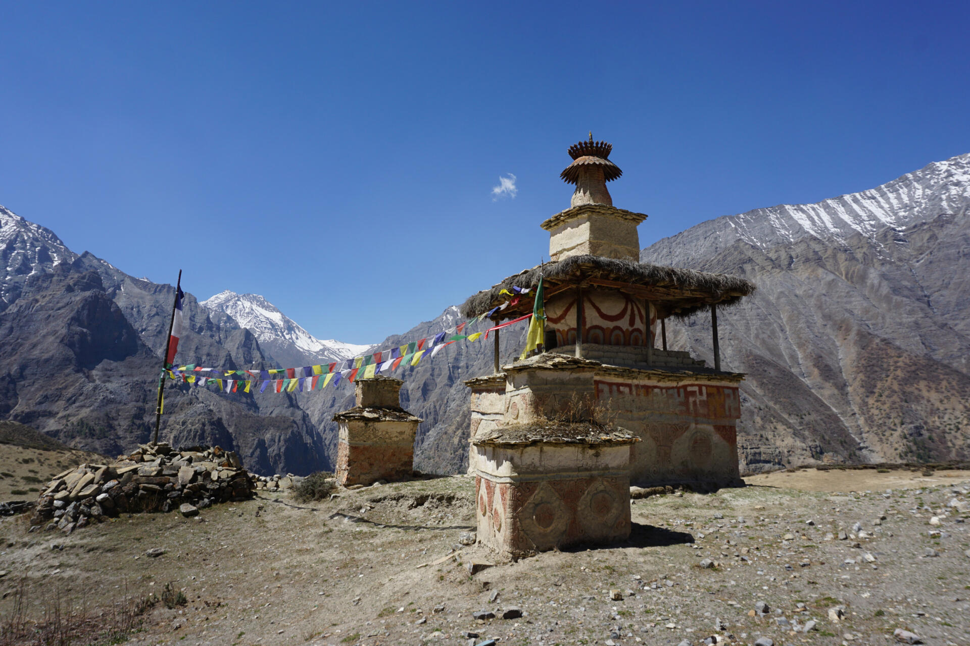
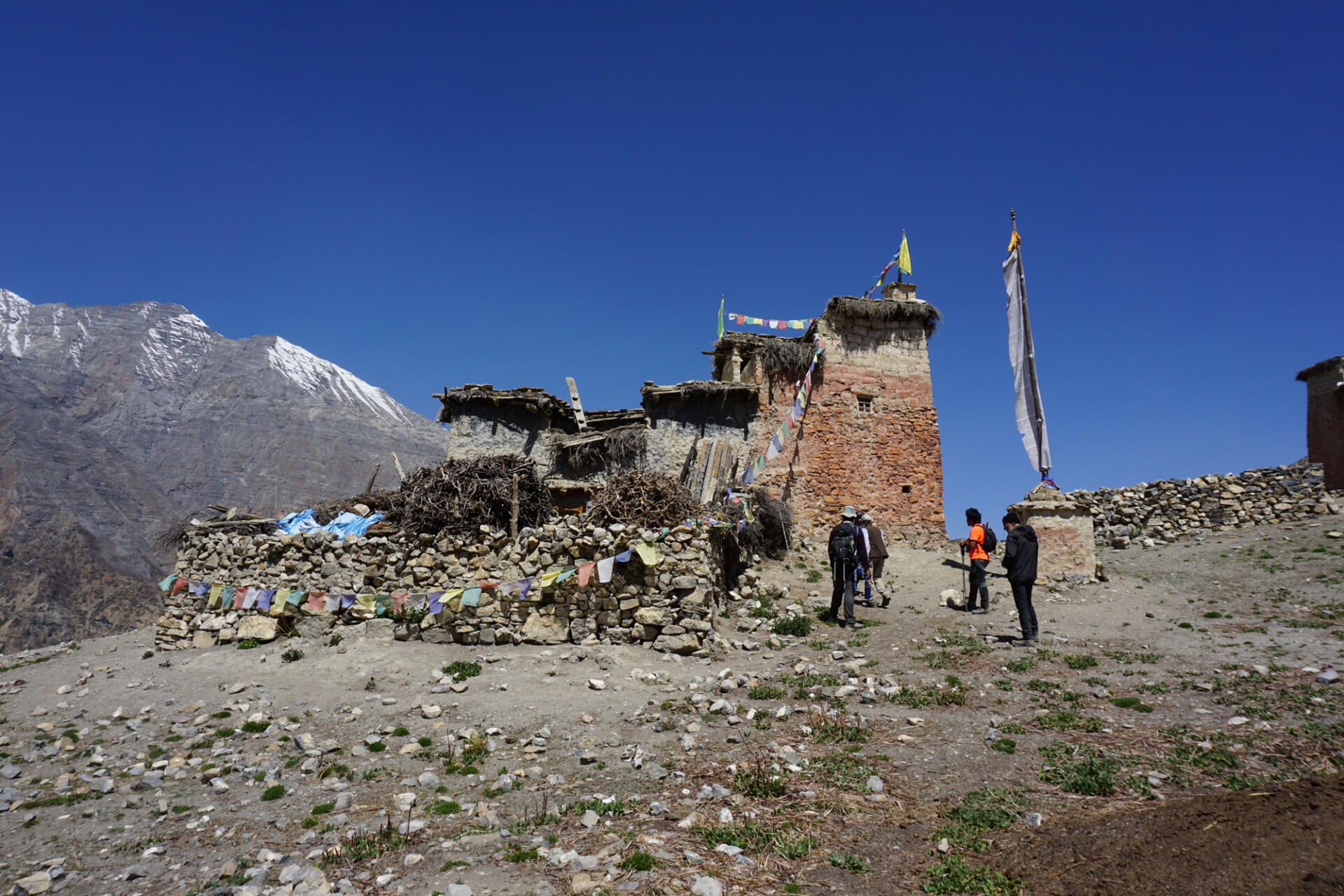
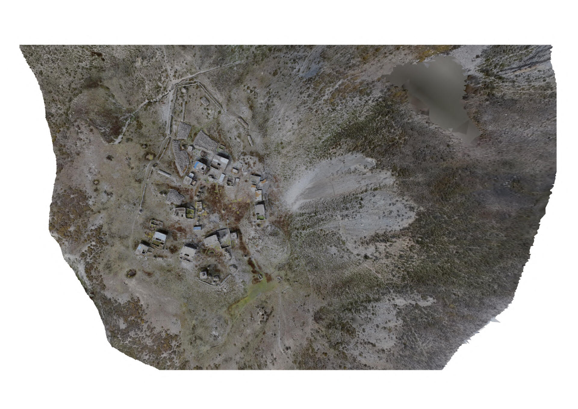
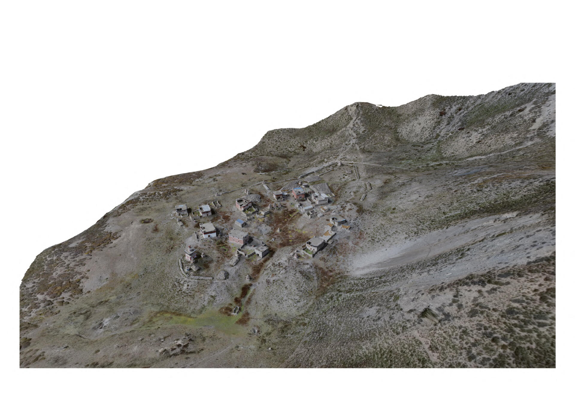
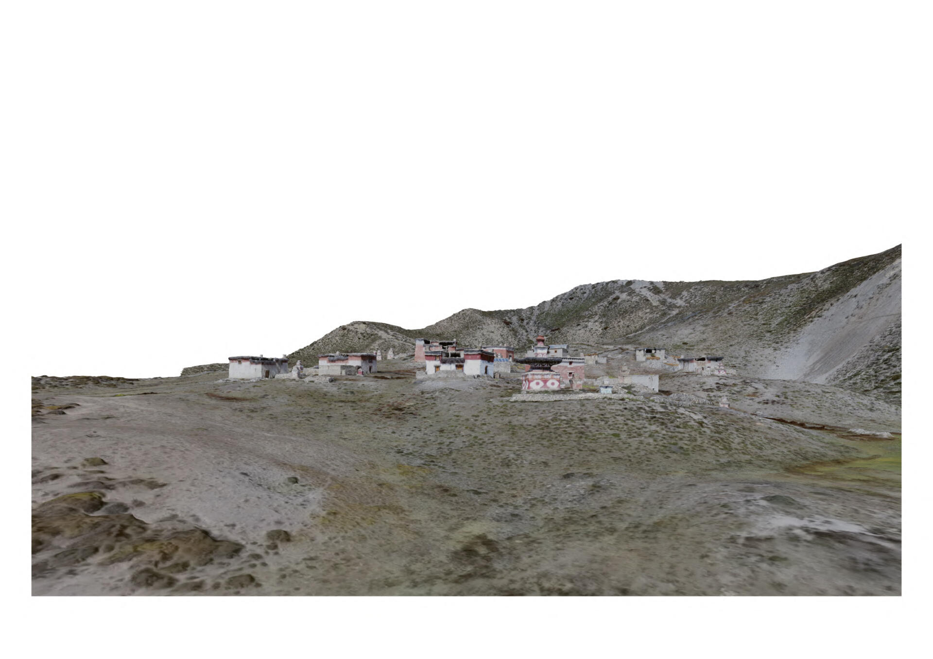
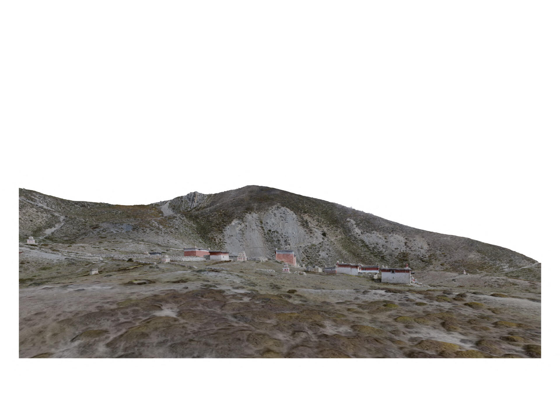
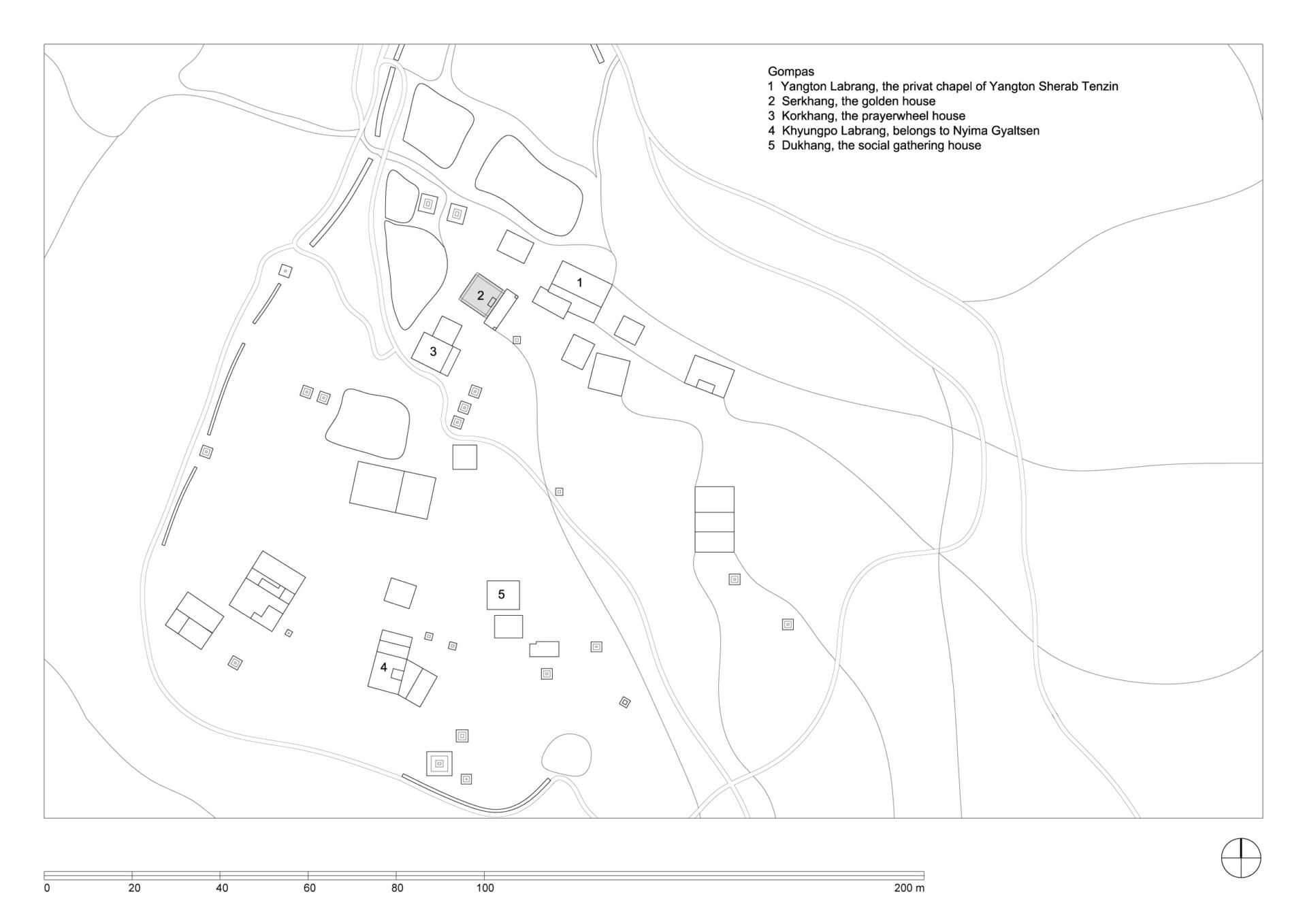
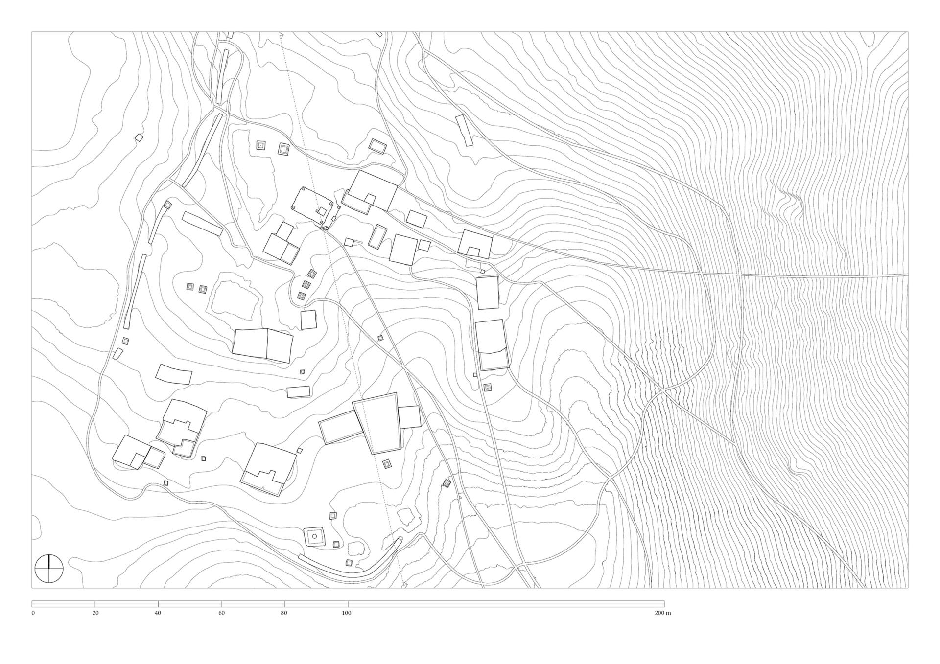
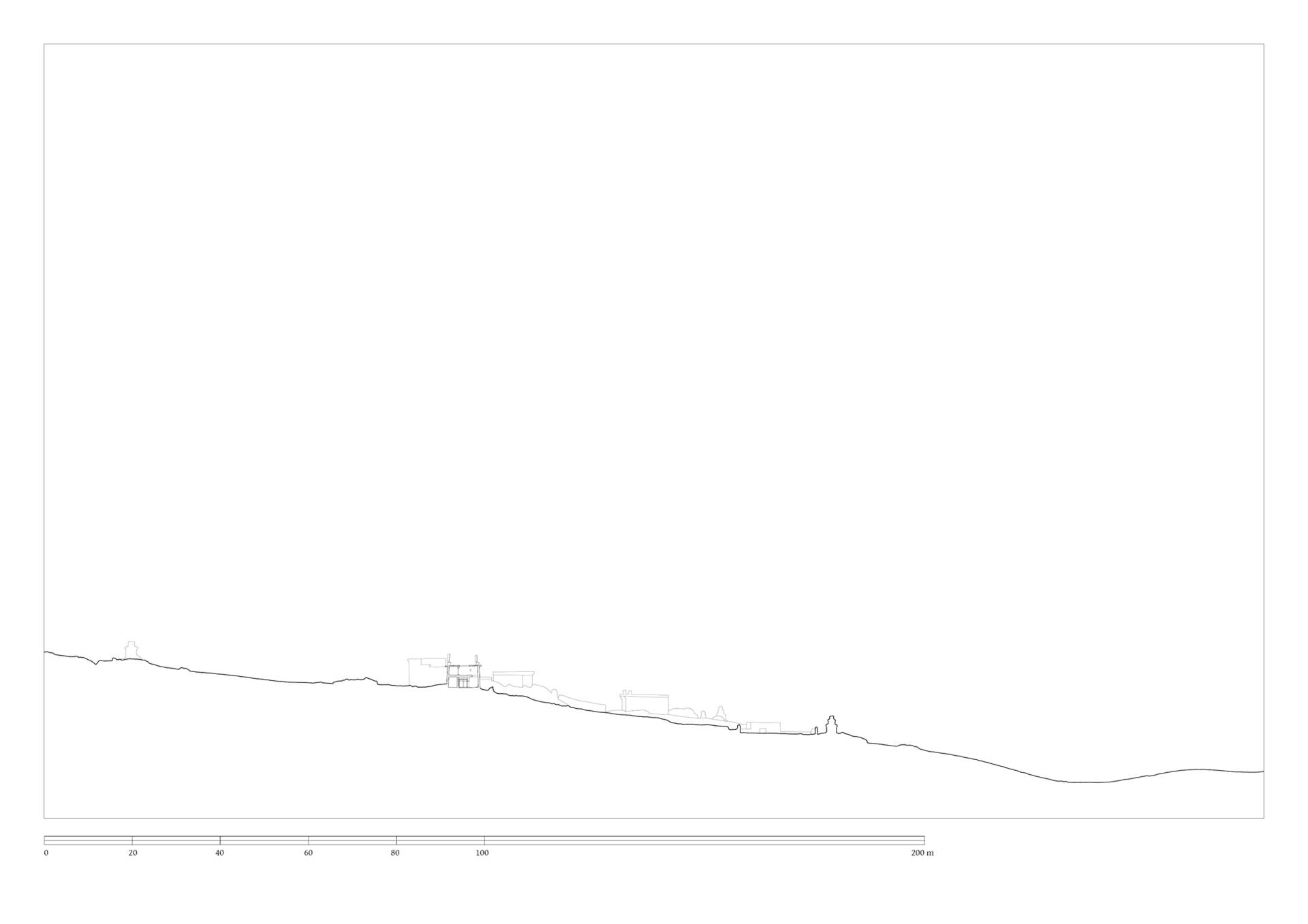
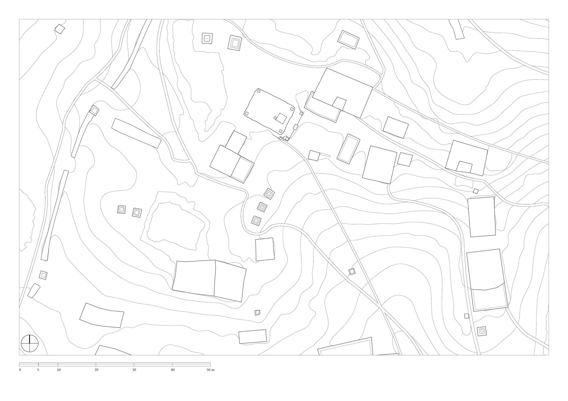
Samling lies in a grassy valley basin that opens up to the south, surrounded by snow-capped mountain ranges. Above the settlement the way leads from the north at an altitude of 4248 metres down to the southern terrain of the valley at an altitude of 4152 meters above sea level. To the west, a steep path leads into the river valley 200 meters below, which leads to Shey Sumdo. The monastery, usually called Samling Gompa or Yangton Gompa, turnted into a chief monastery of Bon for the region. The foundation goes back to the 12th century, the heredity line of the Yangal lineage provides the abbot up to the present day. At the present day Lama Sherab Tenzin leads Samling monastery. The monastery complex consisted of thirteen buildings and numerous chörten as well as large mani-walls (see Kind 2012). The building structures of the entire ensemble are spread across the sloping terrain, with an extension of 195 meters in a north-south direction and 135 meters in an east-west direction. In recent years, some buildings have been rebuilt, while others have disappeared.
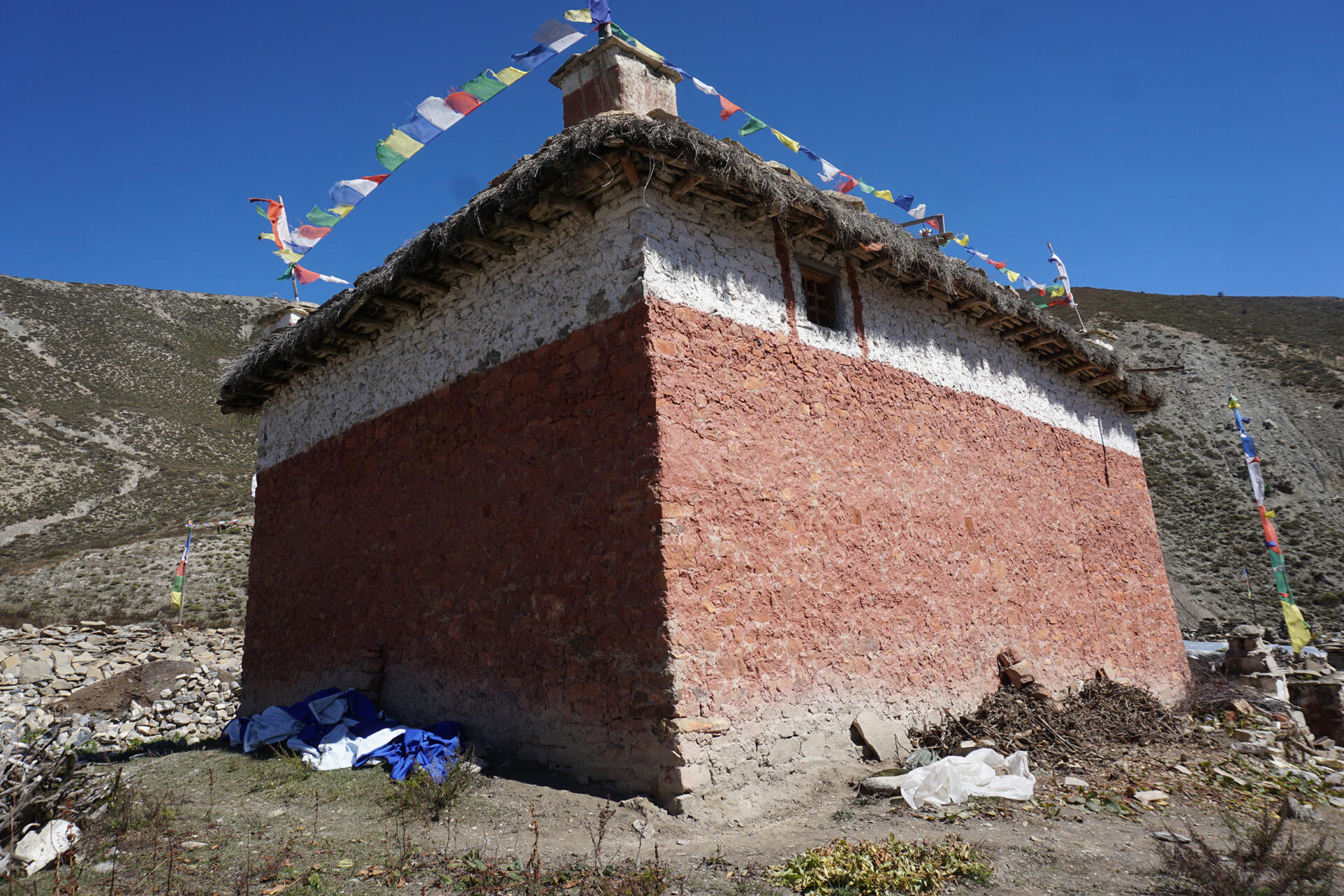
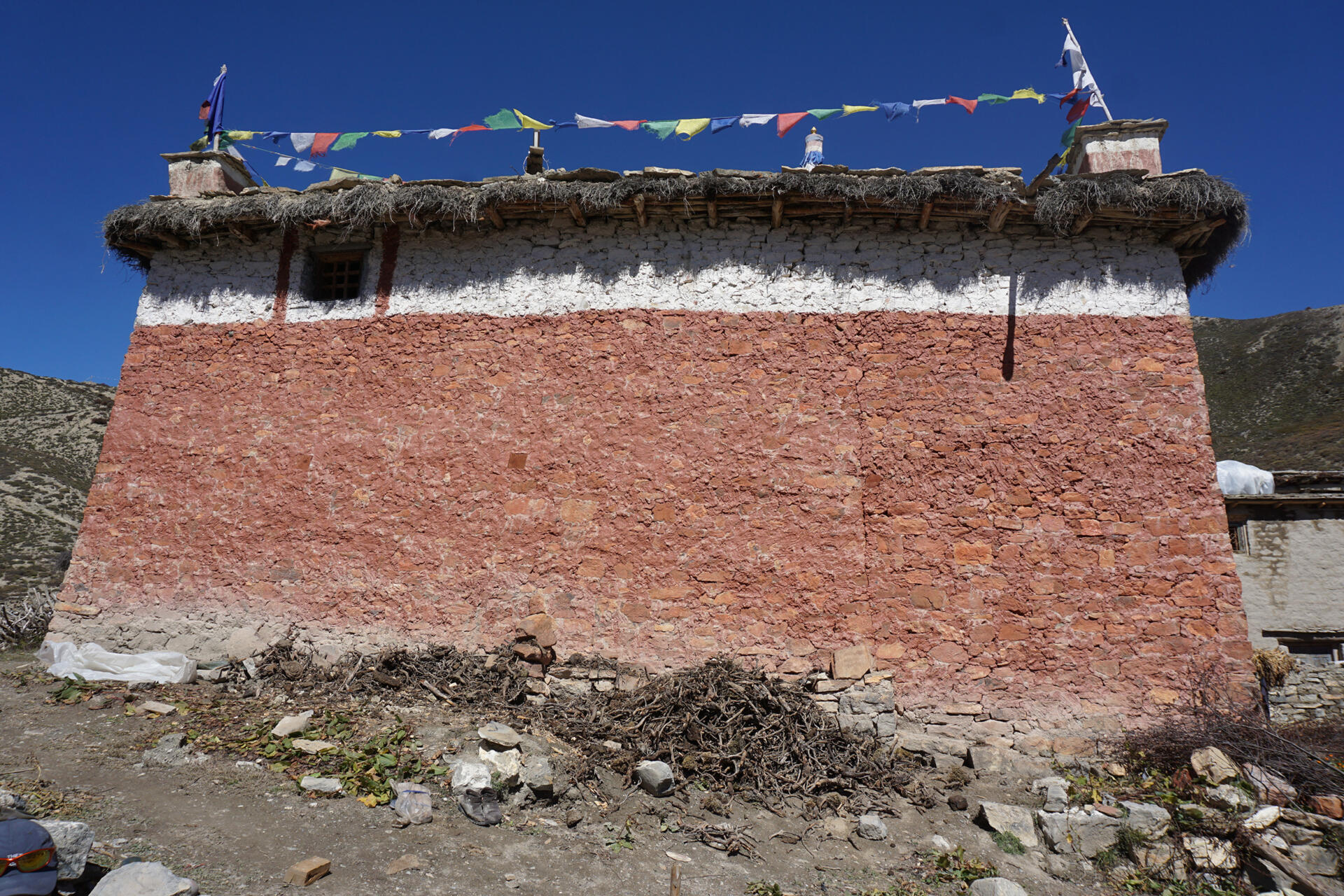
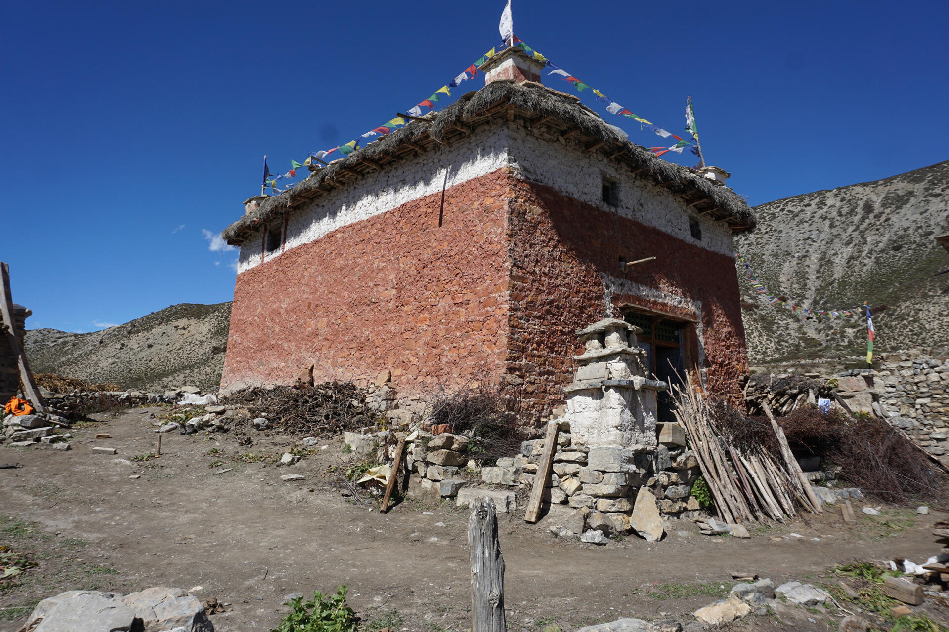
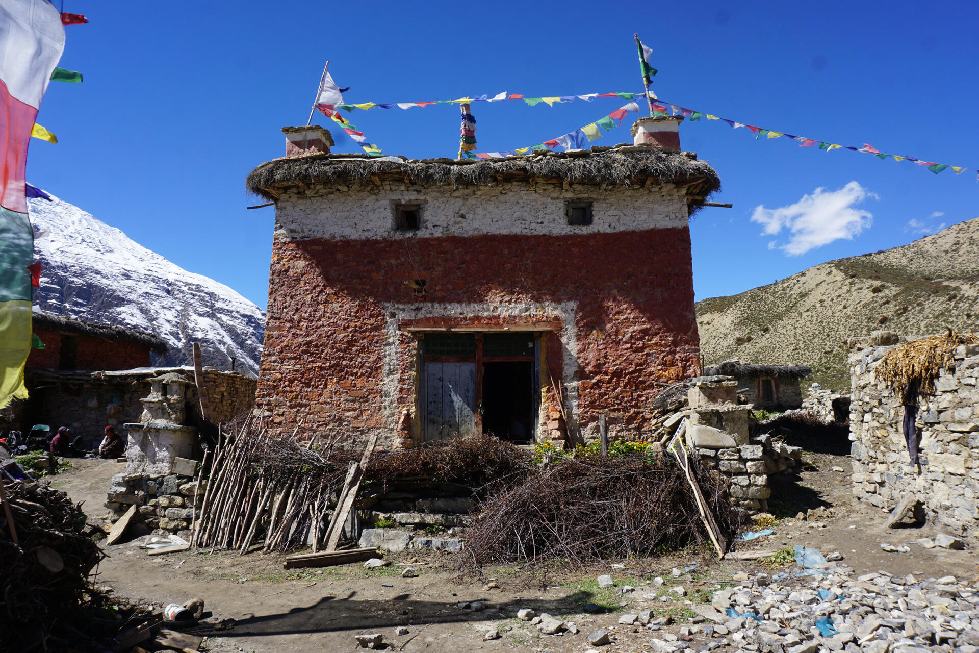
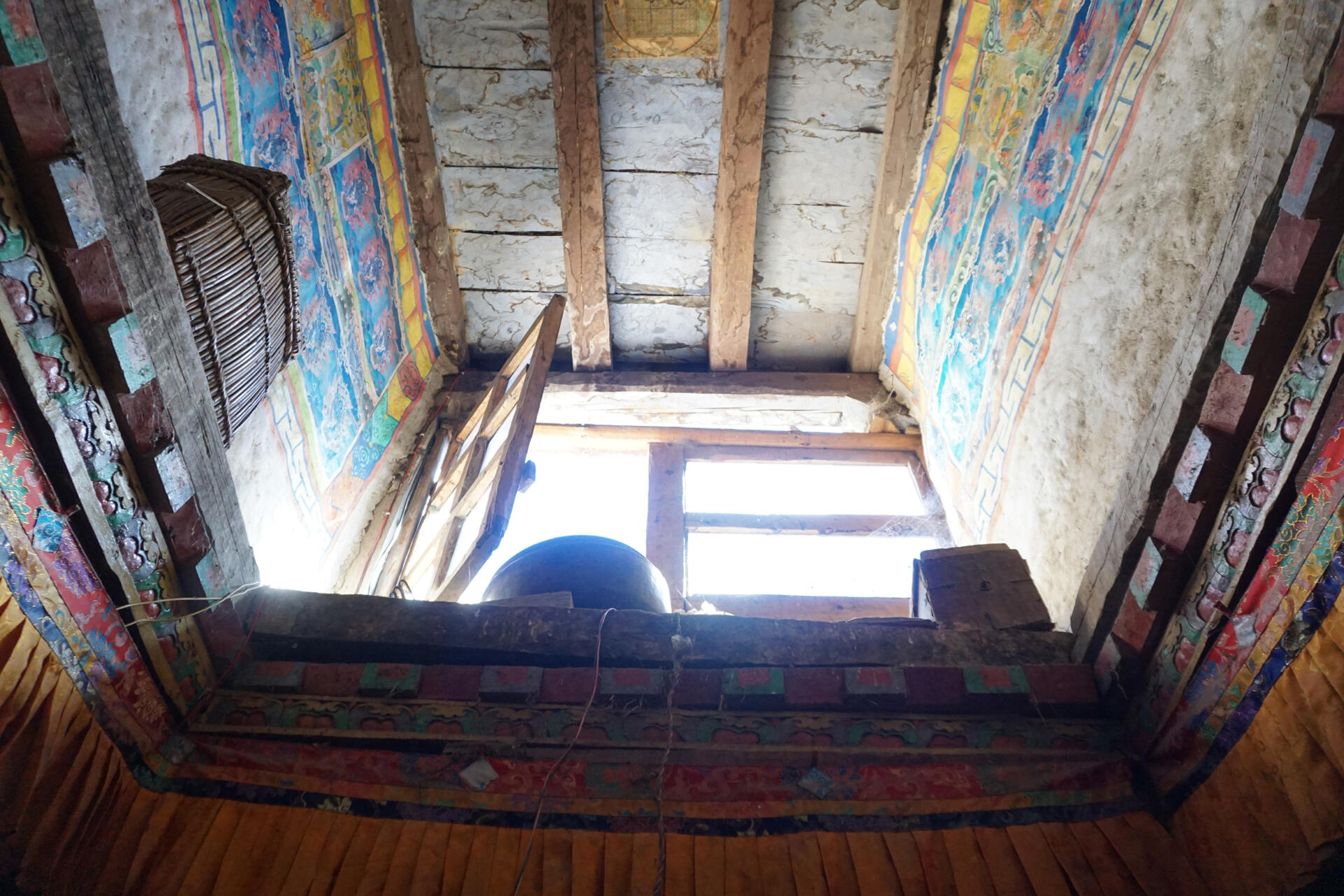
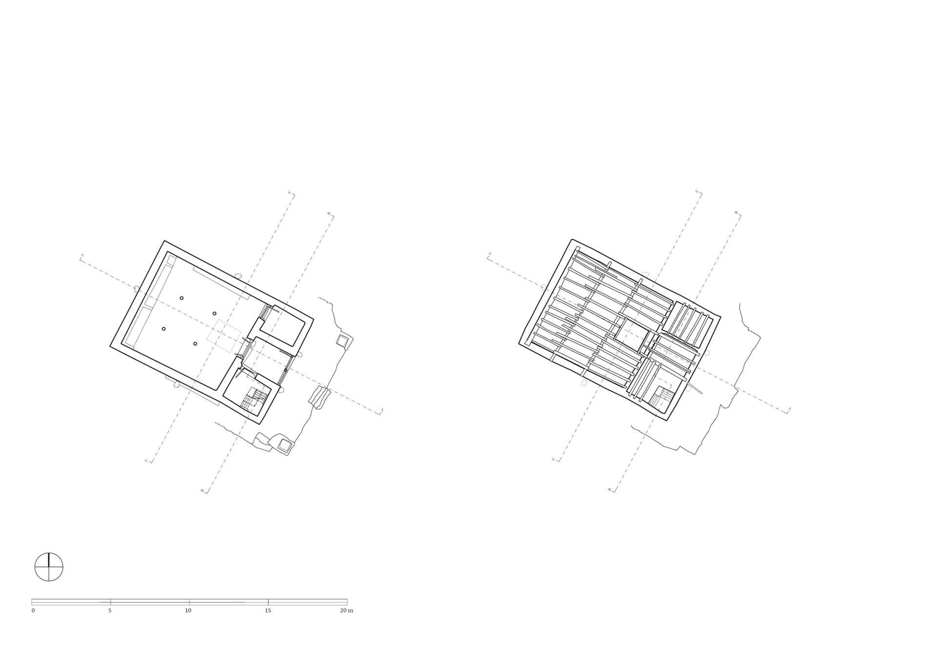
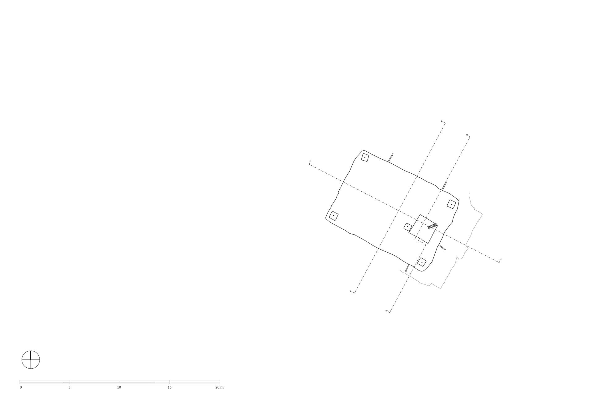
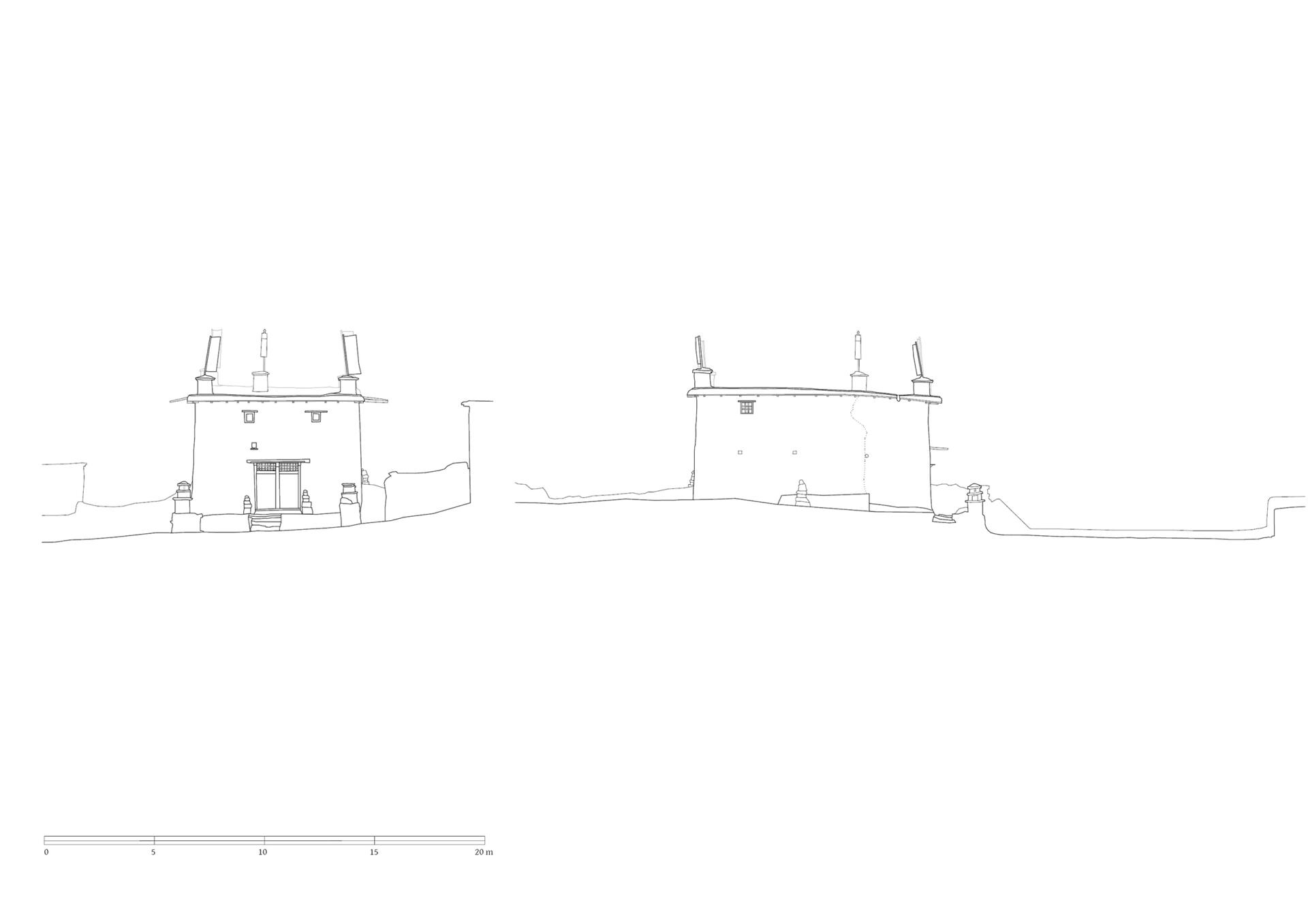
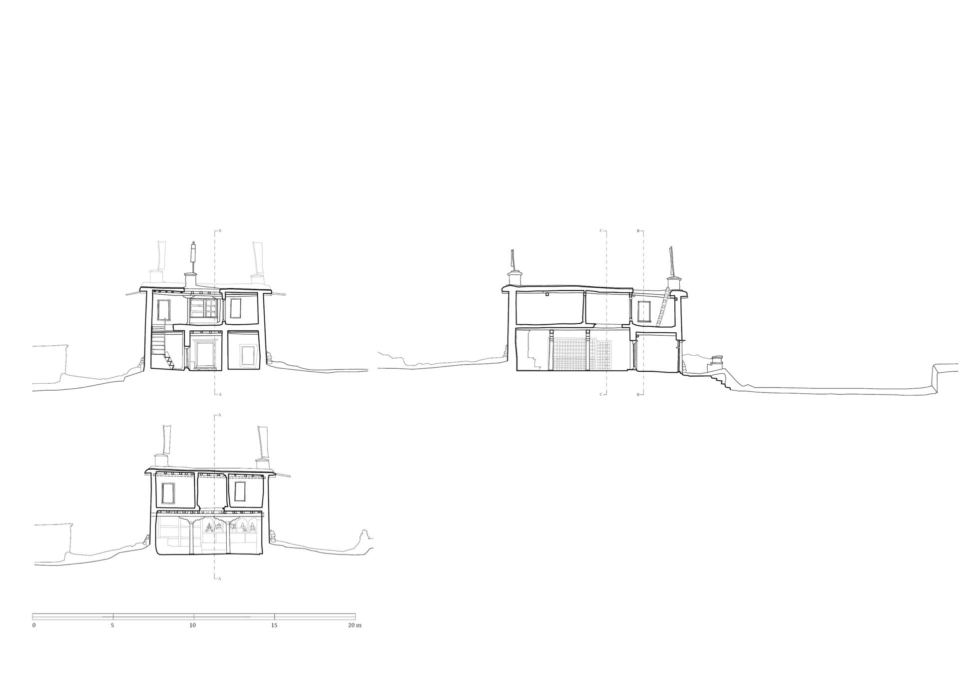
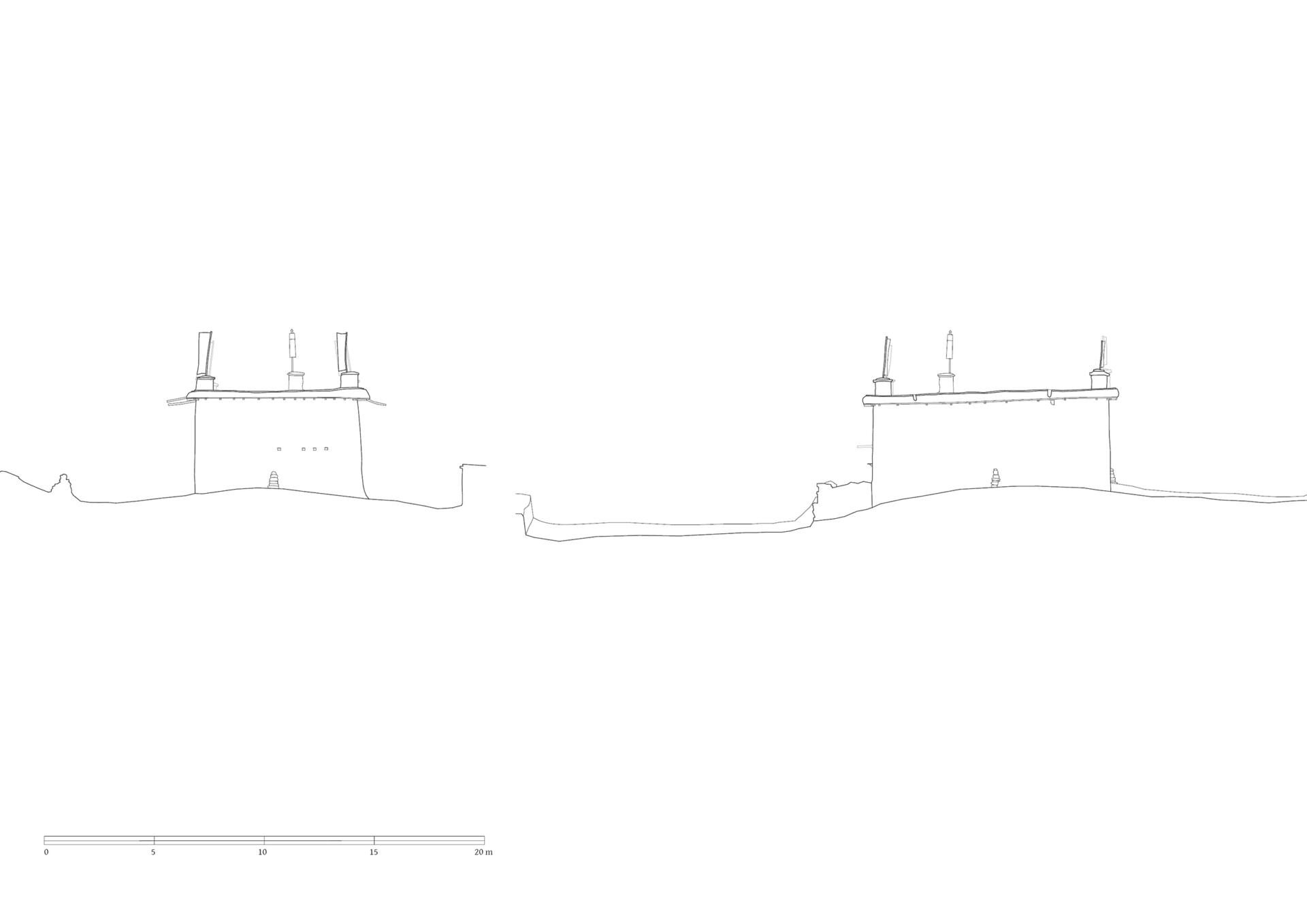
Today´s main gompa, the Serkhang (A), is located on the north side of the ensemble. Its entrance faces southeast where a forecourt gives space for meetings and celebrations. Its external dimensions are 10.78 x 7.54 meters, with a total height to the roof surface of between 5.00 and 5.30 meters. The walls are made of solid stone masonry which was redwashed in the lower and whitewashed in the upper part. Two small windows are located on the south-eastern façade, another on the south-western side, which illuminate the rooms of the upper floor. The wooden construction of the flat roof and the attic which is fastened with dried plants and stone slabs protrudes above the whitewashed part.
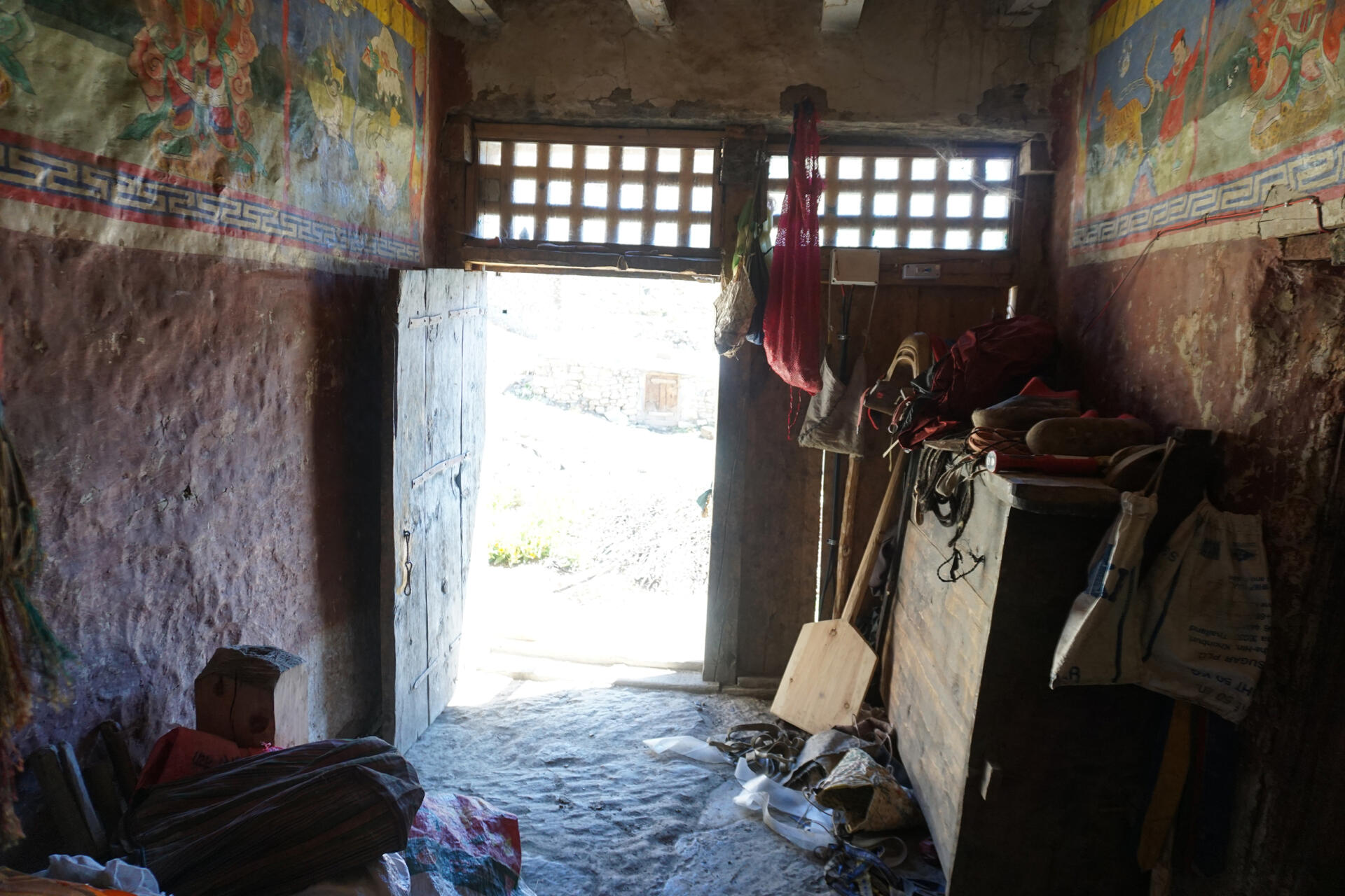
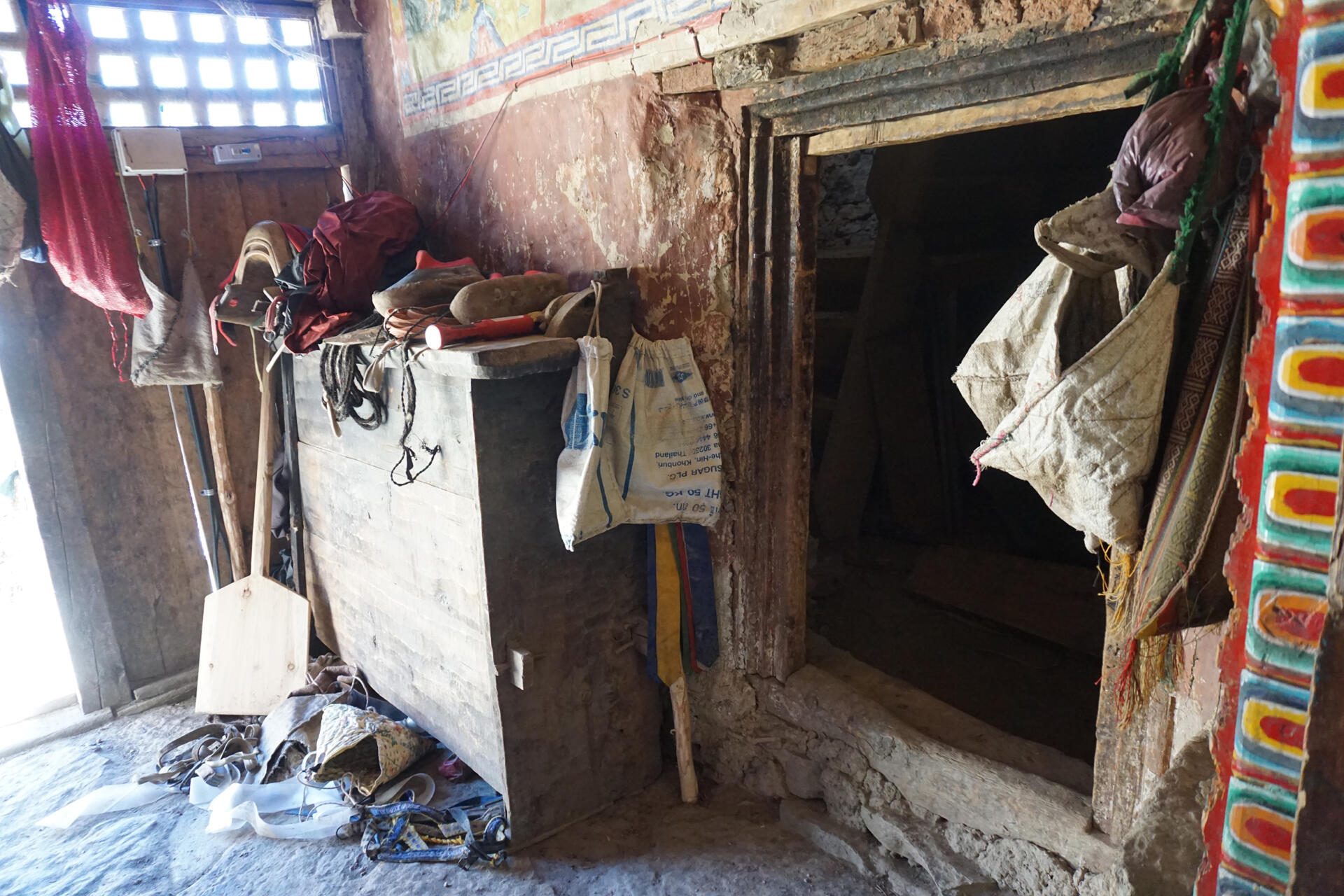
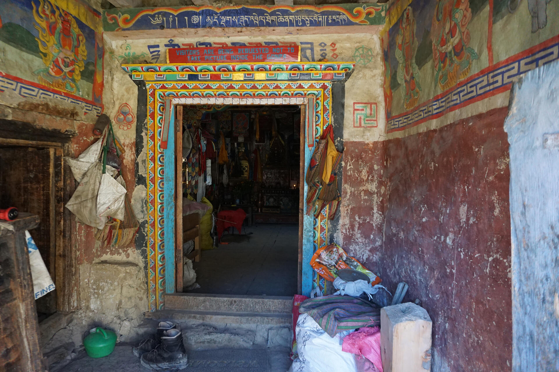
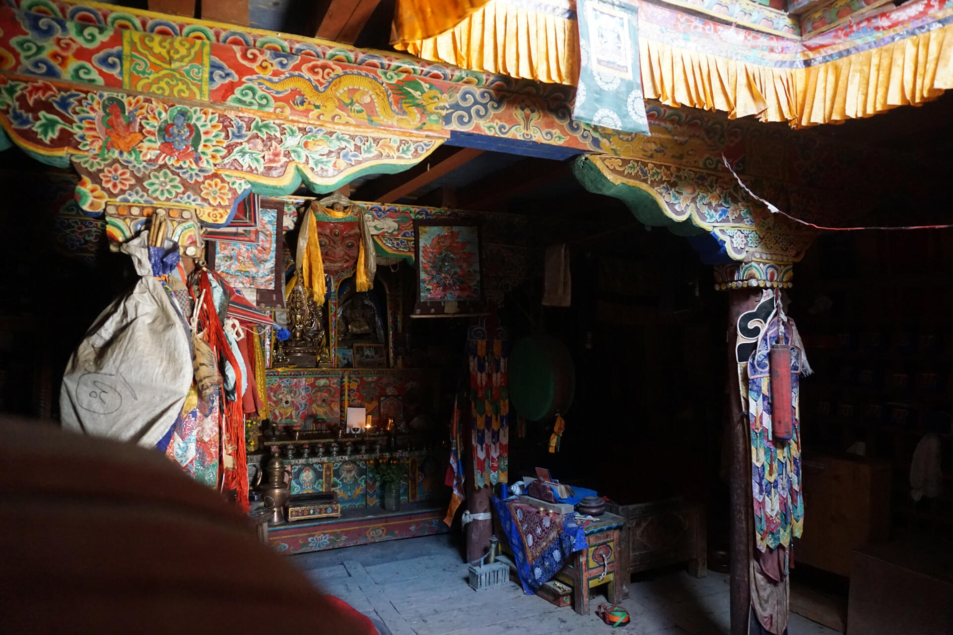
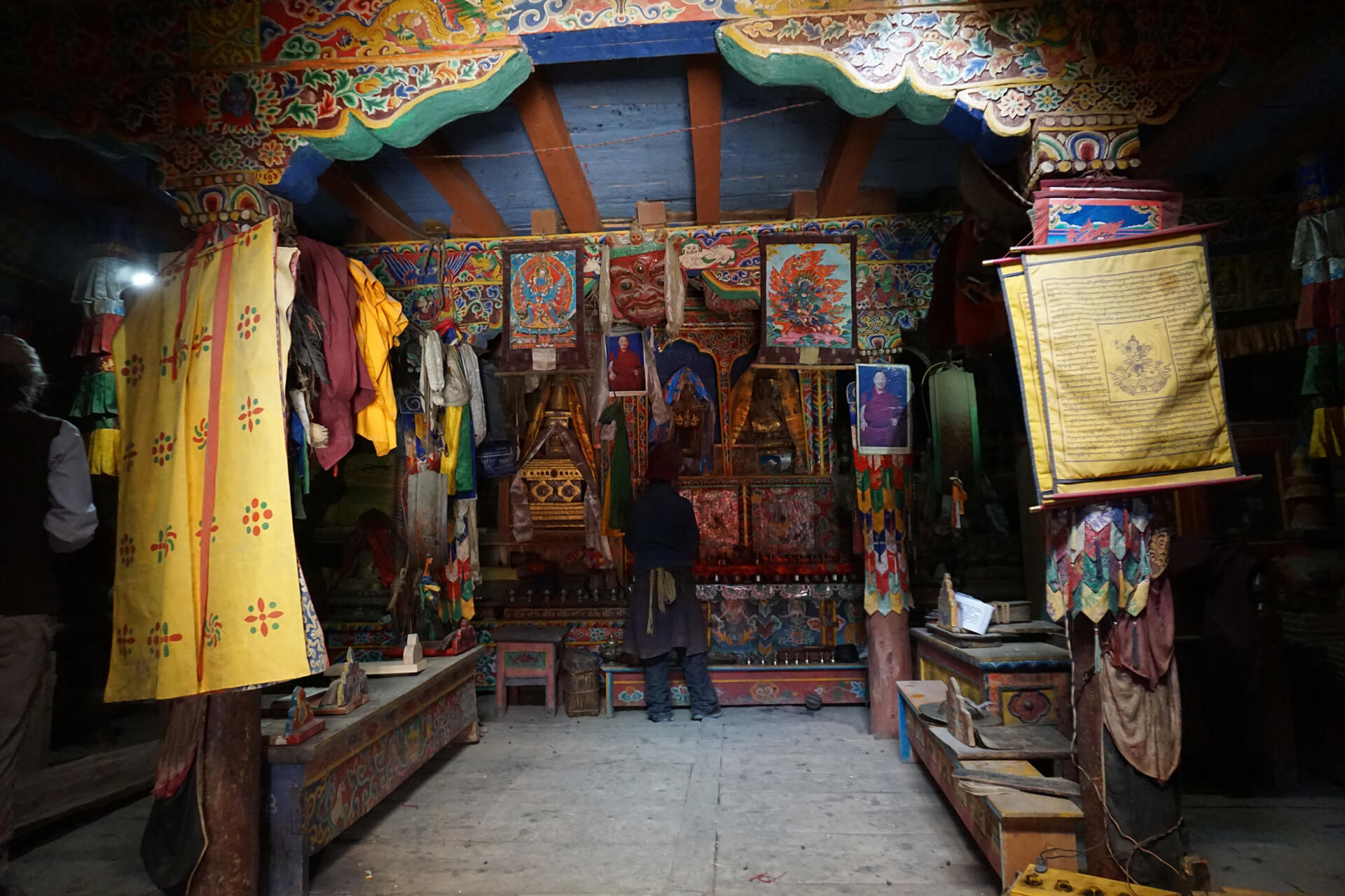
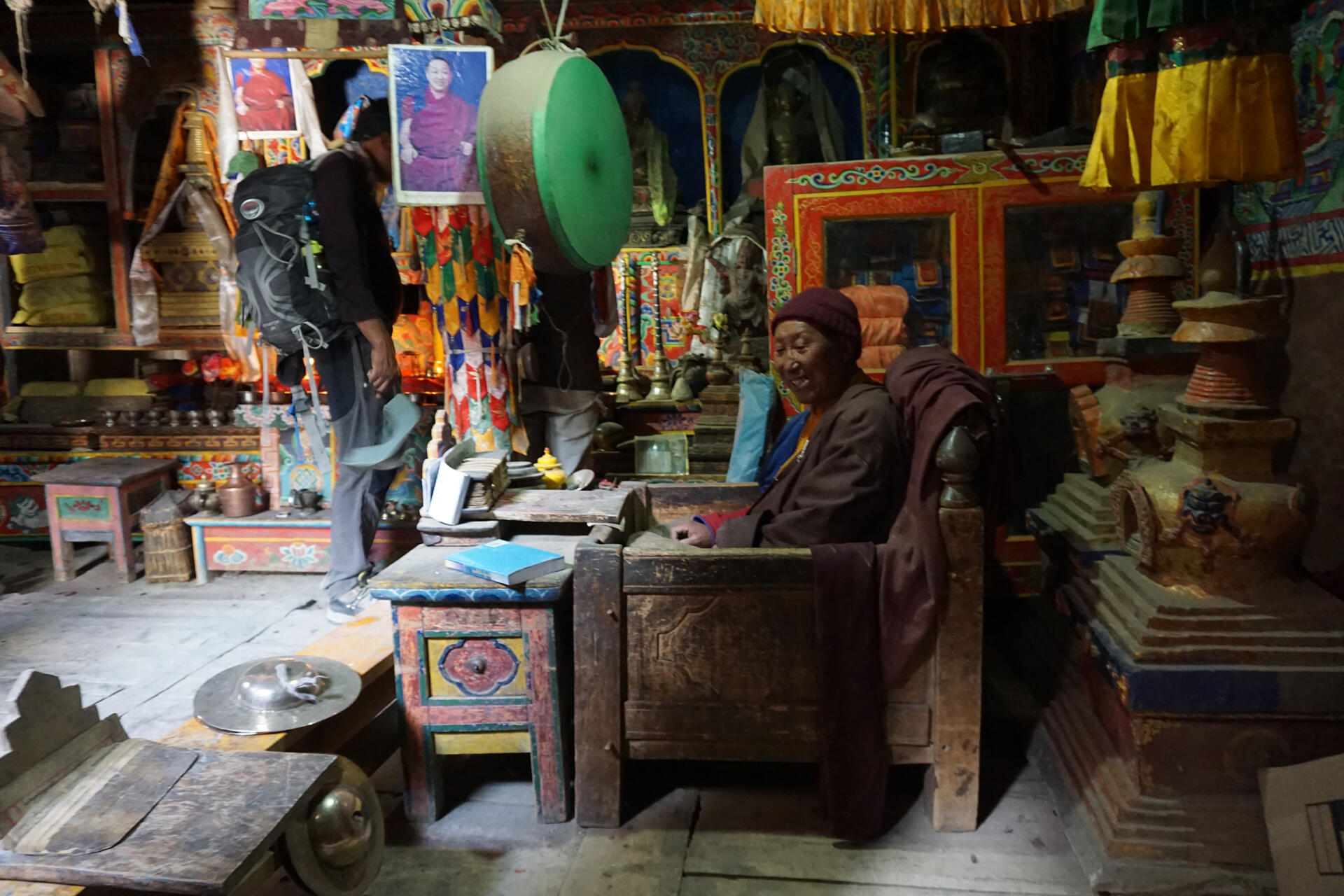
The entrance to the temple is reached from the south-eastern forecourt via a raised, walled terrace. A room wide doorway with wooden panelling leads into the vestibule which is 2.00 metres wide, 2.57 deep and 2.27 metres high. From here the entrance door to the assembly room is straight ahead, while the door on the left leads to the staircase to the upper floor. The assembly hall is approximately squared – 6.55 metres wide and 6.90 metres deep – and has a room height of 2.52 meters up to the ceiling construction. The ceiling with the two main beams is supported by four pillars with carved and colorfully painted capitals. In the front area of the ceiling, next to the entrace area of the assembly room, an opening with a lantern above lights up the room. In the right corner, another door gives access to a side room, which is used as a strage room. The altar, bookshelves and sculptures of the assembly room cover the raer of the room.
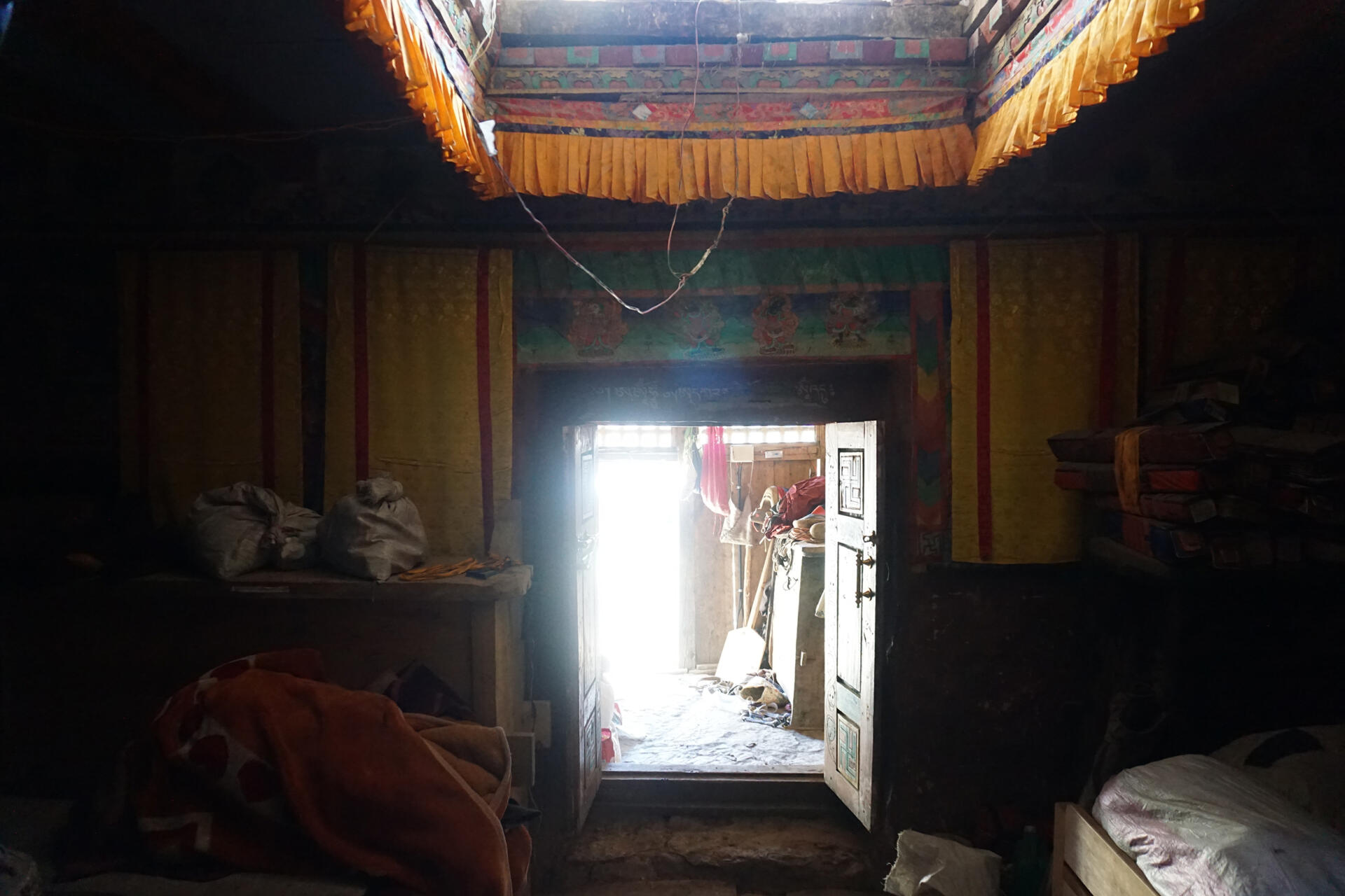
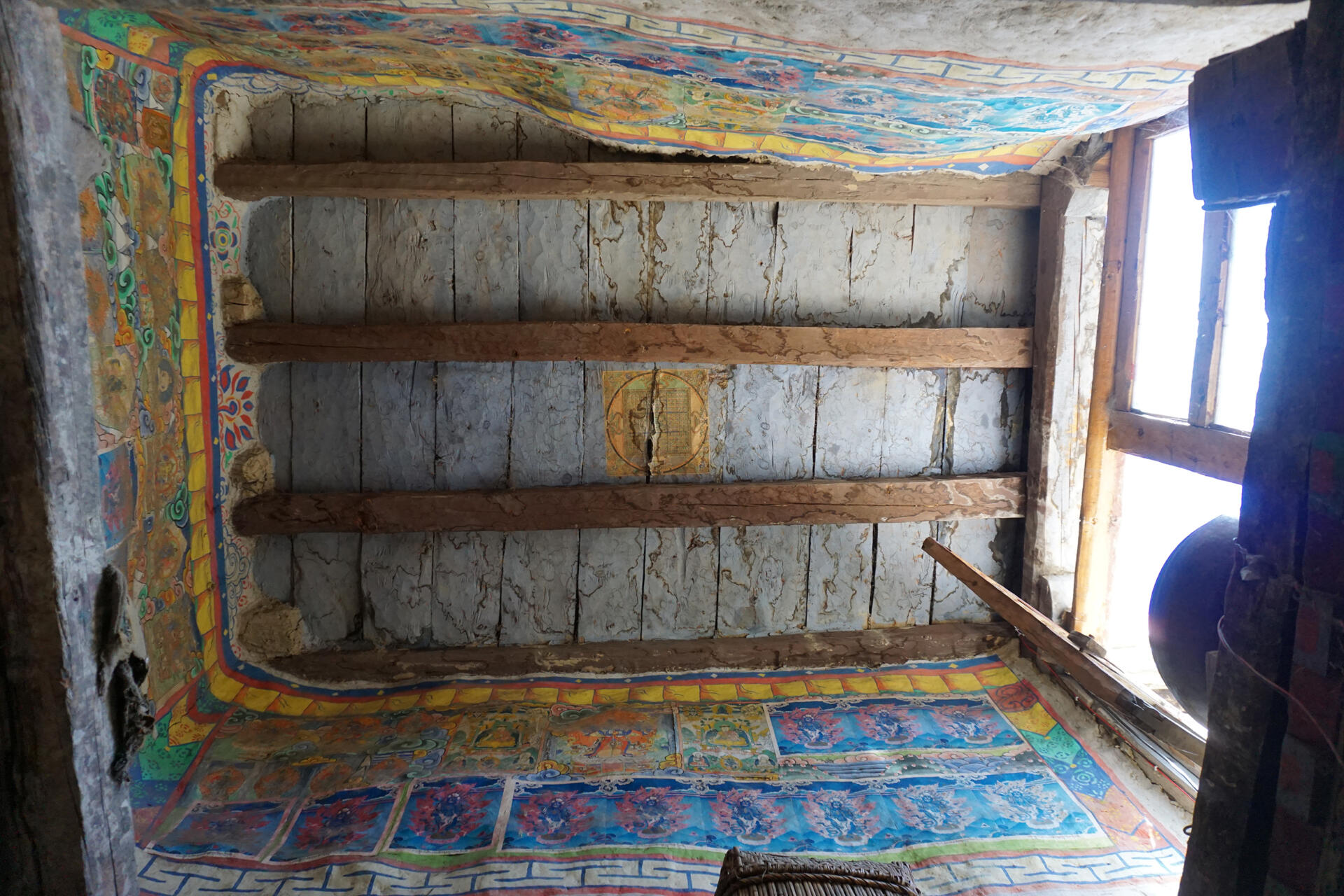
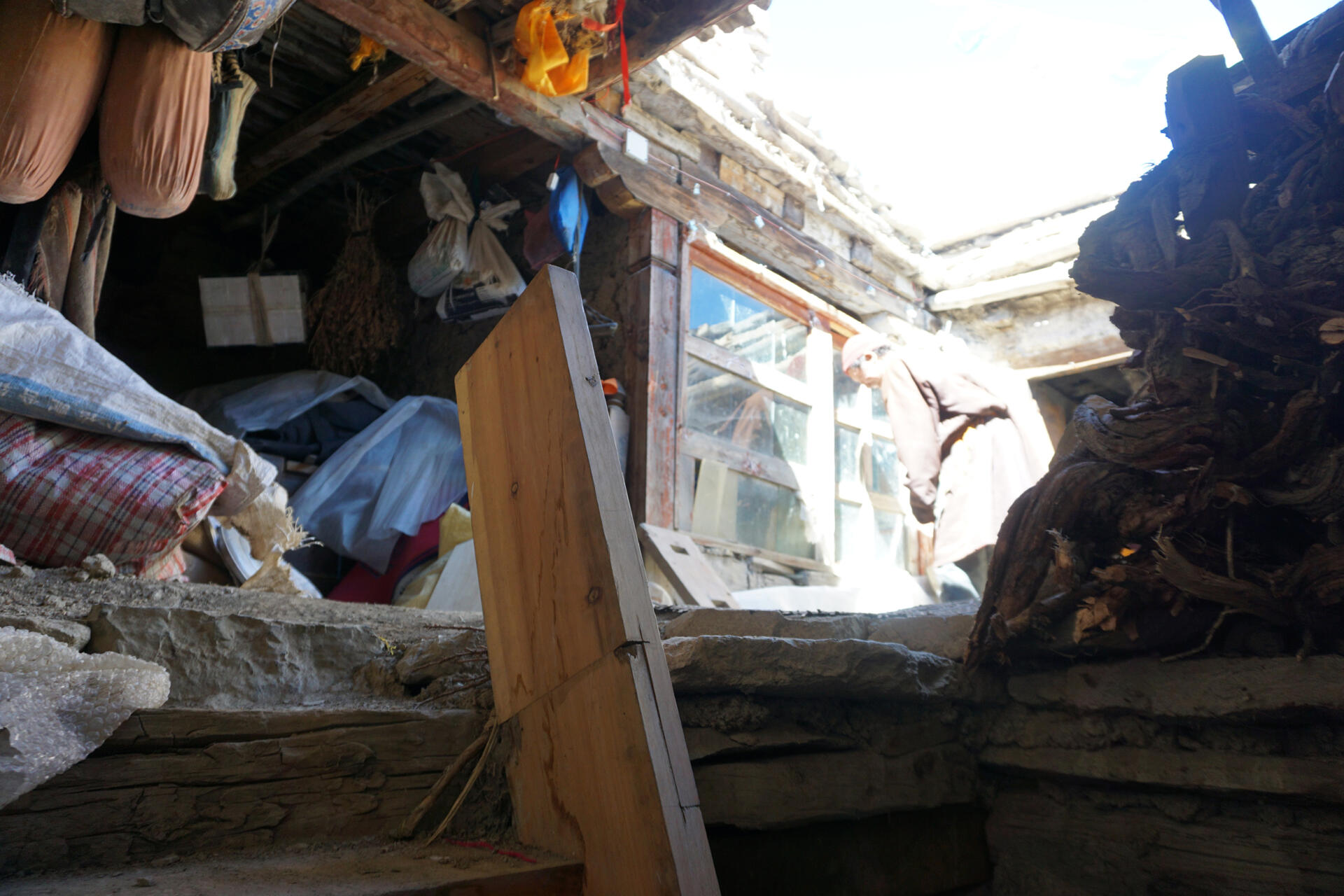
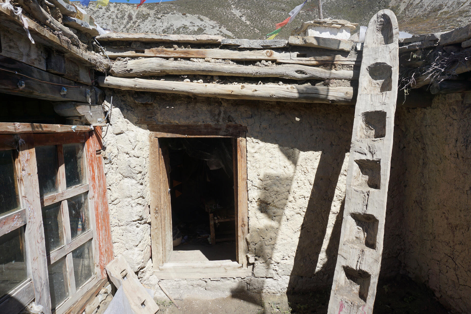
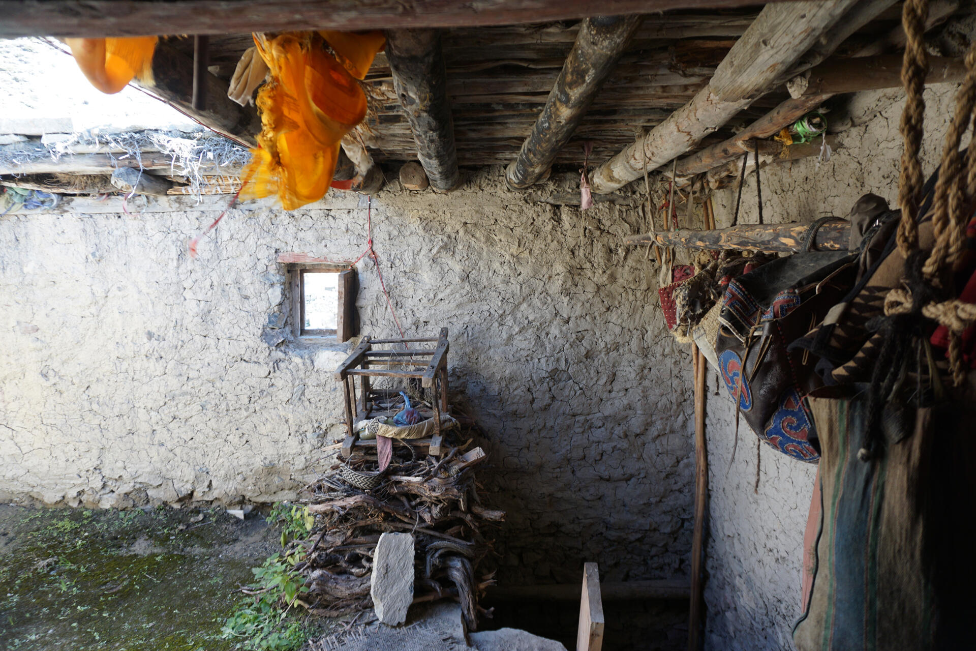
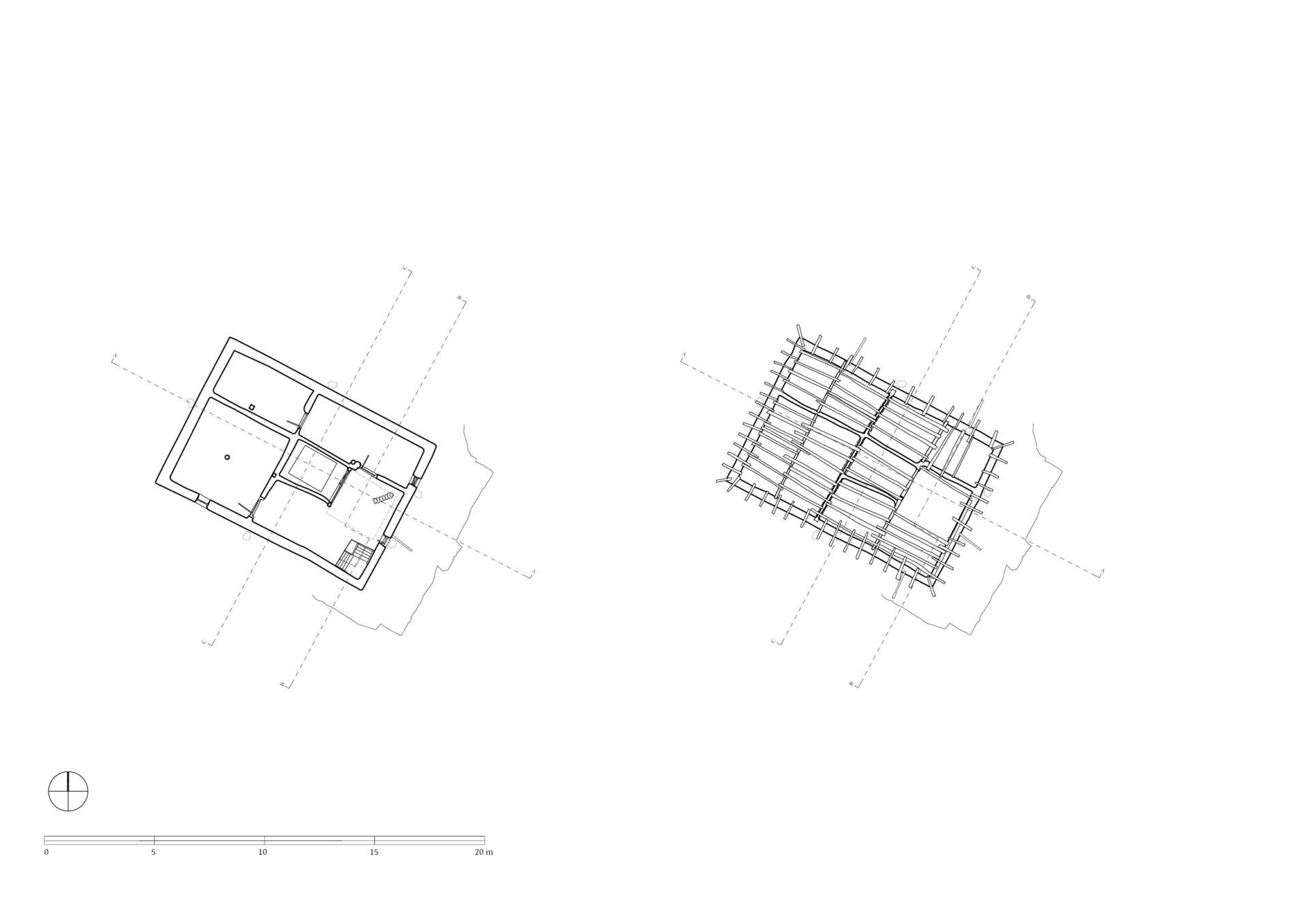
On the upper floor lie residental and storage rooms, which are all accessed via a small open courtyard in front of the lantern´s window, which faces southeast. The construction of the glazing suggests that this area was originally open. The two adjoining rooms on the north-east side, which are just under two meters wide, were designed as side rooms. The larger room on the south-west side, which also has a window, is more carefully equipped in comparison; its walls are plastered and painted. The room is square with a side length of 4.18 meters and a ceiling height of 1.95 meters. In the center of the room, a pillar supports the main beam of the ceiling. Via a ladder one can get from the open courtyard of the first floor up to the roof, which is decorated with the characteristic corner structures and flags.
TU Graz – IGMS, Woschitz, H. & Bauer, P. (2024): 3D Model of the survey in 2022.
References: Kind, Marietta. The Bon Landscape of Dolpo: Pilgrimages, Monasteries, Biographies and the Emergence of Bon. Berlin: Peter Lang 2012: 190-194, 195-212. Snellgrove, David. Himalayan Pilgrimage. A study of Tibetan religion by a traveller through Western Nepal. Oxford 1961: 110-129.
Photo documentation
Interior
3D Views

2D Plans
More from


